Luhansk, Ukraine Terrain Database Information
- Imagery: 30cm of the city of Luhansk blended to 50cm to 15m surrounding imagery
- Elevation: SRTM 30m of Luhanks blended to an underlying STRM 90m
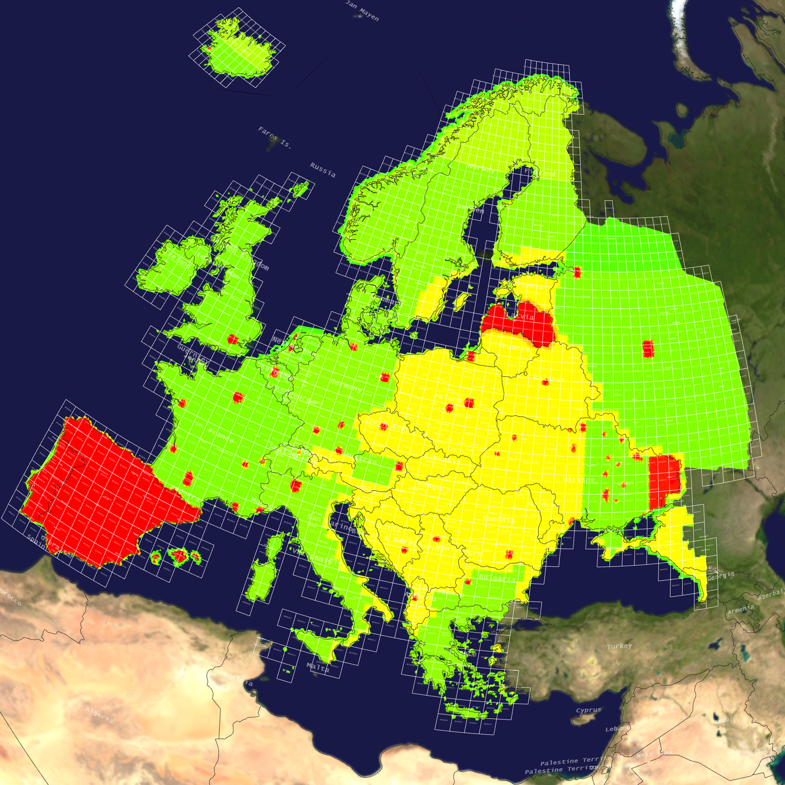
- Terrain Drive: Europe
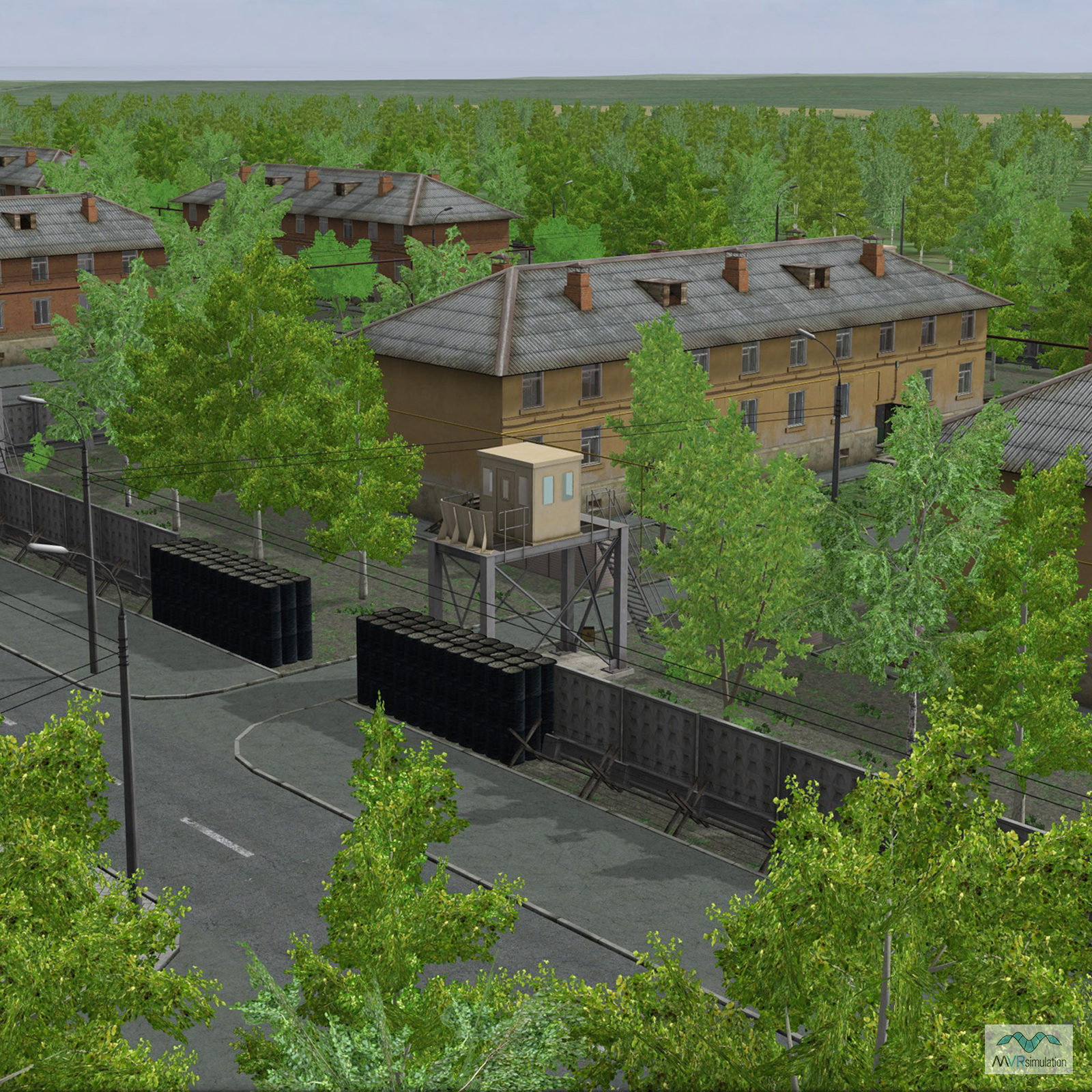
- 3D modeled inset of Luhansk, Ukraine
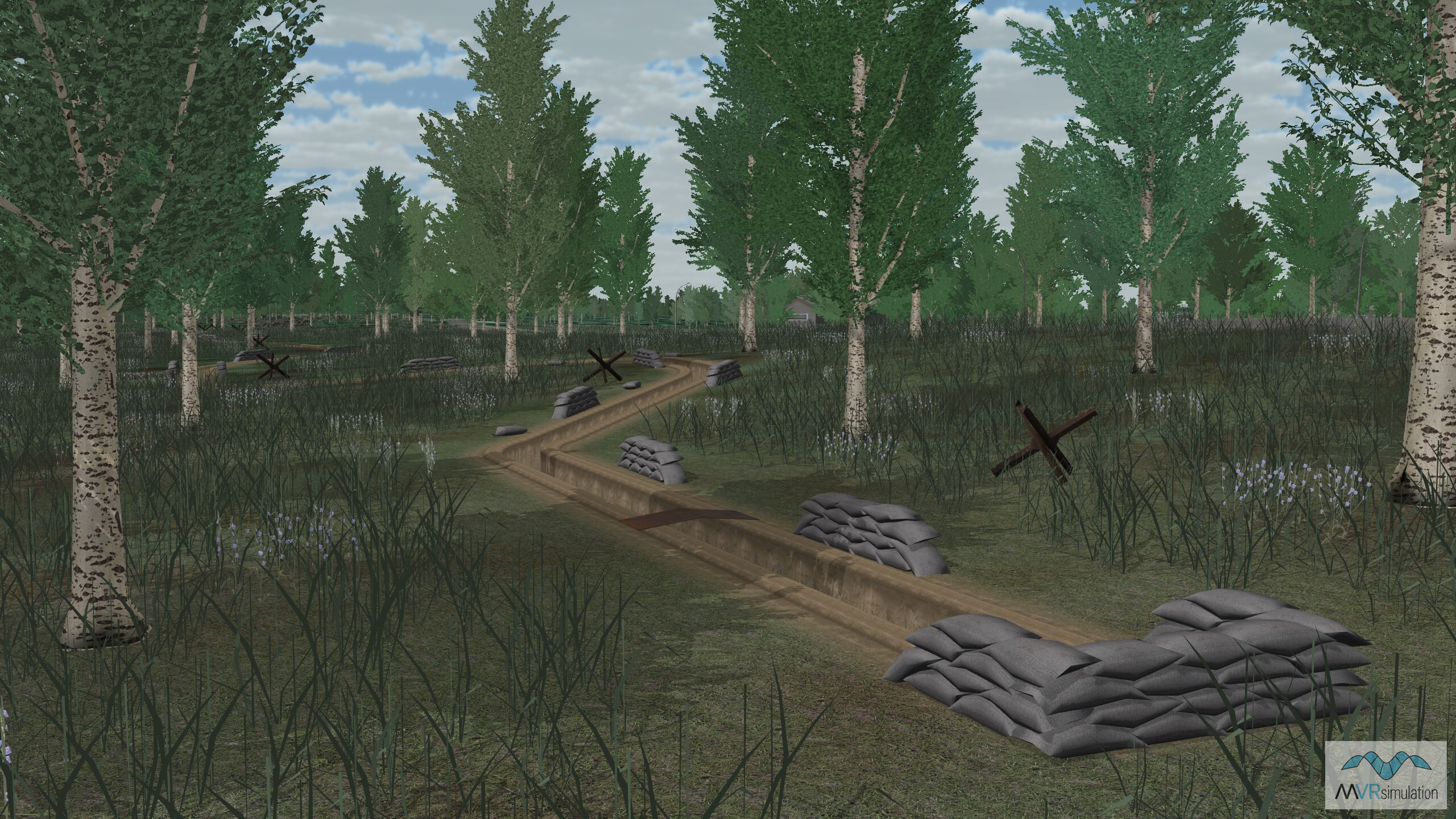
- Cultural Features: CityEngine (Geotypical) Buildings, Landscape Features (Shrubs, Grass, Paved Medians, etc.), Light Poles, Lighting for Non-Runway Areas (Streetlights), Roads, Runway, Runway Lights, Signs, Static Aircraft or Helicopters, Taxiways and Associated Markings, Trees, Trenches, Utilities (Poles, Powerlines or Transmission Lines)
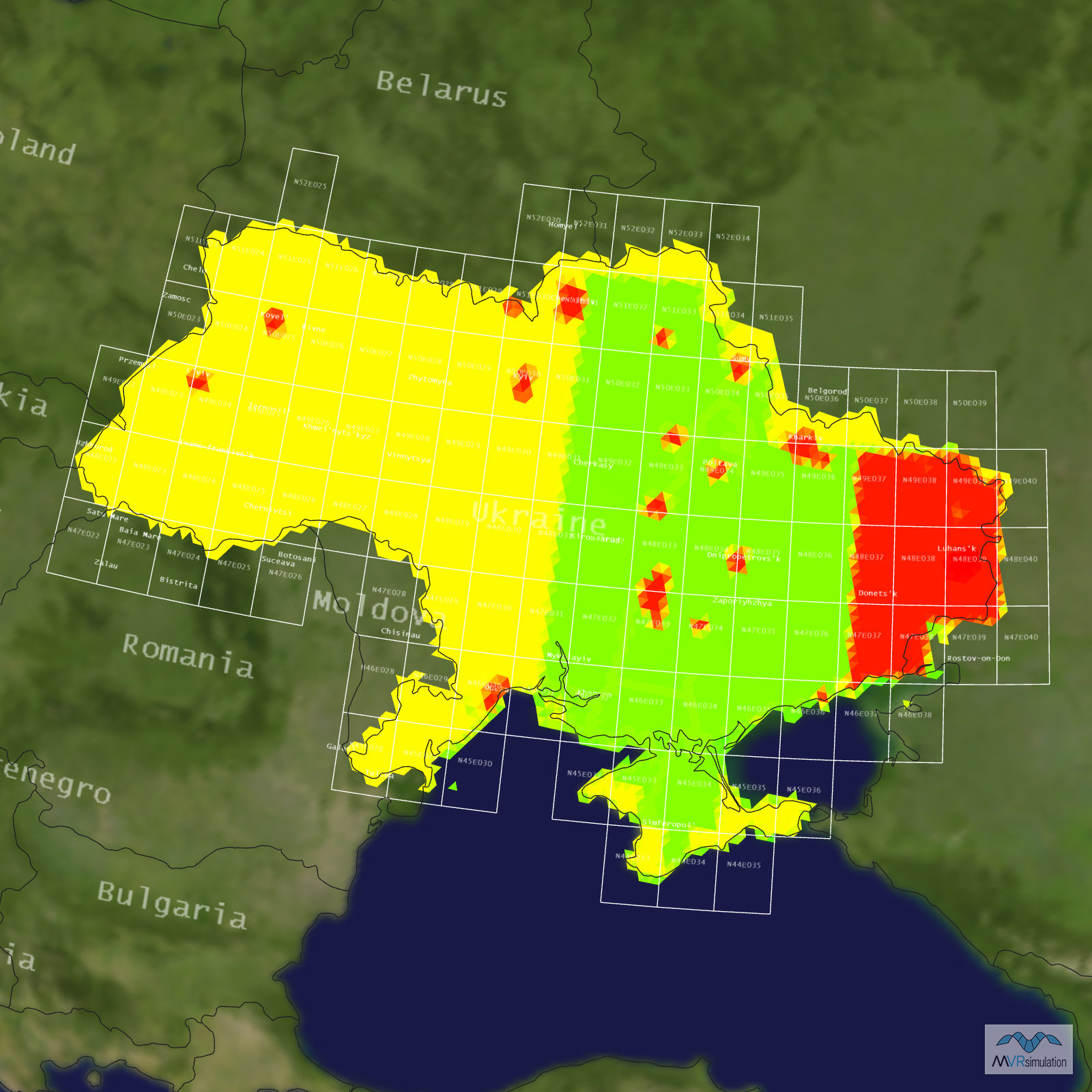
Tile Coverage Map
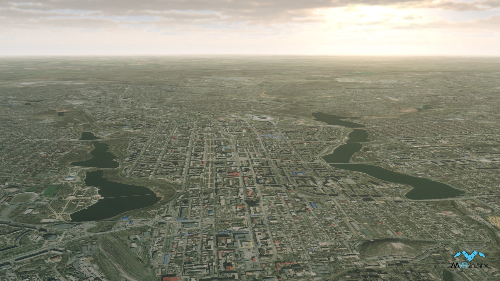
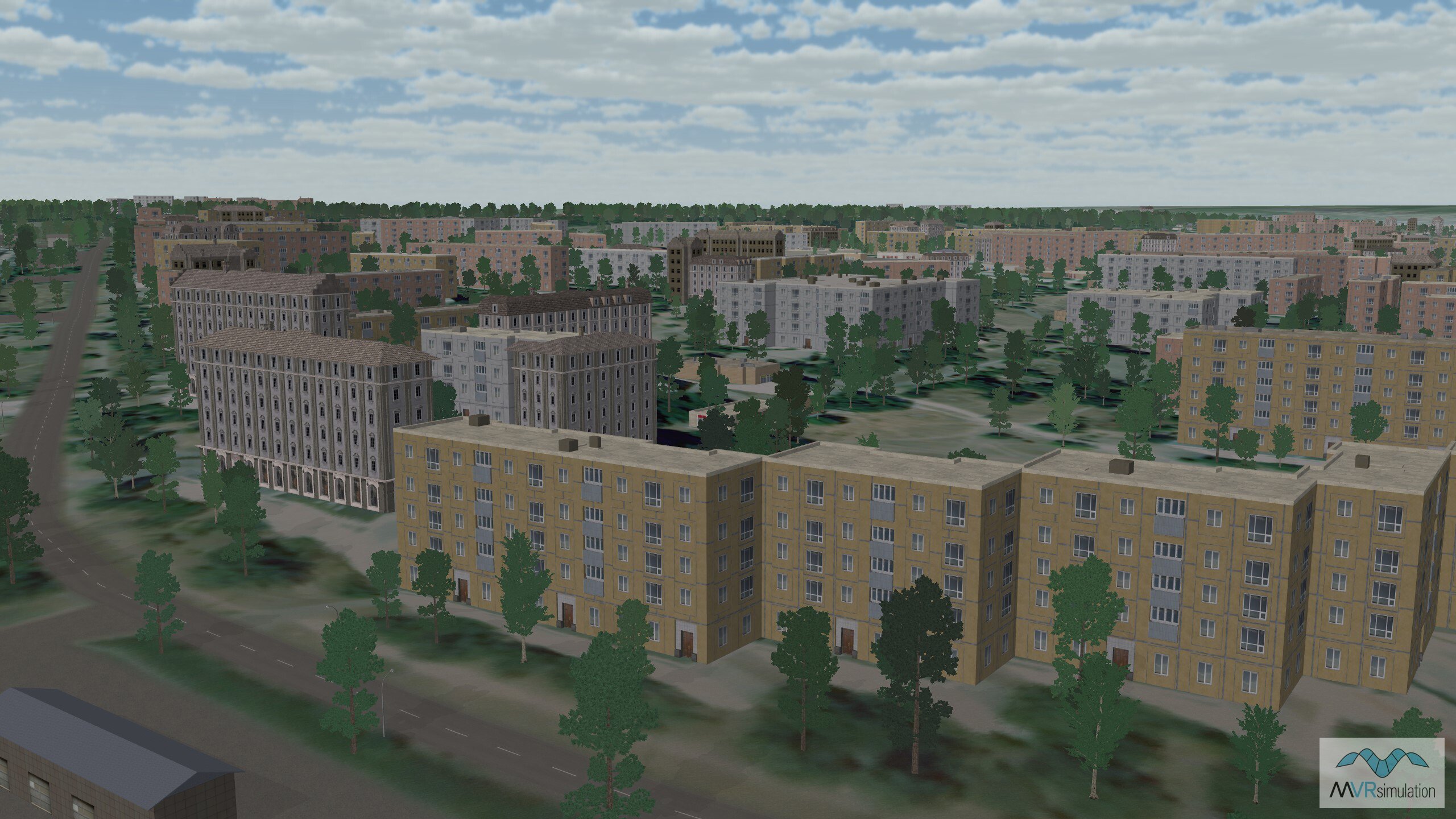
Donestsk, Ukraine, part of VRSG's Ukraine terrain.
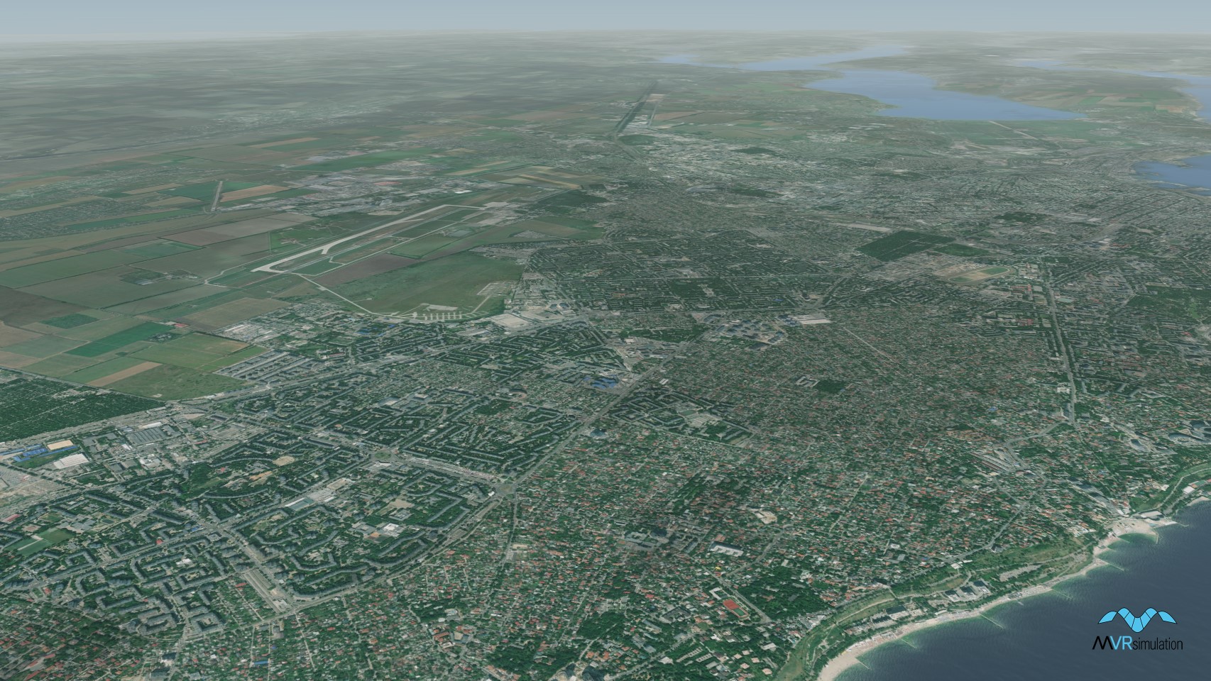
VRSG's virtual Ukraine terrain is built from 0.50 to 15.0 mpp resolution source imagery and SRTM1 elevation source data.
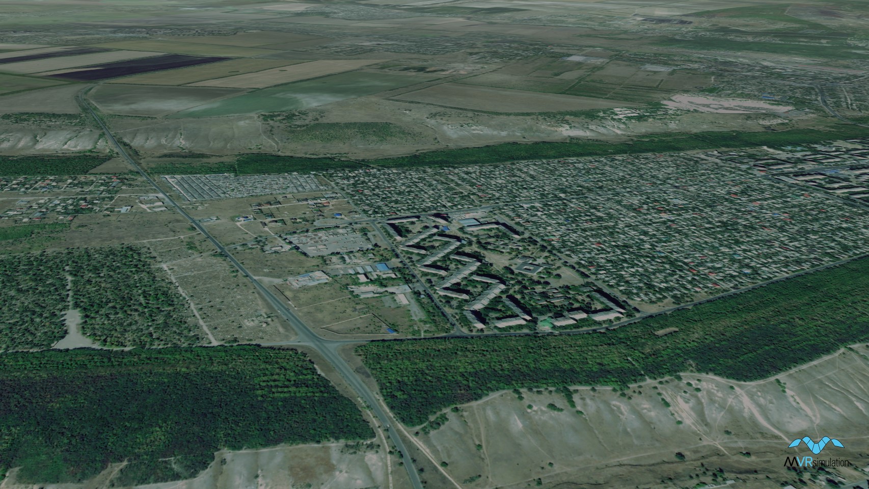
VRSG's virtual Ukraine terrain includes 5,465 road vectors from OSM compiled in throughout the city of Luhansk.
MVRsimulation's 3D virtual Ukraine terrain includes 57,842 CityEngine buildings.
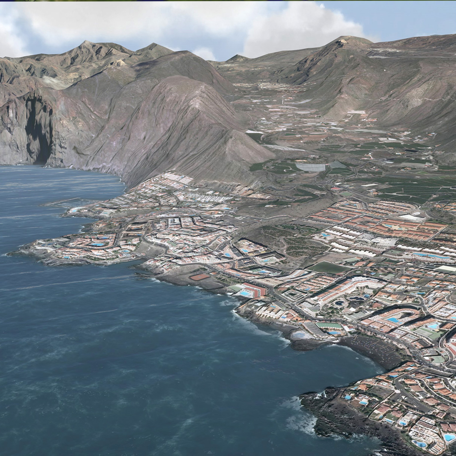
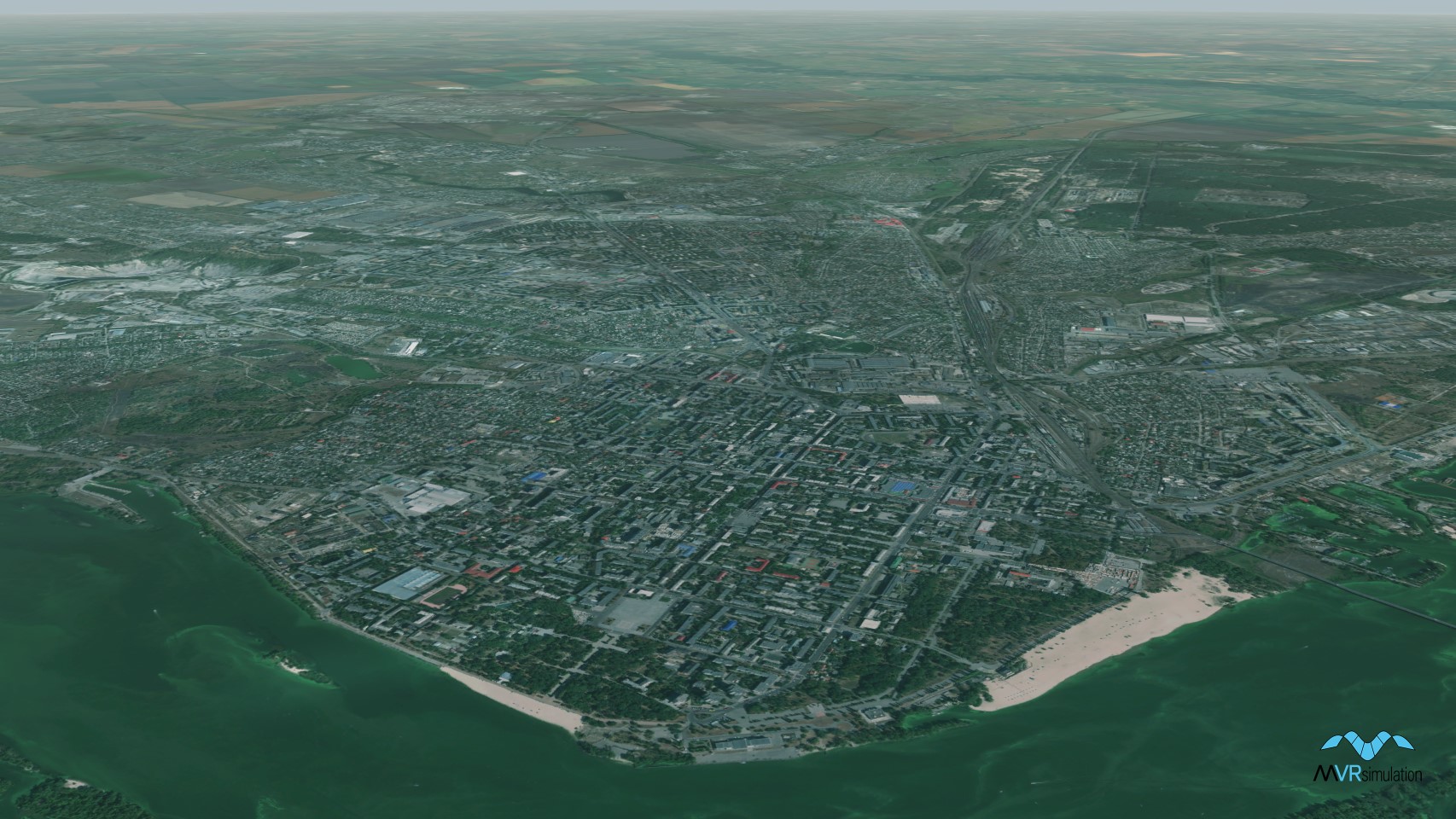
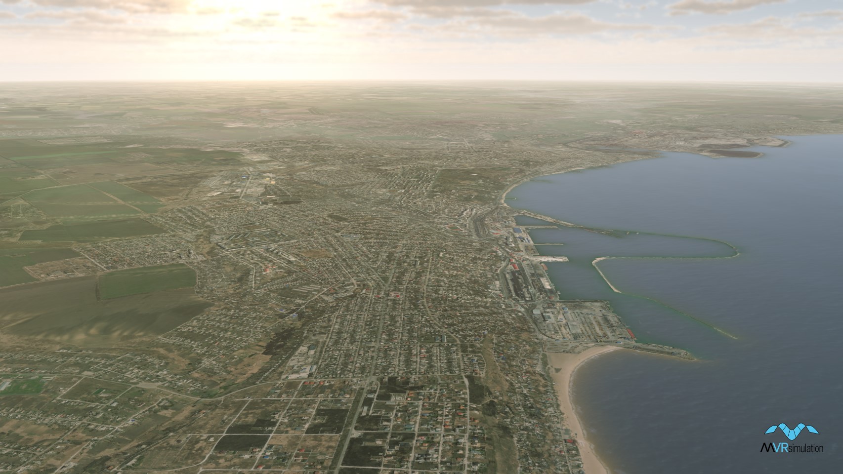
MVRsimulation's 3D virtual Ukraine terrain includes Odessa, a port city on the Black Sea in southern Ukraine.
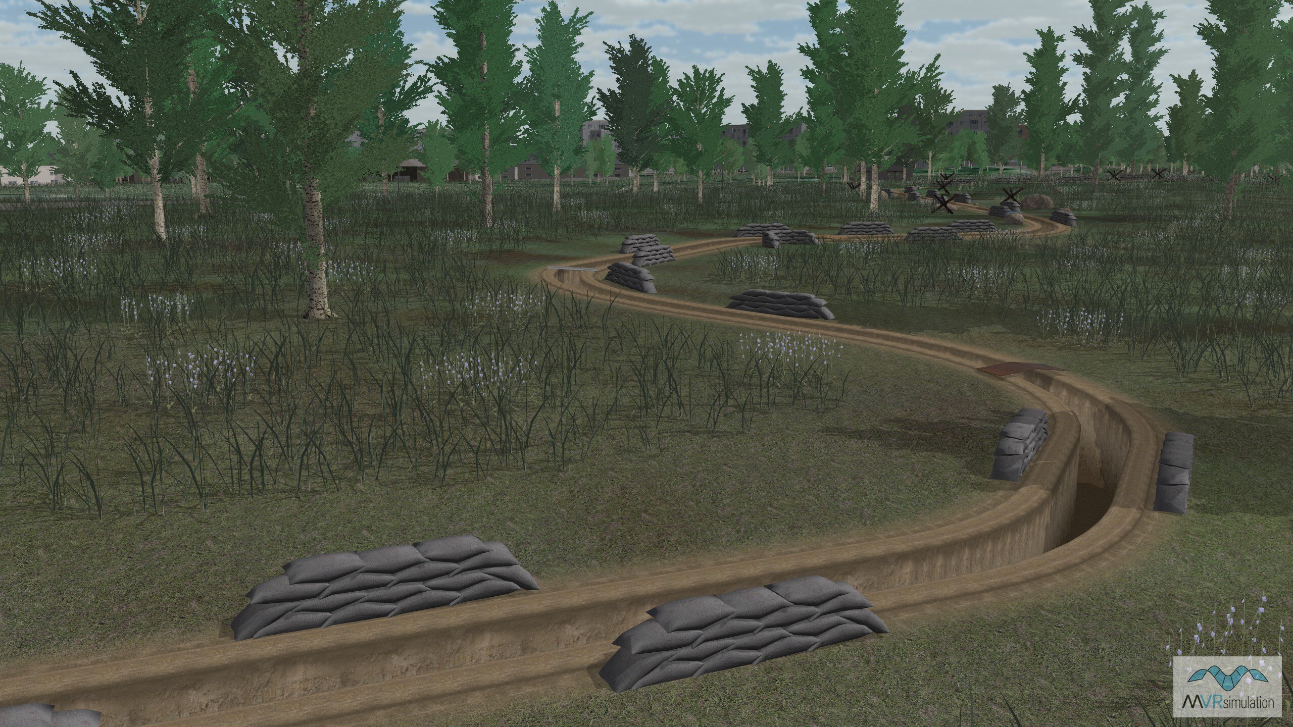
Trench models compiled into VRSG's Ukraine terrain, created using CityEngine rule files.