Threshold Requirements for Simulating Terrain for Ground Vehicles
MVRsimulation’s ability to create round-earth 3D terrain for a realistic simulation experience in Virtual Reality Scene Generator (VRSG) entails representing the surface of the terrain model at a finer resolution than the vehicle's wheelbase, what we refer to as "better-than-wheelbase terrain."
This ultra high-resolution real-time 3D terrain has many advantages for real-time simulation purposes. Of equal importance, this high-resolution visualization provides a direct link to real-time 3D ground-based situational awareness (that is, augmented reality) as an embedded system that is comparable to those systems used for unmanned aerial vehicles (UAV) embedded systems.
Simulating navigation in crew-based and robotic vehicles
Development of ground combat vehicles faces design challenges from the sheer complexity of navigating earth and man-made surfaces and obstacles. Compounding this challenge is the fact that the smaller the vehicle, the more complex the task of navigating difficult terrain. During the design of such vehicles, analytical simulation models that are not real-time have traditionally been used to study the interaction of the terrain with the vehicle suspension system.
With MVRsimulation technology, our customers can use the same elevation data model that is used for the analytic simulation for simulating the vehicle dynamics response to terrain feedback points as is used in the real-time simulation at 60 Hz. In conjunction with the software advancements, MVRsimulation's complete solutions are available for prototyping embedded systems.
The examples below show VRSG real-time rendering of vehicles on terrain built with sub-inch (2 cm) imagery collected by MVRsimulation’s SUAS of the Prospect Square area at the Yuma Proving Ground, AZ. The source imagery was compiled with elevation sources ranging from 2 meters per-post resolution aircraft data to 30 meter USGS National Elevation Dataset (NED).
Example of effect of elevation resolution on simulation
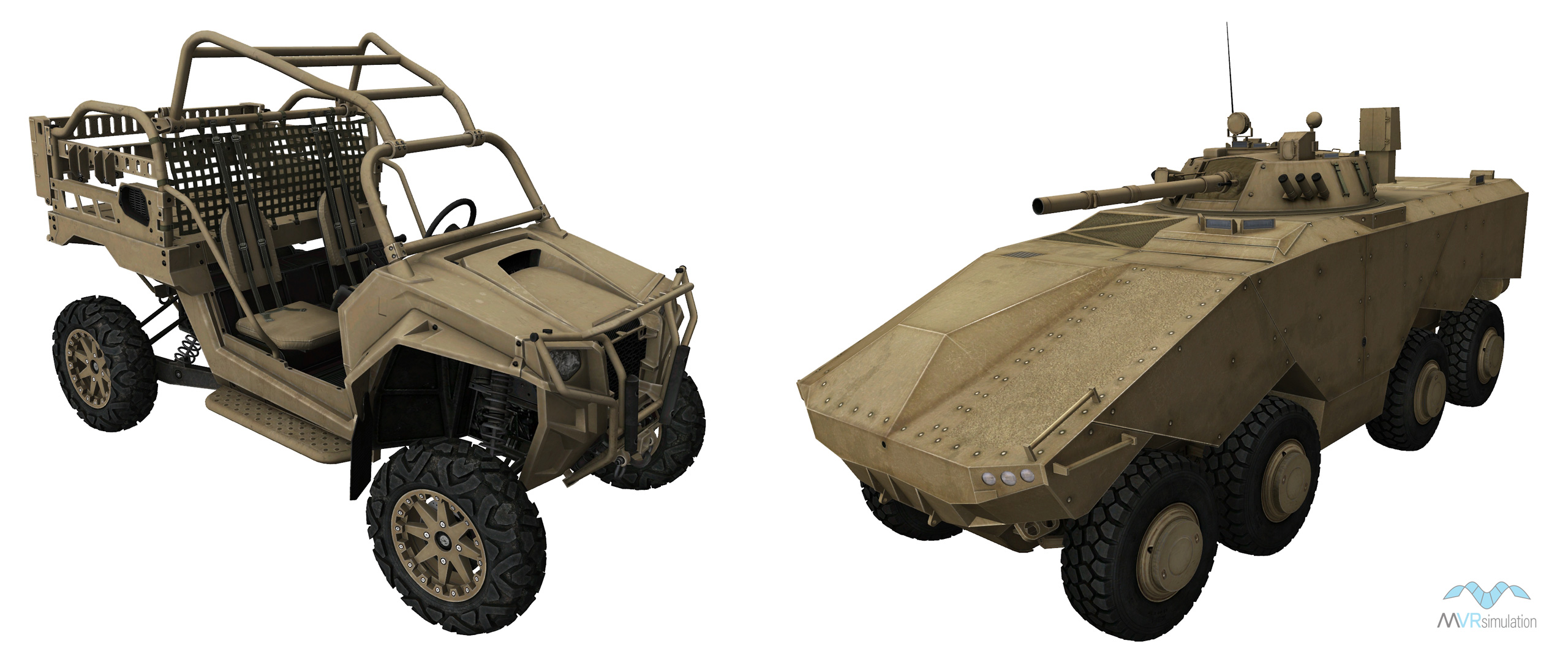
As shown in the images below, the MRZR-2 ultra-light tactical vehicle reacts dramatically to the higher resolution elevation data used to create the underlying terrain.
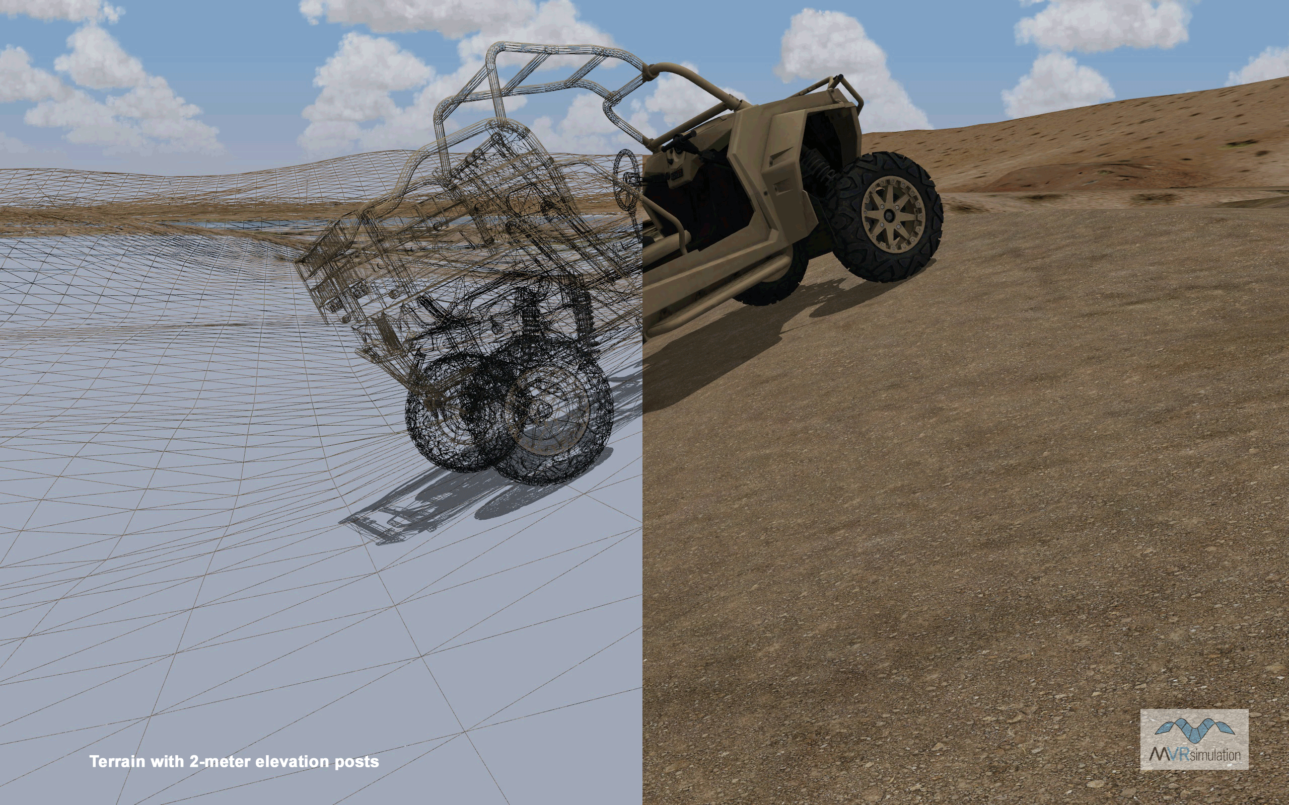
More accurate dynamics feedback due to the higher resolution terrain with 2-meter per-post elevation will give you a more accurate prediction of how the real-life vehicle will behave during actual use. Note that an operator may drive the simulated vehicle over terrain simulated at 30-meters per-post but might tip over driving over terrain using 2-meter per-post. As the wheelbase is smaller for the MRZR-2 vehicle in this example than the larger Enigma vehicle shown below, it is affected more by sudden changes in elevation data. It is even more critical to know where the vehicle can be driven without tipping over or encountering an impassable obstacle.
Simulating navigation in crew-based vehicles
Historically, the simulation of ground vehicles has separated the physical modeling of the host vehicle and its environment from the visual representation portrayed in its corresponding operator training system. This separation was needed because typical visual systems could not cope with the amount of information required in both the physical modeling of the vehicle and terrain environment. The criterion defining this separation is the relationship between the wheelbase of the vehicle being simulated and the resolution of the underlying terrain. Often the simulation host model running the vehicle physics model ran its own higher resolution version of the terrain with a lower resolution version on the visual systems. In such situations, anomalies occurred for the driver; subtle driving cues that were experienced with high-resolution elevation data were not visible in the associated visual system if the two systems use different databases. Navigating through densely featured urban environments is one example of where having an accurate terrain representation is especially important.
Example of the effect of elevation resolution on suspension
As shown in the images below of MVRsimulation's Enigma 8x8 armored modular fighting vehicle model on terrain compiled with differing elevation source data, you can see how the suspension system of the vehicle reacts more dramatically to the higher resolution elevation data used to create the underlying terrain. In a real-time simulation, the suspension articulation is handled by the simulation host.
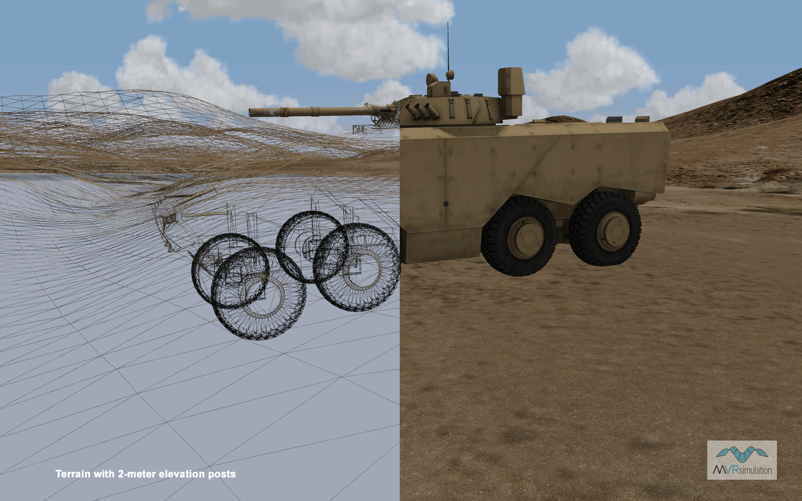
The terrain built with 2-meters per-post elevation data provides the most accurate dynamics feedback which in turn gives a more accurate prediction of how the real vehicle will behave during actual use. This provides a better evaluation model for simulation-based acquisition and a more accurate model for training the vehicle operators.
The terrain model must be "better-than-wheelbase terrain” for a realistic simulation experience. Currently an important transition is occurring in modeling and simulation of ground vehicles. PC-based image generators that have extremely wide data bandwidths are reducing the separation between the physical model and the visual model, which in turn greatly improves the accuracy of the simulated behavior. MVRsimulation VRSG is capable of visualizing the terrain geometry at resolutions commensurate with the physical models.
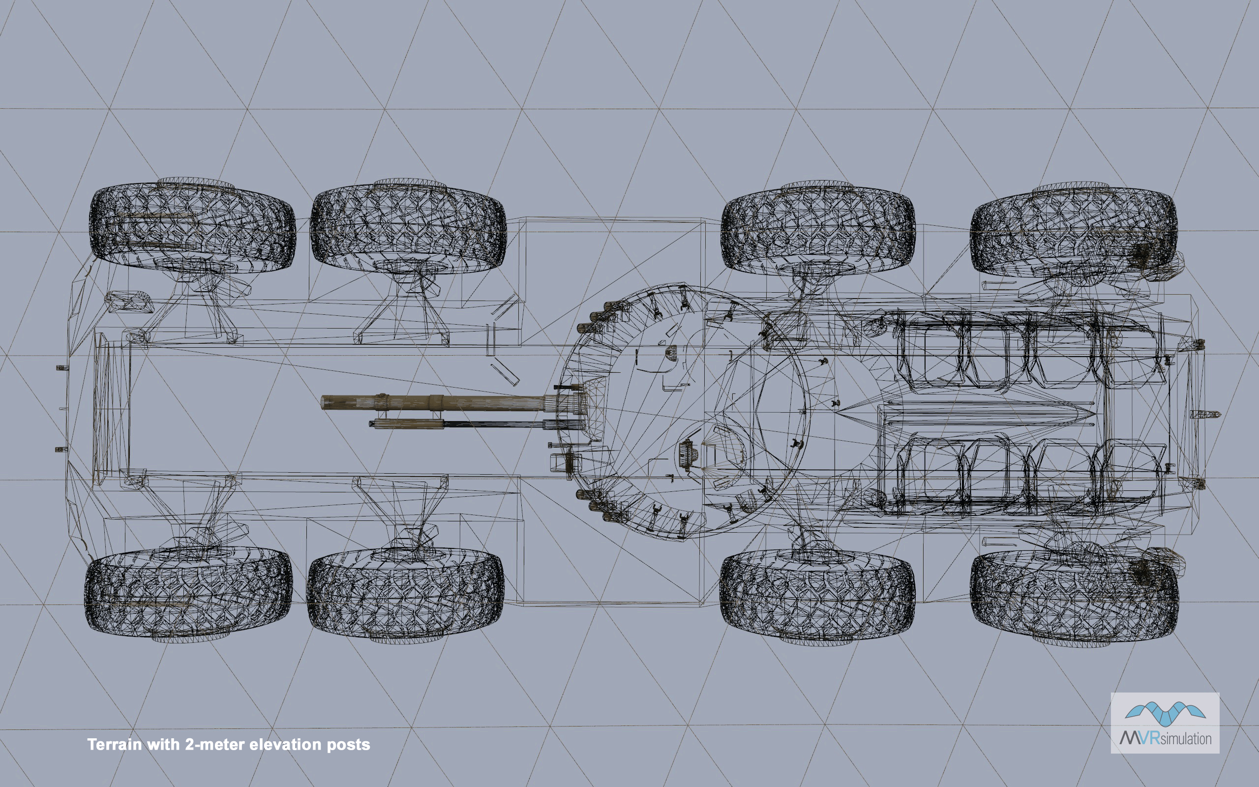
Example of high resolution terrain elevation under the vehicle
As shown in these next images of the Enigma 8x8 model on terrain compiled with differing elevation source data you can see that the terrain support points at 2 meters per-post resolution lie within the confines of the wheelbase of the vehicle and therefore provide very high-fidelity terrain interaction for the vehicle suspension system used to create the underlying terrain.