
Deformation of Terrain for Craters
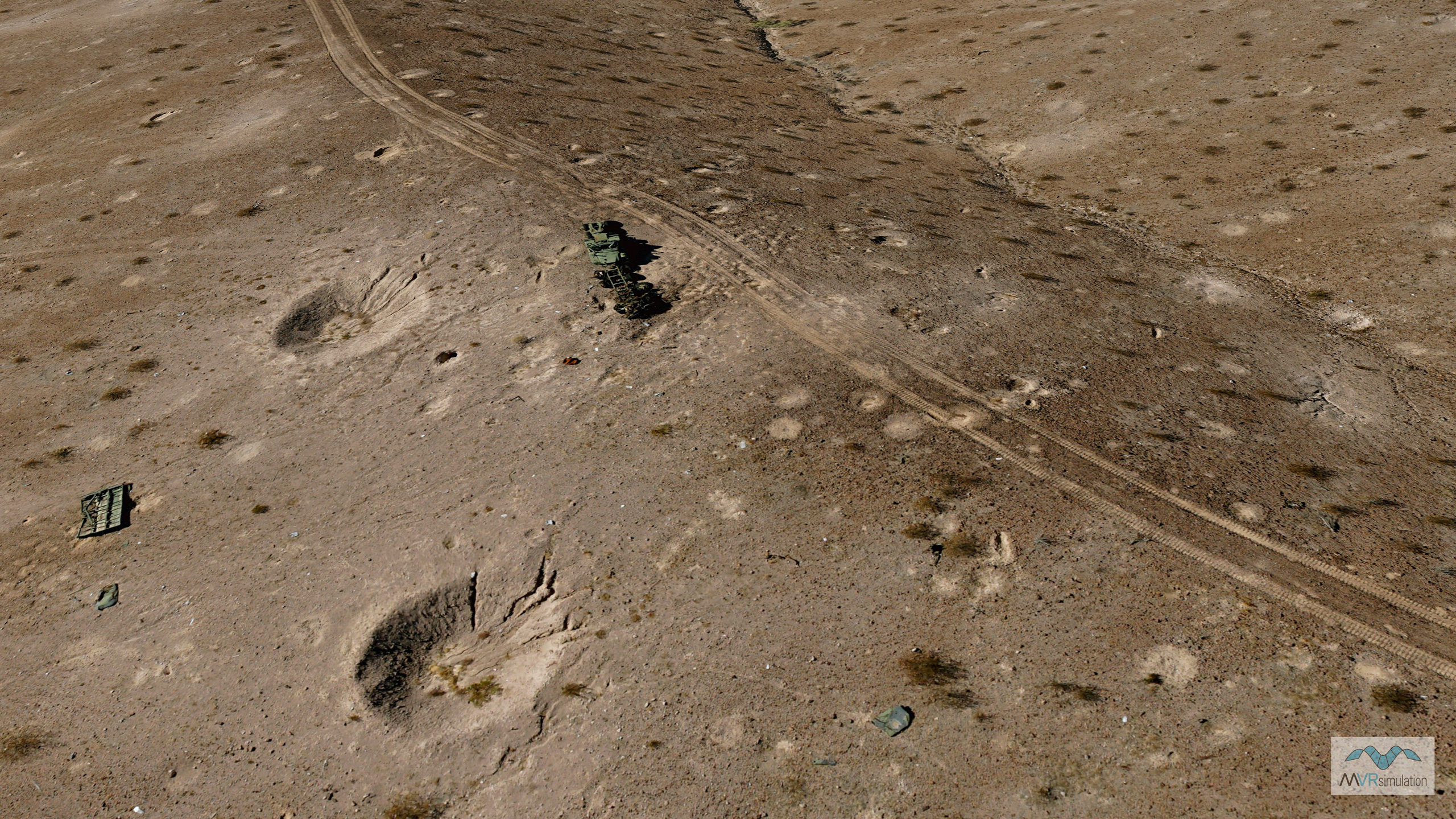
MVRsimulation VRSG real-time rendering of craters. The 2 cm per-pixel resolution virtual terrain is of the Prospect Square area at the U.S. Army Yuma Proving Ground, AZ.
MVRsimulation VRSG can dynamically deform terrain surfaces to represent craters resulting from munitions impact. Users can associate various crater radius and depths with differing munition types.
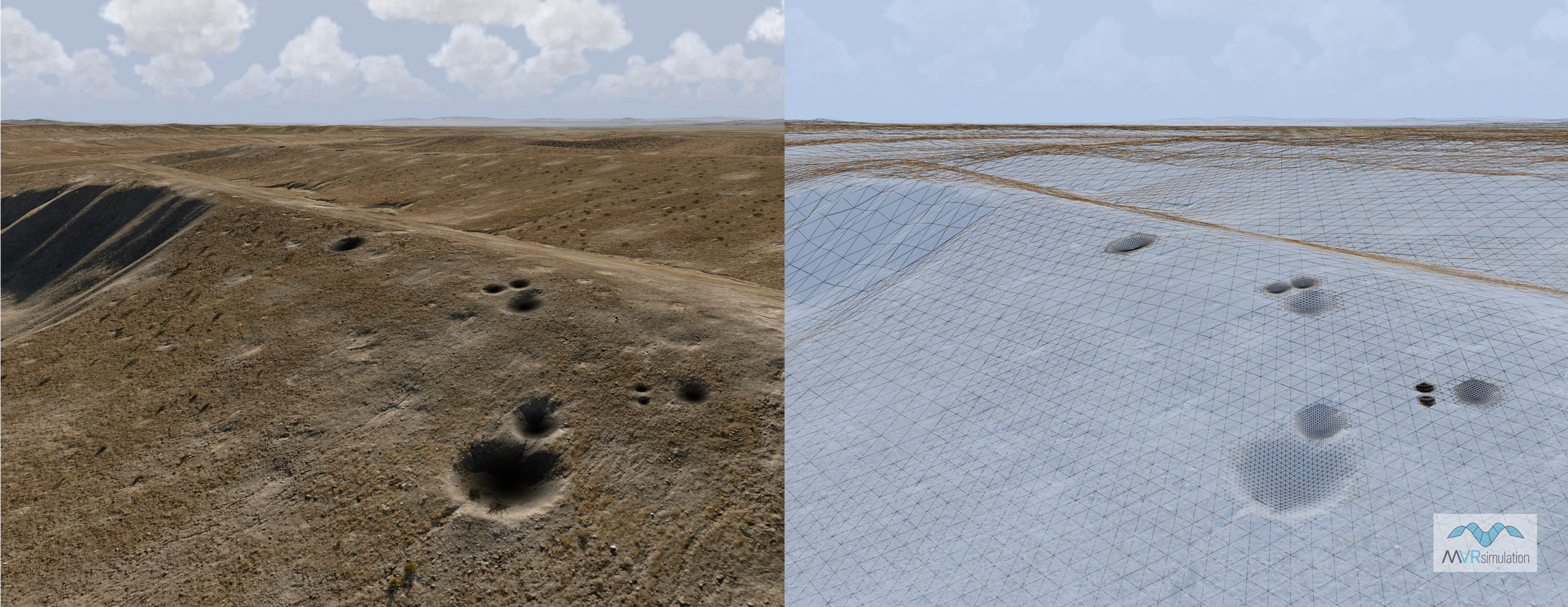
MVRsimulation VRSG real-time rendering of textured and wireframe views of craters.
For a detonation event, VRSG can dynamically hyper-tessellate the local terrain surface to the degree needed to capture the crater's shape. The newly formed crater supports mission functions such as elevation lookups and intervisibility queries. In VRSG's physics-based IR rendering, the crater appears hot, with incremental cooling over time, from the outer radius inward.
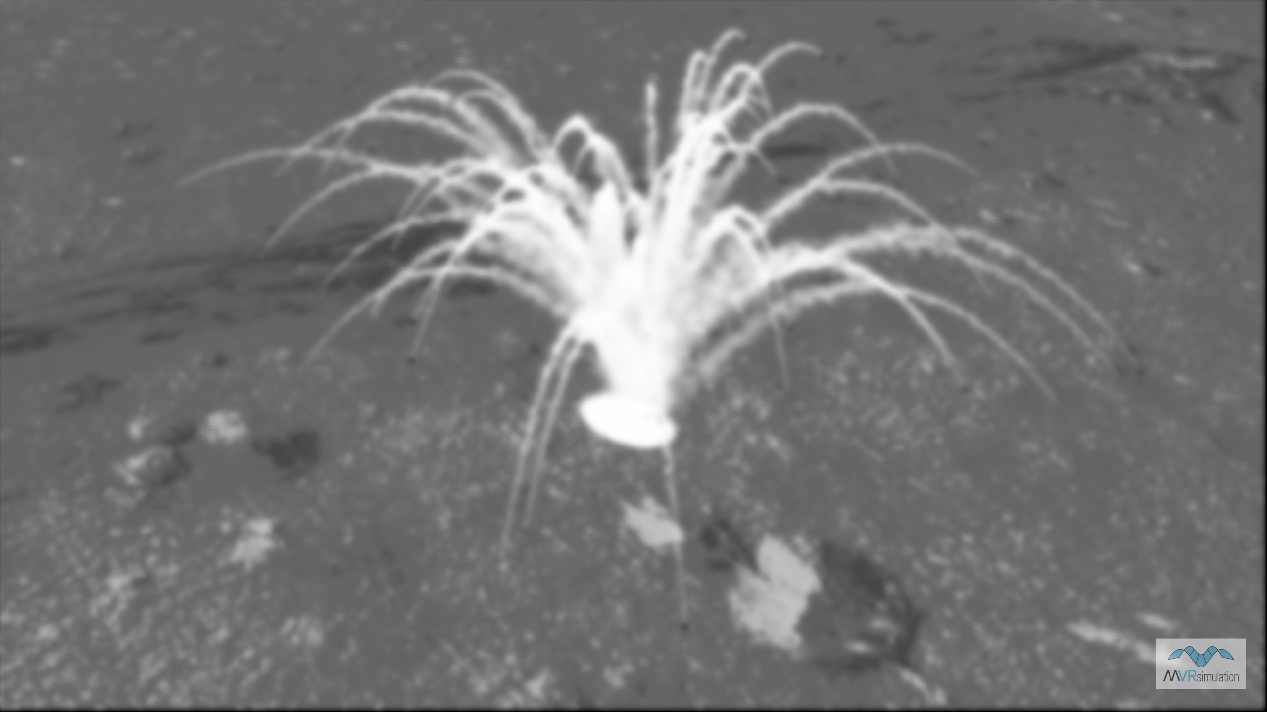
MVRsimulation VRSG real-time scene of a detonation event, and a newly formed crater.