
What's New In Terrain Tools 2.0
Terrain Tools for Esri ArcGIS Pro version 3.0 includes:
- Support for all features from Terrain Tools for ArcGIS Desktop version 2.1 on the new Esri ArcGIS Pro platform.
- Automate transitioning legacy databases from Terrain Tools 2.1 and Esri ArcGIS Desktop software.
- Performance improvements including parallelized display rendering during compilation.
- Adds support for cutting CityEngine features into the terrain and 3D fences. Also, support for randomizing damage states from the CityEngine rule files.
- Compile imagery from Web Tile layers into terrain.
- Fine tune output from areal forest features. Add model weight attribute to specify the frequency of different models. Adds permodel colorization and LOD settings specified via JSON.
MVRsimulation Terrain Tools for Esri® ArcGIS® version 2.0 contained the following new features and enhancements:
- New Tile Set Layer feature, which provides the ability to use a one or more terrain tiles as imagery and/or elevation source. With this feature you can use existing tiles built by MVRsimulation as part of your site’s terrain building effort, blended with your site’s own imagery and elevation source data.
- Build Manager improvements:-Ability to rebuild one or more tiles from an existing build, optionally with different a minimum texture and/or elevation resolution.-Ability to inspect a tile in the Model Viewer without leaving Terrain Tools.
- CityEngine SDK integration, which provides compilation performance improvement with support for instancing and automatic LOD generation. With this release MVRsimulation is making available its library of City Engine rule packages (rpks), which were created in recent years for several terrain datasets. You can obtain these .rpks on MVRsimulation’s Download Server, in /Software/Terrain Tools/.
- New areal forest feature, which quickly populates a given polygon with points (with a buffer region around each) for dense tree coverage.
- Ability to generate 2048 x 2048 pageable textures automatically during compilation, which can be rendered in VRSG v7.0 and higher.
- The new name convention for cultural feature files and microtextures is vrsg.clt and vrsg_microtexture_ x_y_z.tex. Previously created cultural feature files and microtextures with the old convention of "metadesic" their name are respected by Terrain Tools and VRSG 7.
- Automatic generation of LODs for runway features.
- All the advancements in the latest ArcGIS for Desktop version 10.8 are supported in Terrain Tools.
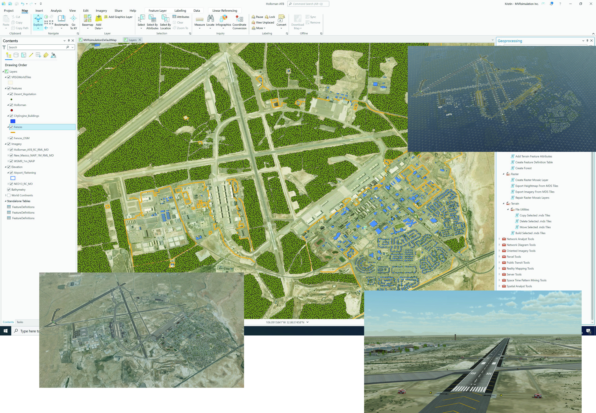
Composite of MVRsimulation's Holloman Air Force Base, New Mexico map shown in ArcGIS Pro. The terrain is based on 10-meter resolution elevation data from the NED USGS with high-resolution 30 cm imagery. Other images are VRSG's real-time rendering of the terrain, airfield and wire frame of the cultural models.
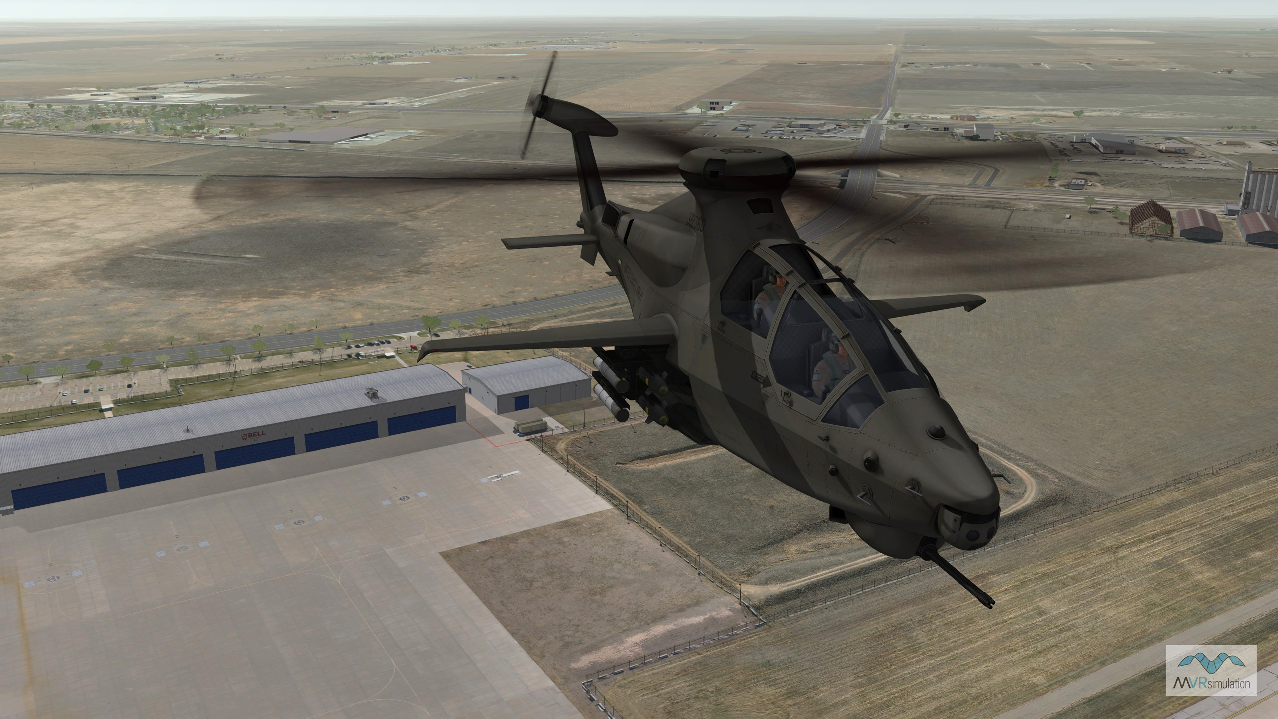
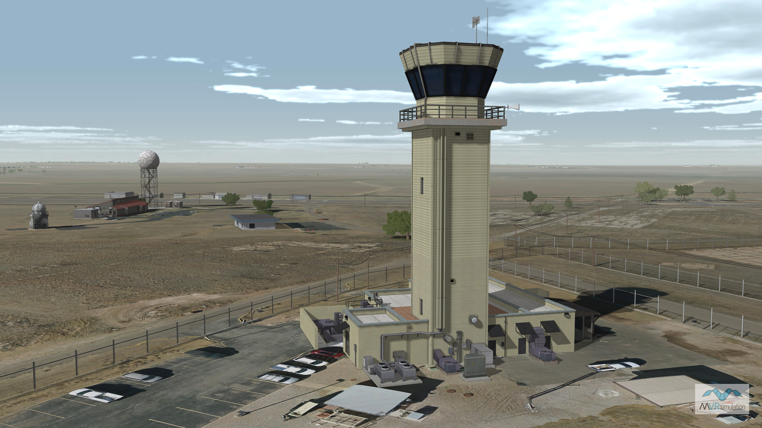
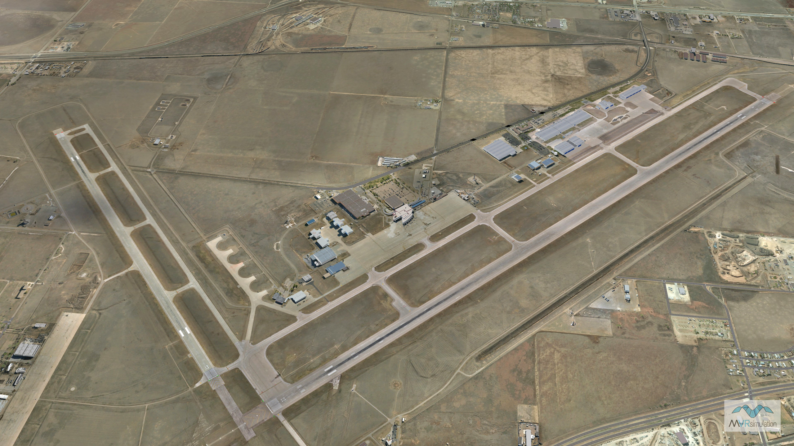
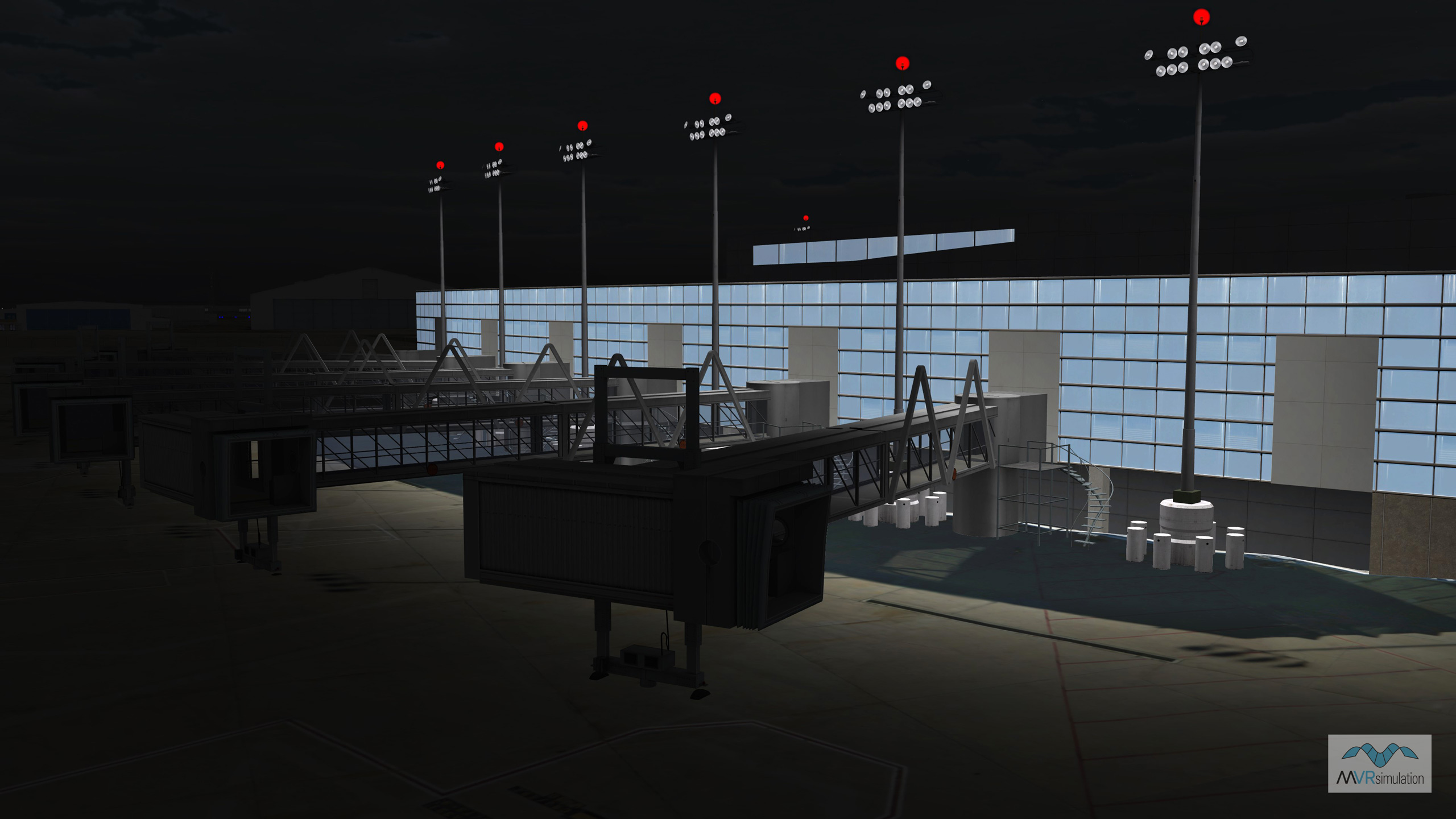
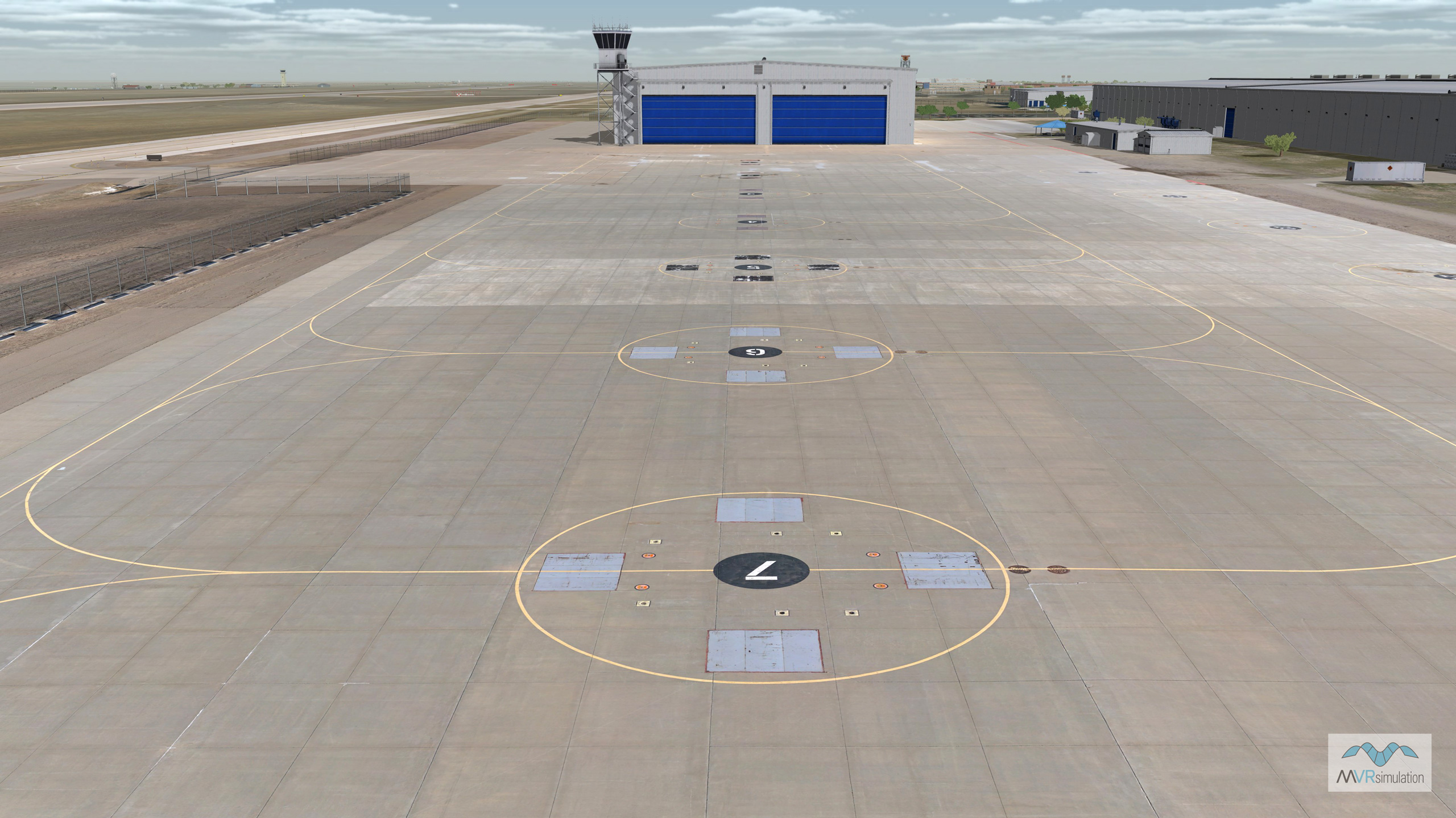
Using Terrain Tools, MVRsimulation has built a new geospecific 3D dataset of Rick Husband Amarillo International Airport (KAMA), and the city of Amarillo, TX, available to customers with active software maintenance.
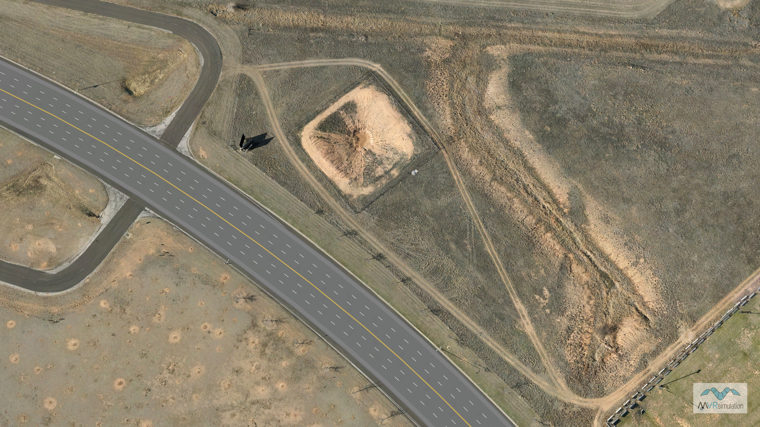
The terrain is comprised of 5 mm per-pixel and 2 cm drone imagery of the airport (14 sq km), 30 cm Maxar imagery of the airport, and 30 cm Texas Open Data (TRNIS) imagery of the Amarillo metropolitan area blended to 1m NAIP base imagery of CONUS terrain. The elevation source includes 70 meter elevation data of the airport blended to 10 meter NED data of Amarillo and underlying DTED-1 base elevation. This terrain contains a substantial number of 3D culture models of the airport, such as two geospecific runways, helipads, runway lights, runway signs, a control tower, multiple hangars, and CityEngine-generated 3D culture of the city of Amarillo. The terrain was compiled in our round-earth terrain format for rendering in VRSG.
This ultra-high-resolution terrain is available on MVRsimulation’s CONUS NAIP South Central region 3D terrain for use by customers who are on active VRSG software maintenance and are US Government agencies or contractors (for official use only).
HOW TO OBTAIN TERRAIN TOOLS
Current Terrain Tools customers on active maintenance can obtain the latest release of Terrain Tools version 3.0 by downloading the software from their account on MVRsimulation's Download Server. Terrain Tools version 3.0 is also delivered on a USB hard drive. Contact MVRsimulation for further information.
Note: Terrain built with the latest features of Terrain Tools version 3.0 requires the latest release of VRSG 7.0 or higher. Customers with a VRSG license and valid software maintenance can also obtain the latest release of VRSG on MVRsimulation's Download Server.