
La Union, Spain

La Union, Spain

La Union, Spain Terrain Database Information

  • Imagery: 25cm
  • Elevation: 30m
  • Terrain Drive: Europe
  • Cultural Features: CityEngine (Geotypical) Buildings, Custom Models, Destructible Buildings, Landscape Features (Shrubs, Grass, Paved Medians, etc.), Light Poles, Roads, Trees, Wind Turbines 
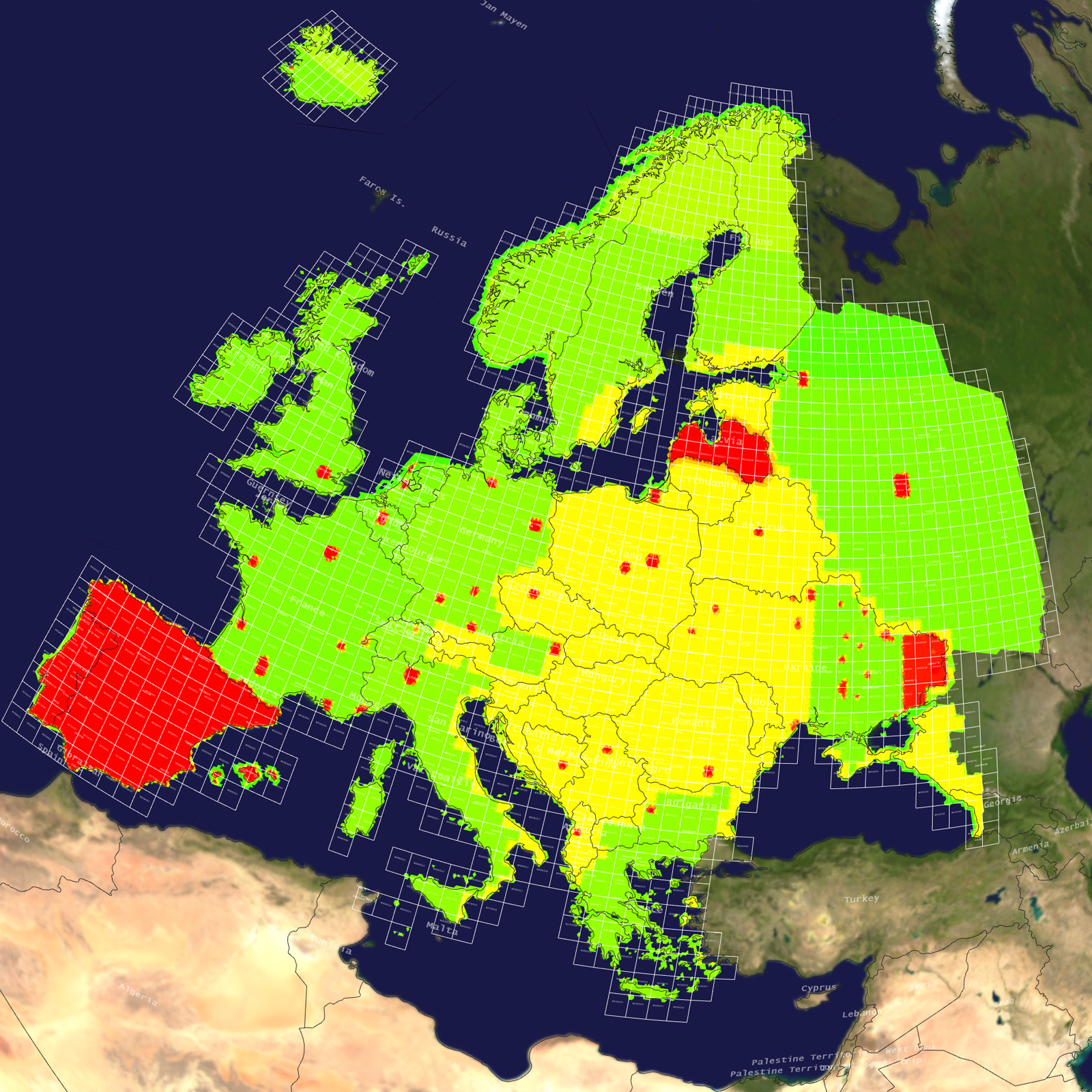
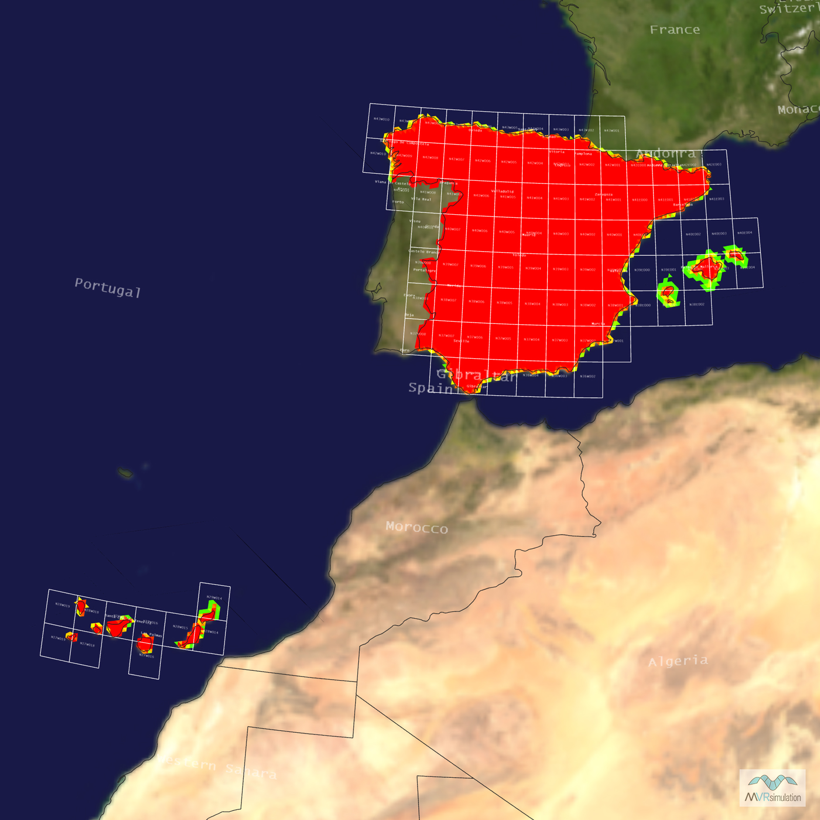
Tile Coverage Map

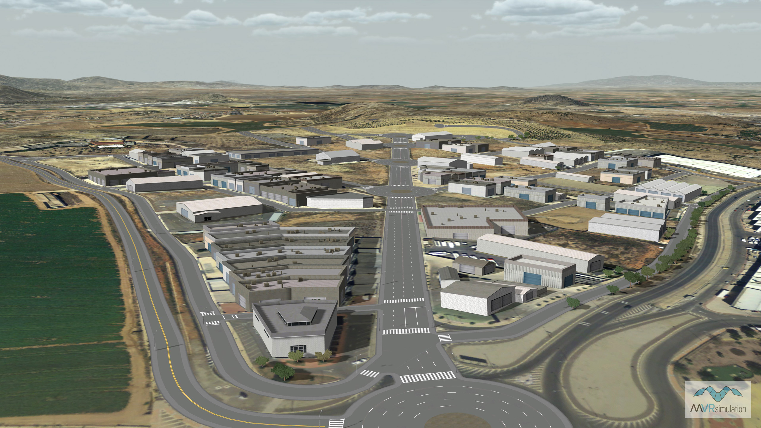
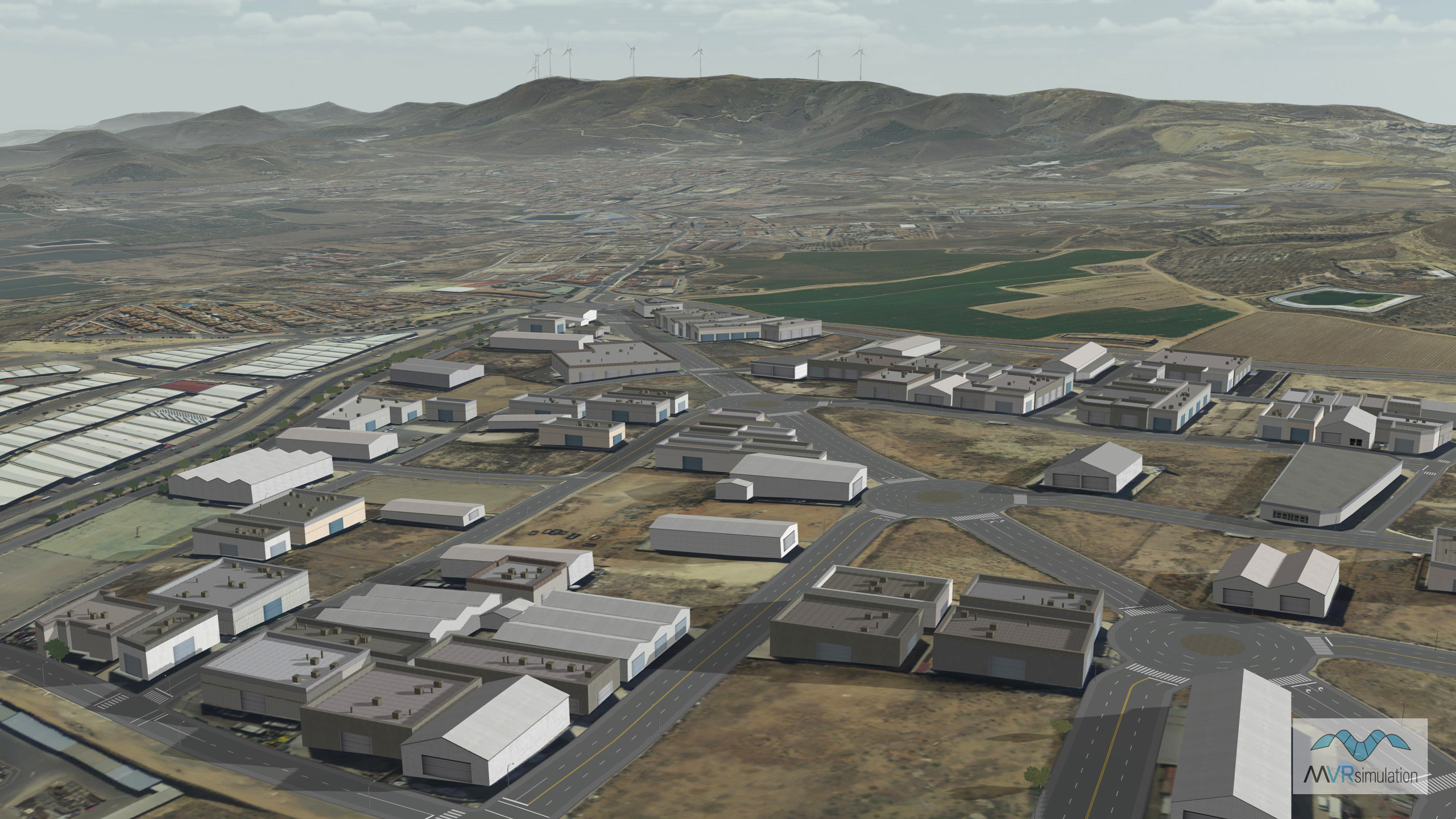
MVRsimulation VRSG scene of a commecial district in La Union, Murcia, Spain with mountaineous terrain in the background.

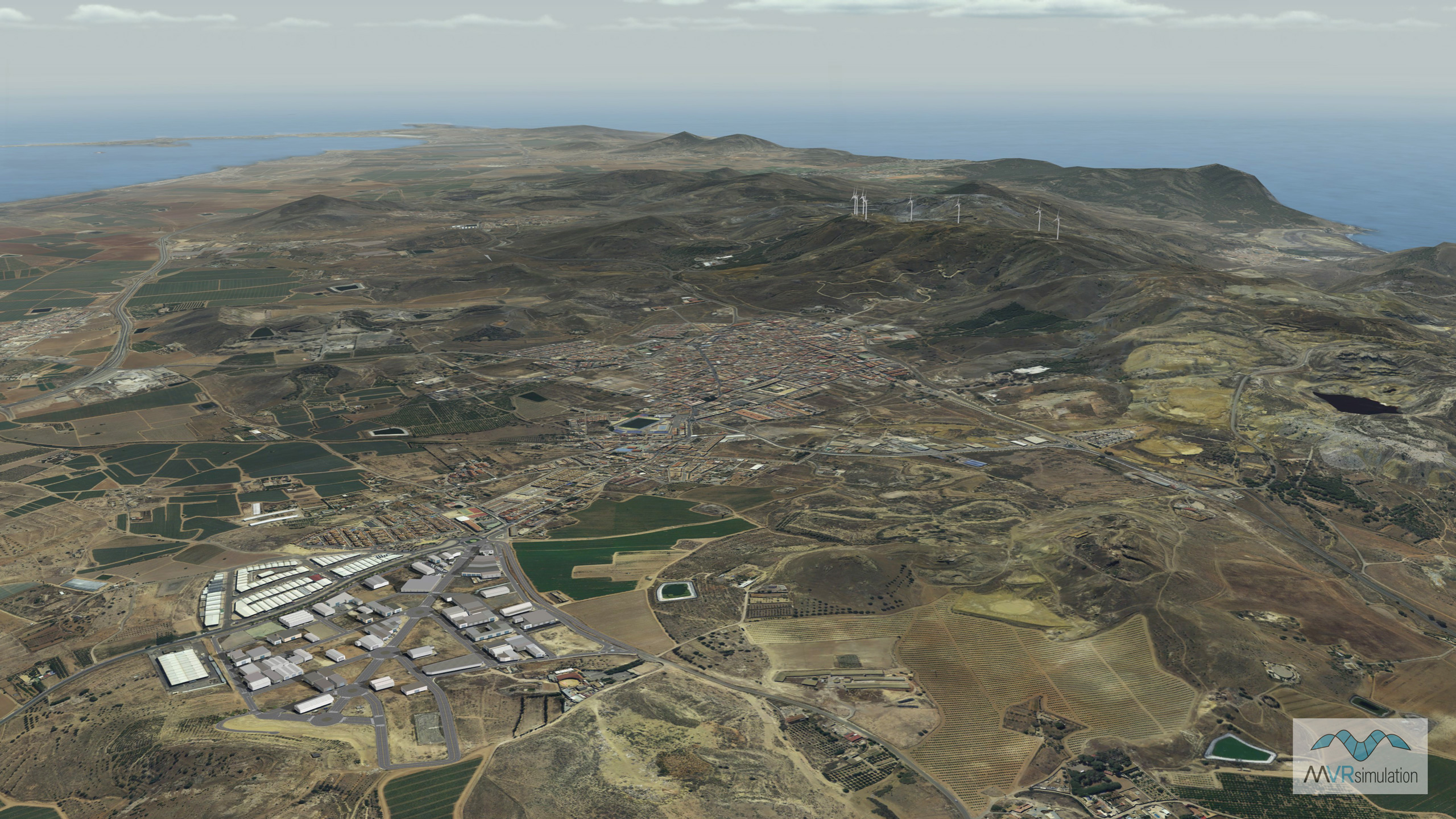
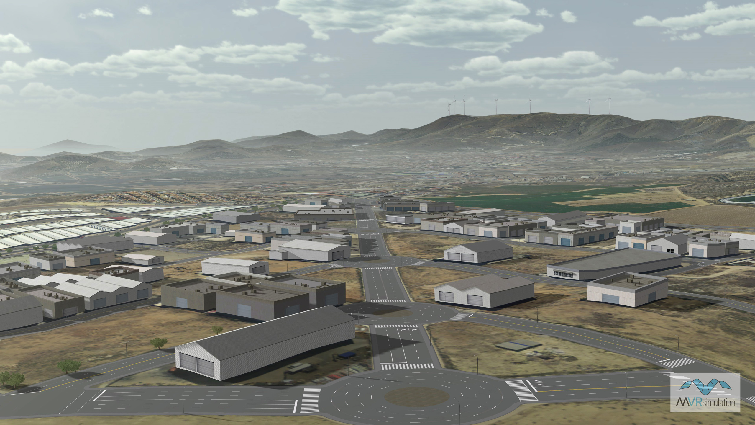
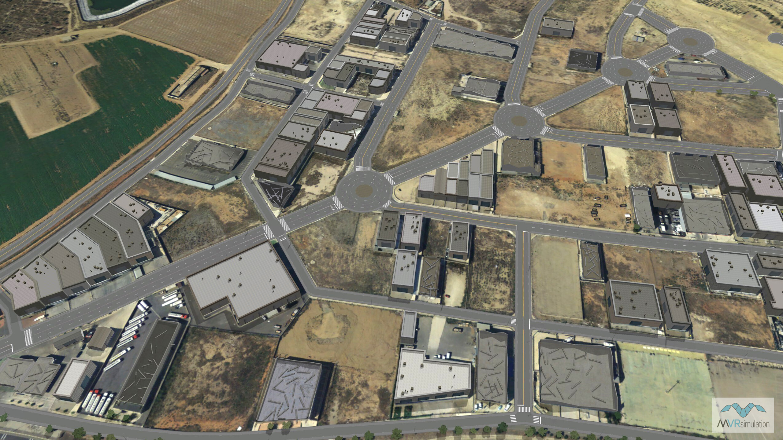
MVRsimulation VRSG scene of a portion of the Region of Murcia in southeastern Spain. The scene shows geospecific and geotypical buildings along with roads, roundabouts, sidewalks, cross walks, lane lines, stree lights, trees and wind turbines. 

MVRsimulation VRSG scene of La Union, Spain depicting some destroyed buildings in the commercial district.

Related Terrain

EXTEND YOUR TERRAIN DATABASE

MVRsimulation Downloads Server

  • Explore and implement terrain updates
  • Download and use new 3D models
  • Stay up-to-date with VRSG features
  • Discover utilies for expanding VRSG
    Filler for Spacing

Request Account

MVRsimulation Regional Terrain Drives

  • External hard drive - regional terrian
  • Network attached storage device - whole-world terrain
  • Ready for plug and play
  • Available to customers on active maintenance
    Filler for Spacing

Request Drive

MVRsimulation Produced Custom Terrain

  • Custom terrain created by MVRsimulation's terrain team
  • Specify your desired area of interest
  • Indentify needed terrain features.
  • Use your own or commercially available imagery
    Filler for Spacing

Request Quote

Create Terrain with Terrain Tools

  • Build real-time 3D terrain for VRSG using GIS technology with ArcGIS Pro
  • Designed to be user-friendly for users with basic ArcGIS knowledge
  • Use imagery, elevation, and optional vector data to create terrain
  • Compile buildings from 2D polygon footprint features using a CityEngine rule package
    Filler for Spacing

Terrain Tools