Lugo Province, Spain Terrain Database Information
- Imagery: 25cm
- Elevation: 5m source data
- Terrain Drive: Europe
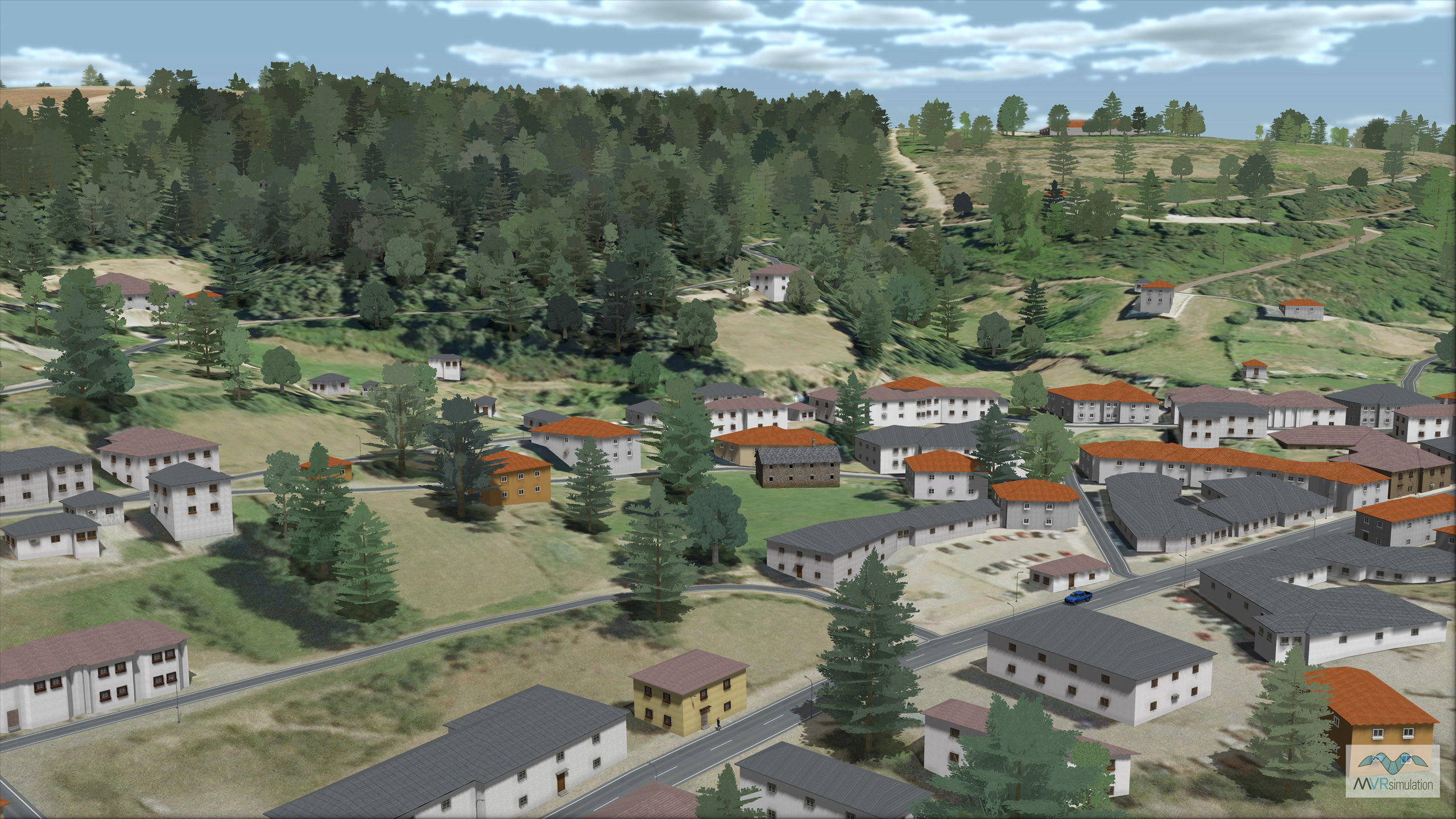
- 3D modeled towns of Fabero, Lilo de Bierzo, Otero de Naraguantes, Fontoria, Sesamo, Vega de Espinareda, La Espino, and Espinareda de Vega.
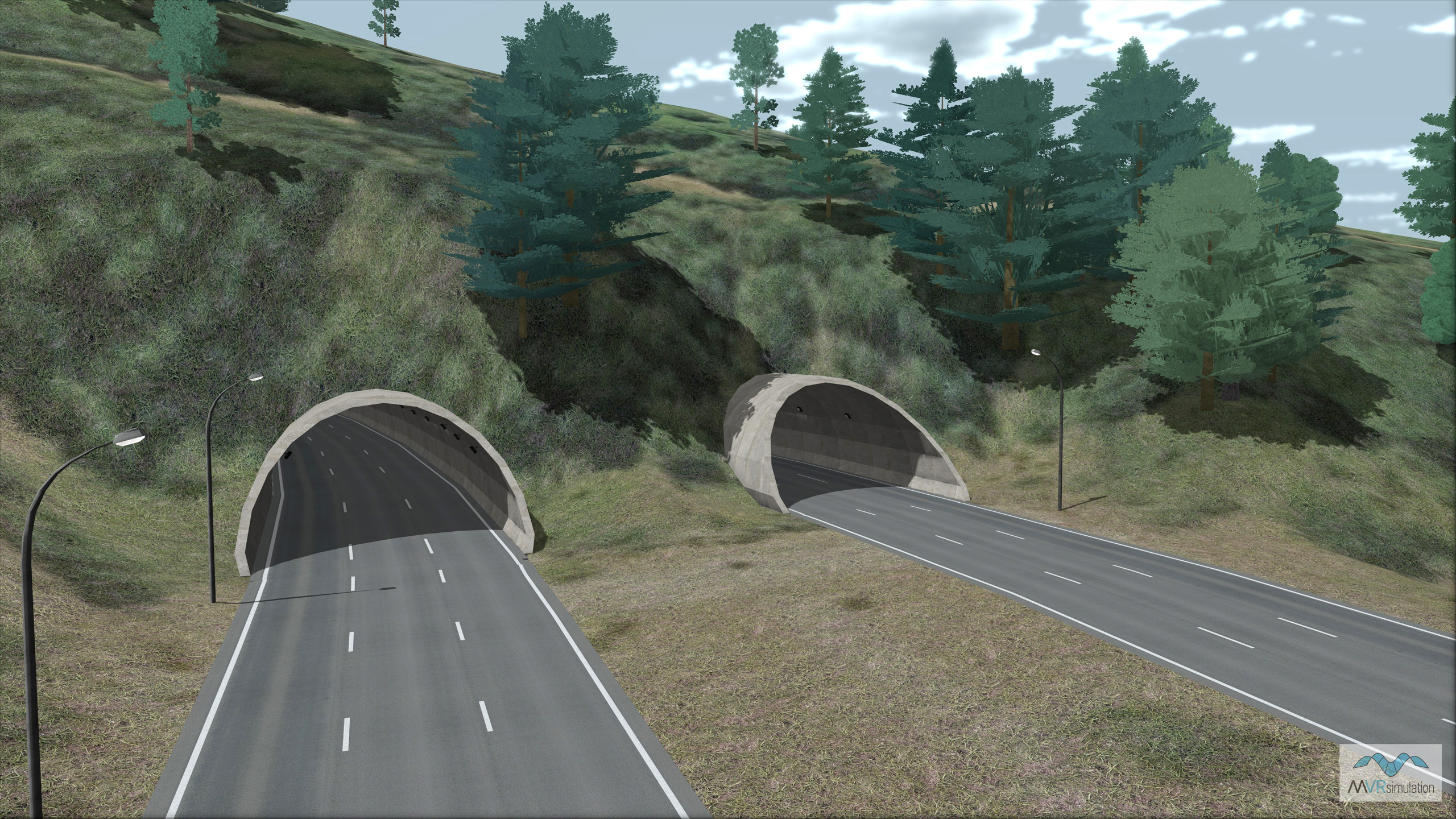
- Five sets of twin tunnels and 55 bridges were modeled along highway A6 leading to the town of Pedrafita do Cebreiro. Accompanying the structures are streetlights and tunnel lights, illuminated with light lobes for tunnel and nighttime scenes.
- Cultural Features: CityEngine (Geotypical) Buildings, Bridges Geotypical, Light Poles, Lighting for Non-Runway Areas (Streetlights), Roads, Trees, Tunnels
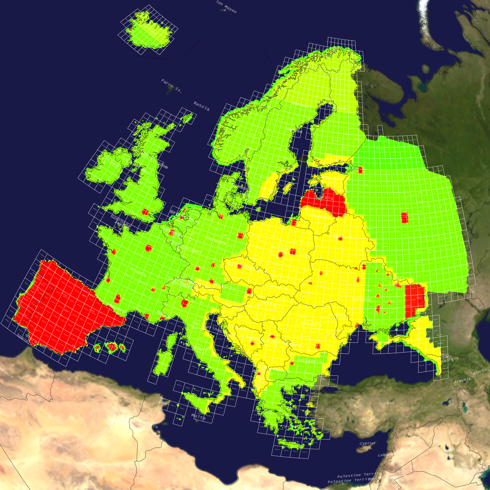
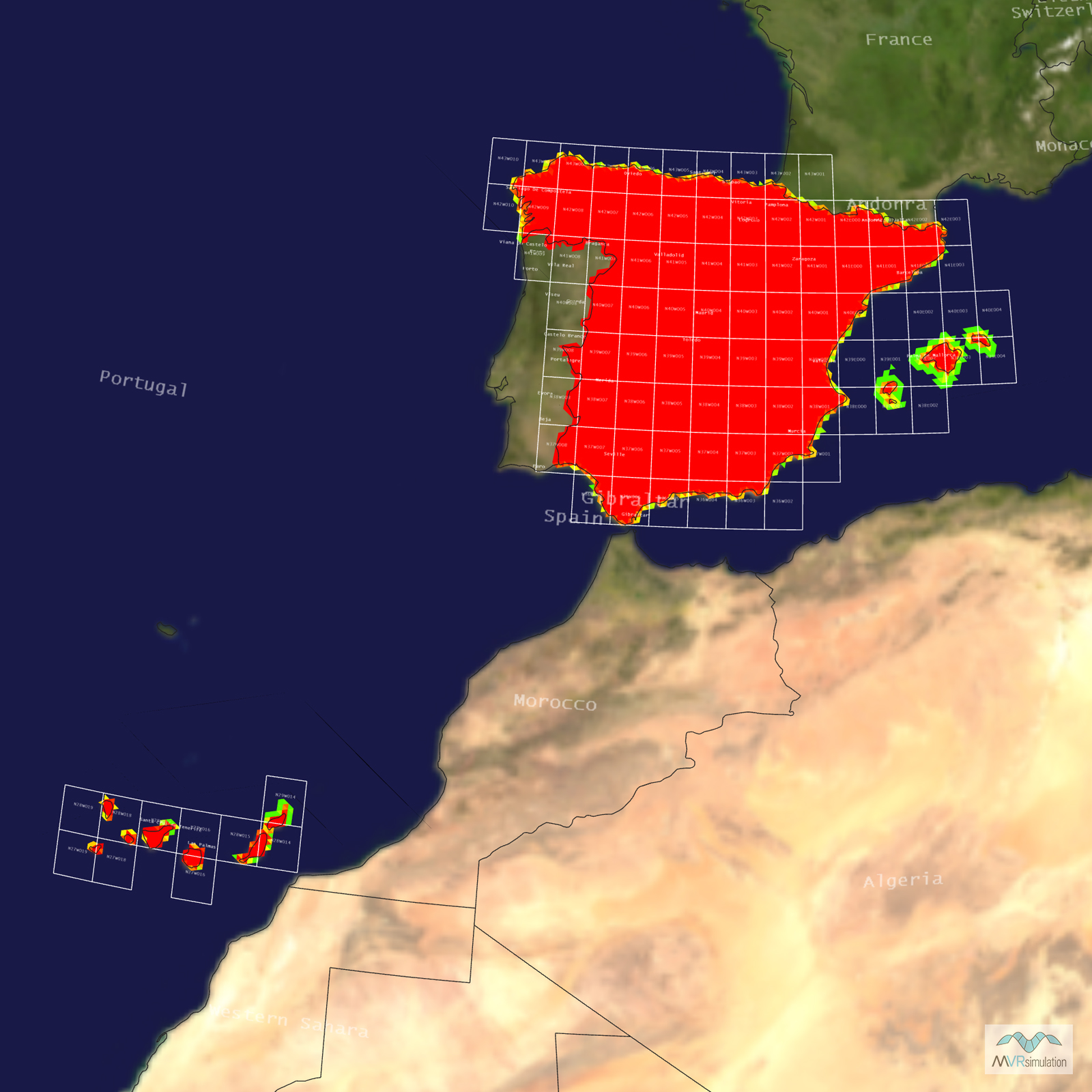
Tile Coverage Map
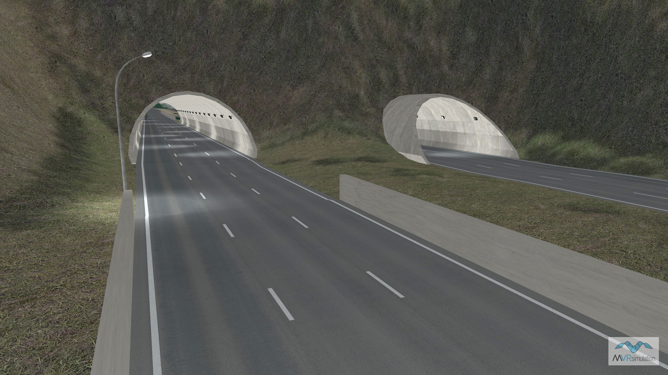
MVRsimulation VRSG real-time dusk scene of one of the twin tunnels, illuminated, outside Pedrafita do Cebreiro along the A6 highway of virtual Lugo, Spain.
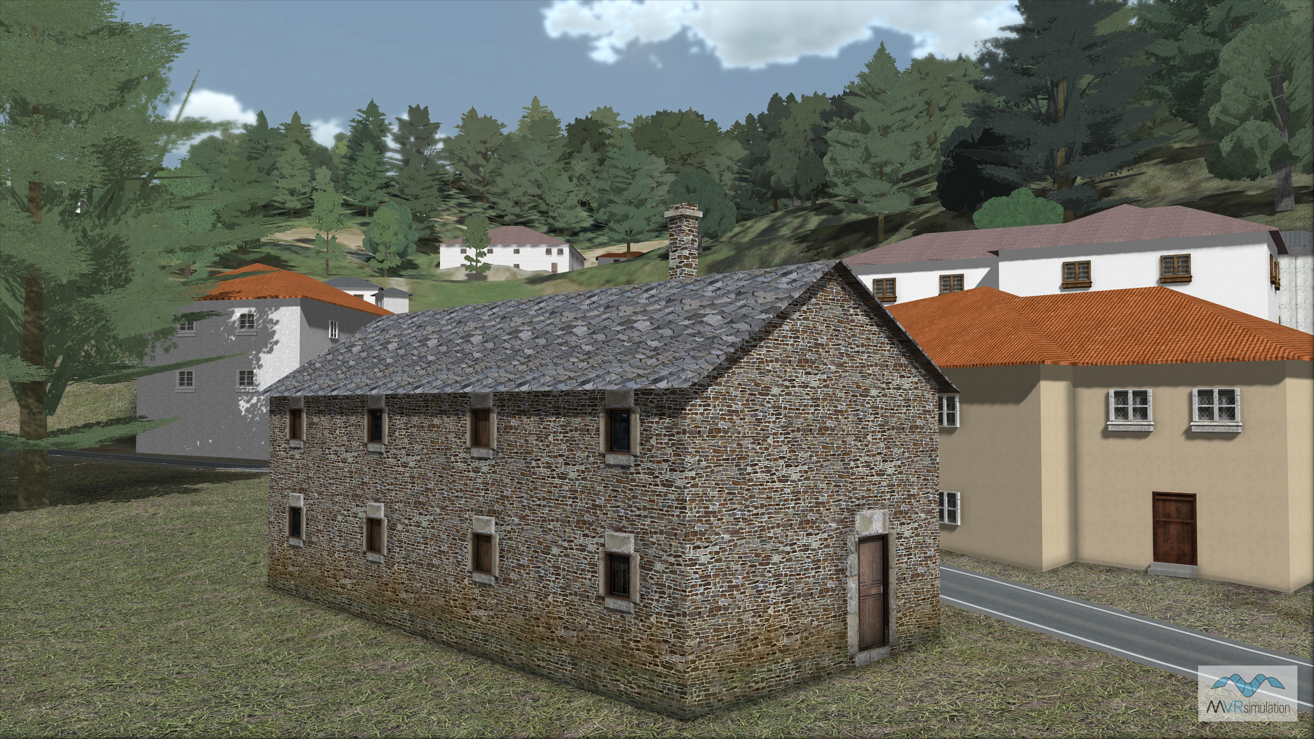
MVRsimulation VRSG real-time scene approaching the town of Pedrafita do Cebreiro in virtual Lugo province, Galicia, Spain. Featured in the scene is a model of a traditional style stone building of the type found in the Galicia region.
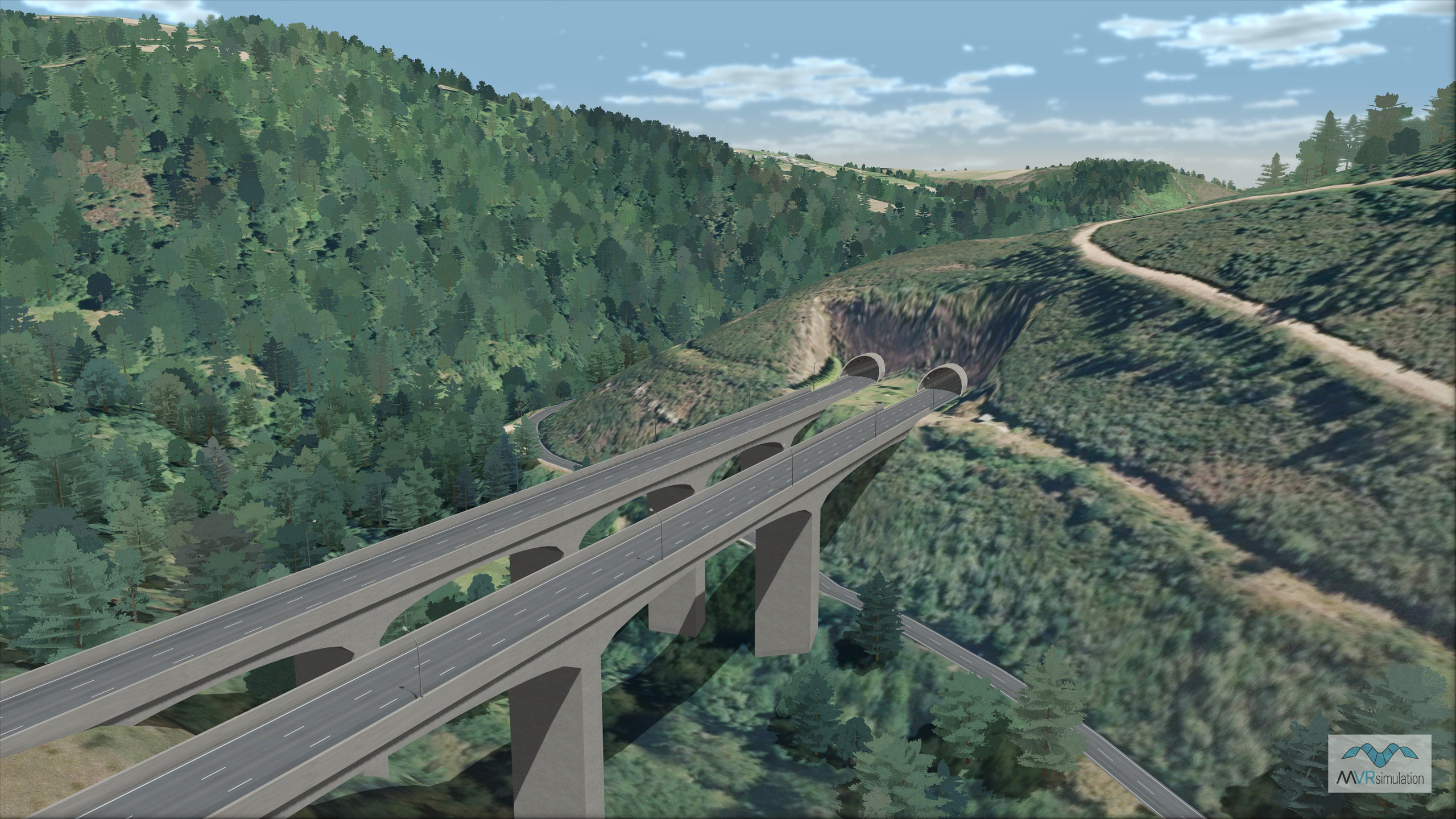
MVRsimulation VRSG real-time scene of the lush forest and one of the many twin bridges and tunnels along the A6 highway of virtual Lugo, Spain.
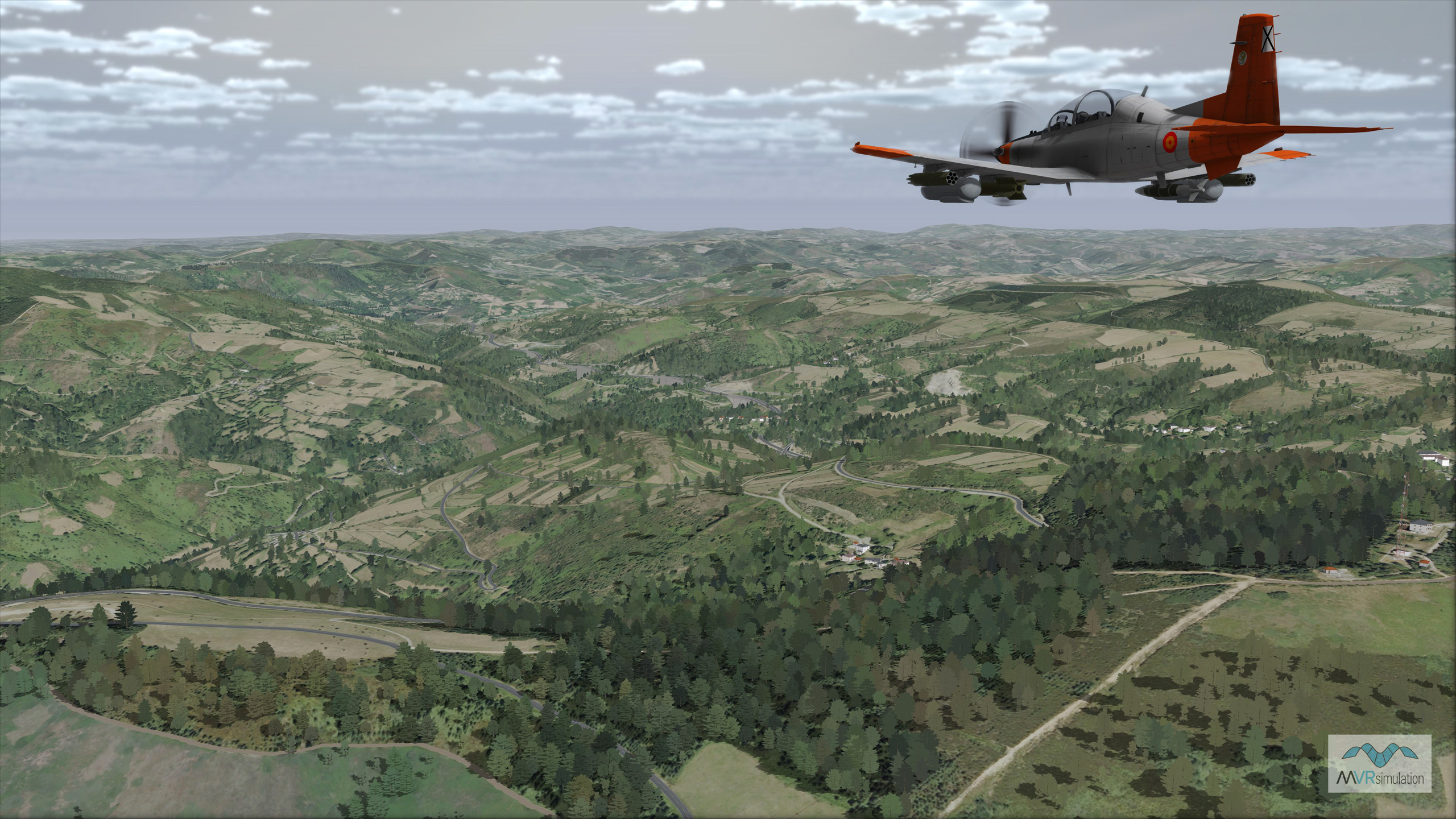
MVRsimulation VRSG real-time scene of the approach to the modeled town of Pedrafita do Cebreiro in virtual Lugo province, Galicia, Spain.
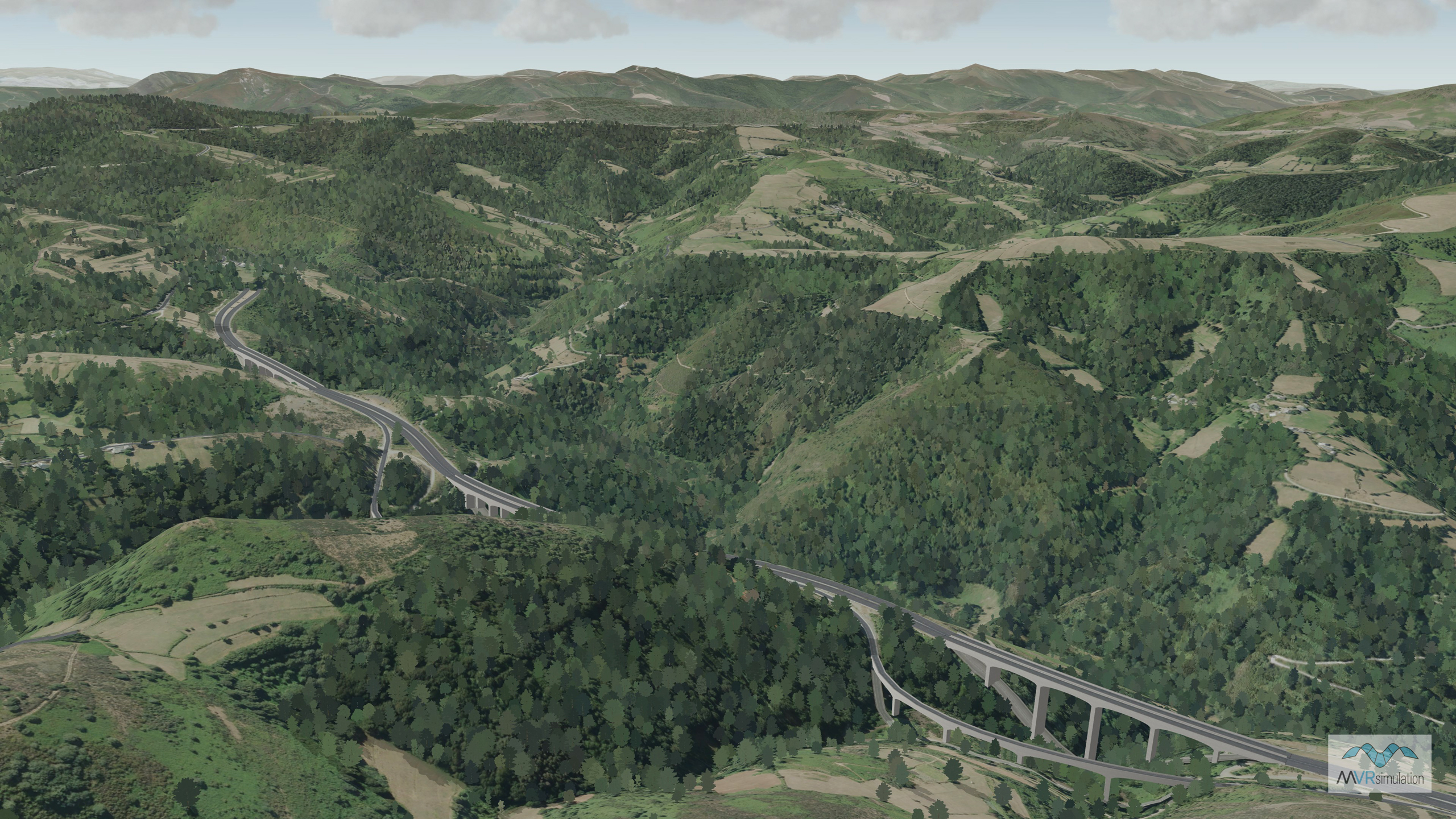
Over 3 million trees are embedded into the Lugo, Spain terrain. The trees are color sampled to match the underlying terrain.
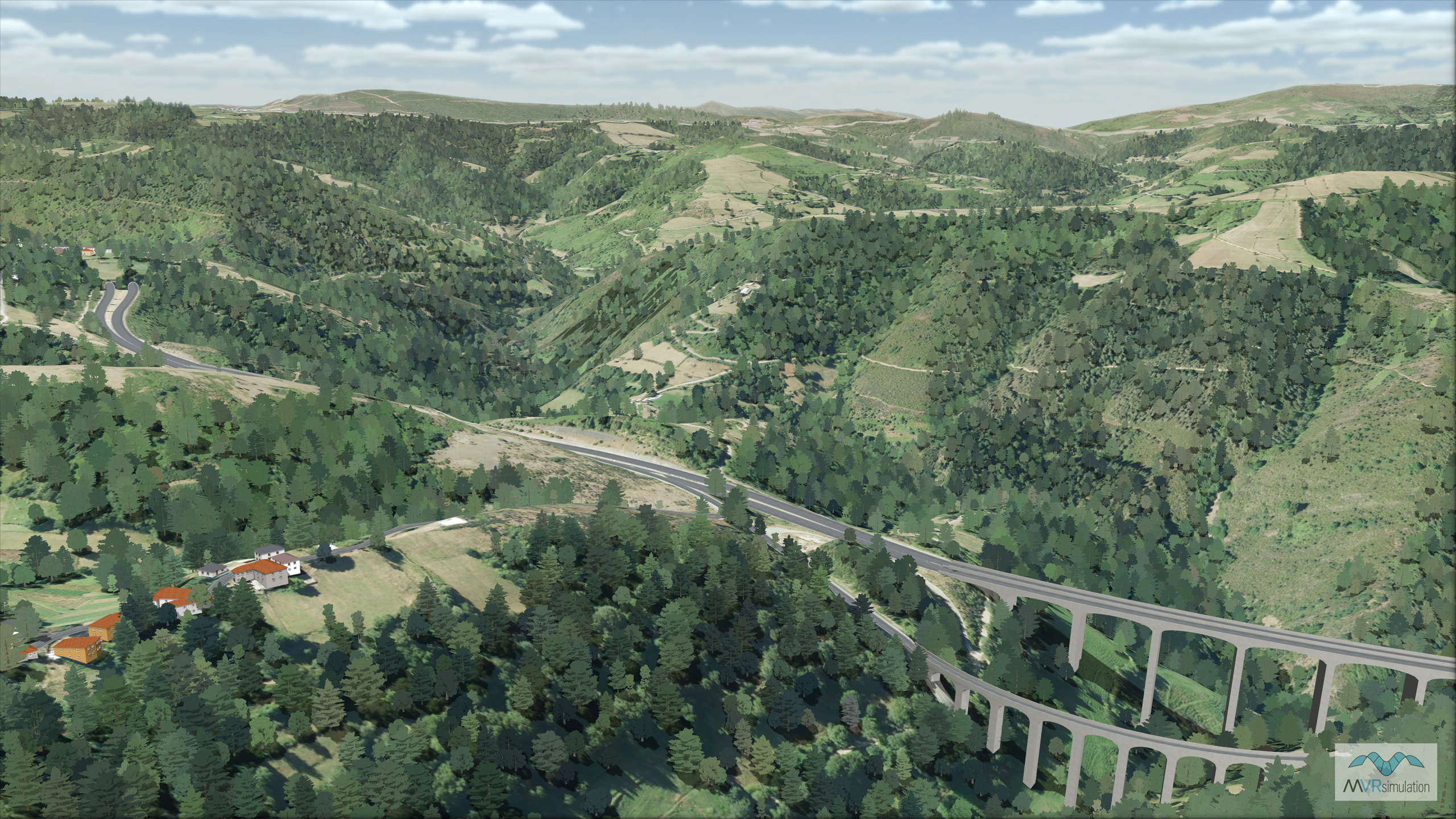
Over 3 million trees are embedded into the Lugo, Spain terrain. The trees are color sampled to match the underlying terrain.