
MVRsimulation News Issue 67
Step into the future of mixed-reality training
At I/ITSEC 2023 we invite you to step into the future of mixed-reality military training, powered by MVRsimulation's Virtual Reality Scene Generator (VRSG).
Experience VRSG's ability to provide a collaborative and comprehensive situational awareness capability that supports the entire training ecosystem - delivering training effect long before students enter a simulator, right through to mission after action review (AAR) - all on geospecific 3D terrain.
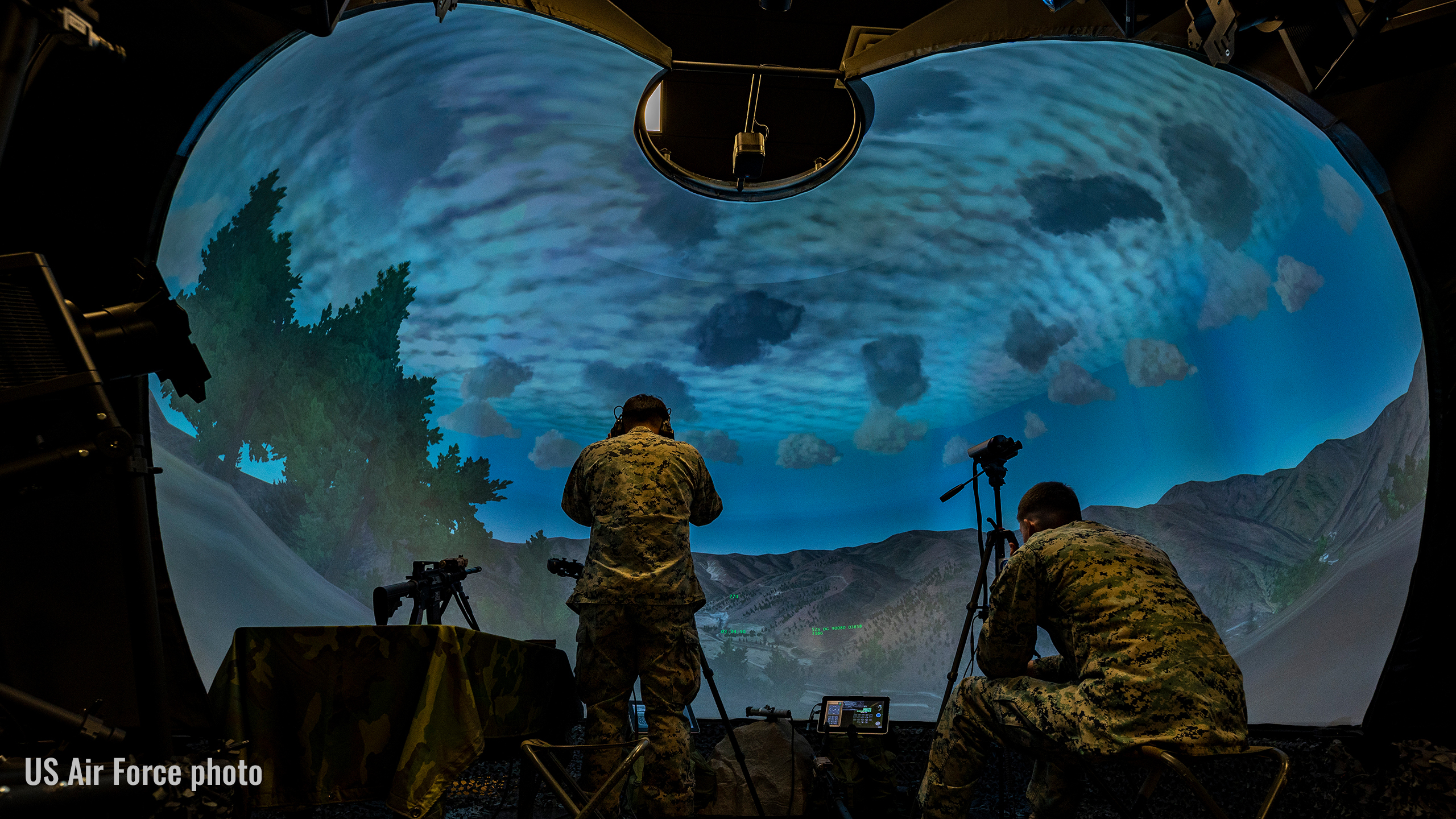
Undertake mixed-reality training across all stages of the training pipeline, starting in our new mixed-reality Sand Table, and moving into the Deployable Joint Fires Trainer (DJFT) and fixed-wing Part Task Mission Trainer (PTMT) - all integrated with five Varjo mixed-reality headsets.
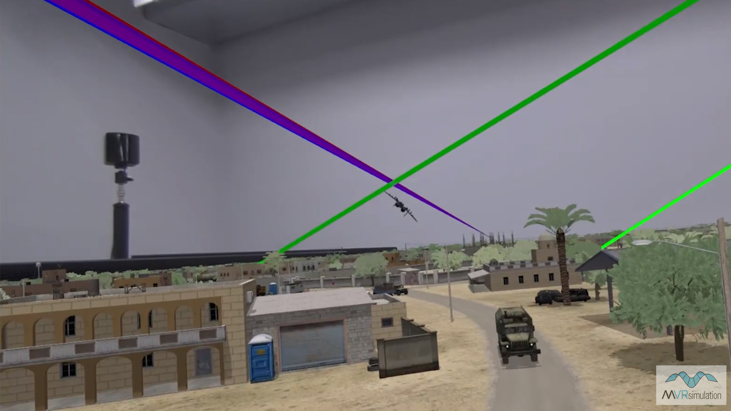
The new MVRsimulation mixed-reality Sand Table allows commanders, instructors, trainees, and students to interactively plan and review training missions in a collaborative, mixed-reality setting. Interact with a virtual ‘sand table’ upon which the virtual battlespace is rendered by VRSG in its geospecific, round-earth 3D format, while wearing a Varjo mixed-reality headset. Plan and enact training scenarios while directly interacting with ‘drag and drop’ 3D model entities in VRSG or via any DIS-based Semi-Automated Forces (SAF) commercial or government off-the-shelf (GOTS) software. Operate GOTS military training equipment such as ATAK via the Special Warfare Assault Kit (SWAK) with imagery correlated to the terrain. Collaborate with co-participants using a Valve Index Controller to point to relevant objects/entities/locations on the terrain with a visible 'laser pointer'.
See Sand Table scenarios brought to life by VRSG’s brand new CONUS National Agriculture Imagery Program (NAIP) terrain, featuring a 2 cm-per-pixel resolution inset (collected by our drone asset and built with Terrain Tools) of the Prospect Square area of U.S. Army Yuma Proving Ground, AZ. See the effect of elevation, geographic and cultural features of the landscape on mission objectives in VRSG's 3D round-earth terrain visualization - all built with ESRI enabled Terrain Tools.
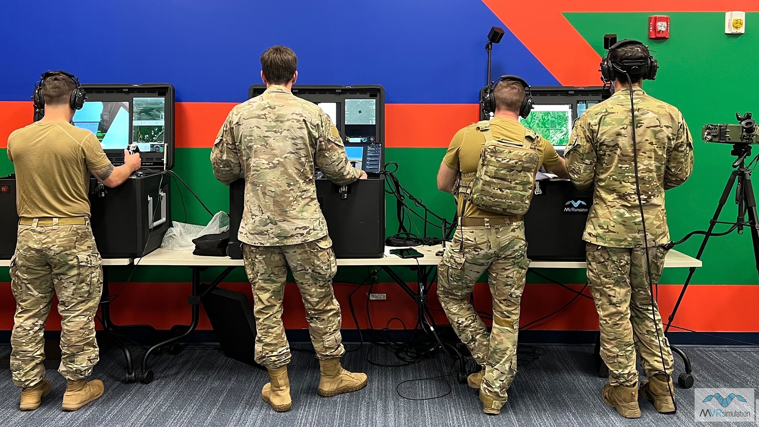
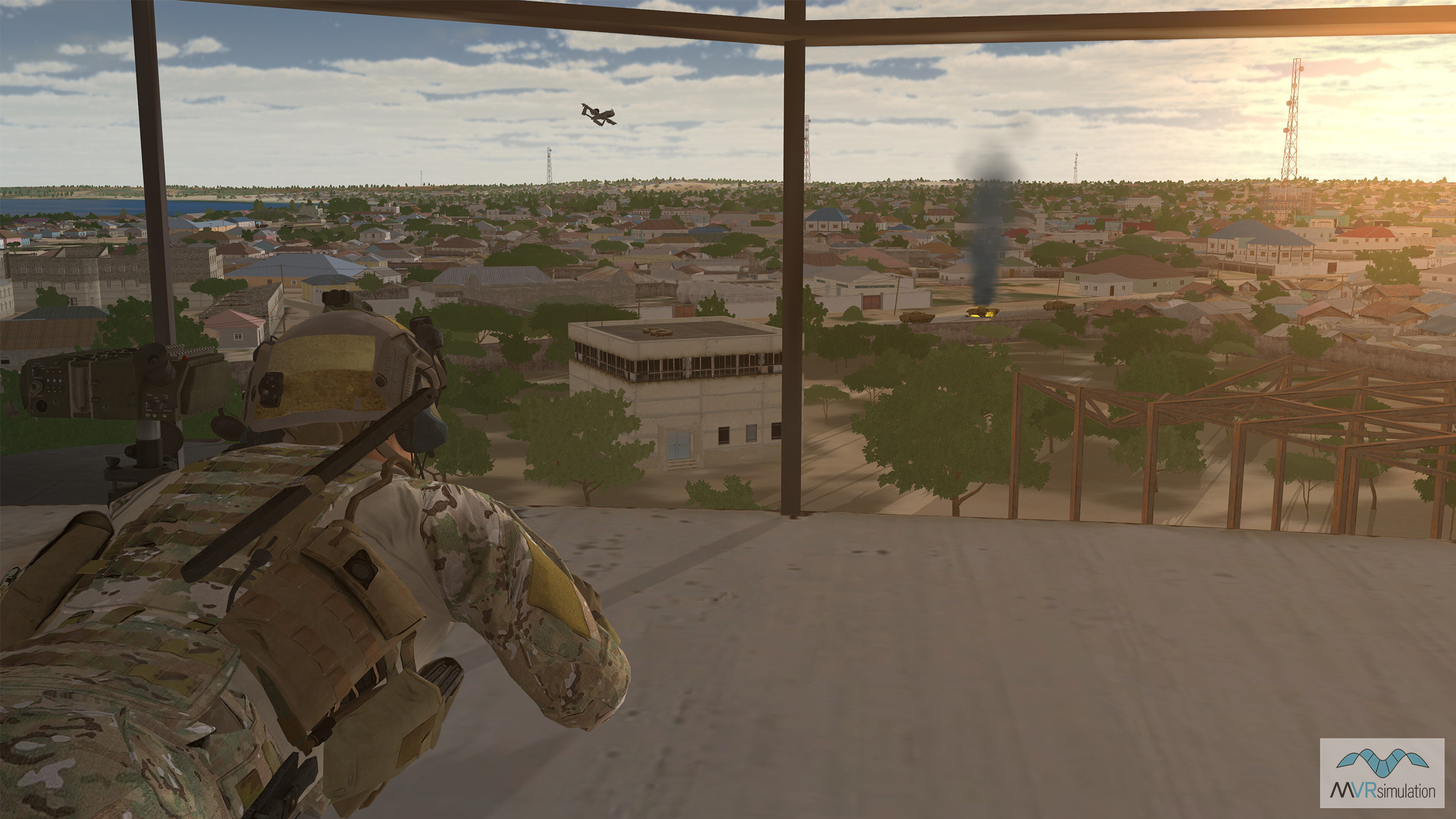
Next, take the training mission into the simulator. A full three-station DJFT will be running JTAC/CAS/FO training missions in our Mobile Classroom, with Role Player station configured as MQ-9 Predator RPAS providing overwatch. JTAC trainees will experience the power of the Yuma terrain at ground level via the Varjo mixed-reality headset, while receiving stimulated VDL of MQ-9 sensor feed from the Role Player, rendered from the same terrain streaming into ATAK, while carrying out Type 1, 2, 3 Terminal Attack Controls (TACs).
Return to the Sand Table to carry out AAR of the mission, enabled by VRSG’s DIS recording and playback capabilities. Understand where trainees were looking throughout the mission via eye-gaze capture within the Varjo headset and visualization by VRSG. Pause the playback to evaluate the full 3D mission as it unfolded, facilitate discussion and solidify learning takeaways.
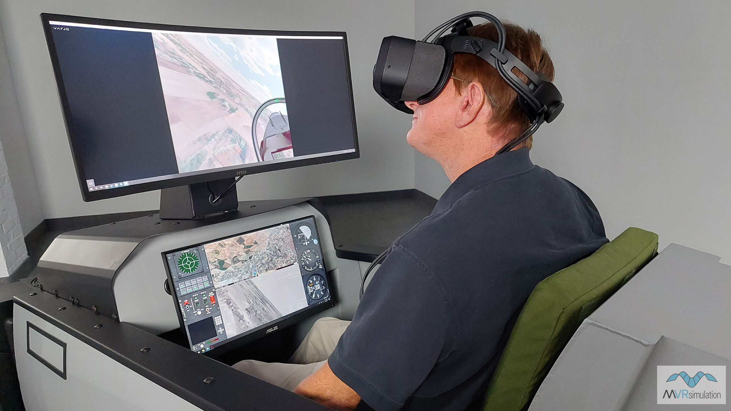
Finally, take in the views of our CONUS NAIP terrain from altitude in the fixed-wing PTMT. Take a flight over the Grand Canyon, and experience the difference VRSG's new CONUS terrain’s 1 meter per pixel (mpp) NAIP imagery combined with 10 mpp National Elevation Data (NED) makes to the realism of the training mission.
Everything you find in the MVRsimulation booth is made possible by the unifying power of VRSG to support LVC training with consistent visuals. Come by to experience it for yourself - please email us at demos@mvrsimulation.com to arrange a time.
Come and log a JTAC control
In the MVRsimulation booth you will find the full three-station DJFT set up in our Mobile Classroom running dynamic, full-spectrum JTAC/Joint Fires and CAS training scenarios all week. With the DJFT fully accredited by the JFS ESC, serving personnel are welcome to log the following controls for currency right on the show floor:
|
|
|
|
|
|
|
|
|
|
|
|
Plan, Simulate, Train, Execute
DJFT demonstrations will be running in VRSG's Yuma, AZ, terrain, and will incorporate the following technologies, including multiple DJFT Block 3 upgrades being shown for the first time:
• Integration with brand new mixed-reality Sand Table application: allows for DJFT and PTMT interactive mission planning using MACE, with the ability to interactively add, delete and manipulate entities while controlling mission events in the running exercise;
• Current model, form-fit-function emulated physical hardware - including the new emulated Type 163 laser target designator - SOFLAM, IZLID, laser range finder, GPS, and simulated IR pointer and strobe, AN/PRC-152C/117G radios, and DAGR;
• Integration with two fixed-wing Part Task Mission Trainers (PTMTs) networked in as optional additional role players;
• Five Varjo mixed-reality headsets providing full immersion in the scenario, with first-person views and real-time trainee eye-gaze depicted on external screens for instructor feedback;
• New JTAC inspired communications headset with similar look and feel to operational JTAC radio headsets, with four frequency push-to-talk (PTT);
• Trainee 'attach' capability, allowing the JTAC to move around the mission attached to a vehicle or rotary-wing aircraft.
New VRSG terrain on display
Our 3D artists have been busy this quarter bringing new terrain online to support our customers' training requirements around the world. In addition to demonstrating features of the latest VRSG version 7, highlights on display in the MVRsimulation booth include:
• Next-generation CONUS National Agriculture Imagery Program (NAIP) terrain, built using 1 meter imagery combined with underlying 10-meter NED. Now exportable beyond the U.S.;
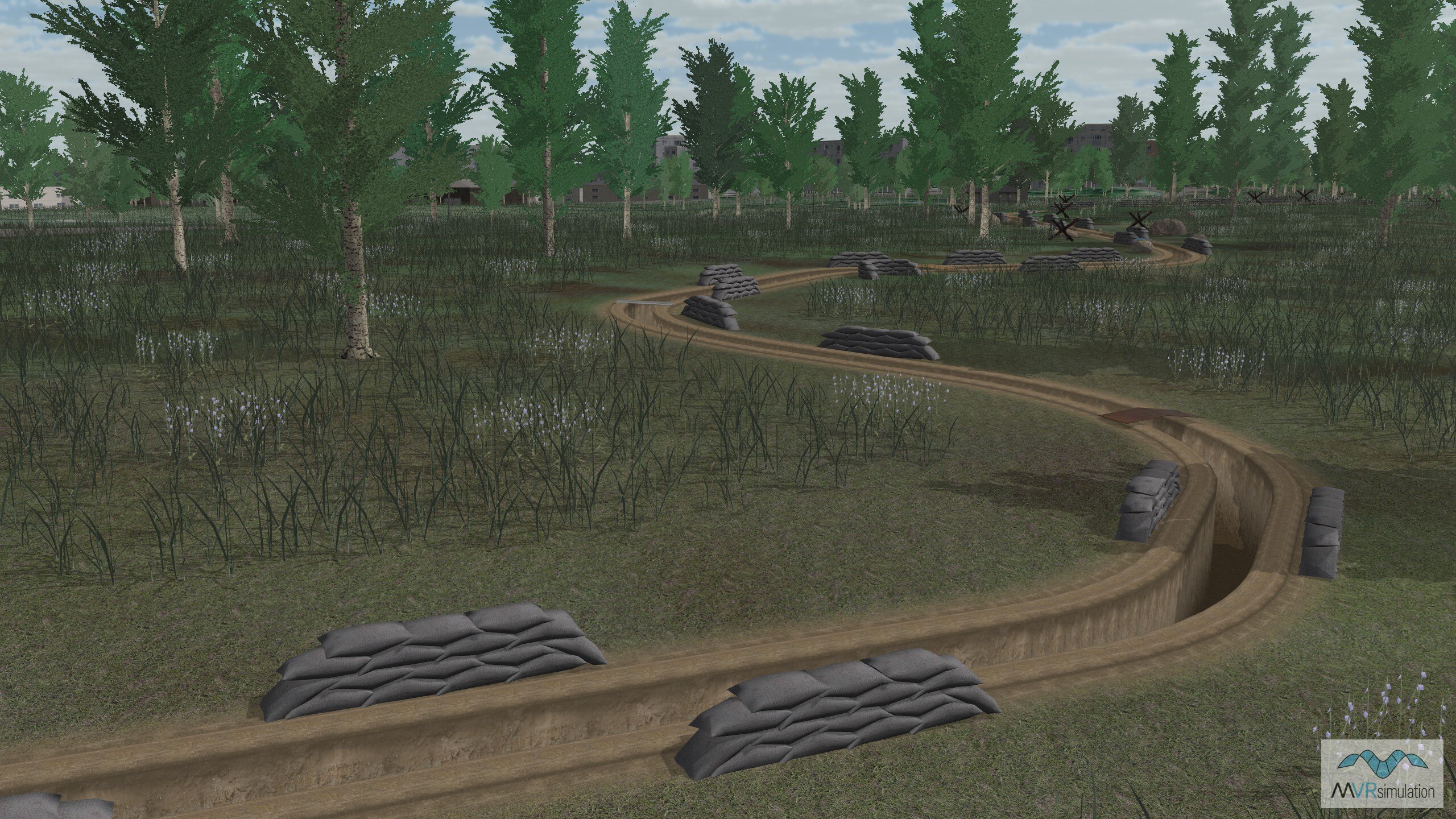
• Terrain of Ukraine, built from 0.50 to 15.0 mpp resolution source imagery and SRTM1 elevation source data. Includes a high-resolution 3D modeled inset of the city of Luhansk in eastern Ukraine; and trench models, created using CityEngine rule files, compiled into the terrain (pictured below).
• New Taiwan terrain built with 50 cm per-pixel resolution imagery covering the majority of the island, the Penghu Islands and Green Island;
• High-res geospecific 3D terrain of the island of Okinawa, Japan, built with 30-50 cm per-pixel and 30m SRTM elevation source data. Includes much of the Okinawa Prefecture including the Main Island of Okinawa, Kerama, Iheya, Izena, Aguni, le, Yoron, and Lotorishima islands.
Remember: we build new terrain and models continuously, and all new terrain and models added to the VRSG library can be downloaded at no charge by users on active software maintenance. Please get in touch with any comments or to talk about new terrain and model requests to support your training needs at support@mvrsimulation.com.
New VRSG sales
We continue to grow the capabilities of VRSG across JTAC, fixed- and rotary-wing training, RPAS, and extend its position in the military simulation training market. To take a deeper dive into the innovation it is helping to drive across military training, read this new Technology Report by Giles Ebutt, "World Building". Notable sales in 2023 included:
U.S. Air Force MJAT
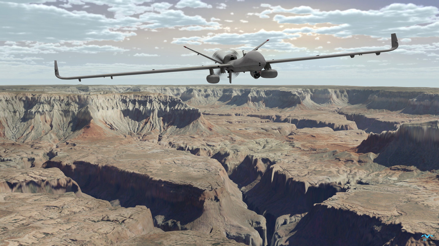
The second half of 2023 has seen nearly 700 VRSG licenses renewed in support of the U.S. Air Force's MJAT training program for the MQ-9 Predator RPAS.
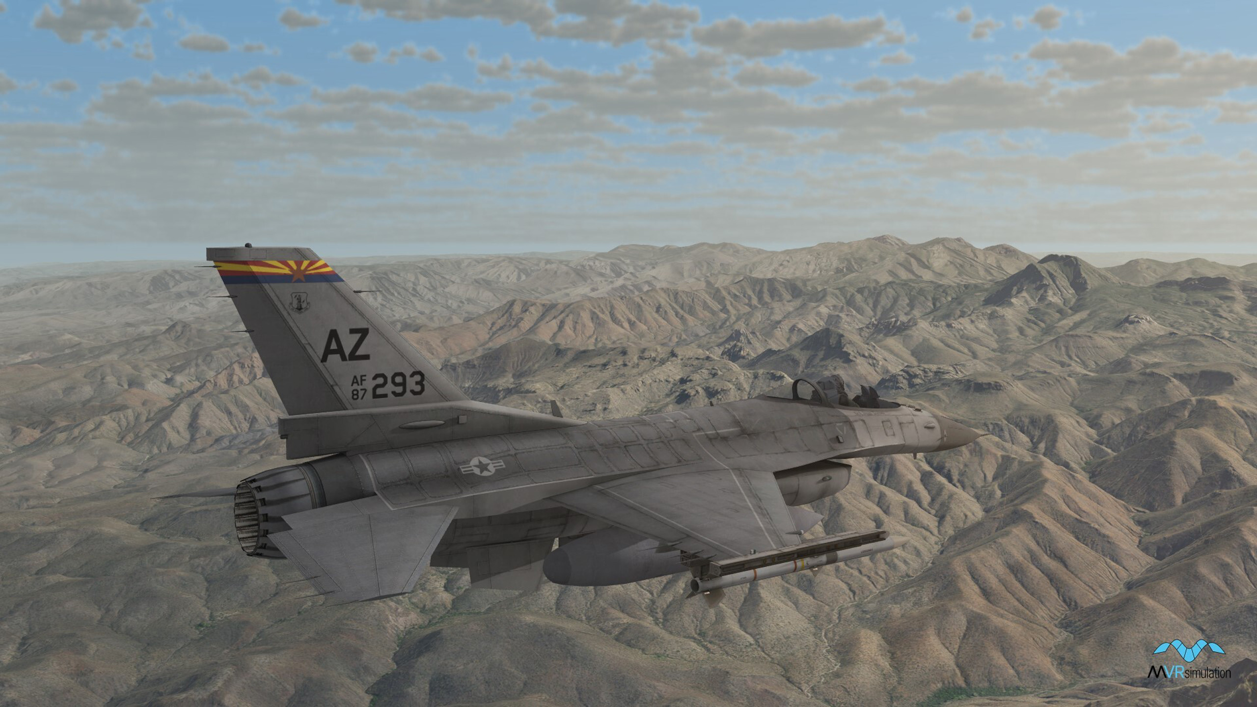
F-16 Mission Tactics Trainer
More than 470 VRSG licenses have been renewed to support the U.S. National Guard and U.S. Air Force Reserve Command's F-16 Mission Tactics Trainer program.
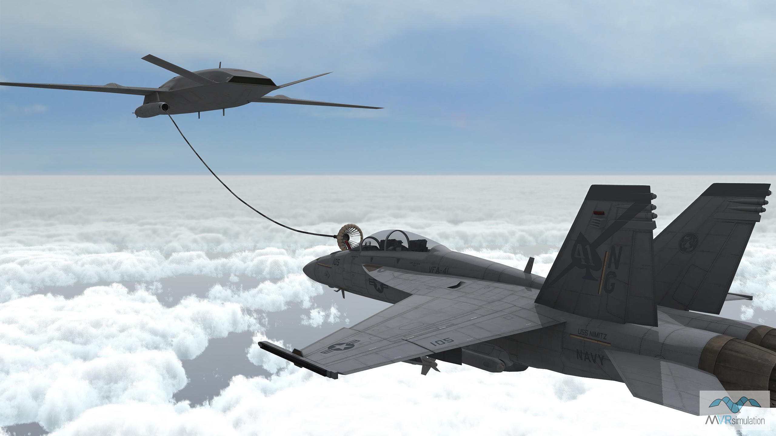
MQ-25 Mission Systems Trainer
VRSG has been selected to provide graphics for the the U.S. Navy's MQ-25 Stingray carrier-based aerial refueling/ISR RPAS training system
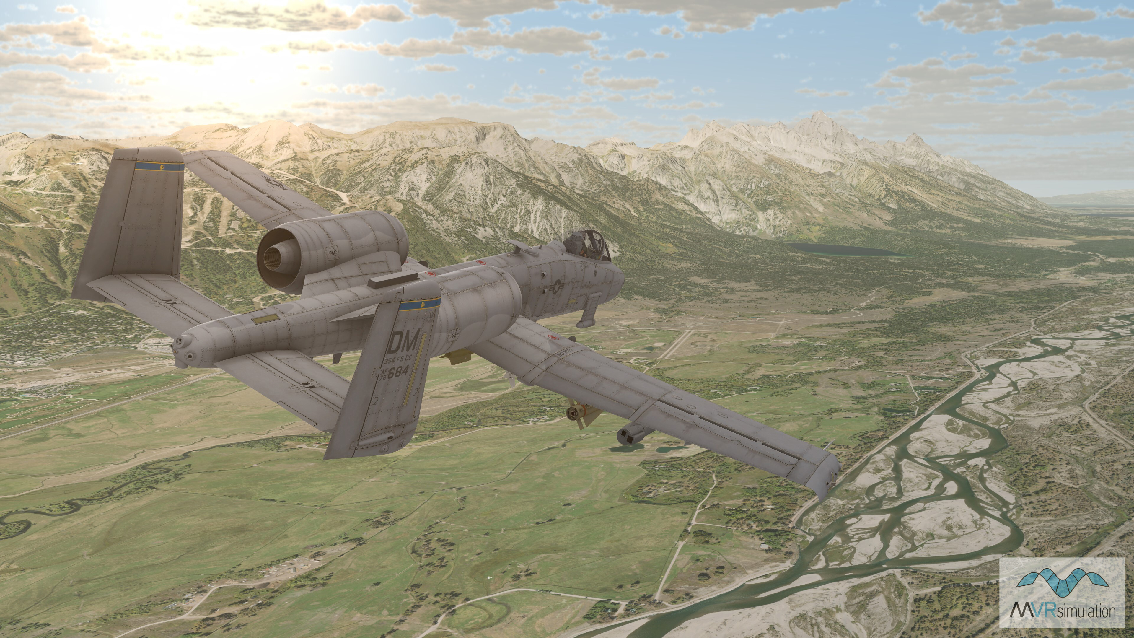
A-10 Full Mission Trainer
A total of 385 VRSG licenses have been renewed in 2023 to continue providing out-the-window and sensor views for the U.S. Air Force's A-10 Full Mission Trainer program.
Japan Self-Defense Forces
Thirteen VRSG licenses and terrain databases of Ishigaki & Miyako Islands ordered to support the development of Japan Self-Defence Forces JTAC training.
We want to hear from you
As always, we welcome your feedback and requests for new VRSG terrain and models, and are always interested in discussing how we can further expand the capabilities of our mixed-reality simulator systems to meet your emerging training requirements. New and existing customers can get in touch at support@mvrsimulation.com, while those looking to arrange a demonstration at our Sudbury, MA site, or virtually via our secure online meeting software can email us at demos@mvrsimulation.com. We can even pack up our simulators into our Mobile Classroom Trailer and bring them to your facility to allow your whole team to get hands-on with the tech.
We look forward to meeting with as many of you as possible at I/ITSEC this week. To those not attending, keep an eye on our LinkedIn page for all the developments from the show floor!
Copyright © 2023, MVRsimulation Inc.
MVRsimulation Inc.
57 Union Ave.
Sudbury, MA 01776 USA
MVRsimulation, the MVRsimulation logo, and VRSG (Virtual Reality Scene Generator) are registered trademarks, and the phrase "geospecific simulation with game quality graphics" is a trademark of MVRsimulation Inc. MVRsimulation's terrain architecture is protected by US Patent 7,425,952.