
What's New in VRSG Version 7
MVRsimulation has released Virtual Reality Scene Generator (VRSG®) version 7 with the following new features, enhancements, and 3D content:
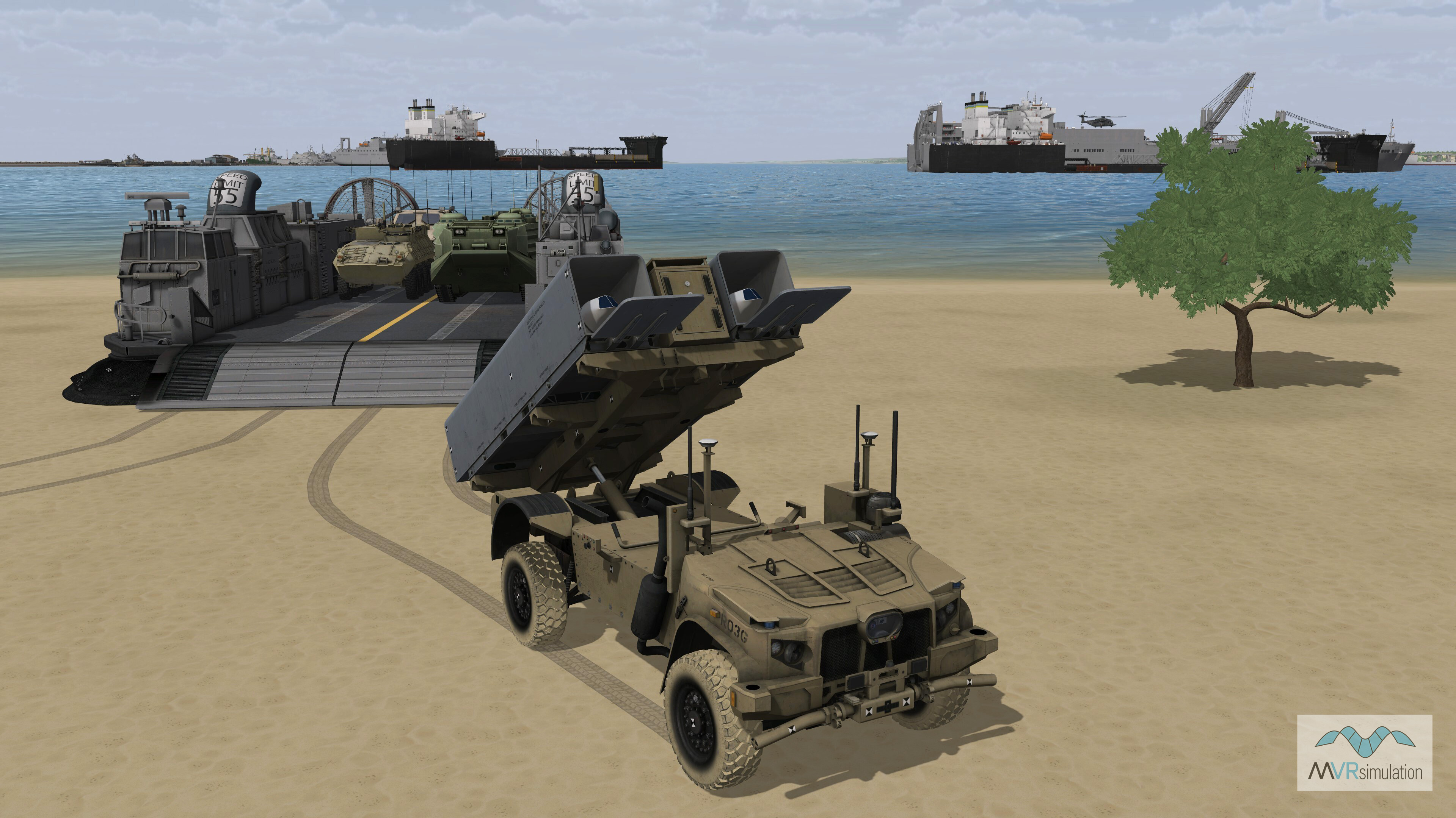
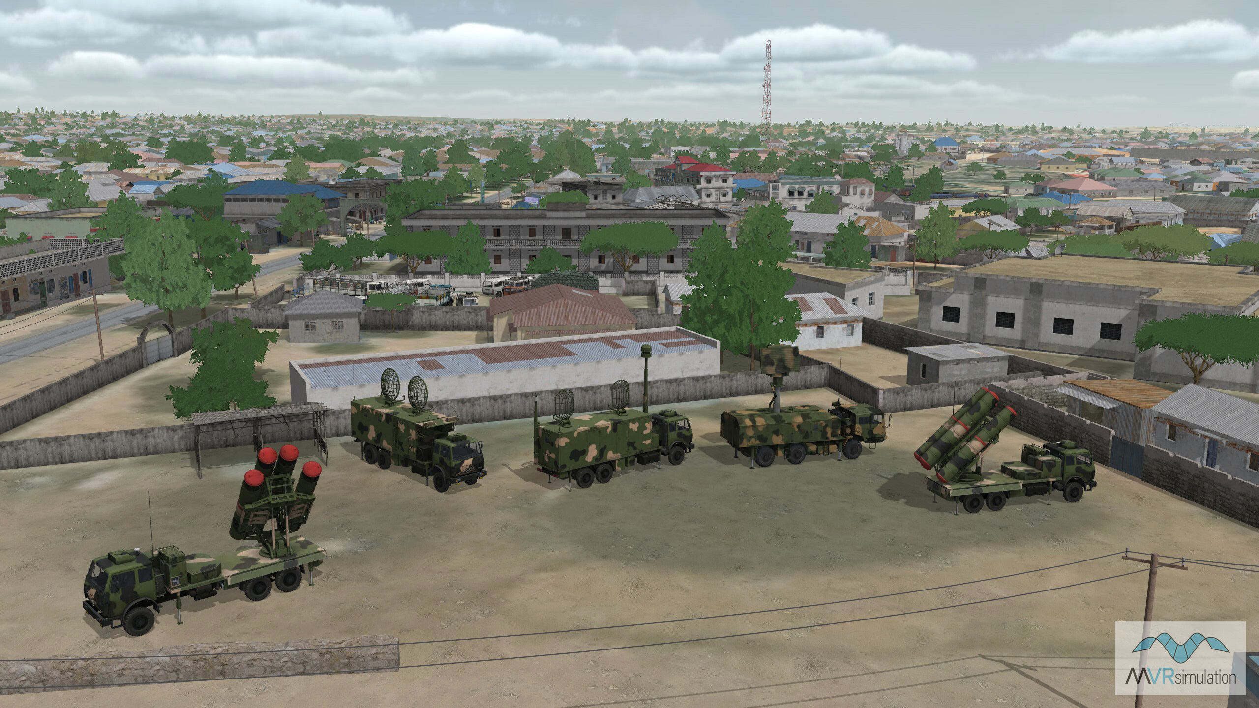
- MVRsimulation’s 3D model library has surpassed 10,000 models. All models are included in the VRSG installer. You can also download new and updated models from downloads.mvrsimulation.com.
- Legacy water surface can now optionally be positioned at the nominal regional geoid height instead of at the WGS84 ellipsoid height.
- Ability to use JSON model metadata to remap a model’s articulated part codes.
- Improvements to CIGI symbol rendering: multi-line text now supported and improved mitering of line edges.
- Add support for covert light lobes, visible only in NVG mode.
- New orthographic rendering mode for visualizing models in ModelViewer.
- ModelViewer now supports SGI RGB image capture format.
- CIGI screen capture requests can now request image sizes larger than the framebuffer.
- Support for terrain microtextures using normal maps.
- Instanced models may now support normal mapping textures.
- New CIGI component control that allows the user to select the sun elevation angle where light lobes are triggered to the on state.
RECENT UPDATES TO 3D TERRAIN
New 3D terrain datasets built since the previous VRSG release include:
- Ishigaki and Miyako Islands, Okinawa Prefecture, Japan with over 70 geospecific building models. The database includes hundreds of detail models of boats, containers, vegetation, and poles.
- Holloman Air Force Base (KHMN), New Mexico and Mayport Naval Station, Florida terrain databases include modeled runways complete with lighting, navigational signs, taxiways, windsocks, and tarmacs with geotypical hangars and control tower.
- Washington, DC Metro Area with a total of 133,644 Cyber City 3D buildings along with geospecific artist rendered models of the Capitol Building, White House and Lincoln Memorial.
- Tampa, Florida with detailed 3D inset of building modesl in Downtown Tampa Bay.
PREVIOUS RELEASES
If you need information about an older release, please contact support@mvrsimulation.com.
- Ability to control model articulation by encoding animations in a model’s JSON metadata file that coordinate movement of multiple articulated parts.
- Improved atmospheric model featuring improved light, haze, and cloud interactions. The underlying atmospheric model consists of 16 distinct layers each with unique visibility ranges and wavelength-dependent absorption and scattering properties.
- Ability to teleport to a location specified by a Google Maps URL.
- The H264 plugin has two new options: an option to select CAF DMO Transmitter PDU compliance level, and an option for "leap second" offset in generated timestamps in the KLV stream. The H264 plugin will now return the encoded KLV metadata via the plugin API, enabling a subsequent executing plugin the ability to access the encoded KLV bitstream.
- VRSG's CIGI support has three new component controls: CIGI_SymbolSurfaceEntityAttached which allows a symbol surface to be able to be attached to a DIS entity, CIGI_ComponentIdDepthOfField to control the depth-of-field sensor effect feature, and CIGI_ComponentIdOwnshipForViewport to allow each viewport to have a unique ownship entity.
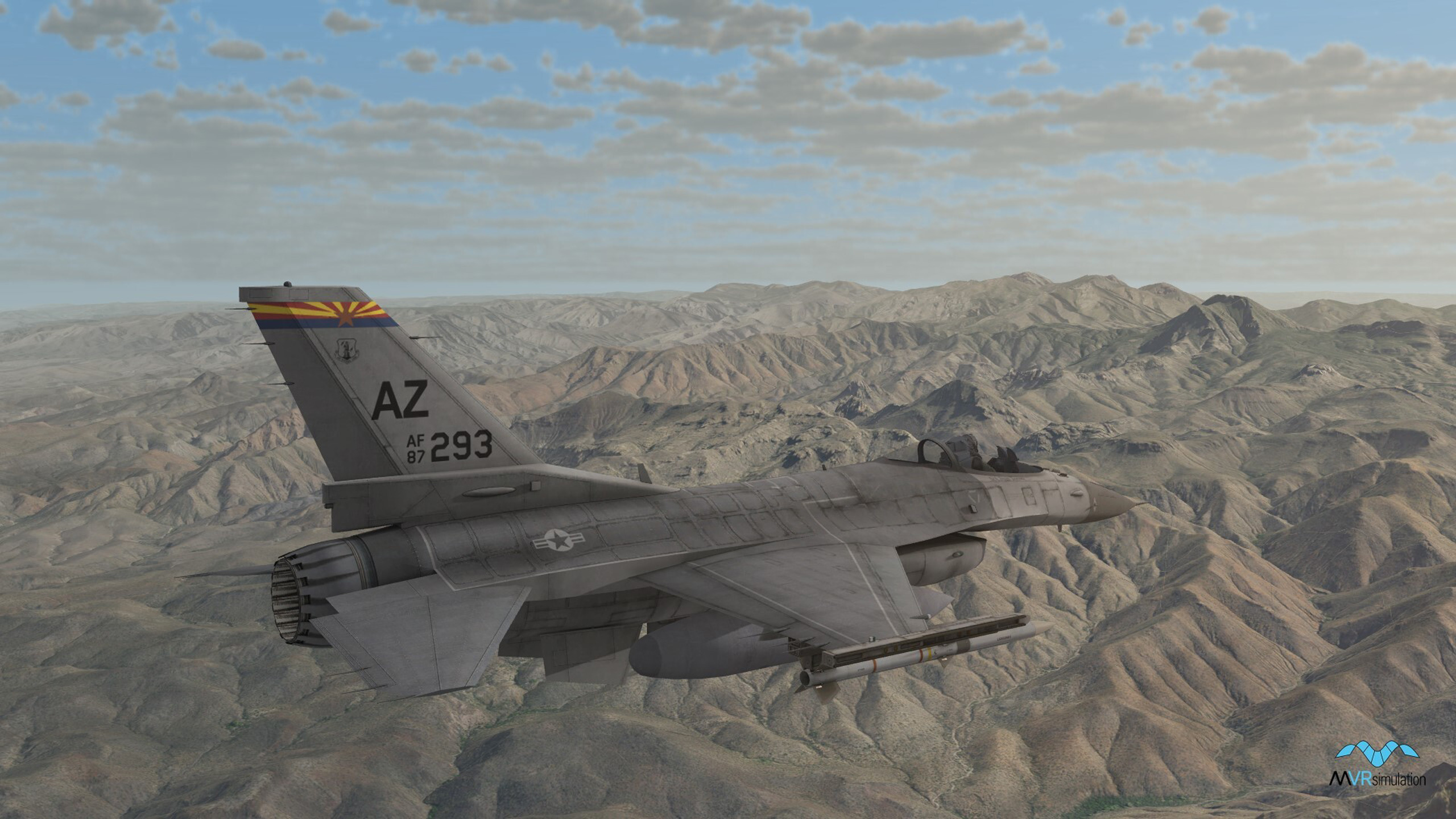
- 828 new models (including 434 new military models) have been added to MVRsimulation’s 3D model libraries since the previous release of VRSG in November 2021, bringing the total count to over 9,740 models.
- MVRsimulation's video player has new plugin API that provides a user-developed DLL the ability to process decoded KLV metadata, and draw graphics over the decoded video frames.The video player also has a new command-line option to change where settings are saved in the registry. This enables multiple shortcuts to remember different saved settings.
- Ability to control the degree of recoil effect for a gun model in response to a FirePDU via a JSON variable.
- Ability to specify textures to replace with VRSG 2D water during OpenFlight conversion.
- Ability to assign a wind-sensitivity metric to a texture used in a vegetation model to control how much the model will respond to wind direction and velocity.
- Ability to control the diameter of the real-world pass-through of the Enable Skirt option on the Dashboard’s Varjo tab. Enable Skirt renders a circular pass-through directly below the viewpoint of the headset, enabling the wearer to look down and always see the real-world for spatial awareness.
- Binocular Zoom Mode added to the Varjo viewpoint. The trainee can control three levels of magnification including a simulated M22 reticle.
- Ability for a role player in VRSG, wearing a head-mounted display (HMD), to be attached to a dynamic 3D model. The viewpoint follows an animation and aligns to the assigned position within the 3D model.
- An updated EME plugin for the SOFLAM, which enables users to dynamically change the FOV to match what they see in the real world.
- Integration with the Special Warfare Assault Kit (SWAK) supporting DACAS. VRSG provides the simulated ROVER feed with KLV metadata that correlates and embeds the video stream into the SWAK terrain imagery.
- Simulated NVG improvements for enhancing realism.
- Scalable plugin support for changes in calibration files produced by Scalable version 8.
VRSG 7.0, released in November 2021, included:
- New features in the Varjo HMD plugin included using Varjo eye-tracking capabilities for visualizing in VRSG, for real-time monitoring (on a separate VRSG channel in stealth mode) and in training mission playback for after action review. Such features (controlled in the Dashboard’s Varjo tab) include Enable Gaze Tracking which turns on tracking and pupil calibration, and Eye-Track Action Review, which inserts the headset wearer’s head position and pupil gaze data into the DIS stream. Other features include foveated rendering options for Varjo headset and the ability to render the VRSG scene in an external display in addition to within the Varjo headset;
- The Eye Track Visualization option on the More Graphics Options dialog box turns on the rendering of the eye-tracking data (head position and pupil gaze) from a Varjo headset that has been captured in the DIS stream in a recorded VRSG session, as described above. Head position is depicted with a head model and pupil gaze direction is depicted with red and blue cones;
- New features in sensor simulation included:
- Built-in sensor fusion, enabling you to select two new possible sensor mode options: Visual Electro-Optic fused with IR White Hot and Visual Electro-Optic fused with IR Black Hot. You can control the fusion blend ratio by CIGI component controls or the slider on the Sensor tab of the VRSG Dashboard;
- Use of a JSON file for creating a radiance profile of materials for sensor simulation. This means you can now generate your own radiance profile either from IR Setup or from scratch in Notepad from a third-party sensor model or notional data. The IRSetup (under ITAR control) now produces an editable JSON file; - Ability to improve the appearance of dynamic cast shadows when viewing the scene through a narrow field-of-view (FOV), such as those typically used for UAV sensors. A narrow FOV induces high magnification and greater standoff distances, which can cause shadows to become washed out or to disappear entirely. Use the Shadow Quality checkbox on the Shadows tab to direct VRSG to render dynamic shadows at a higher resolution, for FOV angles below a given threshold. (You can find the FOV in use on the Dashboard's Graphics tab.);
- 343 new models (including 240 new military models) have been added to MVRsimulation’s 3D model libraries since the previous release of VRSG in February, bringing the total count to over 8,920 models;
- New support for multiple sizes of pageable textures: 512 x 512, 1024 x 1024, and 2048 x 2048 in 3D terrain built with newly released Terrain Tools v2.0. Terrain databases converted from OpenFlight source also benefit from multiple sizes of pageable textures with MVRsimulation's updated OpenFlight to VRSG terrain format conversion utility;
- Remote Regeneration options Generator/Receiver on the Attach Offsets dialog box configure a given VRSG machine in UAV mode to transmit telemetry via DIS packets to a remote VRSG client machine;
- Ability to attach a light lobe to a dynamic moving model via a JSON file;
- The 2D sensor overlay AN/DAS-1 has been updated to AN/DAS-4;
- New SetPDU interface ATTRV_LOAD_MODEL_MAP supplies the directory of a specific ModelMap.ini to load;
- New CIGI component control, CIGI_ComponentIdRotorWashParams, controls particle dispersion of a rotor wash effect: AGL height at which the effect begins, particle speed, and particle speed variance;
- New CurvedDisplay plugin provides horizontal distortion correction for curved monitors;
- New PixelShift plugin supports projectors that require a pixel shift for emulated 4K resolution;
- VRSG recompiled in Visual Studio (VS) 2019. User-developed plugins built with VS 2015 and 2017 will remain compatible with VRSG version 7.0;
- In addition to the rebranding of the company name to MVRsimulation, this release includes a new naming convention for cultural feature files, viewpoint files, PDUlogs, sensor profiles, and microtextures is: vrsg.clt, vrsg.viewpoint, vrsg.pdulog, vrsg.irm, vrsg.json, and vrsg_microtexture_ x_y_z.tex. Previously created files with the older convention of "metadesic" filename are respected by VRSG 7;
- Scenario Editor version 2.3, with full support for newly named vrsg.clt, vrsg.viewpoint, and vrsg.pdulog files. Previously created files with the older convention of "metadesic" in their name are respected.
VRSG 6.5, released in February 2021, included:
- Support for additional virtual reality (VR) systems: Varjo VR-2 and Varjo VR-2 Pro virtual reality systems, Varjo XR-1 and XR-3 mixed-reality systems, Valve Index VR system, and HP Reverb VR system;
- Additional options for configuring VRSG with a VR system, such as foveated rendering;
- Enhancements to tree rendering, including handling the levels of detail (LODs) of instances and automated color matching with underlying geospecific terrain imagery. (Requires terrain generated in Terrain Tools version 1.6 or newer);
- Ability to create light point and light lobe definitions in a model’s JSON metadata file;
- Further enhancements to support KLV metadata in RPA/UAV simulation, such as support for MISB ST 0601.9; achieved full NGA Community Motion Imagery Test Tool (CMITT) compliance. Also support for MISB ST 0601.1 for simulations not capable of processing the newer 0601.9 standard. A new plugin API, extUavMetaData, enables insertion and modification of KLV metadata;
- New direct video streaming option using the Real-time Transport Protocol (RTP) network protocol, without RTSP. (Combat Air Force Distributed Mission Operations compliant);
- New video decoding library, which enables developers to easily integrate VRSG's streaming video into their Windows and Linux applications;
- Several enhancements to MVRsimulation’s Video Player: support for decoding of synchronously-multiplexed metadata, ability to specify a multicast address for receiving video feeds, support for MPEG2 formatted-video (in addition to H.264/H.265), and a drag-n-drop interface to play pre-recorded clips. In addition, the player can now parse program association tables (PAT) and program map tables (PMT), enabling it to play video from sources other than VRSG;
- CIGI enhancements, which include ability to enable trackers on a per-viewport basis, new custom CIGI commands to facilitate mixed use of DIS and CIGI, and a new CIGI auto-tracking feature that simplifies tracking compared to standard CIGI sensor controls;
- New volumetric ray-traced cloud system, with continuously variable coverage from 0% to 100% fully overcast, and global coverage for layers controlled by the Dashboard, CIGI, or DIS interfaces. Coverage polygons can specify coverage, rain, or snow precipitation. Also, volumetric precipitation modulation for simulating reduced visibility underneath rain clouds;
- New SetDataPDU interfaces to dynamically attach particle effects to a moving model, enable remote control of video streaming, and provide cloud coverage polygons that override global coverage in a geographic area;
- New option for 3D ocean simulation to specify the distance at which to fade-out a shoreline/underwater microtexture near sea level;
- New ability to obtain the distance, in meters, between two locations on the 3D terrain;
- New animation and IR bloom effect for a human character smoking a cigarette;
- new_verts_per_meter keyword for an effects .par file;
- MDS API performance improvements, a new asynchronous load option, and updated support for newer terrain formats;
- 696 new models added to MVRsimulation’s 3D model libraries, of which 473 are military models, bringing the total count to over 8,650 models;
- The 3D terrain databases installed with this VRSG release include datasets of Hajin, Syria, and Mischief Reef, Spratly Islands, South China Sea;
- Scenario Editor version 2.2, with improved PDU log export process, ability to export cultural feature files and viewpoints separately, full support for sensor, 3D oceans, dynamic shadows, and model attribute JSON files.
Version 6.5 was the last version of VRSG that supported Windows 7.
VRSG 6.4, released in October 2019, included:
- Object-on-object dynamic shadowing (which can be customized via the Dashboard Shadows tab).
- Ability to add to, or modify attributes/metadata of, a 3D model via a .JSON file.
- New MVRsimulation Video Player. This low-latency player is optimized for VRSG H.264 streaming video and can decode and display KLV metadata.
- Support for streaming VRSG video via Real-Time Streaming Protocol (RTSP).
- Support for recording/streaming VRSG in H.265 video format.
- Support for HTC VIVE Tracker and Samsung Odyssey HMD.
- New OpenGL interoperability plugin to enable users to code their 2D overlay graphics in machine-native OpenGL for rendering in VRSG. (This plugin supersedes VRSG having to emulate OpenGL 2D overlays with a Direct3D layer). Contact support@mvrsimulation.com for a sample Visual Studio 2015 project that illustrates how one can draw graphics using OpenGL and have the graphics display over a VRSG scene.
- 825 new models (of which 736 are military models), bringing the total count to over 7,950 models.
- Support for Battlespace Simulations’ emulated SOFLAM device.
- Support for animations that move the fingers of a character model, such as signaling animations.
- Ability to attach light lobes to entity and static models.
- ModelMap enhancements for attaching models to other models and using multiple exhaust effects.
- Support in the warp/blend plugin for Scalable Display Technologies for all new Scalable features, to include masking, black level, and color correction.
- New warp/blend plugin for using VRSG with DomeProjection on a curved surface with a projection system.
- New SetDataPDU interface for remote control of video plugins.
- Support in the OpenFlight-to-MDS terrain conversion tool for instancing models that are referenced multiple times.
- Three new options for the OpenFlight-to-HPX model conversion tool to optimize the conversion of models originally made in Esri CityEngine.
- New CIGI component control to control light points by name.
- Partial support for CIGI regional weather, via CIGI_ComponentClassRegionalWeather.
- New Model Viewer option to display an open vessel model’s lid mesh which prevents the 3D ocean from penetrating the model.
- New Model Viewer display which shows a selected articulated part’s relative position under the mouse cursor. This information helps provide numbers needed to specify certain model attributes in a .JSON file (such as where muzzle blast particle effects are attached to a model).
- Saved visualization session settings are now captured in a .JSON file.
- New ability to capture a Model Viewer session to an MPEG video. The video is recorded in H264 .mpg format using the same path and filename as used for Model Viewer screen captures.
- Several performance improvements to VRSG Radar simulation and the MDS API.
- Scenario Editor version 2.0. Scenario Editor now shares the same graphics engine as VRSG. As result of the merged codebase, visuals in Scenario Editor now match those in VRSG. In addition, Scenario Editor 2.0 features a new Dashboard, which replaces some former settings dialog boxes.
HOW TO OBTAIN THE LATEST RELEASE OF VRSG
Customers on active software maintenance can obtain the latest release of VRSG7 and recent patch updates by downloading the VRSG7 software from their account on MVRsimulation's Download Server. If you need an account, click here to request one.
You can order VRSG directly from MVRsimulation by filling out the quote request form.