I/ITSEC 2025
MVRsimulation at I/ITSEC 2025
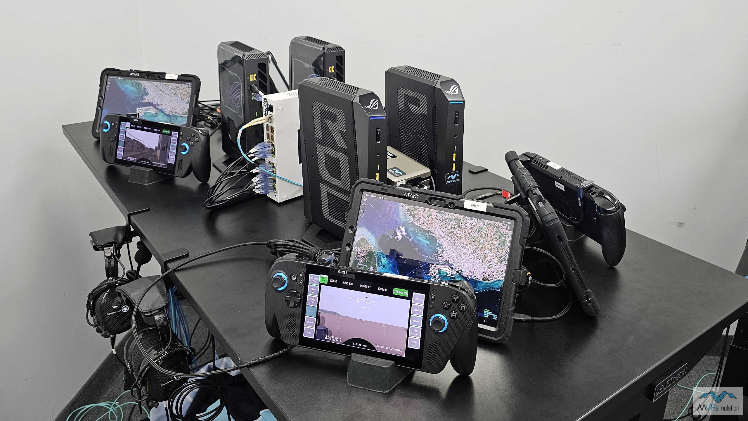
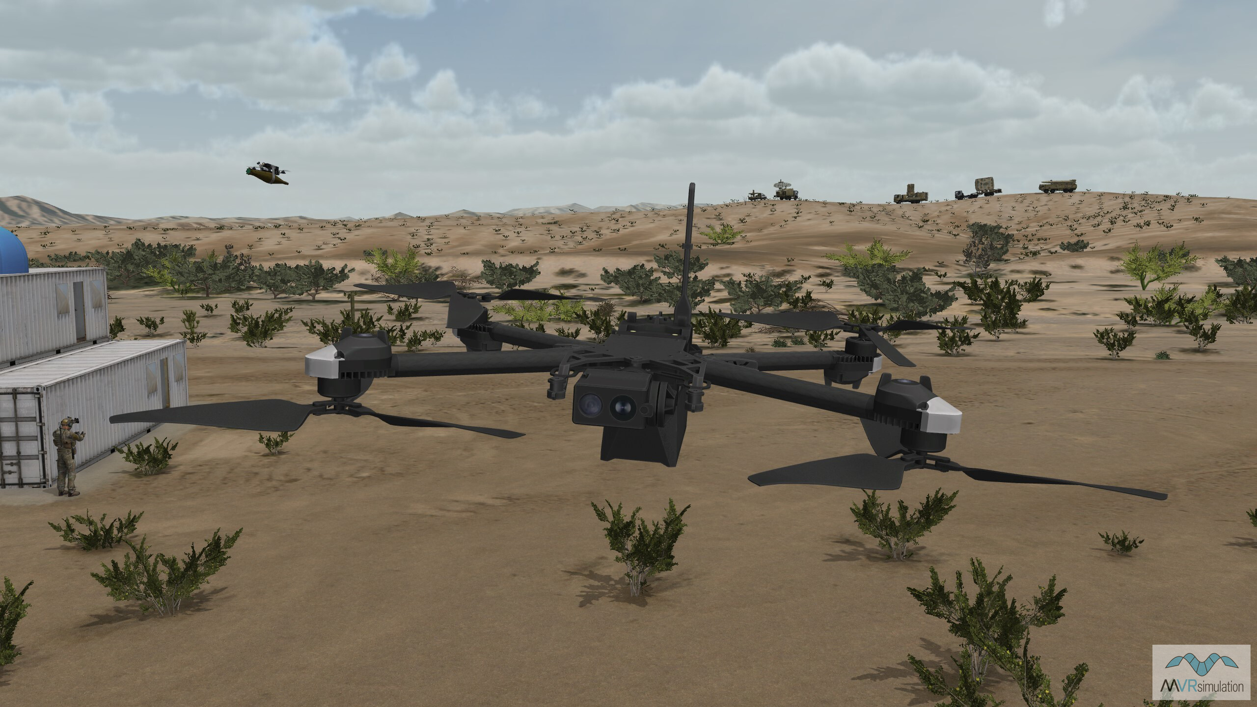
New product launch: FPV Team Trainer
At I/ITSEC MVRsimulation launches a newly-developed FPV Team Trainer. This flexible, scalable solution is designed to provide training for groups of four or more on team FPV UAV operations, tactics and strategy.
The internally-developed FPV Team Trainer builds on the capabilities offered by the individual FPV UAV Simulator, to provide fully-networked team-based FPV drone operations training for between four or more trainees, overseen by a connected Instructor Operator Station. Users can begin with the basics of sUAS flight training and progress through more complex training syllabus that requires coordination between individual FPV drone pilots. This includes everything from flying drones with specific payloads, stealth flight tactics, and the use of ATAK for situational awareness.
By receiving training in a group setting, trainees learn to operate effectively in a way that reflects the reality of real-world battlefield FPV missions. This includes everything from swarm attacks on virtual targets, to full integration into the tactical airspace with Joint Fires, air and ground simulations for Large Scale Combat Operations (LSCO) training exercises.
The MVRsimulation FPV Team Trainer.
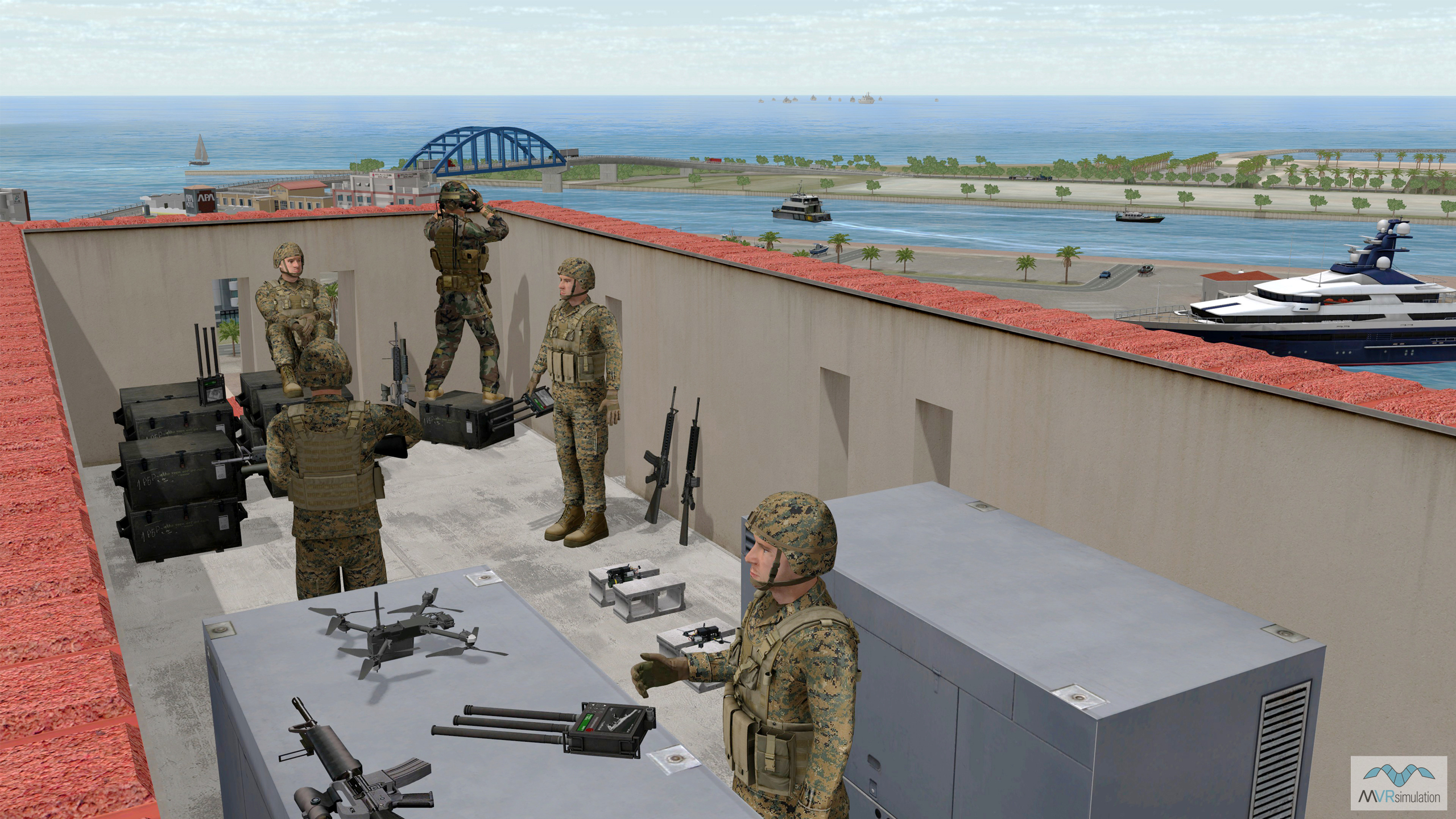
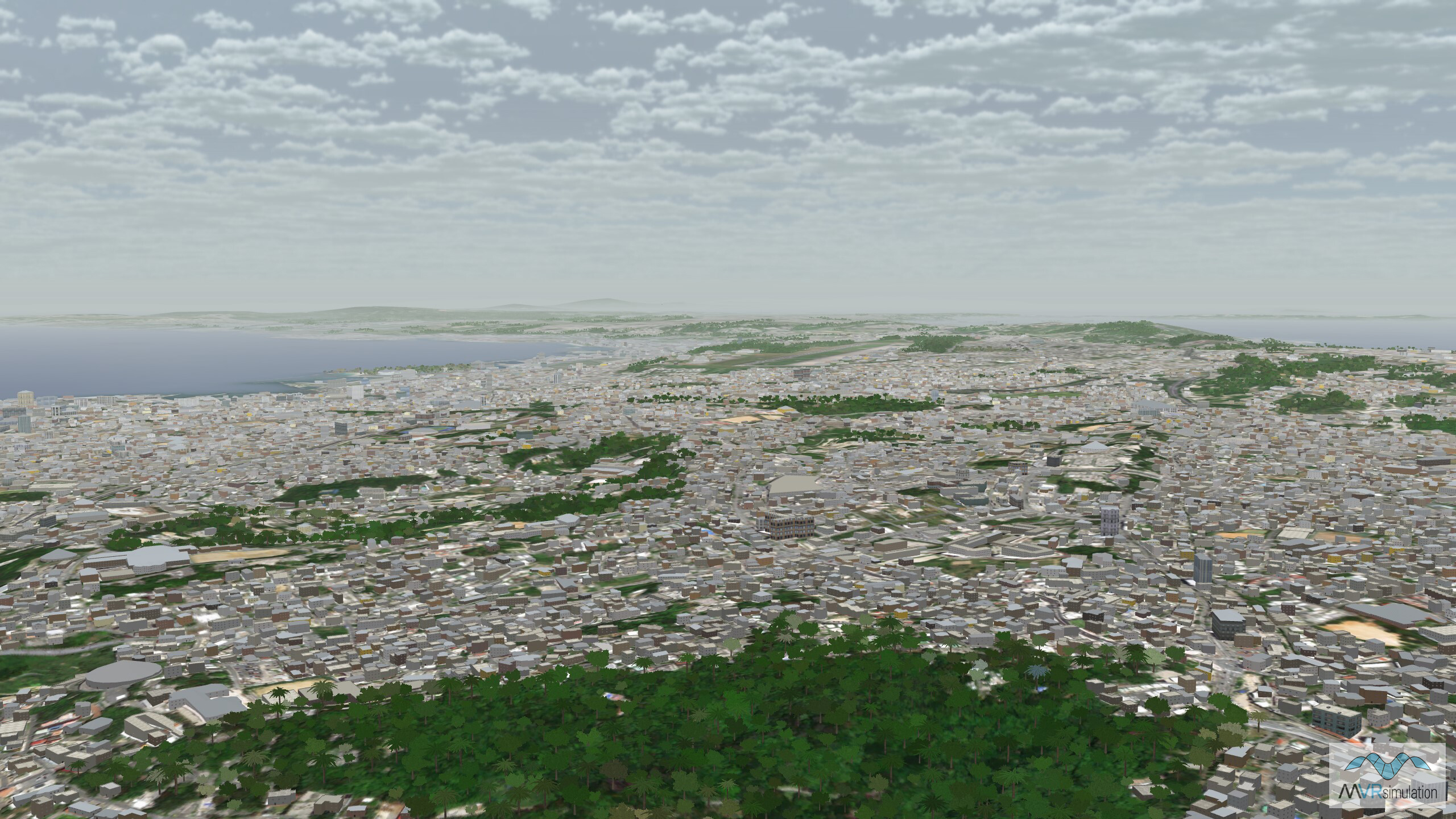
An FPV team prepares for joint operations in virtual Ishigaki terrain.
New terrain launch: Hsinchu, Taiwan
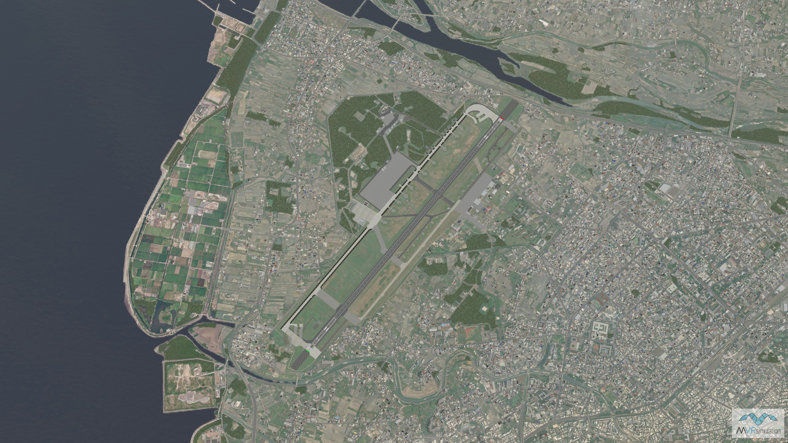
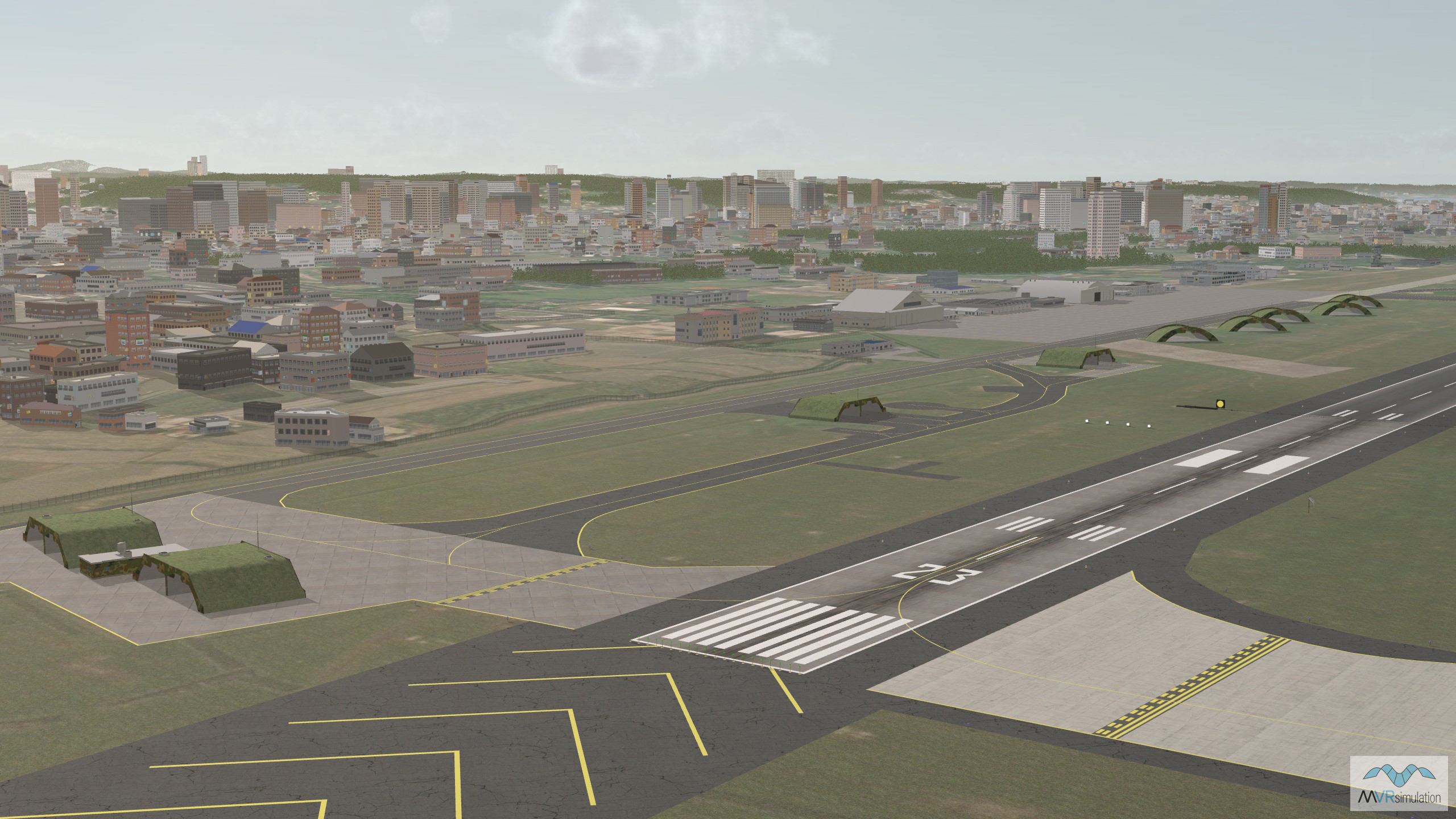
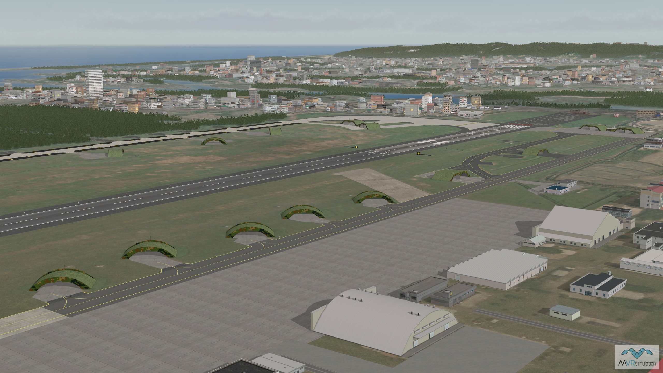
At I/ITSEC 2025 MVRsimulation is displaying new VRSG high-resolution terrain of the Hsinchu region of Taiwan, for the first time. Newly added to the VRSG Asia & Middle East terrain drive, this new dataset is built from 50 cm per-pixel commercial satellite imagery provided by Vantor (formerly Maxar). It features a high-resolution 3D modeled replica of Hsinchu Air Base, complete with a geospecific model of the runway. The base is populated with hundreds of geospecific 3D buildings, critical base structures and facilities, as well as runway lighting, trees, and base fencing.
The urban area surrounding the air base is populated with CityEngine buildings with nighttime lighting, roads and powerlines. The high-resolution air base is blended seamlessly into the surrounding geospecific coastline region of VRSG Taiwan terrain, providing a high-fidelity virtual environment for military training operations.
The new Hsinchu terrain features in the simulated multi-domain training exercise running in booth #727 all week. Visitors will have the option to explore the terrain in 3D wearing a Varjo mixed-reality headset in the MVRsimulation Sand Table, or take part in the scenario in the PJFT, DJFT or new FPV Team Trainer.
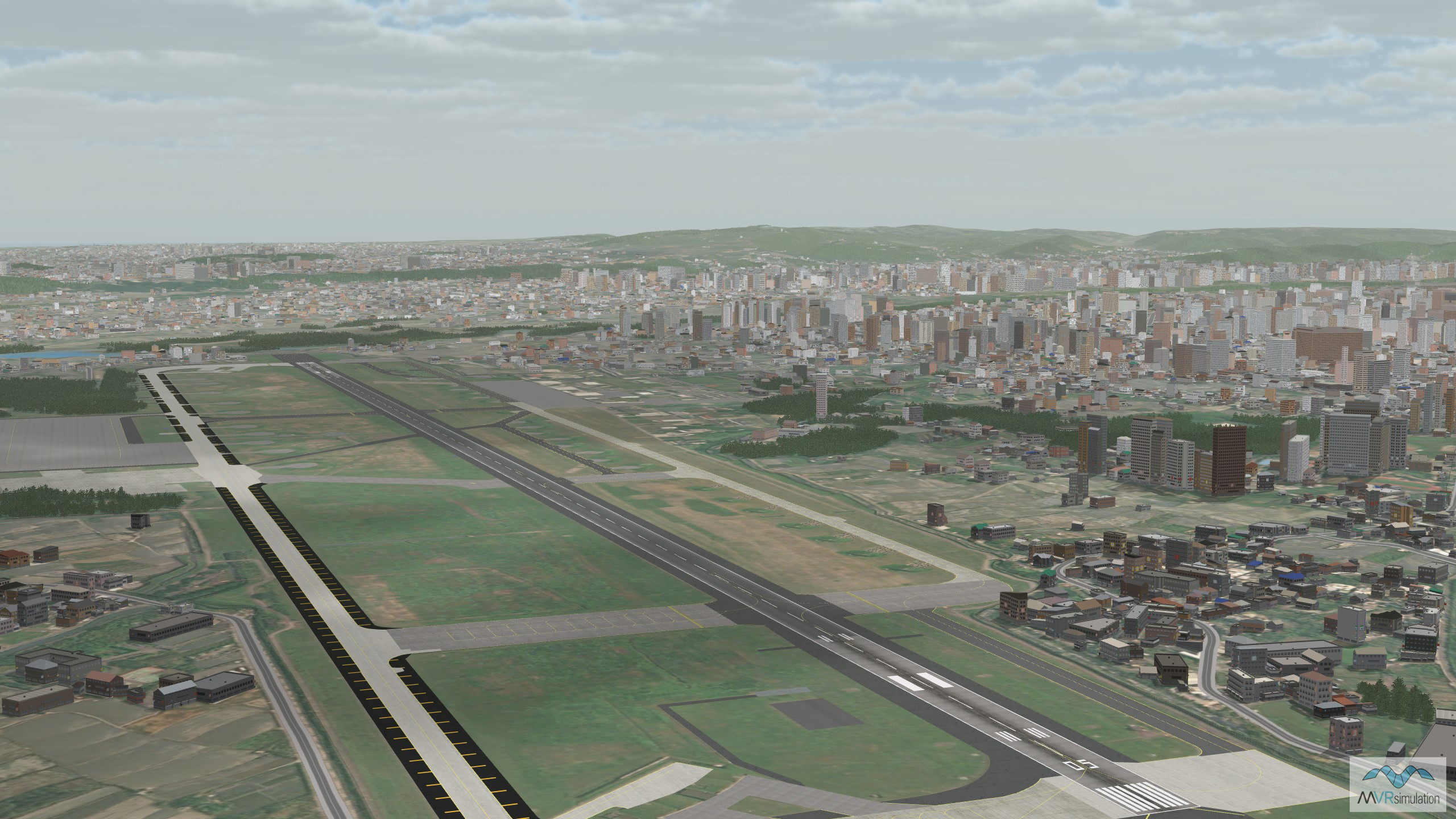
VRSG Taiwan terrain now includes a new 3D replica of Hsinchu Air Base.
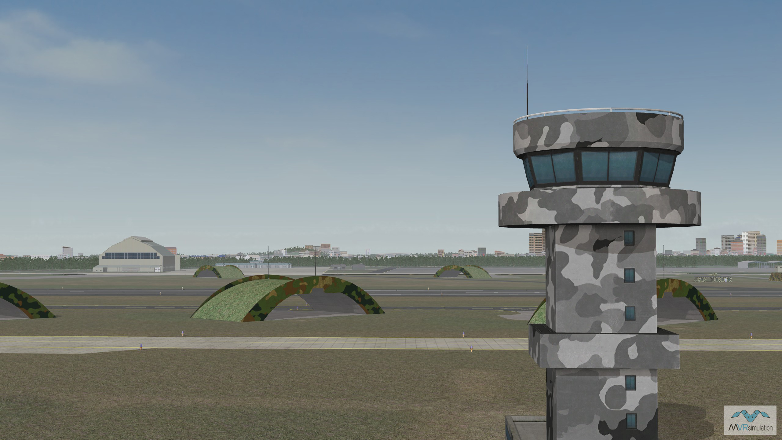
Detail of the control tower in VRSG Hsinchu Air Base, Taiwan, terrain.
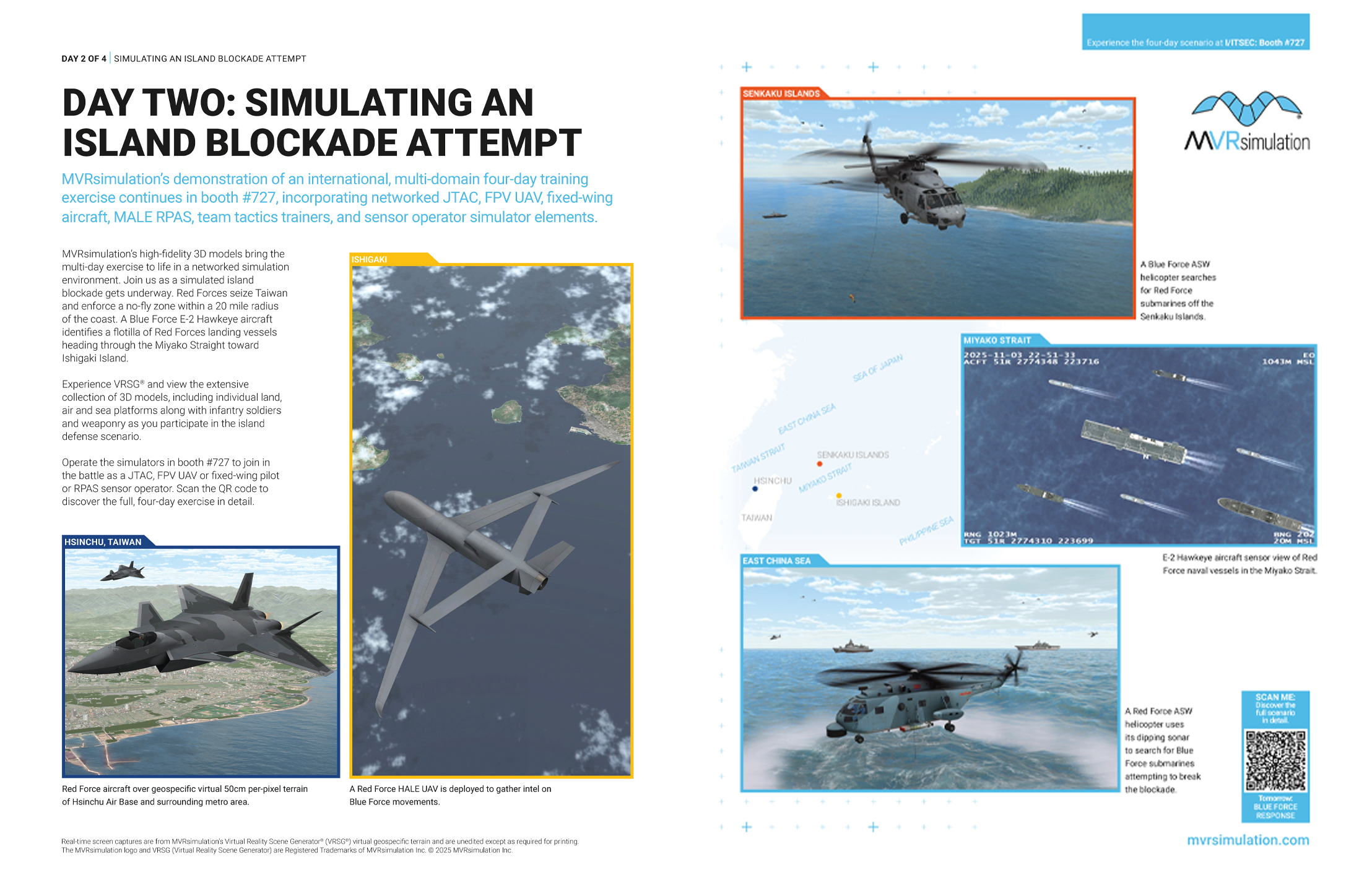
Multi-domain training exercise - Be part of the action!
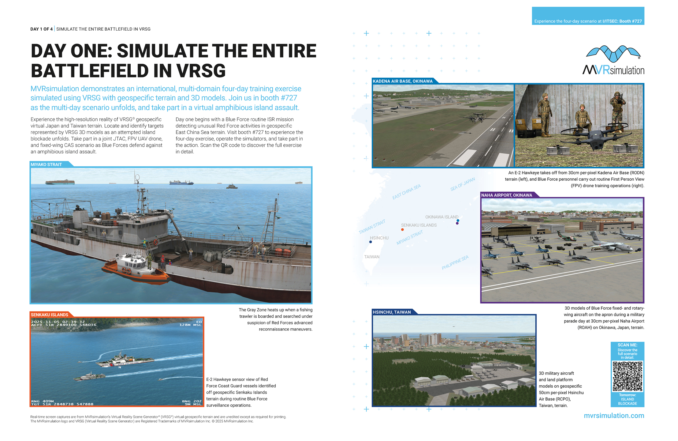
In booth #727, MVRsimulation simulates an international, multi-domain four-day training exercise in the East China Sea. Visualized in geospecific Japan and Taiwan terrain with visually realistic 3D models of currently-deployed military platforms, the exercise incorporates Joint Fires, FPV UAV drone, fixed-wing CAS and RPAS ISR sensor simulator elements.
Beginning with Blue Force detection of unusual Red Force activities in the Miyako Strait and an attempted island blockade of virtual Taiwan, the exercise culminates in a battle for virtual Ishigaki as Blue Forces defend the island against an incoming Red Force amphibious attack.
Be part of the action in booth #727: operate the Joint Fires simulators to coordinate mixed-reality mission rehearsal, acquire targets, and control CAS strikes on naval vessels; locate, identify and share target information on Red Force platforms; or fly FPV UAV drones against armored amphibious vehicles as they swim ashore from a Landing Helicopter Dock positioned in Ishigaki Port.
Experience the reality with which VRSG simulates complex, coordinated mission training and role rehearsal on networked simulators in a shared virtual world. Explore high-resolution terrain, interact with real-time 3D models, and share ATAK information with teammates across the network. Running all week in the MVRsimulation booth, this virtual exercise showcases how VRSG visuals, simulators, and infrastructure delivers world-class training capabilities for military forces. Come and see it for yourself!
Discover more in booth #727
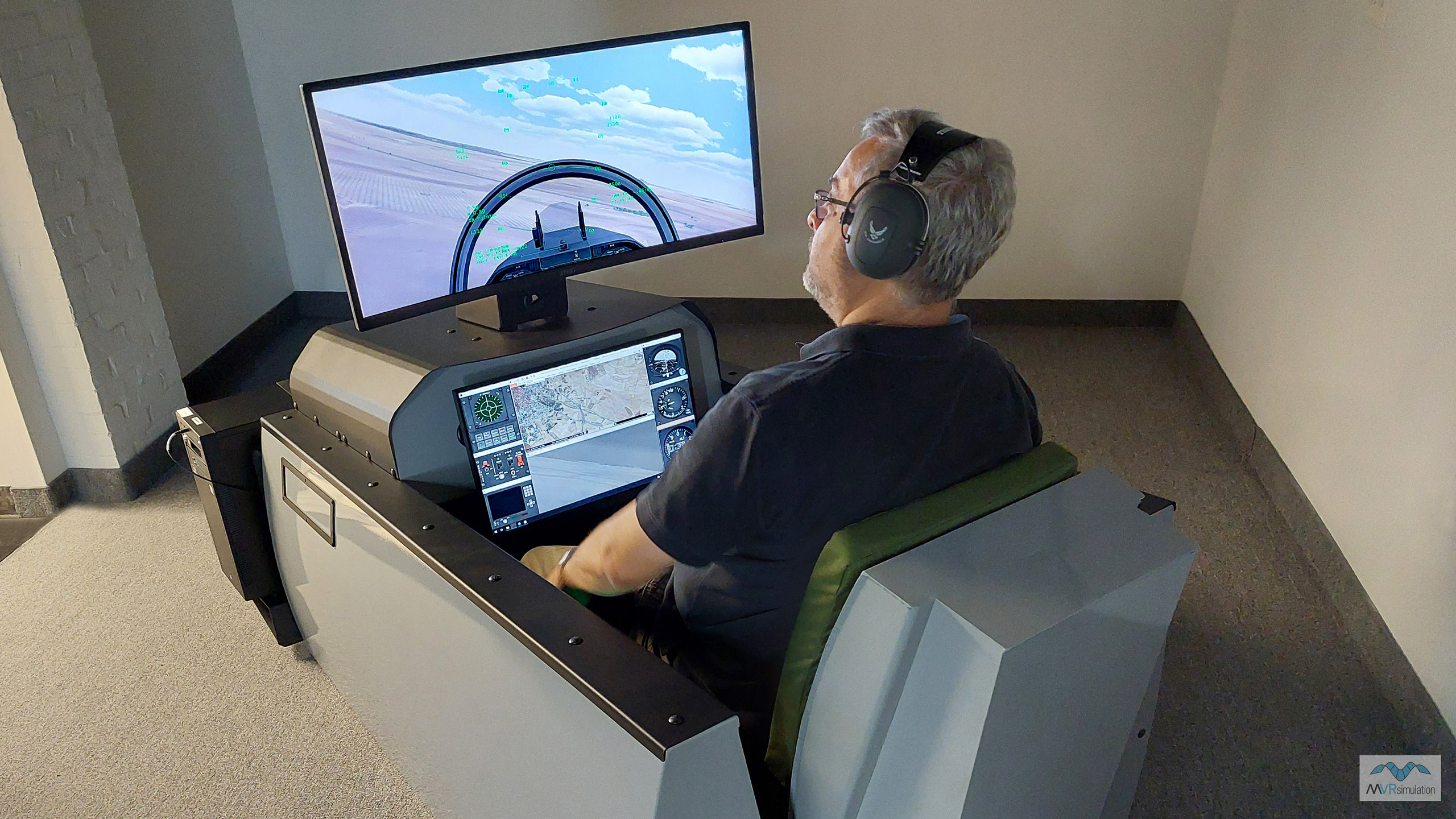
As well as running coordinated group tactics training on the FPV Team Trainer, visitors can fly the FPV UAV Simulator in VRSG high-res Ishigaki, Japan, terrain against 3D model targets, incorporating VRSG, ATAK and emulated PTT radio function.
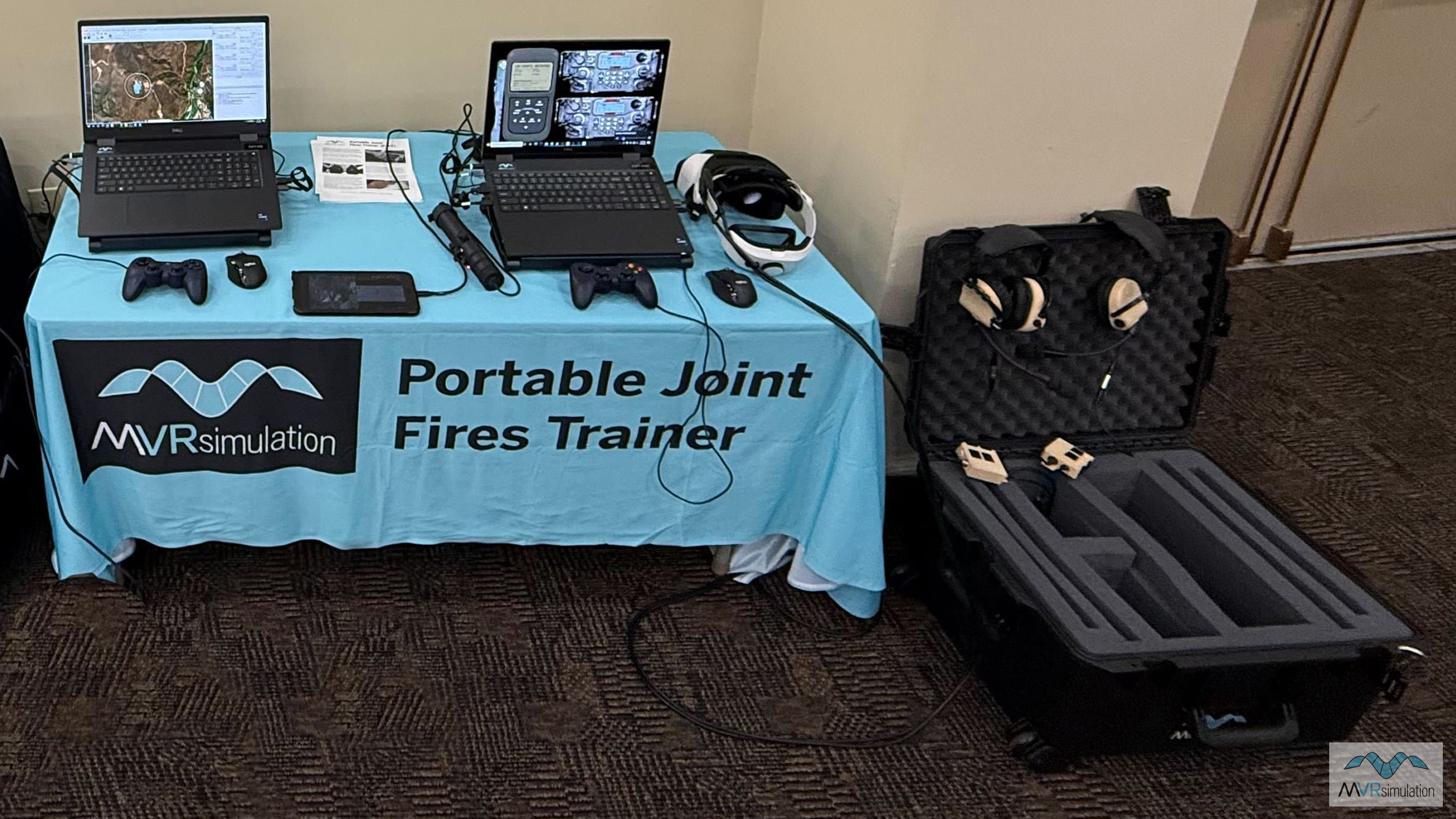
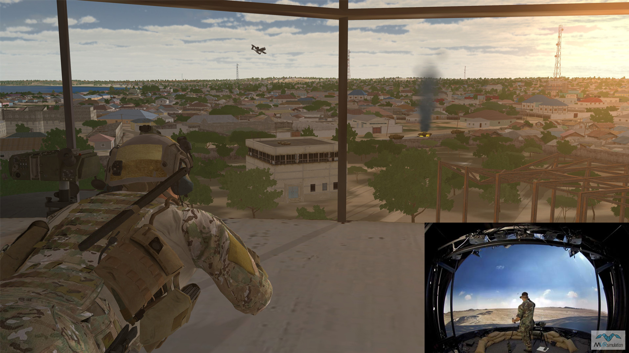
Portable Joint Fires Trainer (PJFT)
Take your Joint Fires training to the tactical edge with the ultra-portable PJFT. Use real-world ATAK end user devices, VRSG, MACE, and the mixed-reality Varjo XR-4 to conduct networked operations in VRSG high-res Ishigaki, Japan, terrain.
Deployable Joint Fires Trainer (DJFT)
Explore deployable, fully JFS ESC-accredited Joint Fires training in this immersive, joint environment for JTACs to train alongside fixed-wing, rotary-wing and RPAS aircrew with real-world and emulated military equipment in virtual Ishigaki Port, Japan.
Part Task Mission Trainer (PTMT)
Fly the fixed-wing PTMT over geospecific VRSG terrain. Practice mission tactics and coordination as part of joint training operations as a CAS role player in a networked Joint Fires training mission taking place in shared Ishigaki Port, Japan, terrain.
Get up close with VRSG geospecific terrain in 3D, including high-resolution training ranges, MOUT sites, airfields, and highly-detailed urban areas. Explore VRSG terrain at the terrain desk or experience the first-person view in the mixed-reality Sand Table.
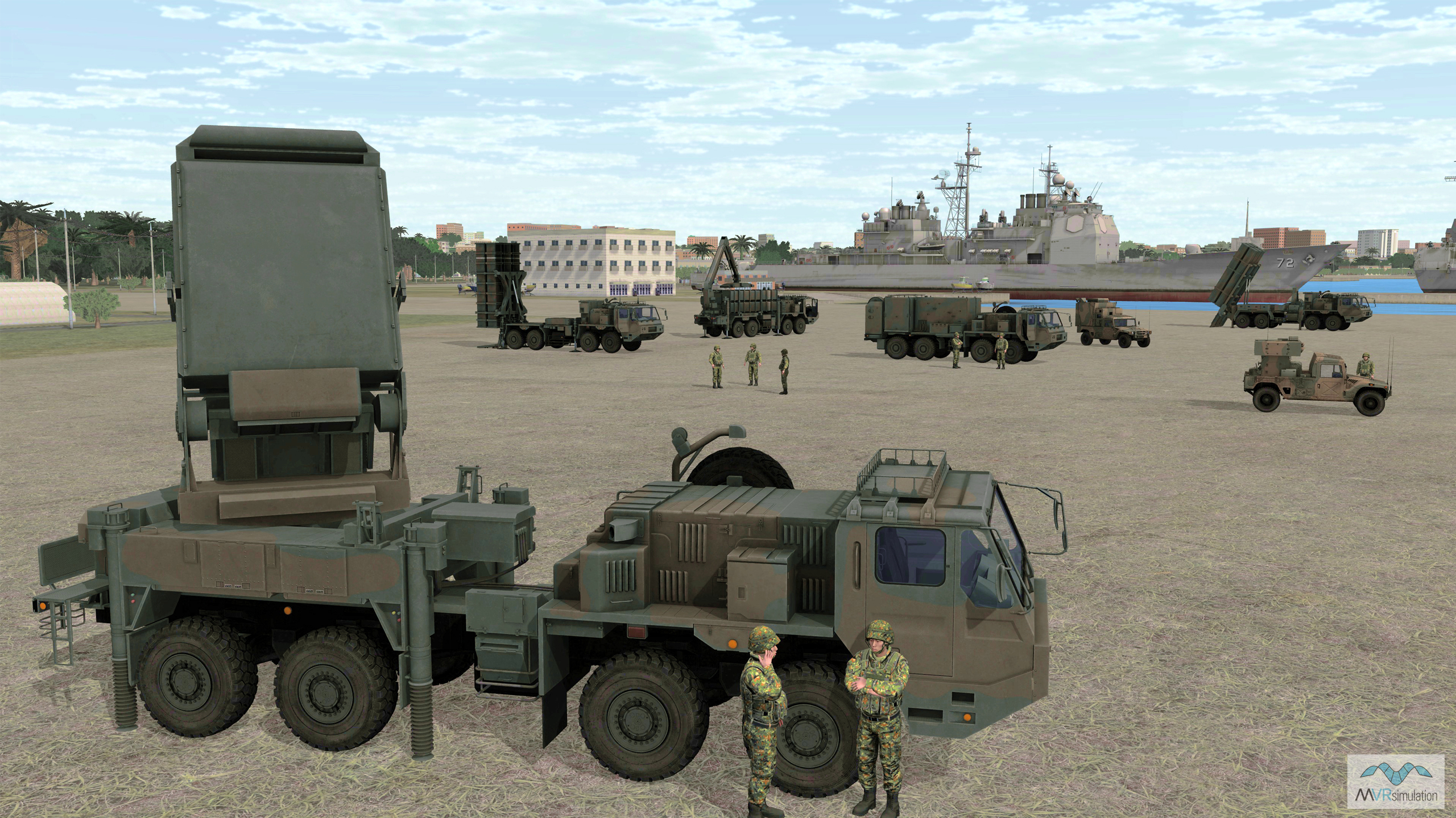
See VRSG 3D models in action in dynamic training scenarios taking place in geospecific VRSG terrain, including newly-released visually accurate replicas of military platforms deployed in current conflicts around the globe.
Day 1: Explore the Show Daily scenario in detail
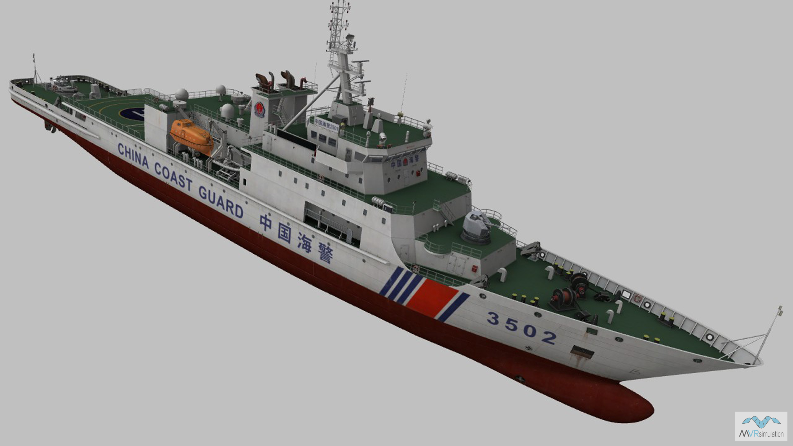
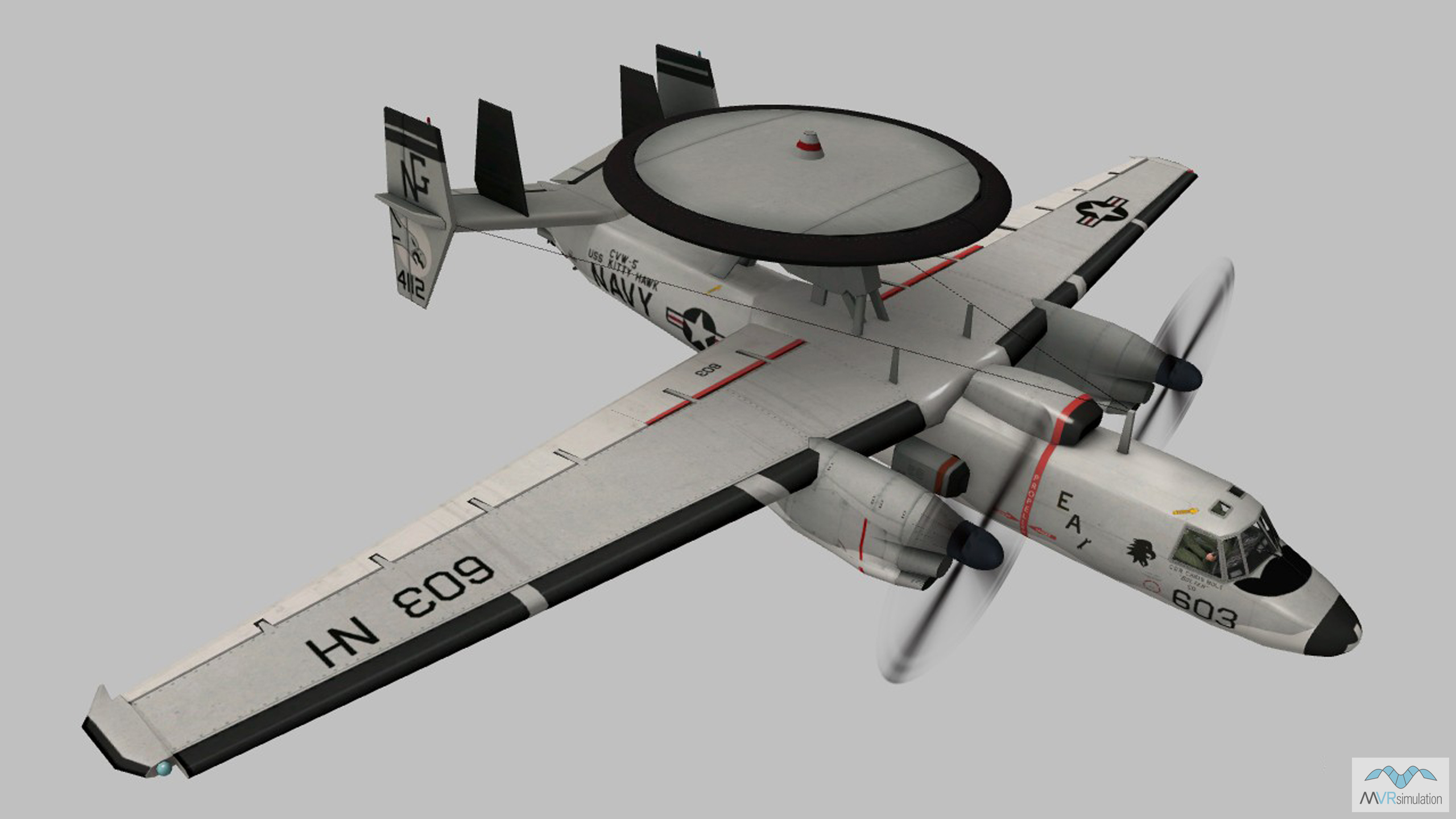
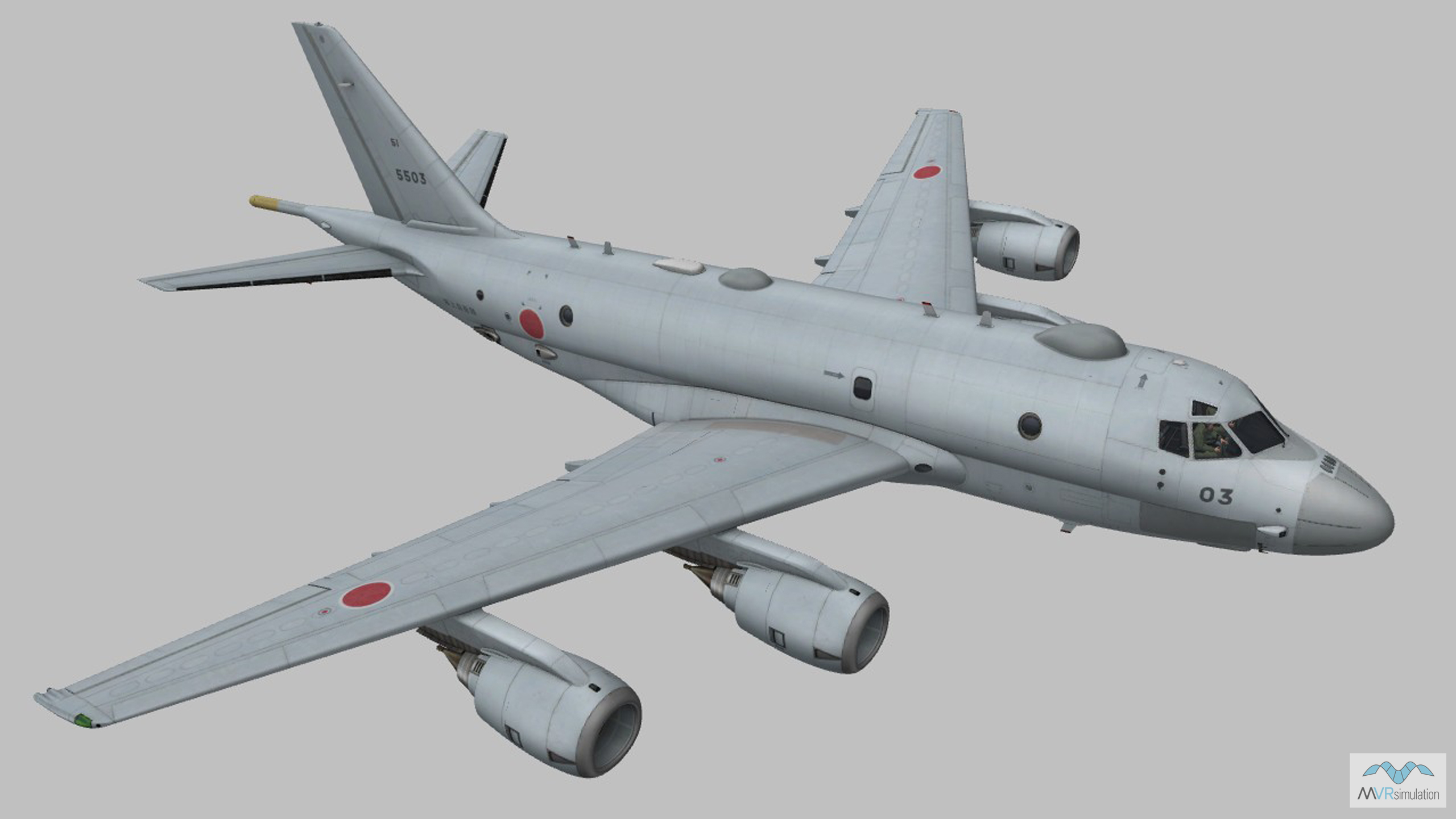
Day 1 begins with business as usual for the Blue Force. Military cargo aircraft run maneuvers from Hsinchu Air Base, Taiwan, and personnel carry out FPV drone training drills on Okinawa. A military parade gets underway at Naha Airport in Japan, and an E-2 Hawkeye airborne early warning (AEW) aircraft departs Kadena Air Base, Okinawa, for routine ISR operations. An hour later, the Gray Zone heats up when the E-2 Hawkeye detects a fishing vessel loitering in restricted waters in the Miyako Strait. Under suspicion of Red Force advanced reconnaissance maneuvers, the vessel is boarded and searched by Blue Force coast guard personnel. The E-2 Hawkeye aircraft begins to search for further Red Force activities in the region, and shortly therafter identifies Red Force Coast Guard vessels off the Senkaku Islands.
VRSG supported simulations
VRSG supported training elements in the Day 1 scenario include manned and unmanned ISR aircraft sensor feed operator simulators for training to locate and identify 3D model targets in geospecific VRSG terrain; and the MVRsimulation FPV Team Trainer for ISR and strike drone operations training. This system provides flexible, networked training in team FPV UAV operations, tactics and strategies for groups of four or more users.
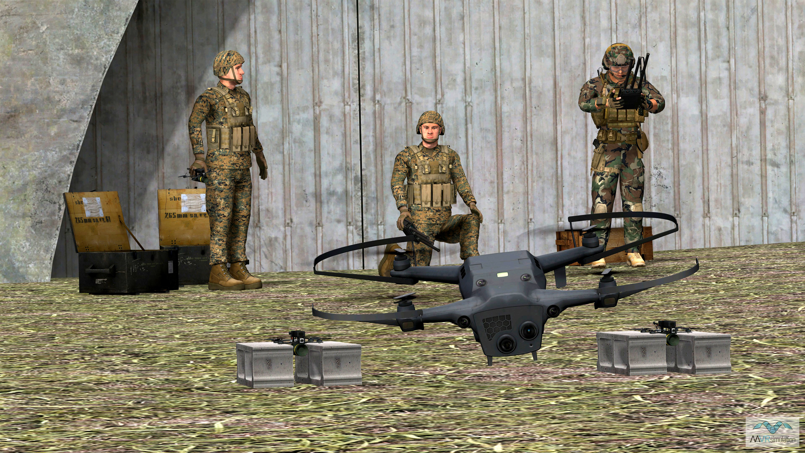
The FPV Team Trainer allows groups of 4+ users to train for coordinated sUAS missions.
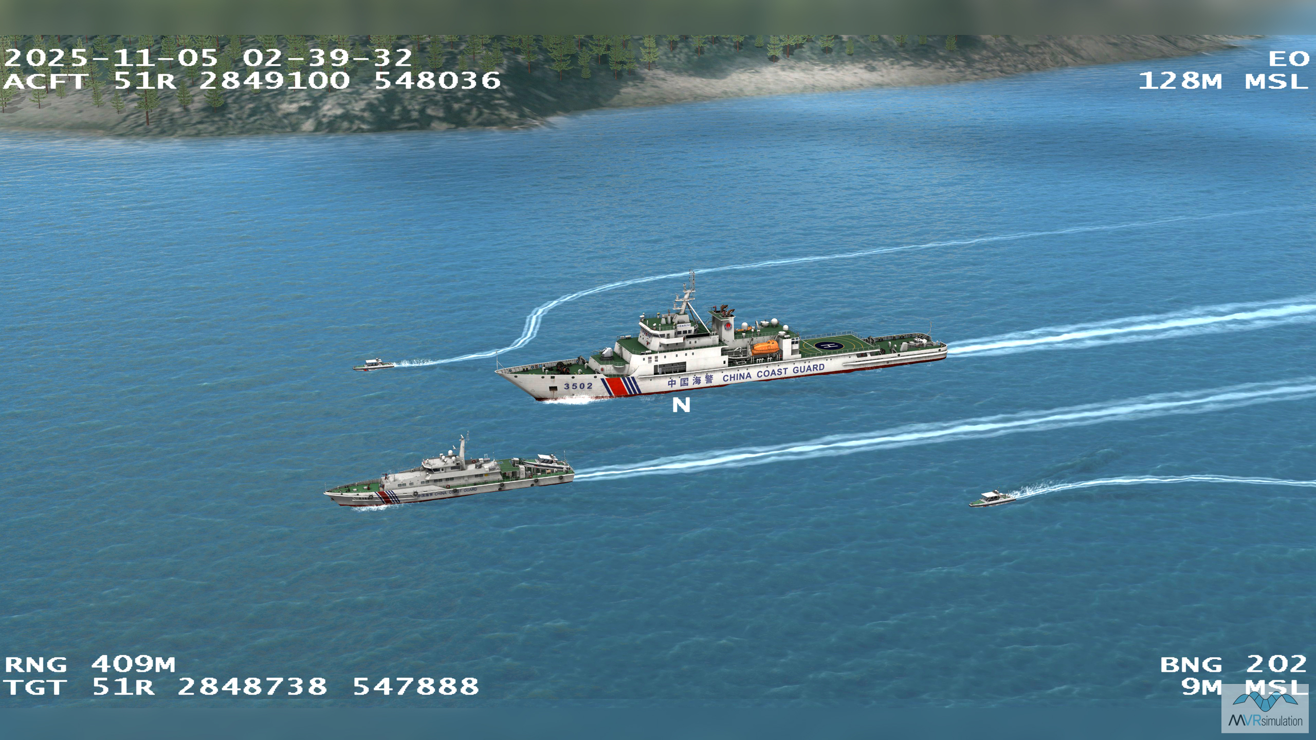
A VRSG simulated sensor feed from airborne ISR aircraft off the Senkaku Islands, Japan.
VRSG terrain
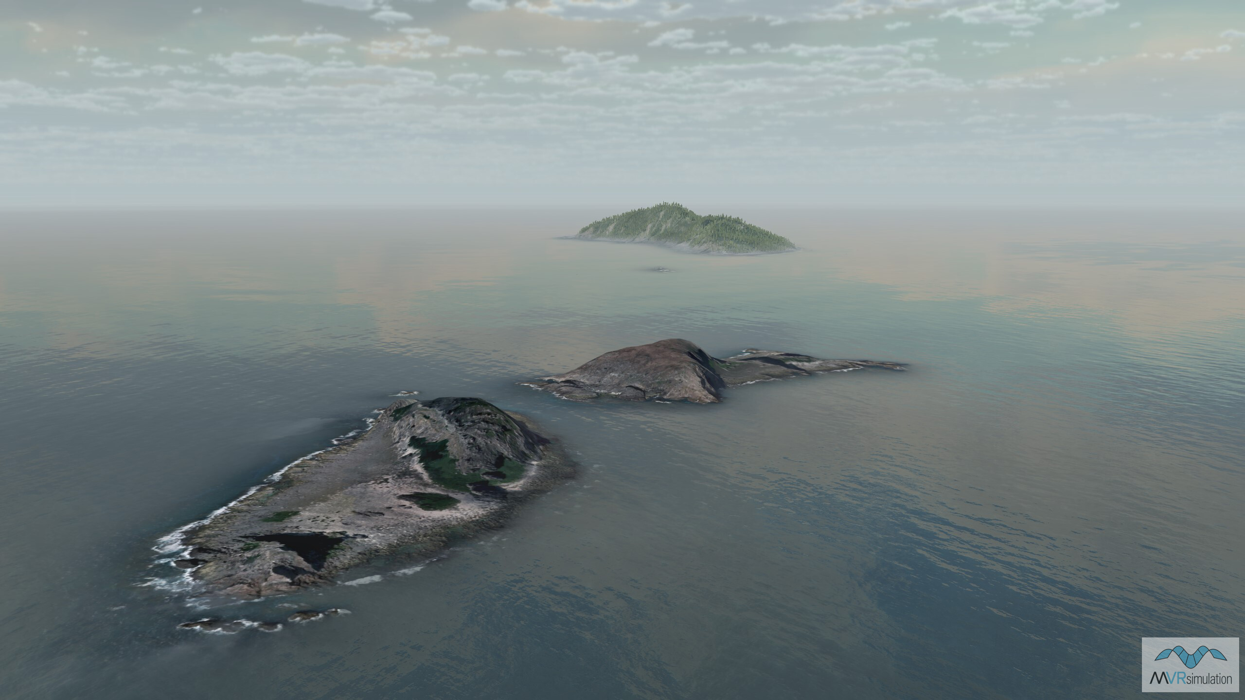
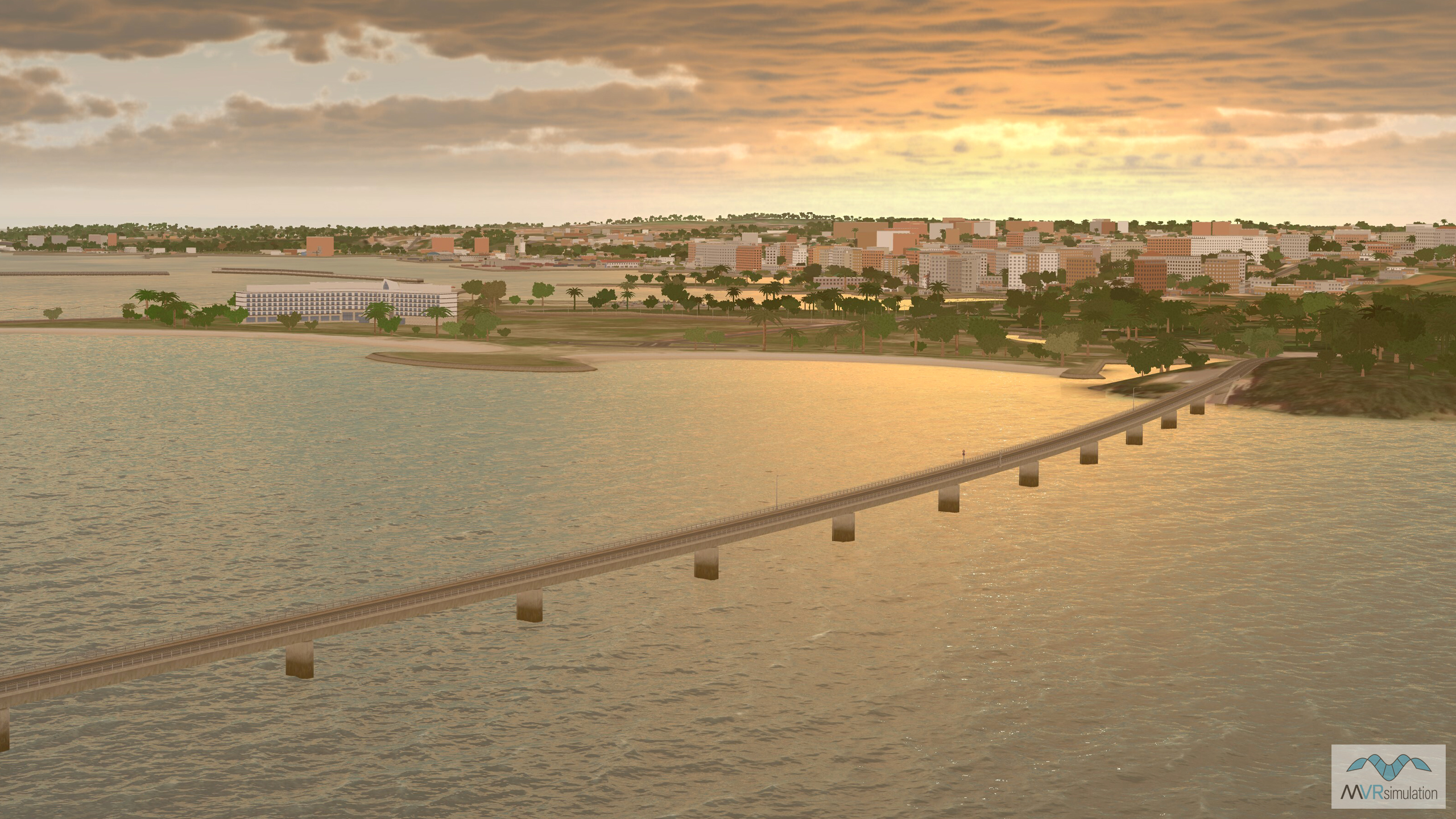
VRSG terrain featured in Day 1 includes islands and strategic territories in the East China Sea: geospecific 30cm per-pixel Kadena Air Base and 30cm per-pixel Naha Airport insets on Okinawa, Japan; and Hsinchu Air Base in geospecific 50cm per-pixel Taiwan terrain. Maritime scenes off the Senkaku Islands and the Miyako Strait are created using VRSG 3D ocean simulation technology, which simulates realistic 3D wave motion, 12 Beaufort scale sea states, 3D wakes and particle spray, and accurate environment reflections.
VRSG 3D models
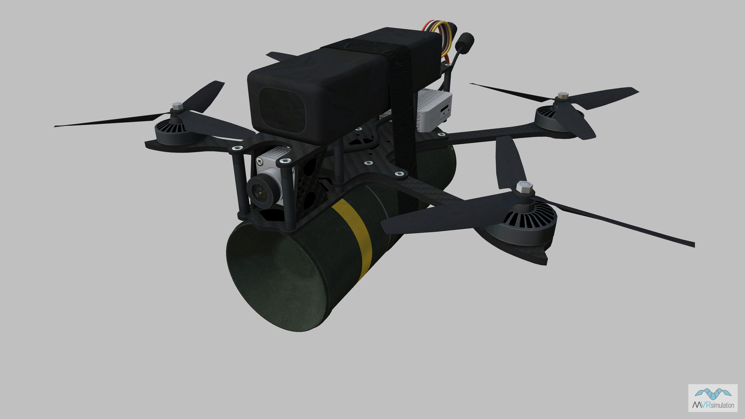
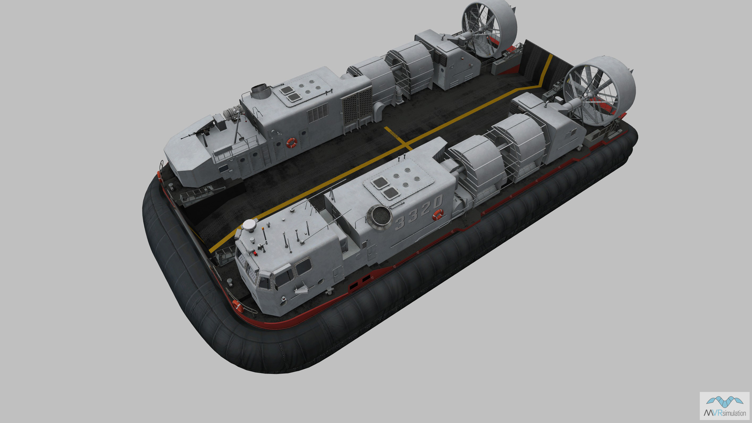
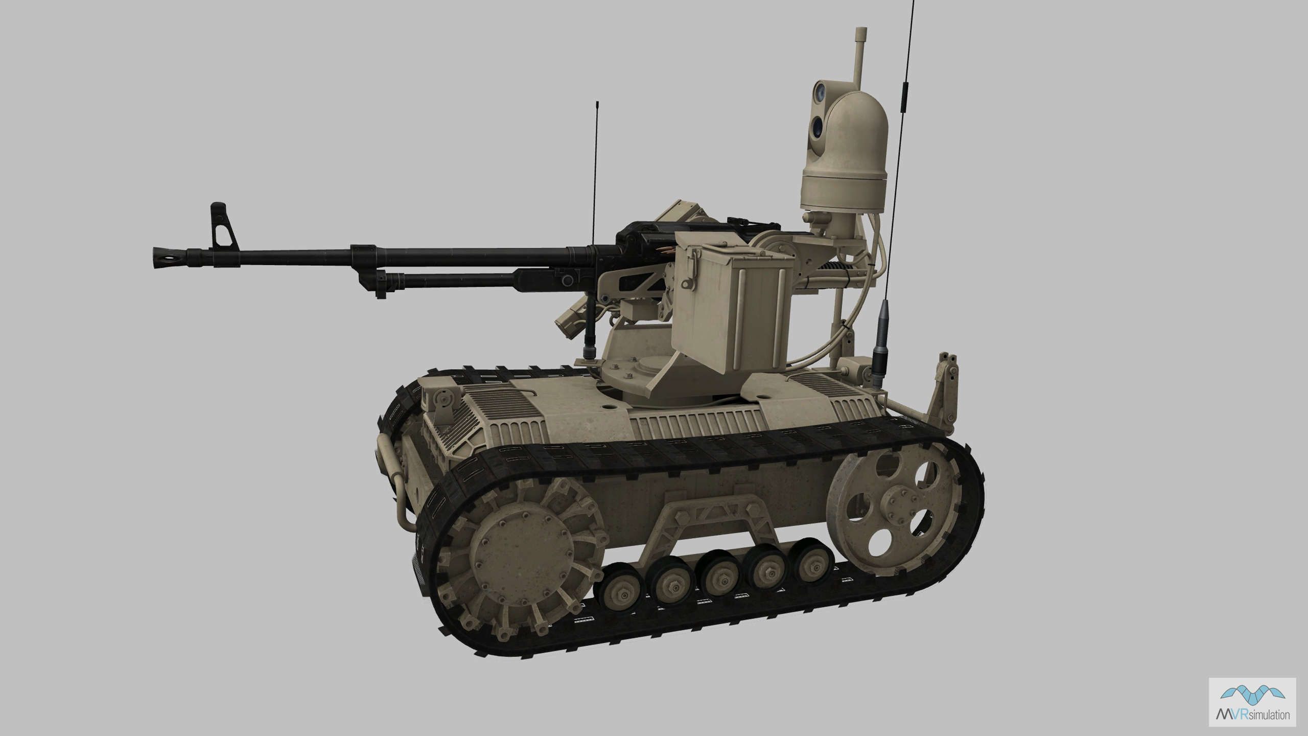
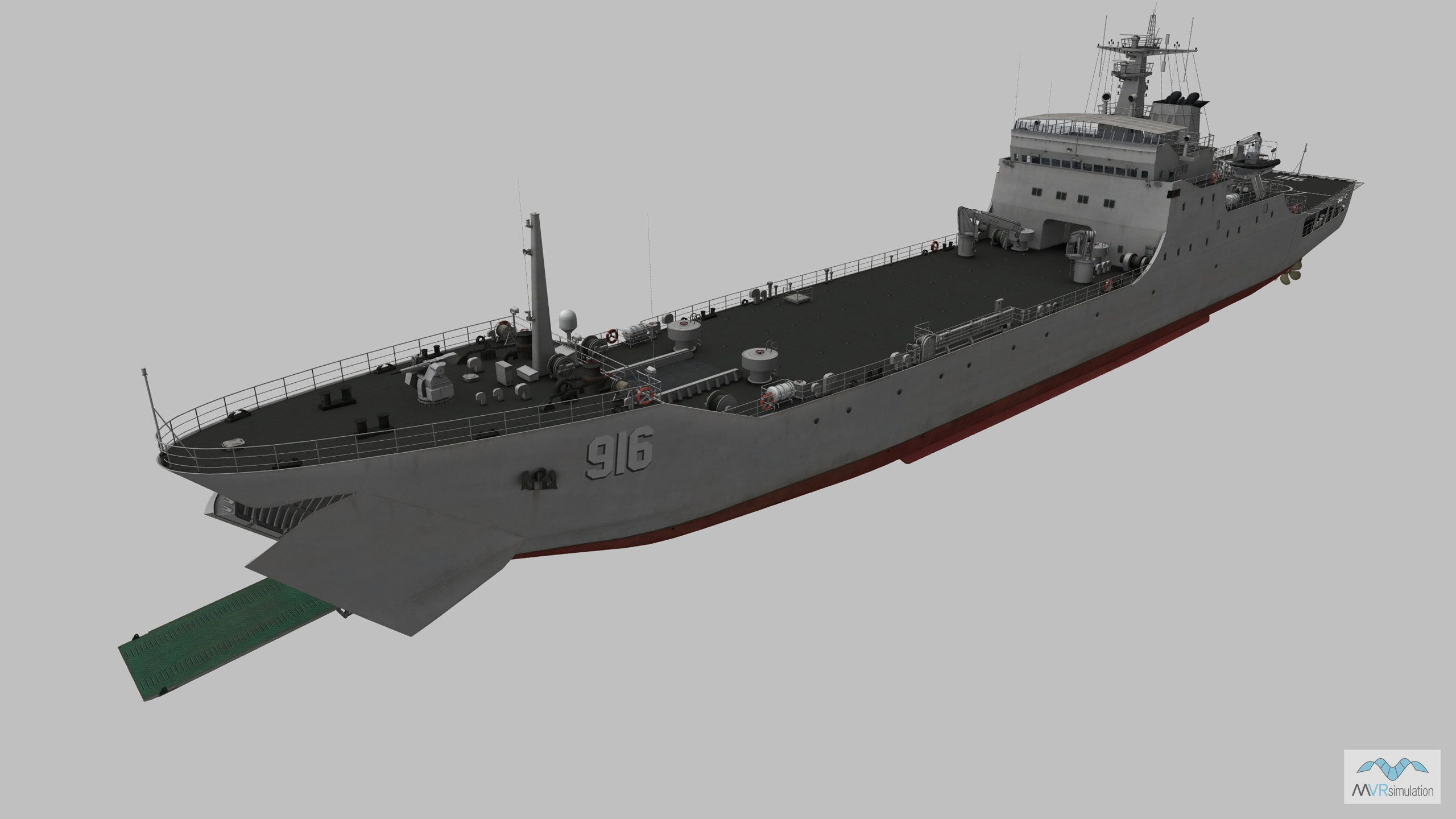
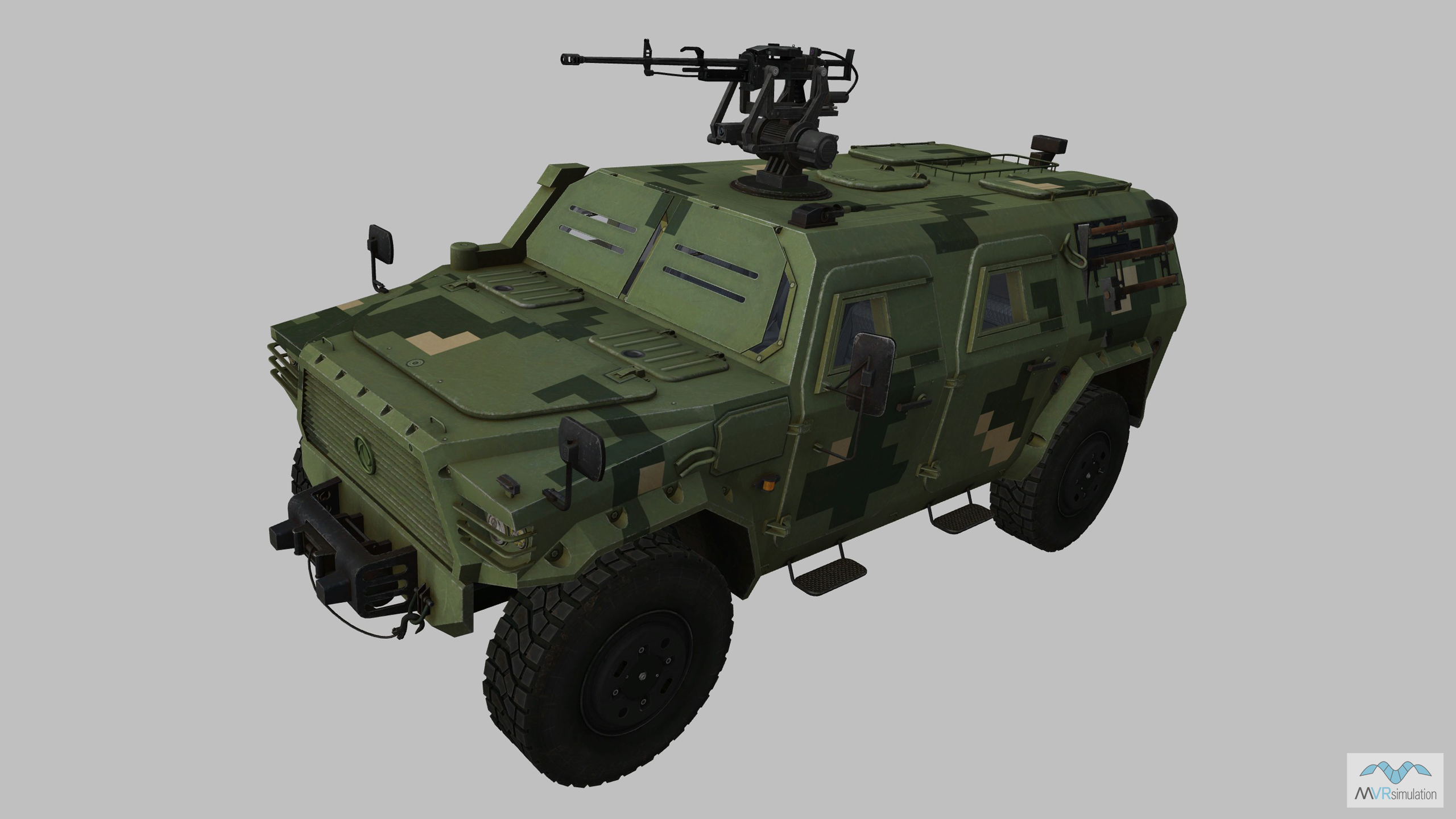
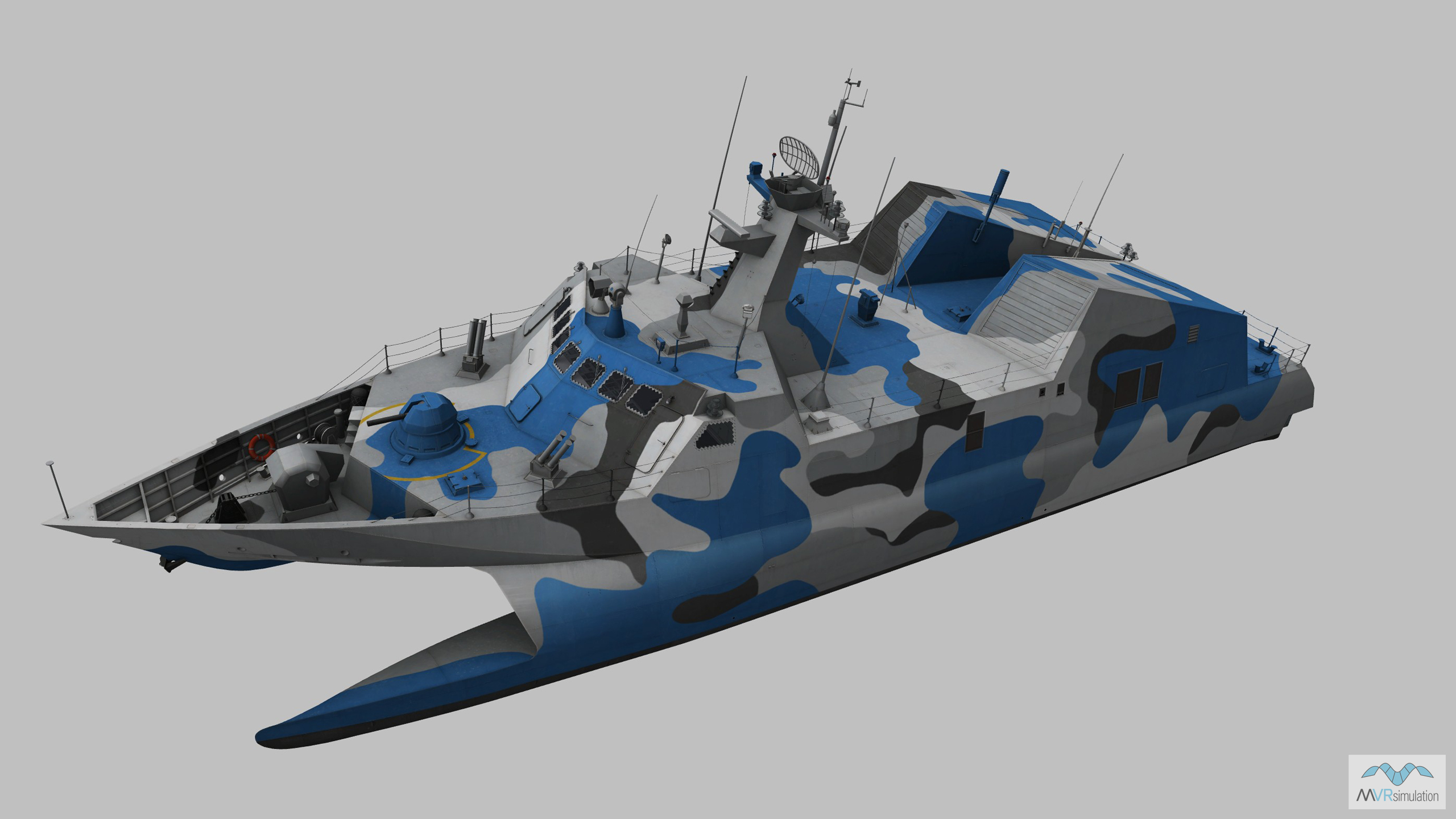
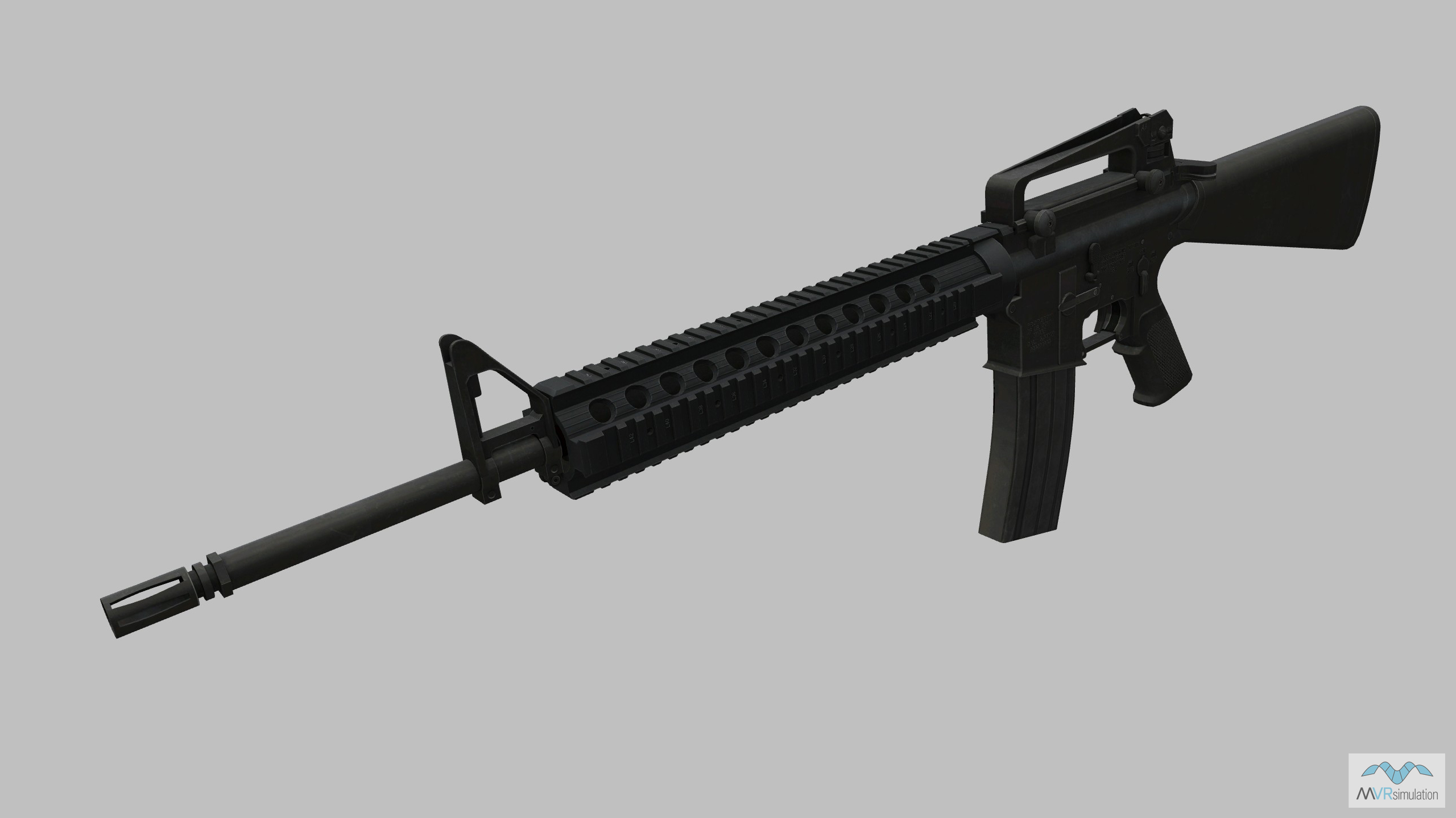
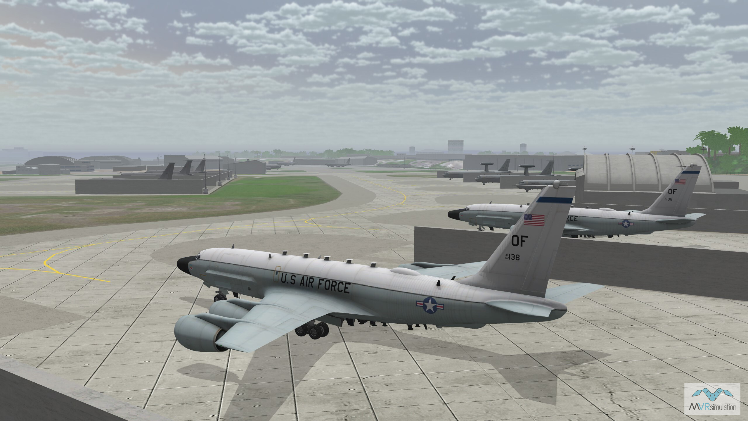
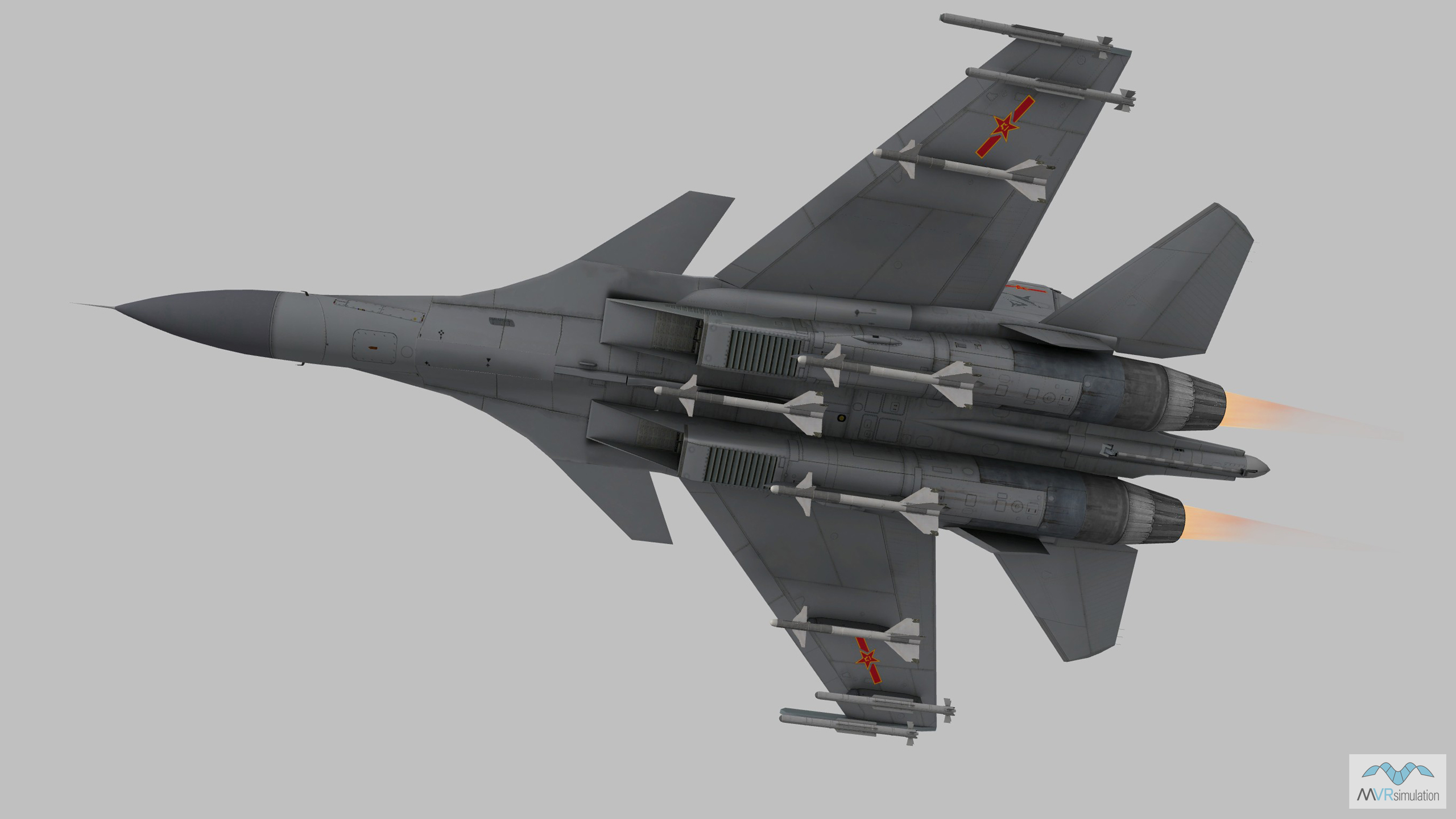
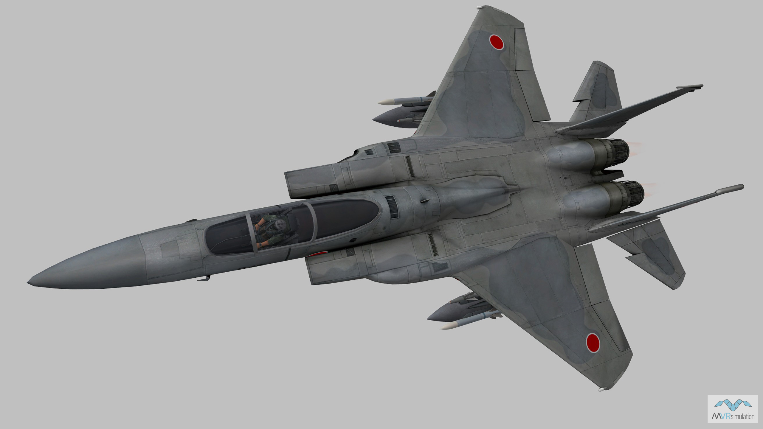
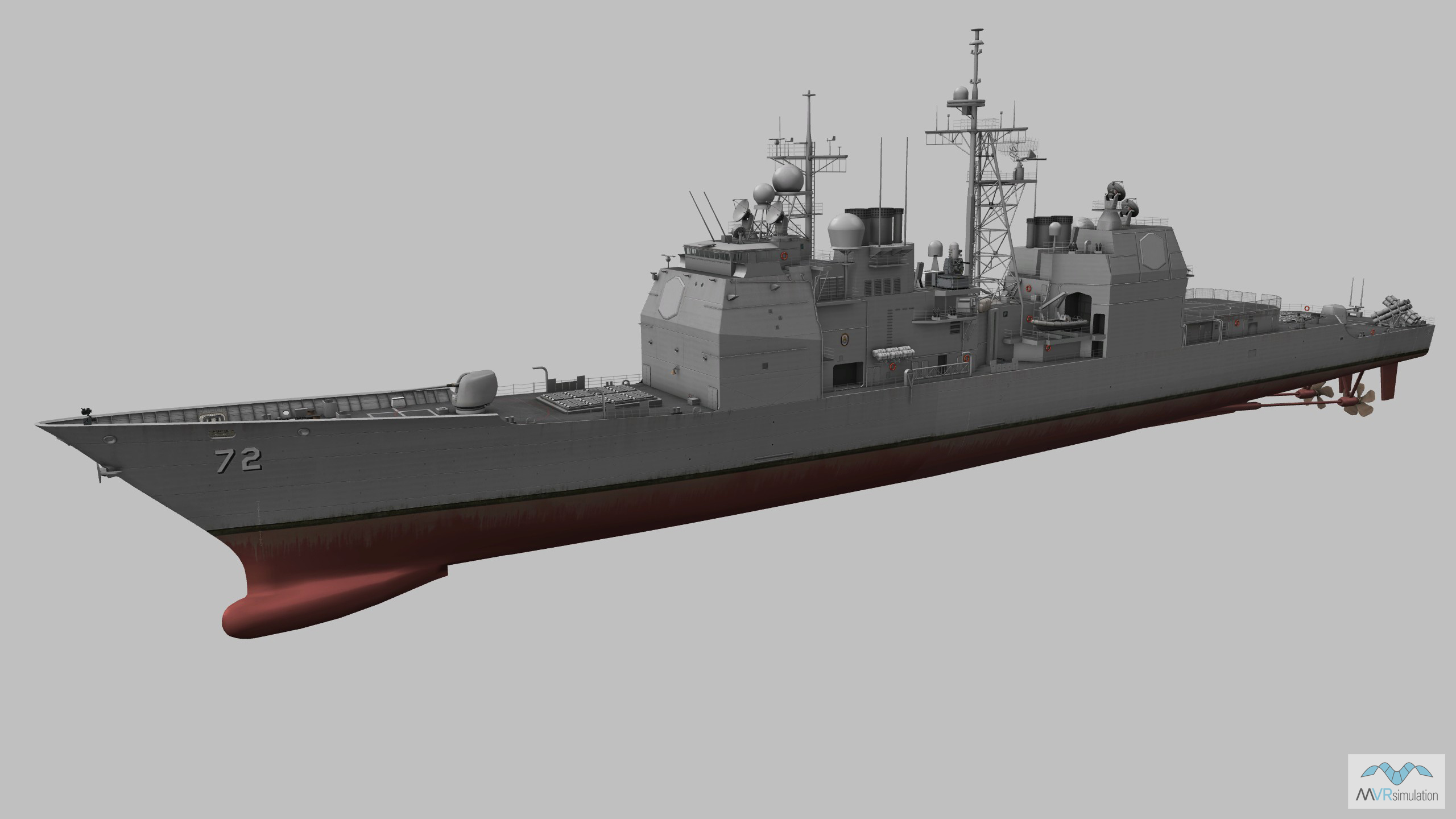
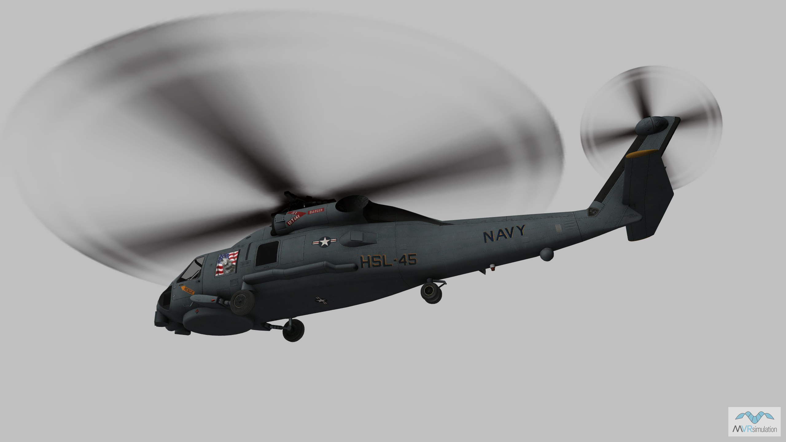
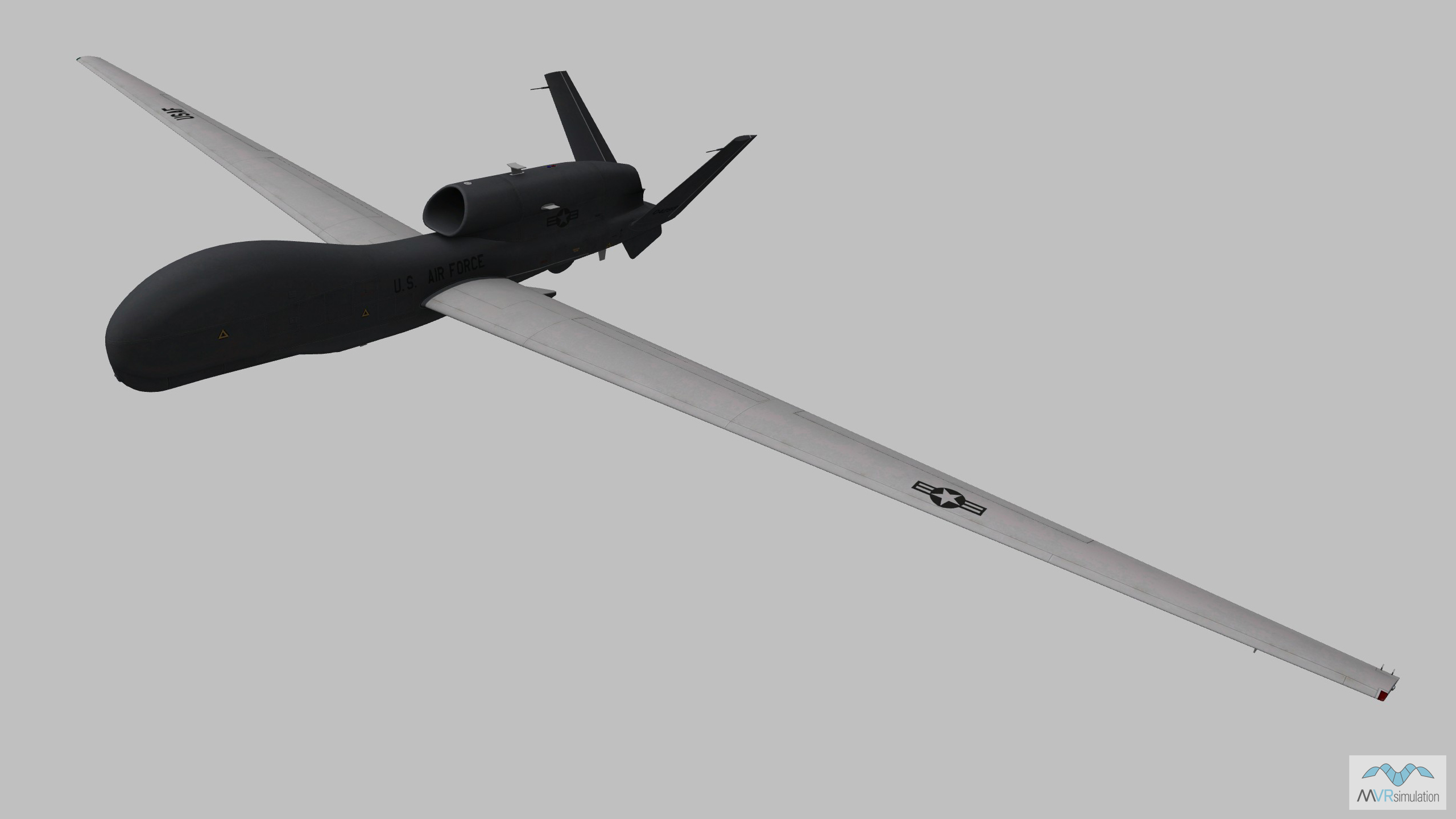
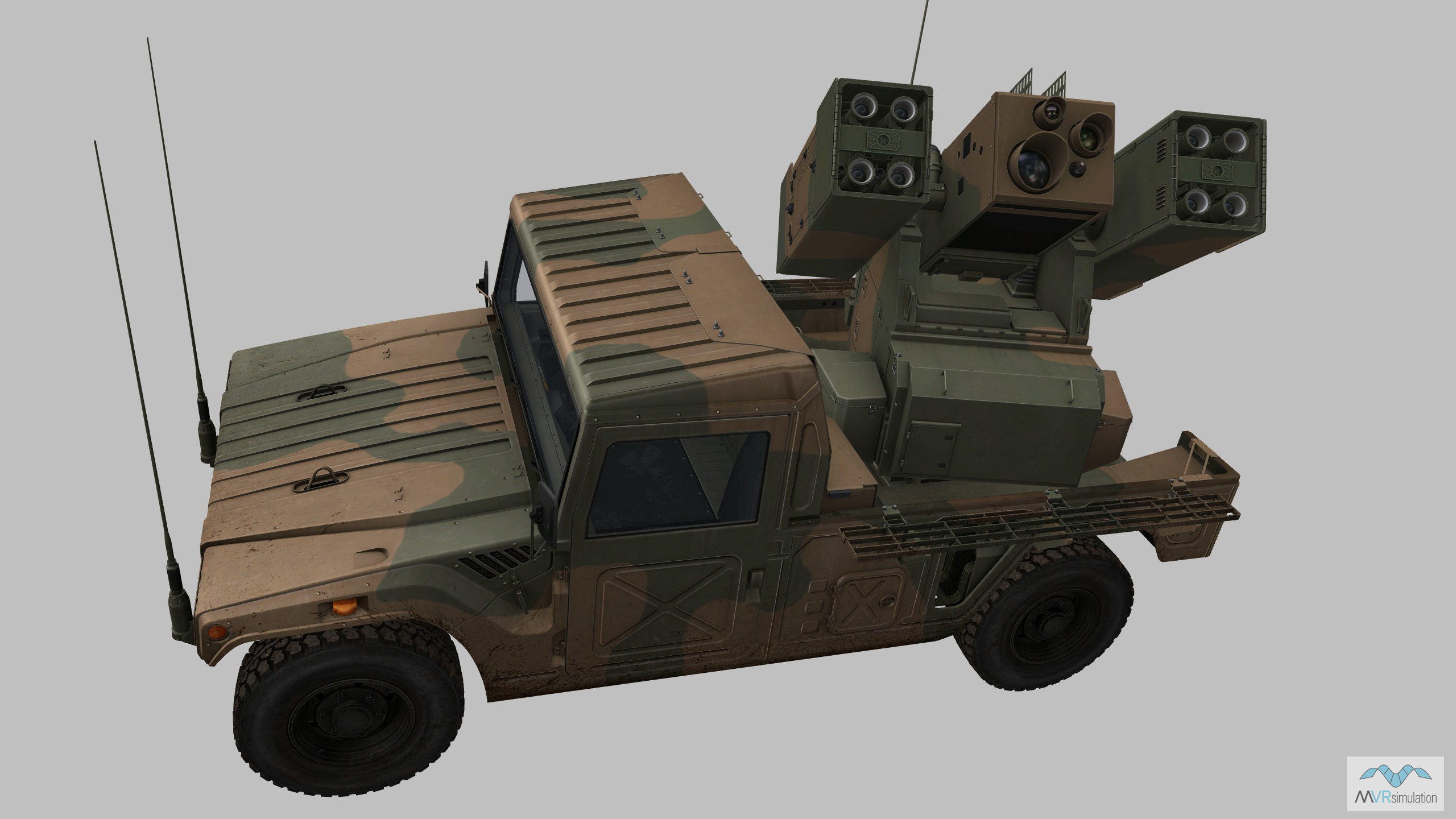
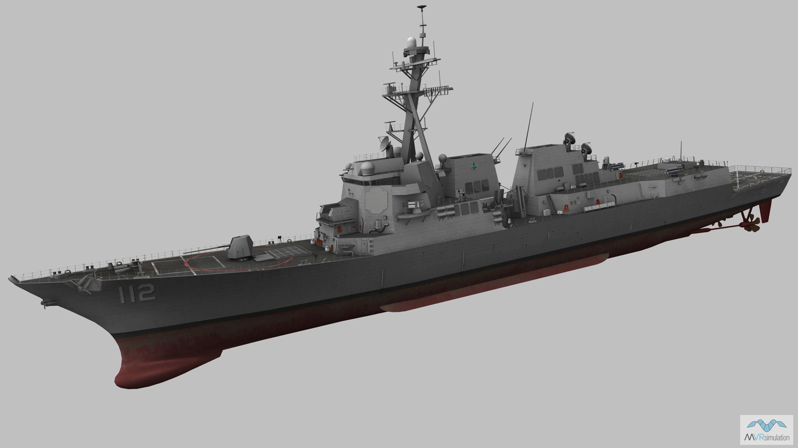
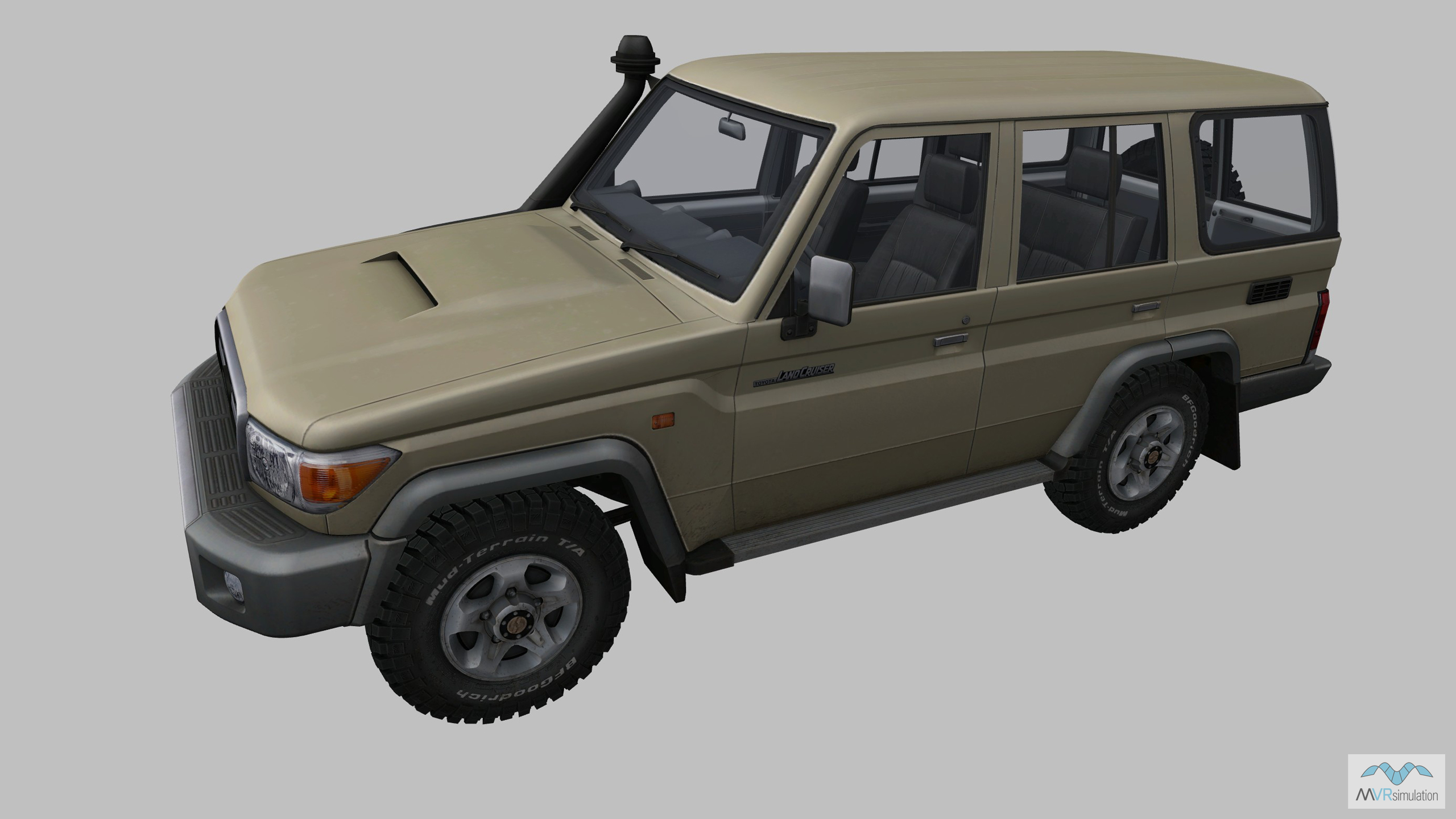
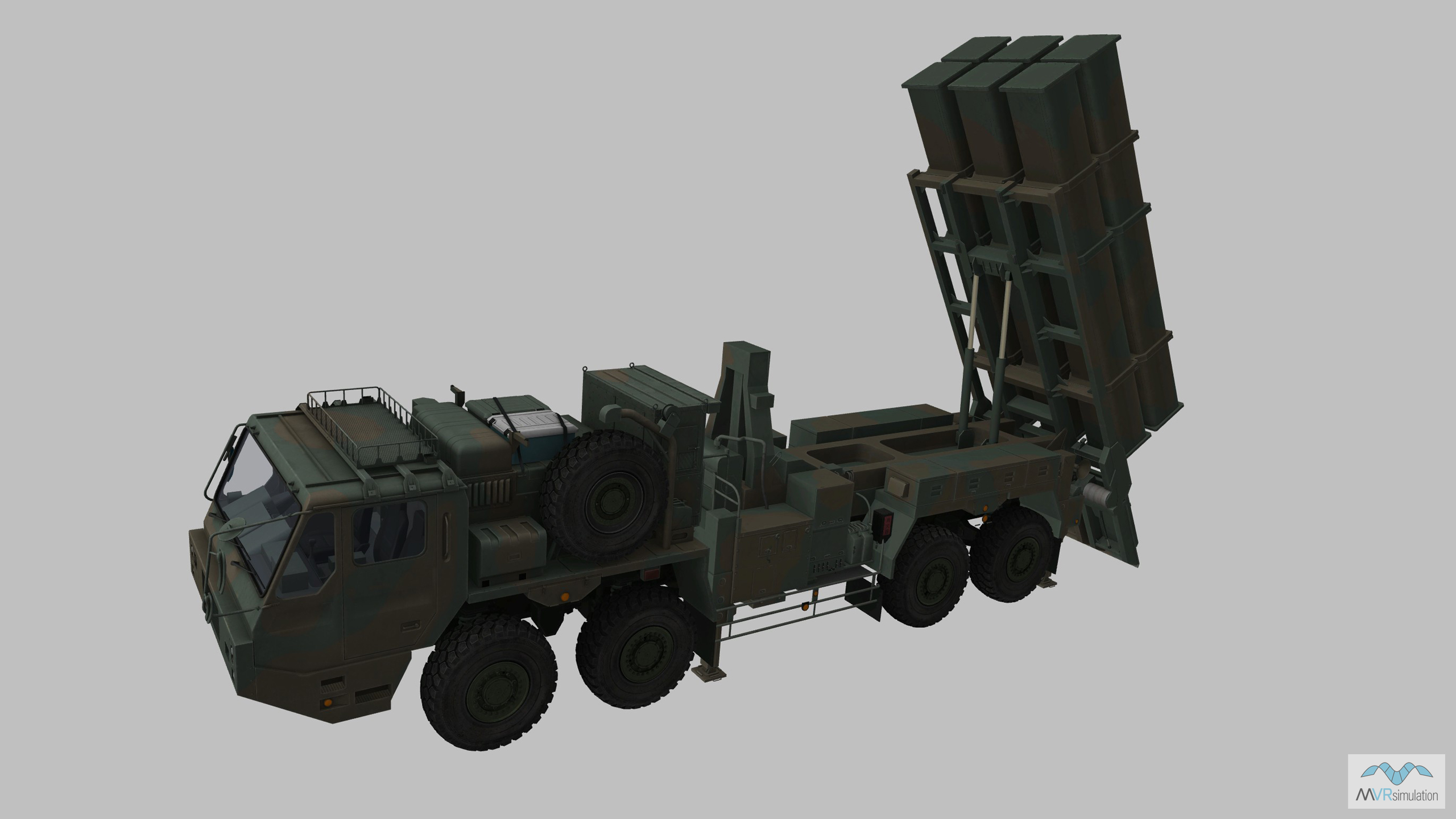
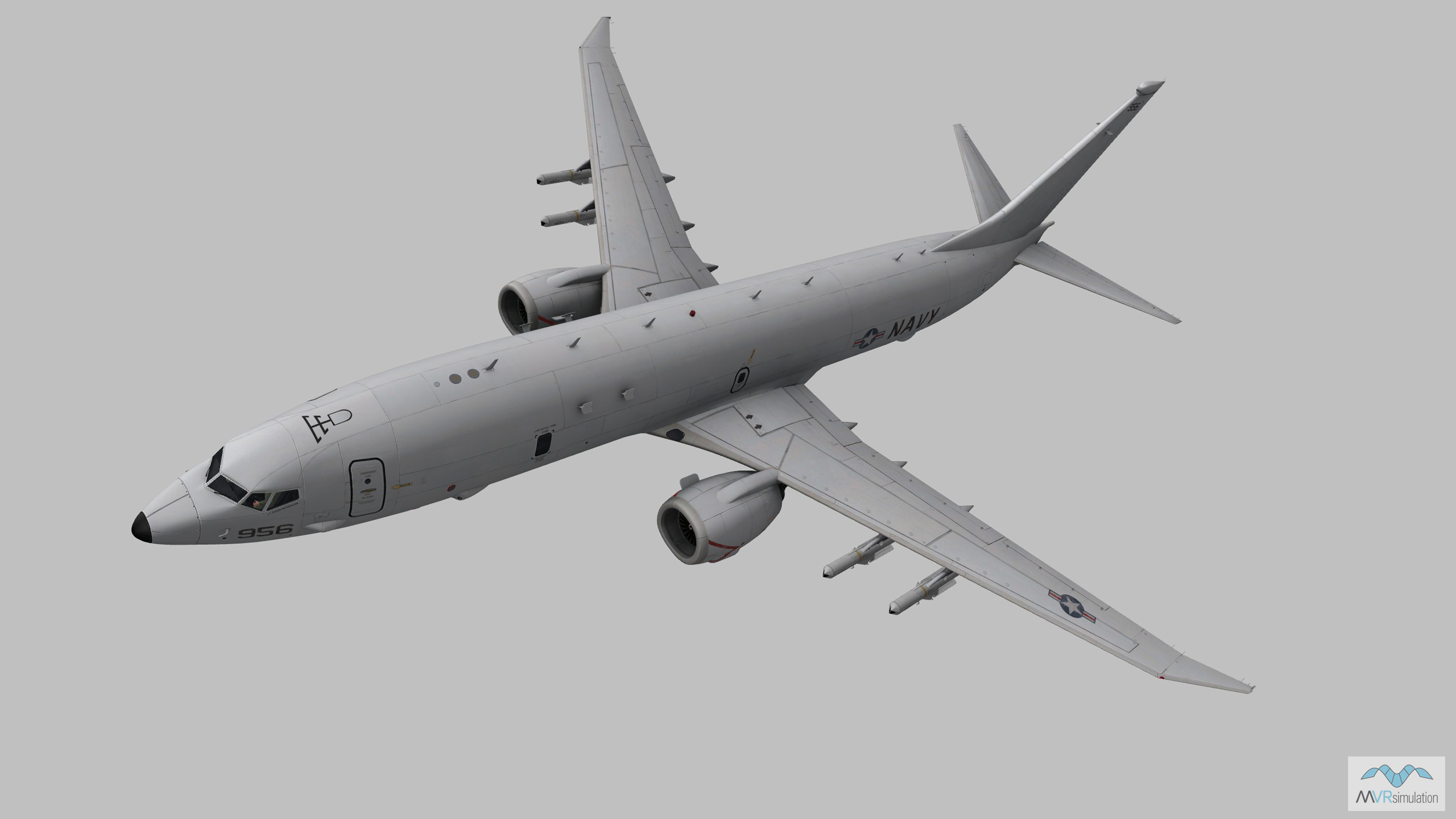
A selection of the VRSG models used in Day 1 of the scenario are below. The VRSG 3D model library features more than 10,500 visually accurate 3D models of currently deployed air, land and maritime platforms. With highly detailed geometry and multiple paint schemes, VRSG models feature articulated parts, damage states, advanced animations, and support time real-time, physics-based thermal sensor viewing within VRSG. The VRSG model library is continually updated. New and updated models are available to download by users of active software maintenance at no additional cost. Search the library here.
Day 2: Explore the Show Daily scenario in detail
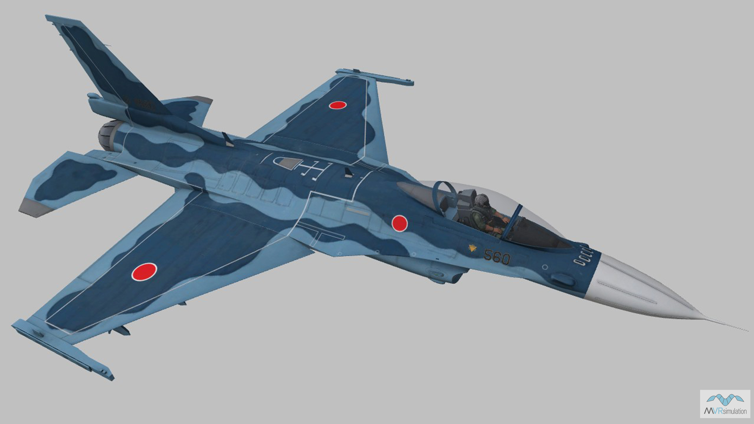
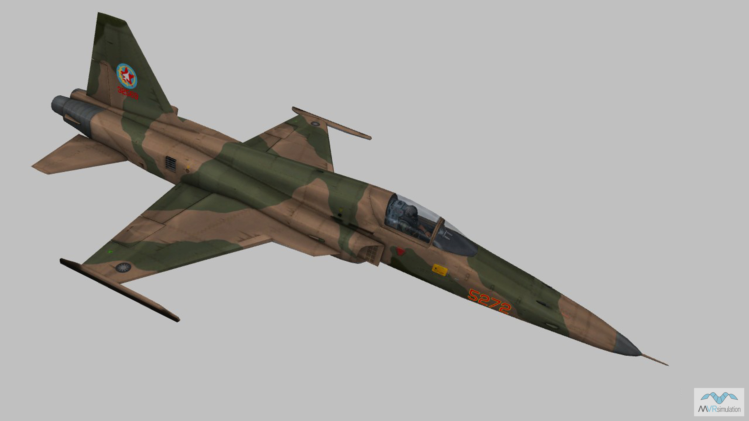
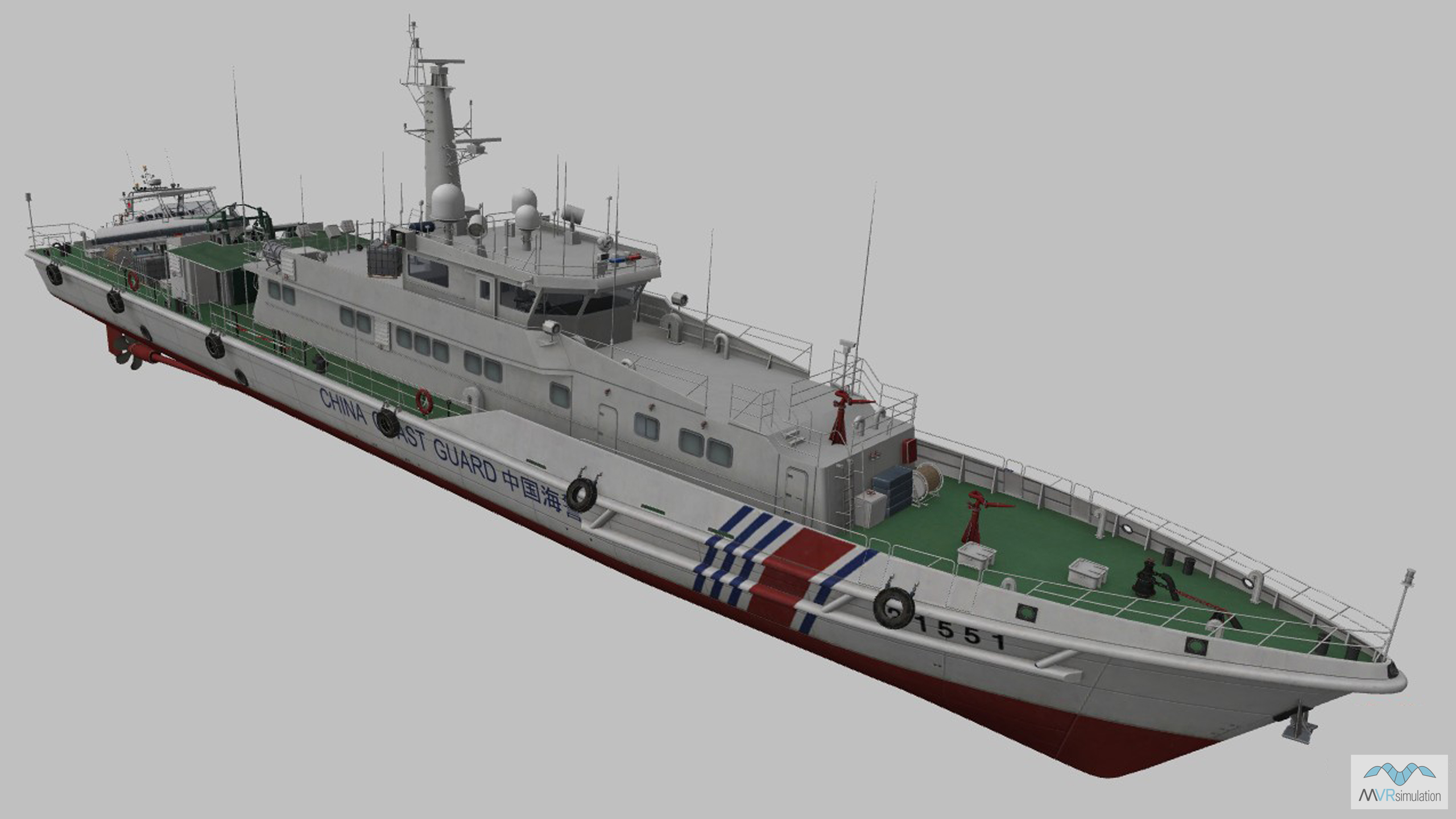
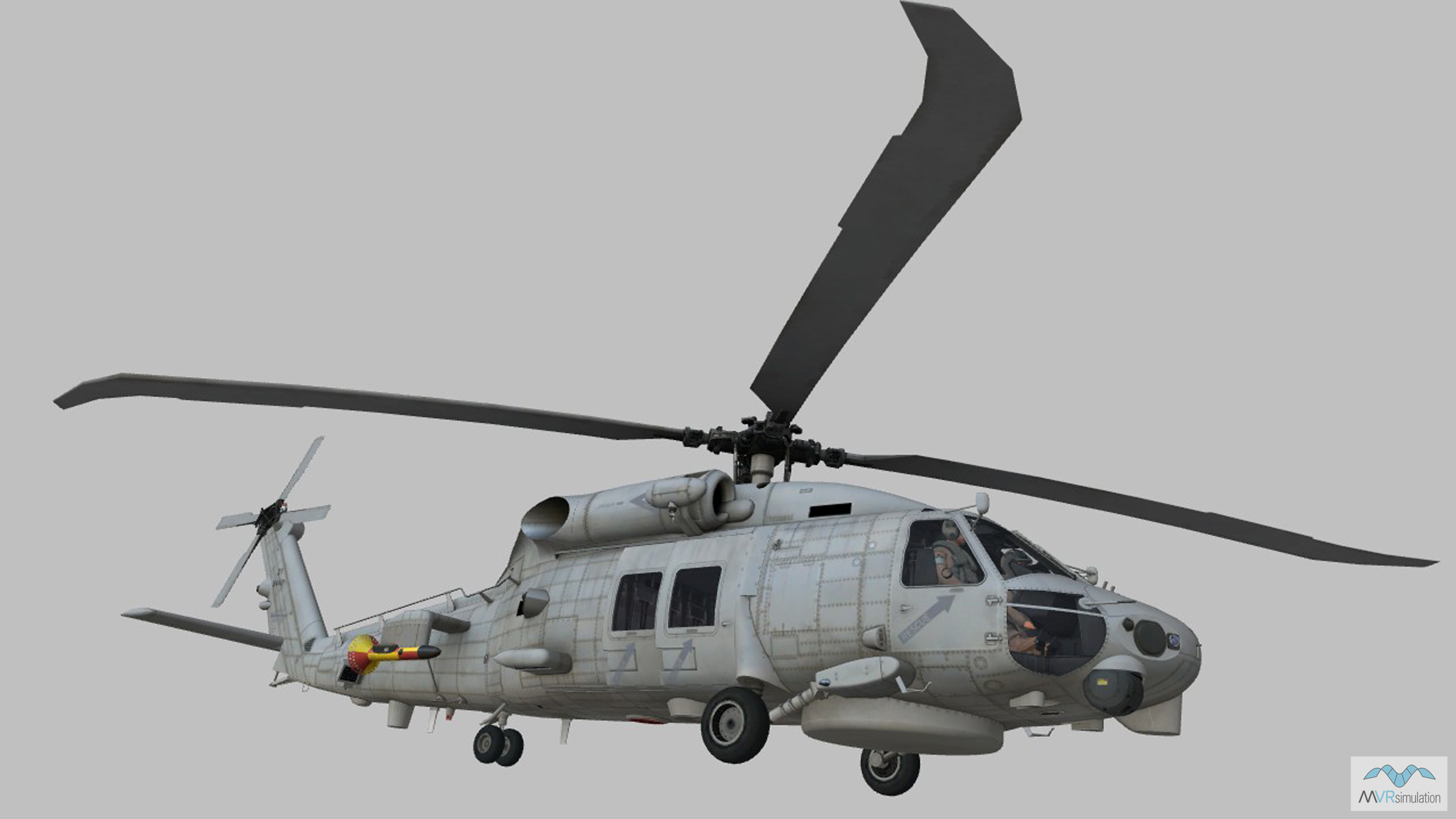
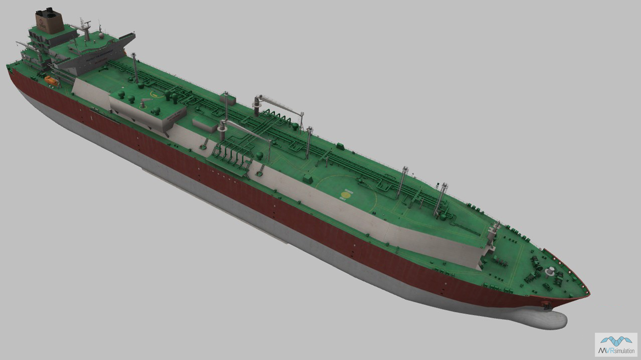
The Red Force attack begins in earnest on Day 2 with a simulated island blockade. Red Forces seize the island, represented by VRSG 50cm per-pixel Taiwan terrain. They enforce a no-fly zone within 20 miles of the coast, patroling the skies over Hsinchu with combat aircraft, and send anti-submarine warfare (ASW) helicopters to search for Blue Force submarines in the East China Sea. A flotilla of Red Force landing vessels head through the Miyako Strait toward Ishigaki, and a Red Force HALE RPAS tracks Blue Force movements in the region, including ASW helicopters deployed to search for Red Force submarines in the waters of the strategically important Senkaku Islands.
VRSG supported simulations
VRSG supported training elements in the Day 2 scenario include fixed-wing aircraft simulators, such as the MVRsimulation Part Task Mission Trainer (PTMT), and rotary wing crew trainers or synthetic flight training systems. Manned and unmanned intelligence gathering platforms can also be used to train participants to locate and identify 3D model targets in geospecific VRSG terrain and open water scenarios. These platforms can also be networked with other simulators running VRSG, such as MVRsimulation's Deployable Joint Fires Trainer (DJFT) or the Joint Terminal Control Training and Rehearsal System (JTC TRS). When configured as a role player for dynamic multi-participant exercises such as these, users can stream real-time VRSG HD-quality simulated video with KLV metadata using the H.264 protocol to other users over the network, which is indiscernible in composition from actual RPAS video feed.
A VRSG scene showing JTAC observer, and inset, the JTC TRS dome.
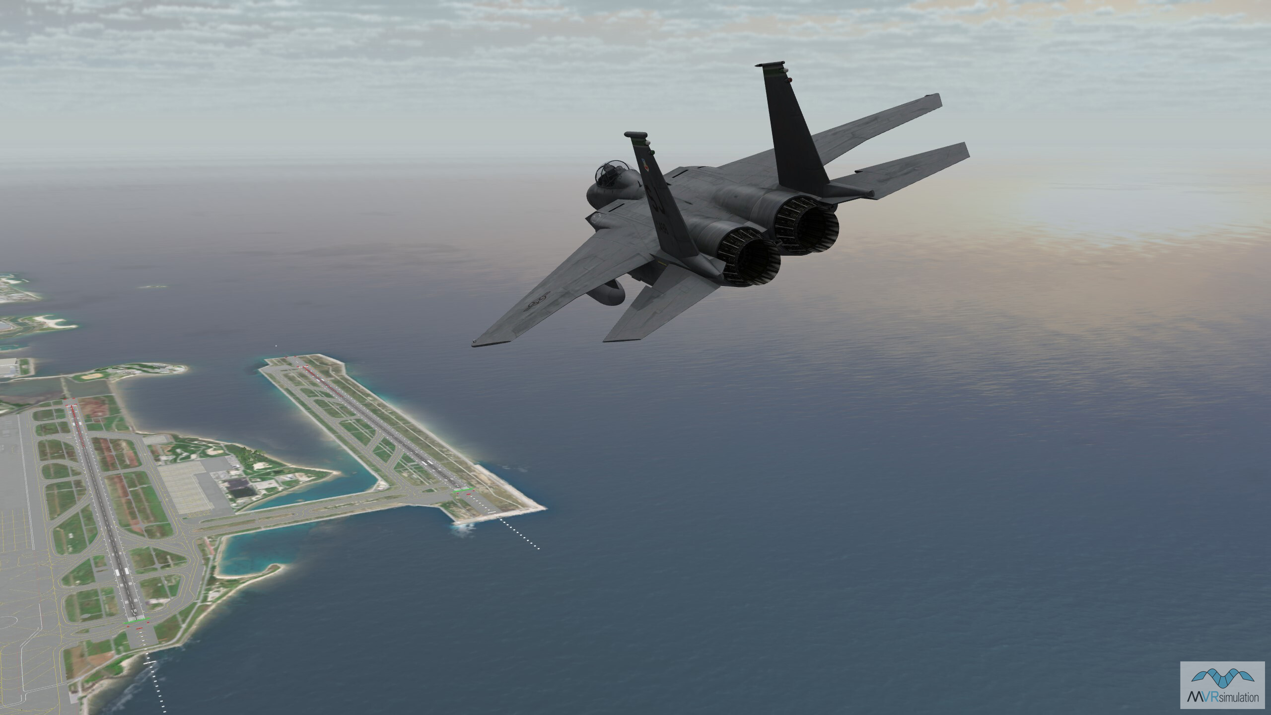
A real-time VRSG MQ-9 entity in flight over virtual Ishigaki, Japan, terrain.
VRSG terrain
The Day 2 scenario takes place over the East China Sea and the Miyako Strait, where VRSG 3D ocean simulation technology creates realistic 3D wave motion, 12 Beaufort scale sea states, 3D wakes and particle spray, and accurate environment reflections. Geospecific 50cm per-pixel Hsinchu Air Base and the surrounding metro area is visible, as are multiple areas of VRSG 1m per pixel geospecific terrain of the whole of Japan, including the Senkaku Islands and 50cm per-pixel Isgihaki.
VRSG 3D models
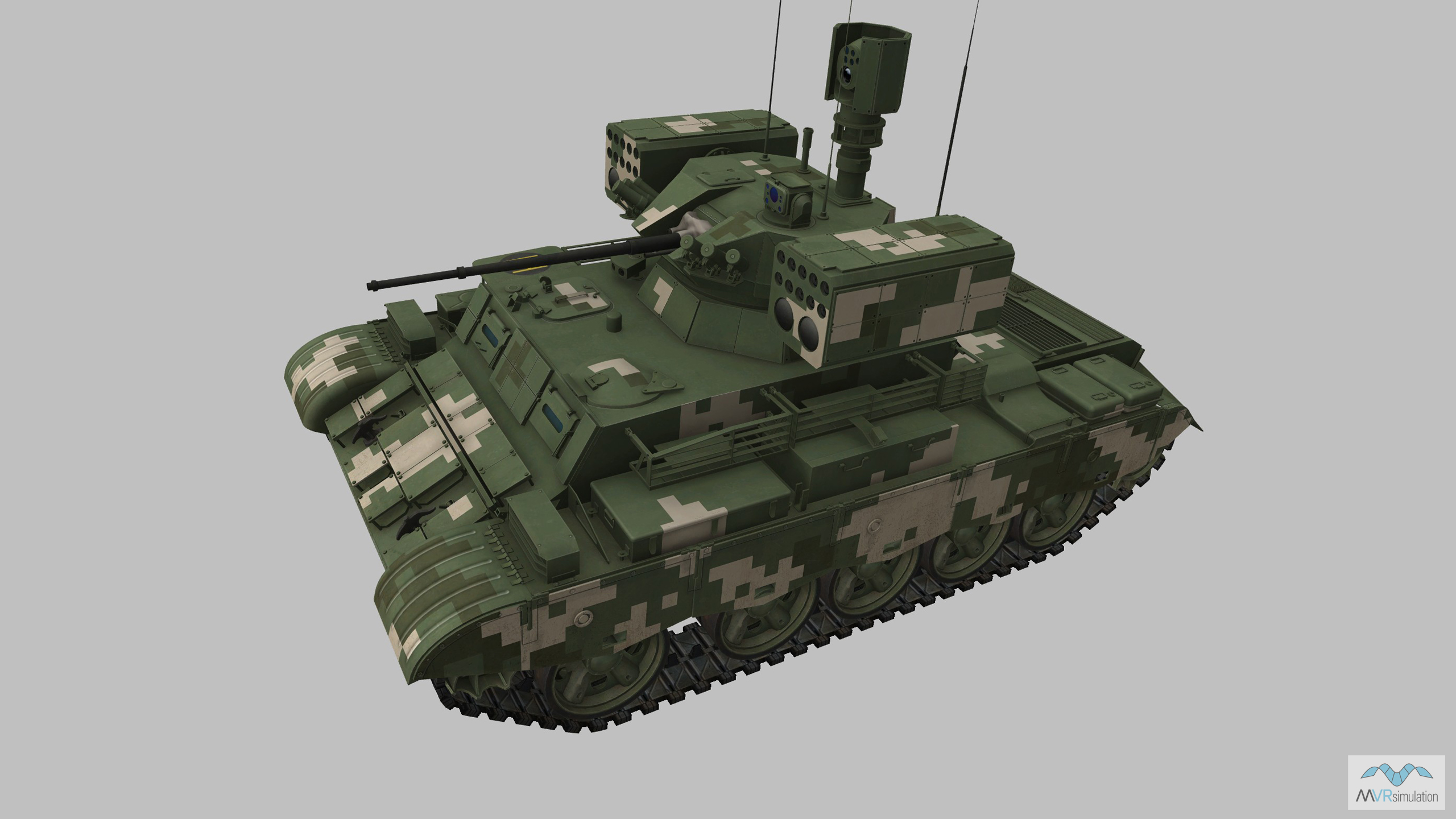
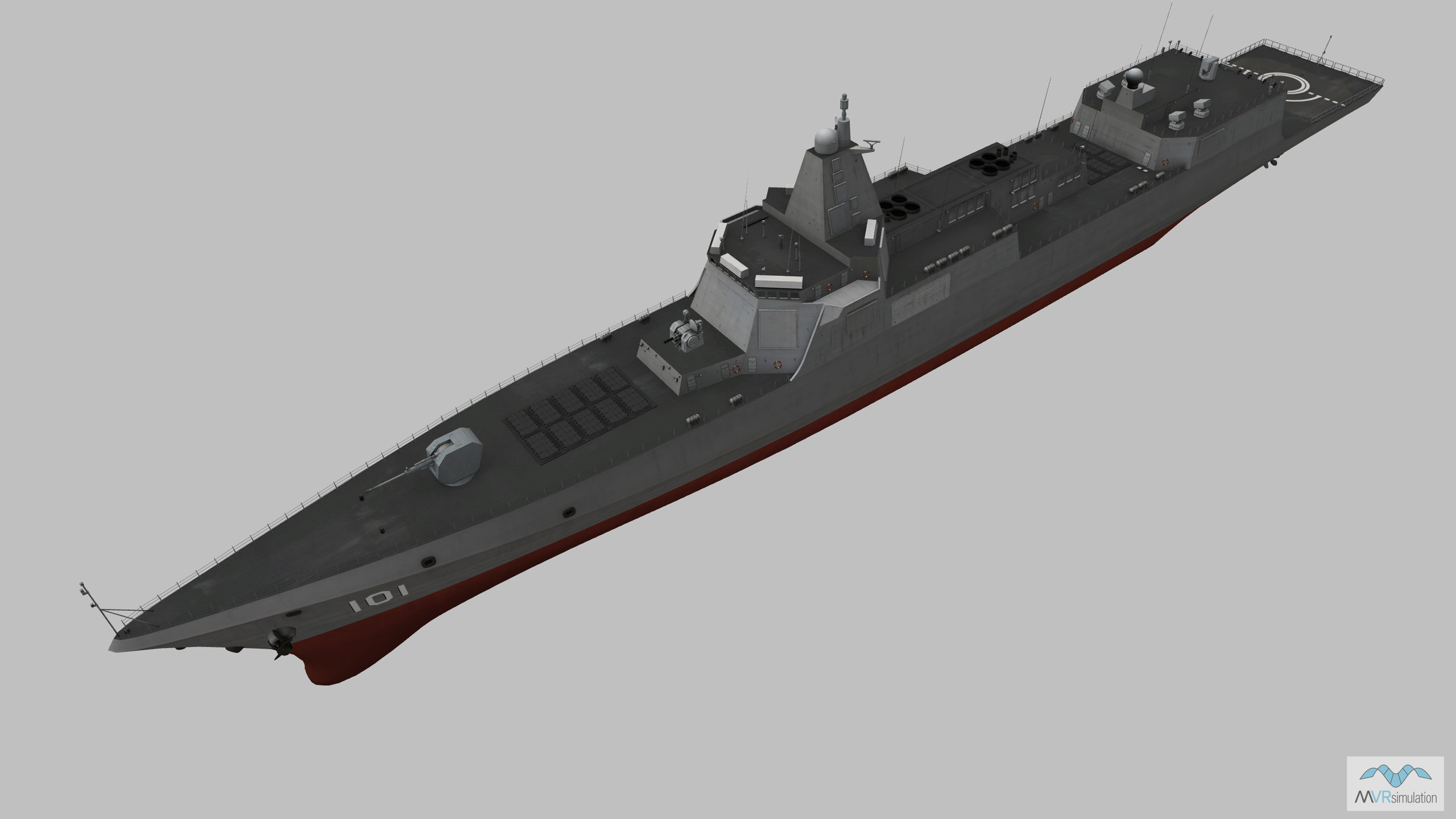
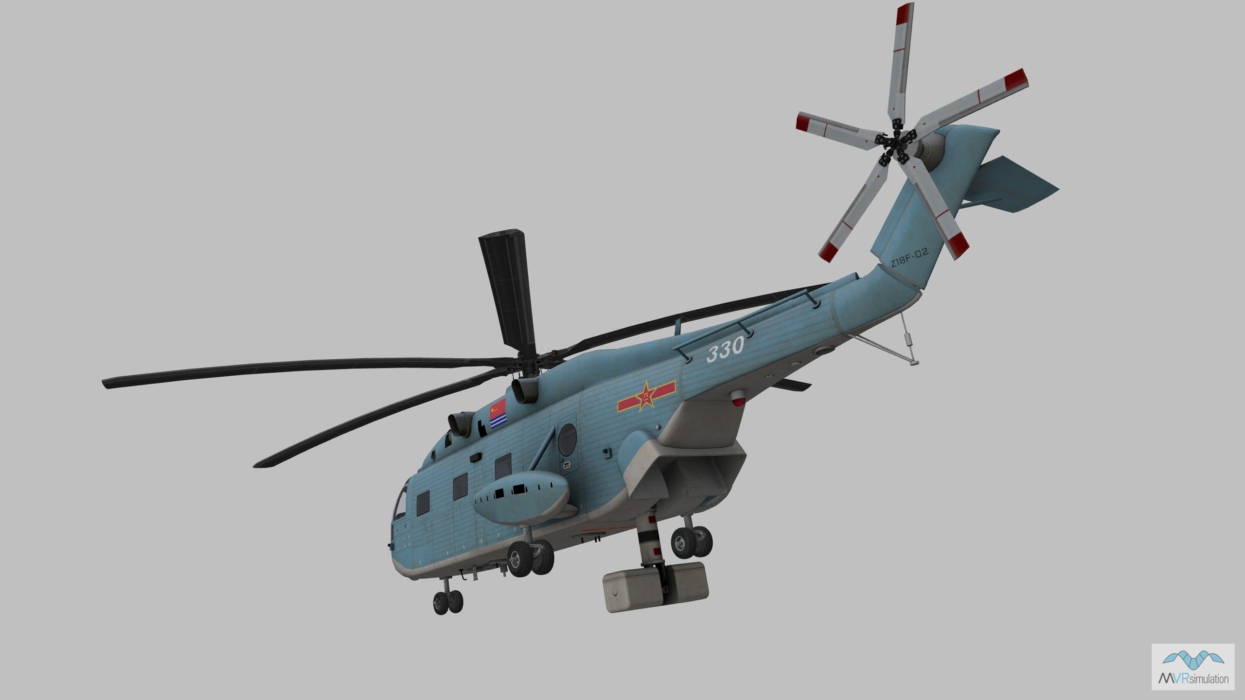
A selection of the VRSG models used in Day 2 of the scenario are below. The VRSG 3D model library features more than 10,500 visually accurate 3D models of currently deployed air, land and maritime platforms. With highly detailed geometry and multiple paint schemes, VRSG models feature articulated parts, damage states, advanced animations, and support time real-time, physics-based thermal sensor viewing within VRSG. The VRSG model library is continually updated. New and updated models are available to download by users of active software maintenance at no additional cost. Search the library here.
Day 3: Explore the Show Daily scenario in detail
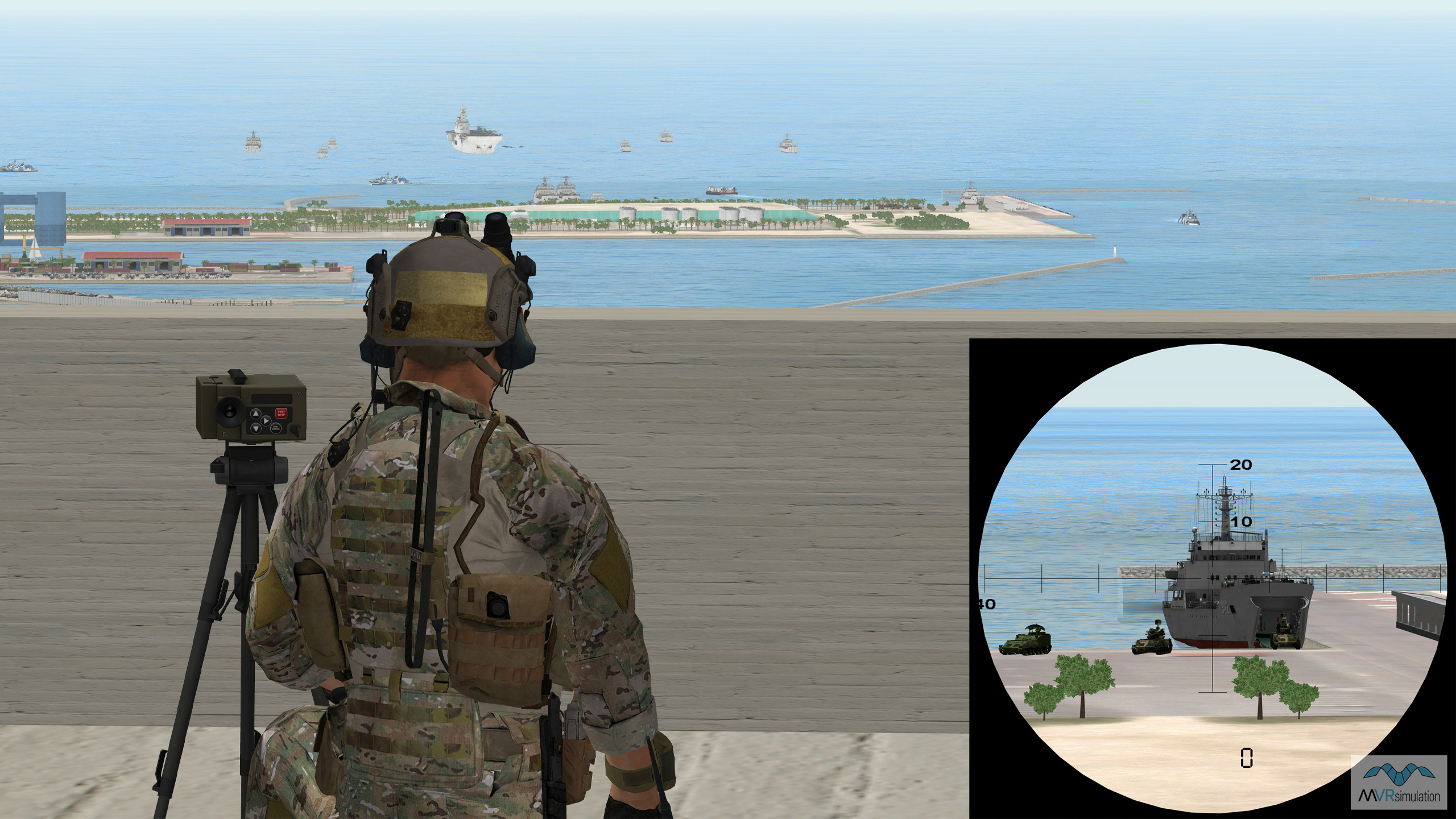
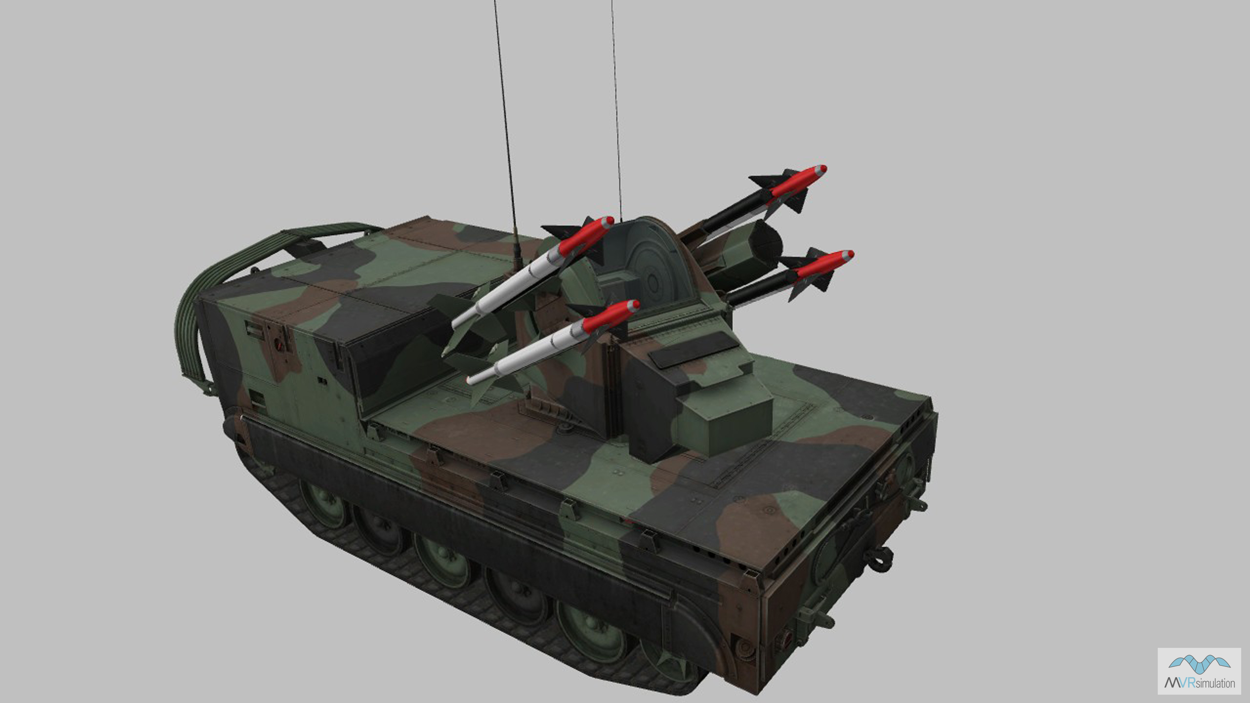
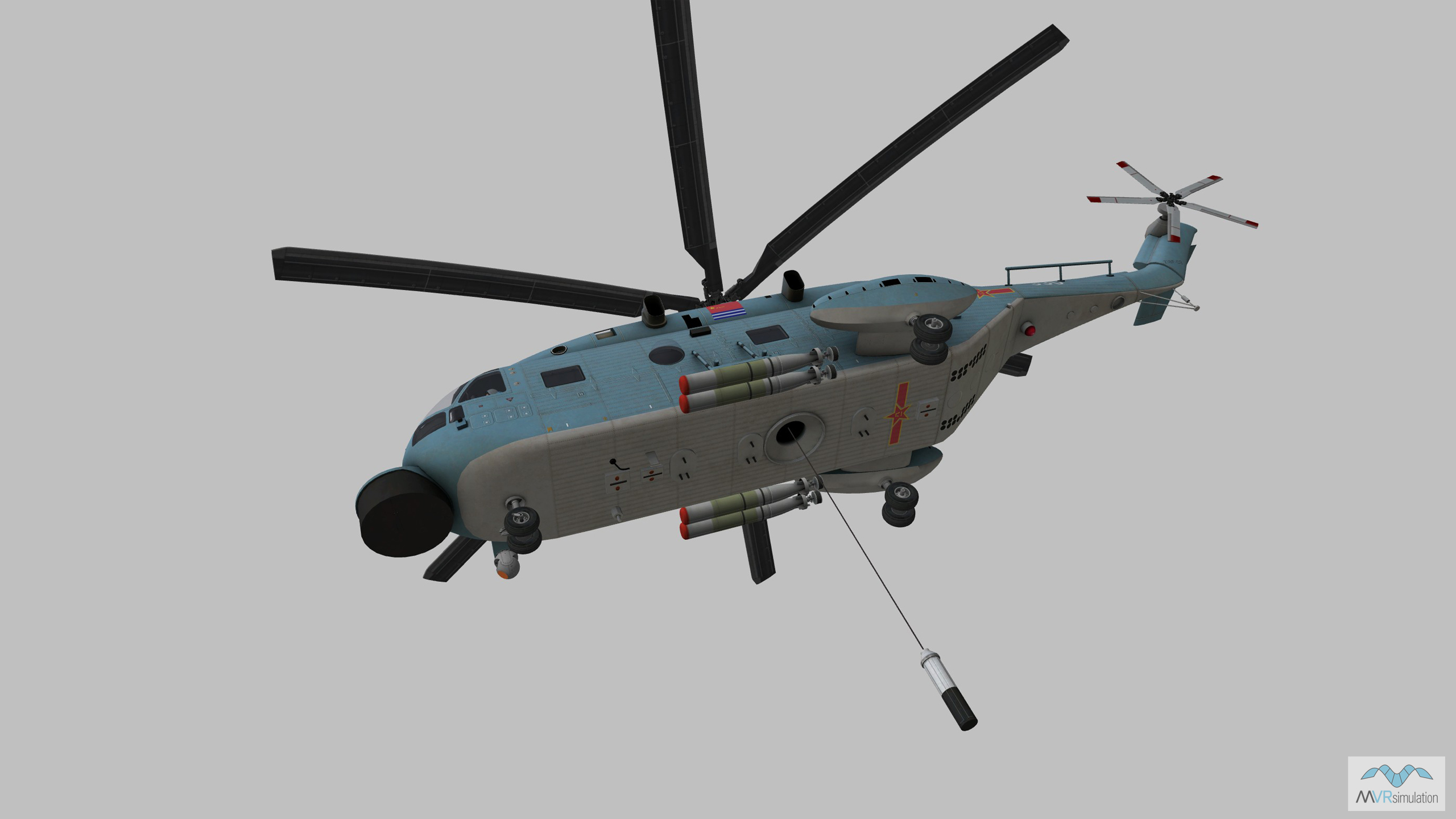
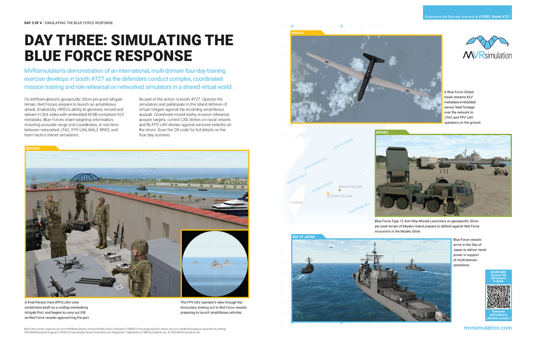
On Day 3 of the simulated exercise the Blue Force response gathers pace. A Blue Force Global Hawk relays simulated sensor footage to JTAC and FPV UAV operators as they establish forward positions in and overlooking Ishigaki Port. They observe Red Force naval vessels preparing to launch amphibious vehicles to swim to shore, and share targeting information over the network. Meanwhile, Blue Force vessels arrive in the Sea of Japan to deliver naval power in support of multi-domain operations; and an anti-ship missile battery is established on Miyako Island as preparations begin to defend against Red Force incursions in the Miyako Strait.
VRSG supported simulations
The Day 3 scenario utilizes first-person training systems, including the MVRsimulation FPV Team Trainer, and Portable Joint Fires Trainer (PJFT) and/or Deployable Joint Fires Trainer (DJFT). All of these systems integrate with semi-automated forces (SAF) software and DIS traffic to see all platforms running on networked simulators as entities within the simulated battlefield as part of Large Scale Combat Operations (LSCO) training exercises in a shared virtual environment provided by VRSG. Targets (3D VRSG model entities) in the virtual environment appear similarly to all participants.
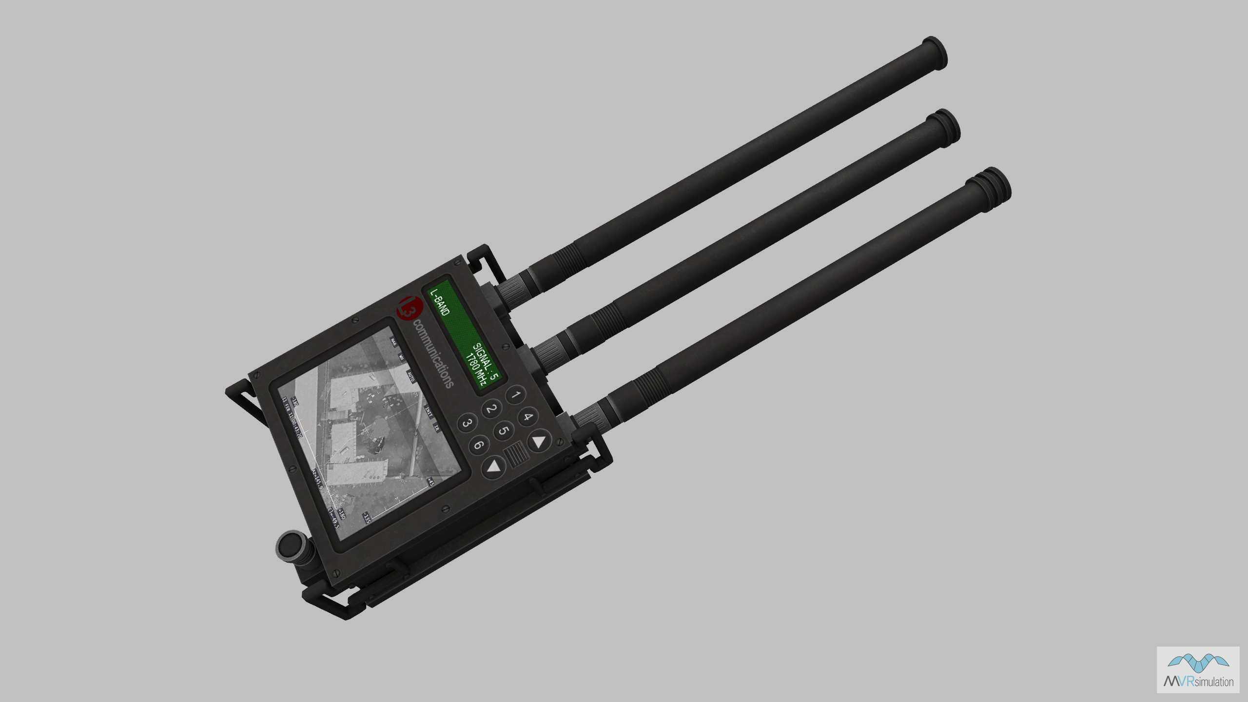
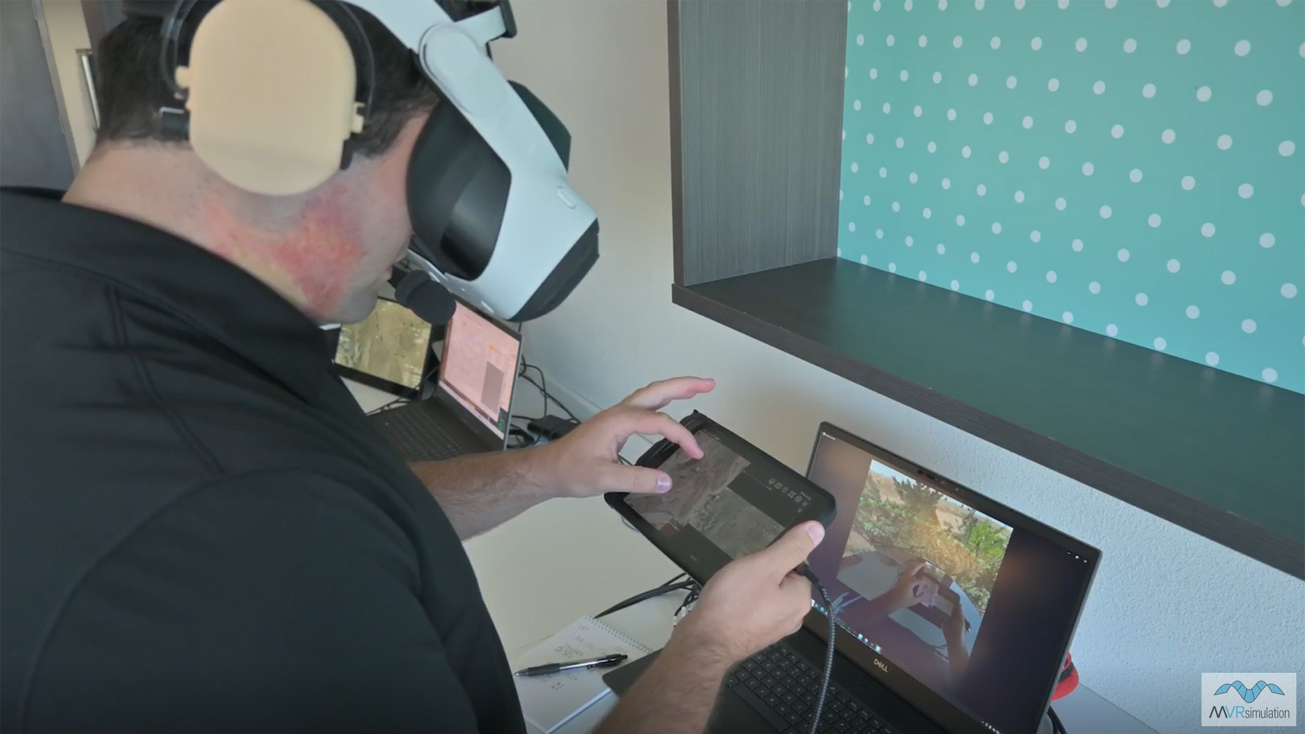
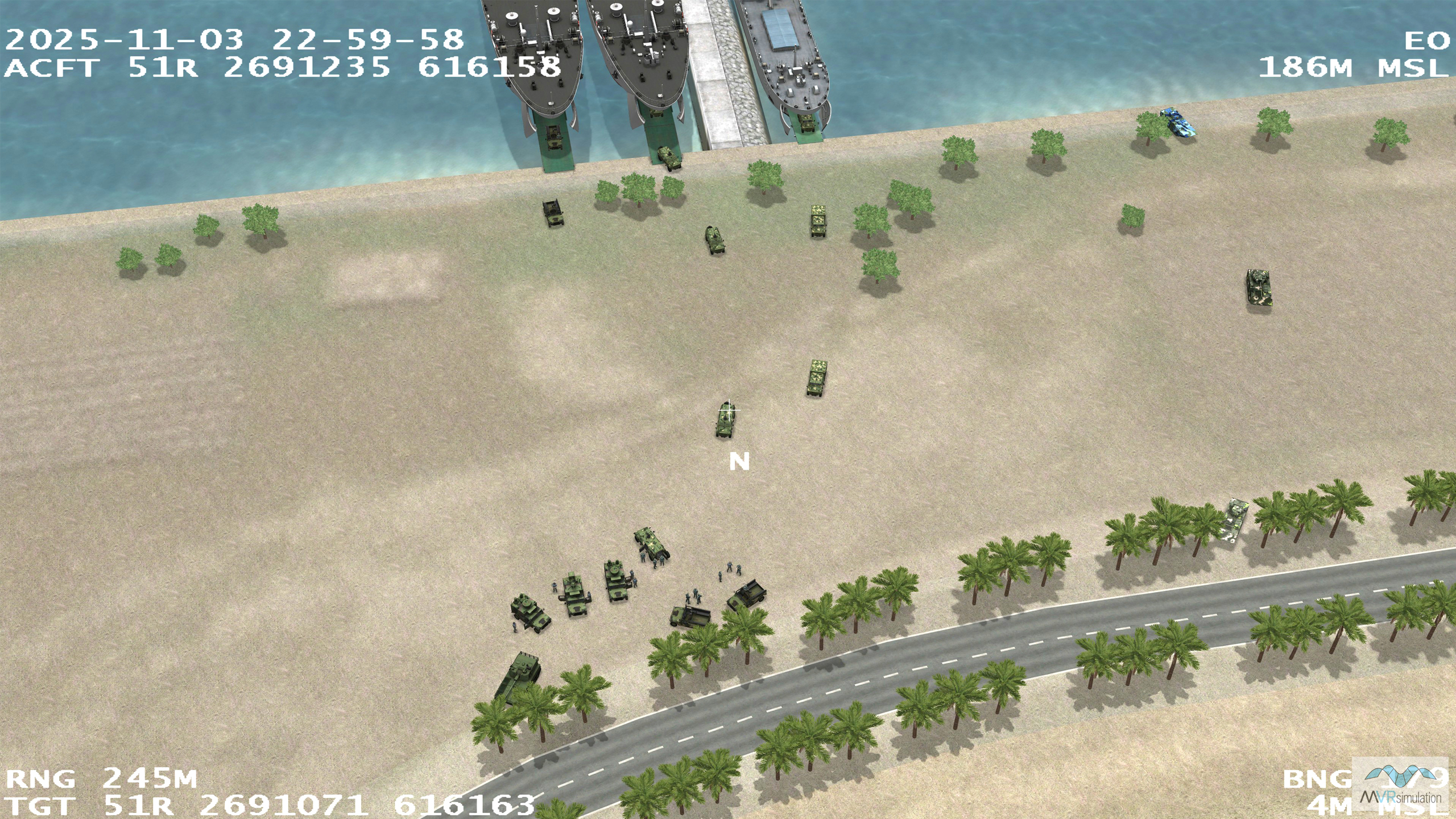
In the scenario, the "overhead" MALE RPAS simulator streams a VRSG-generated HD-quality H.264 video sensor feed with embedded KLV metadata to the network. Networked ATAK devices, used by FPV UAV pilots and JTAC observers, receive this feed as real-time rectified terrain. JTAC Observers use emulated physical devices (Type 163 and/or IZLID 1000P) to identify targets in the virtual environment and mark them on map/terrain on their physical ATAK device. FPV pilots send out sUAS to conduct ISR and gather further information on virtual targets, also marking them on map/terrain on their ATAK devices. In this way, all assets on the network can view, share and contribute to the common situational awareness picture being used to inform all Blue Force actions in the simulated exercise in the same way they do in real-world operations.
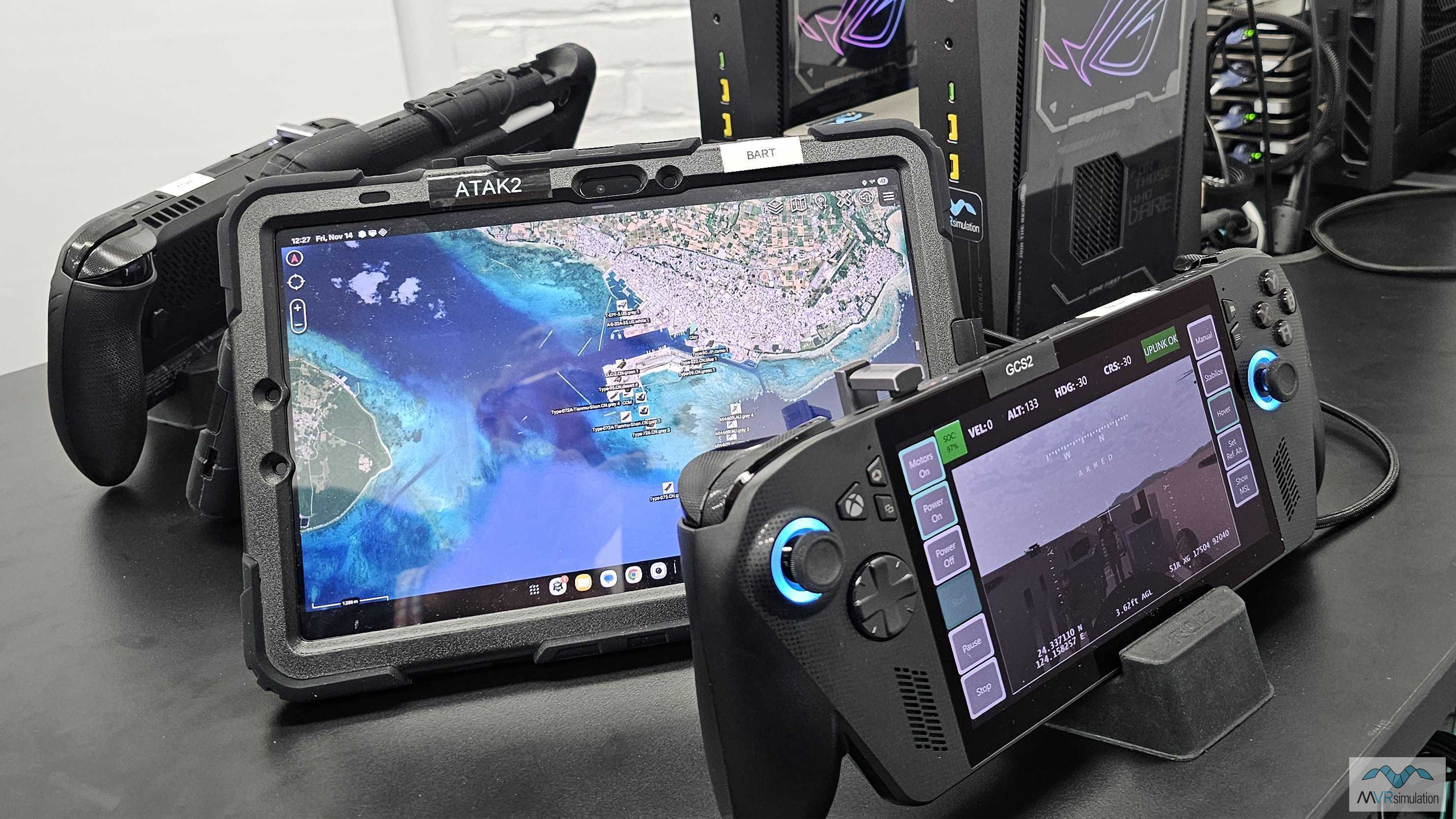
The FPV Team Trainer ATAK device showing geolocated targets.
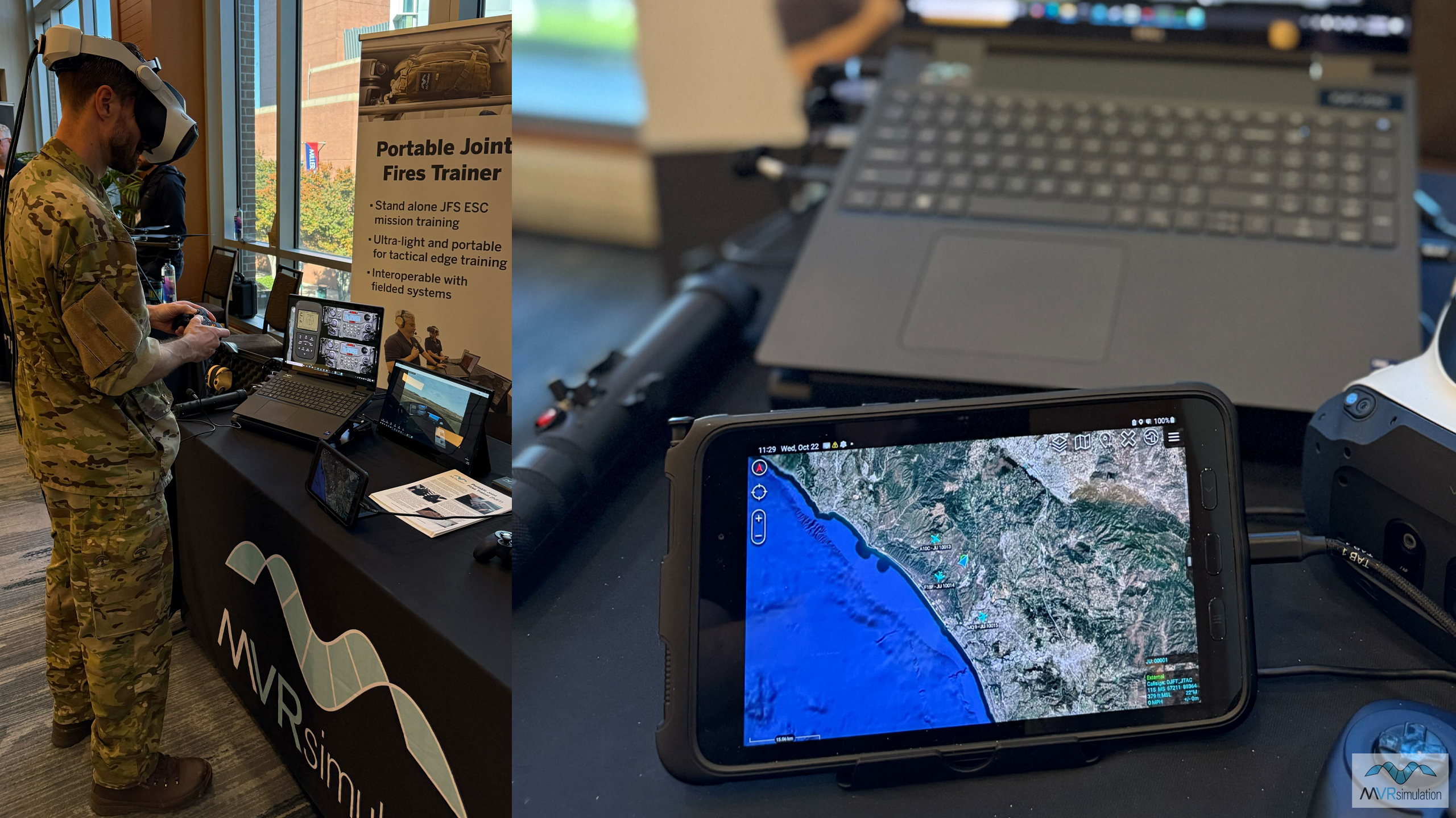
The PJFT ATAK device showing geolocated targets.
VRSG terrain
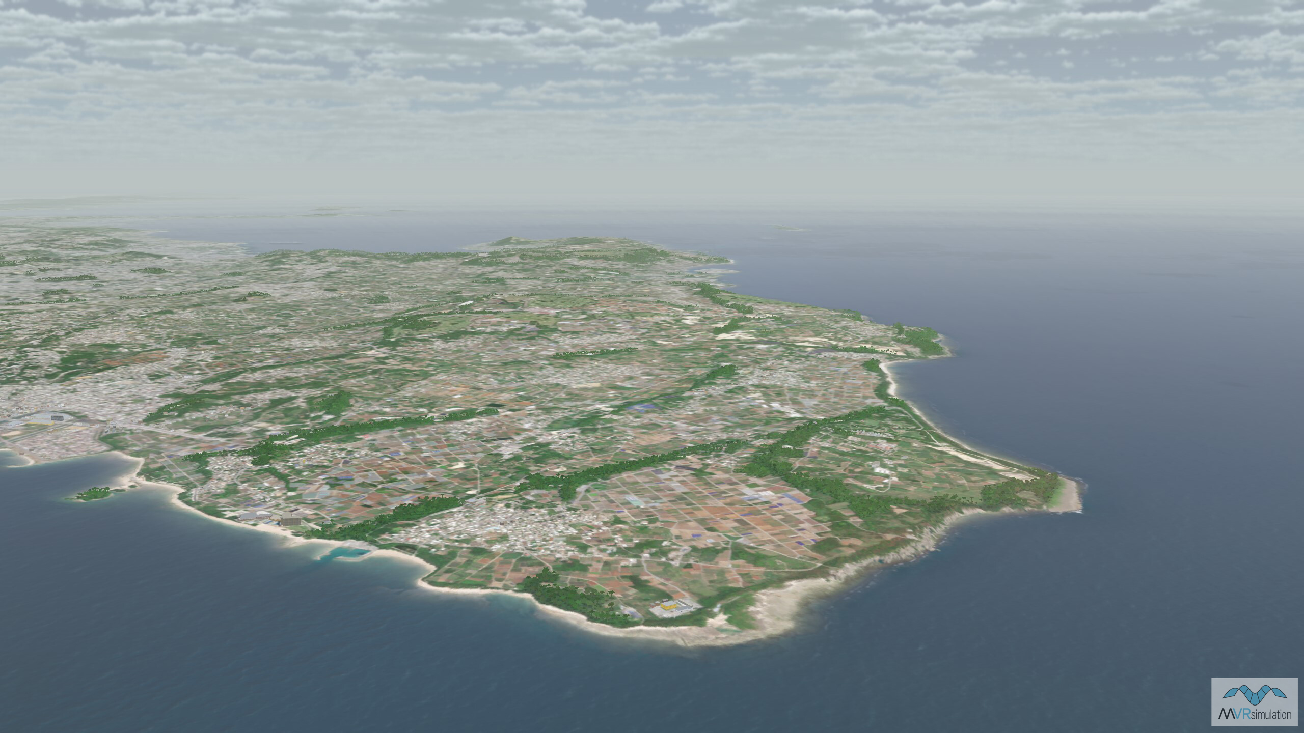
Day 3 takes the action into VRSG Japan terrain, specifically the high-resolution insets of the islands of Miyako and Ishigaki, both built with 50cm Vantor (formerly Maxar) imagery, with 30 meter SRTM elevation data.
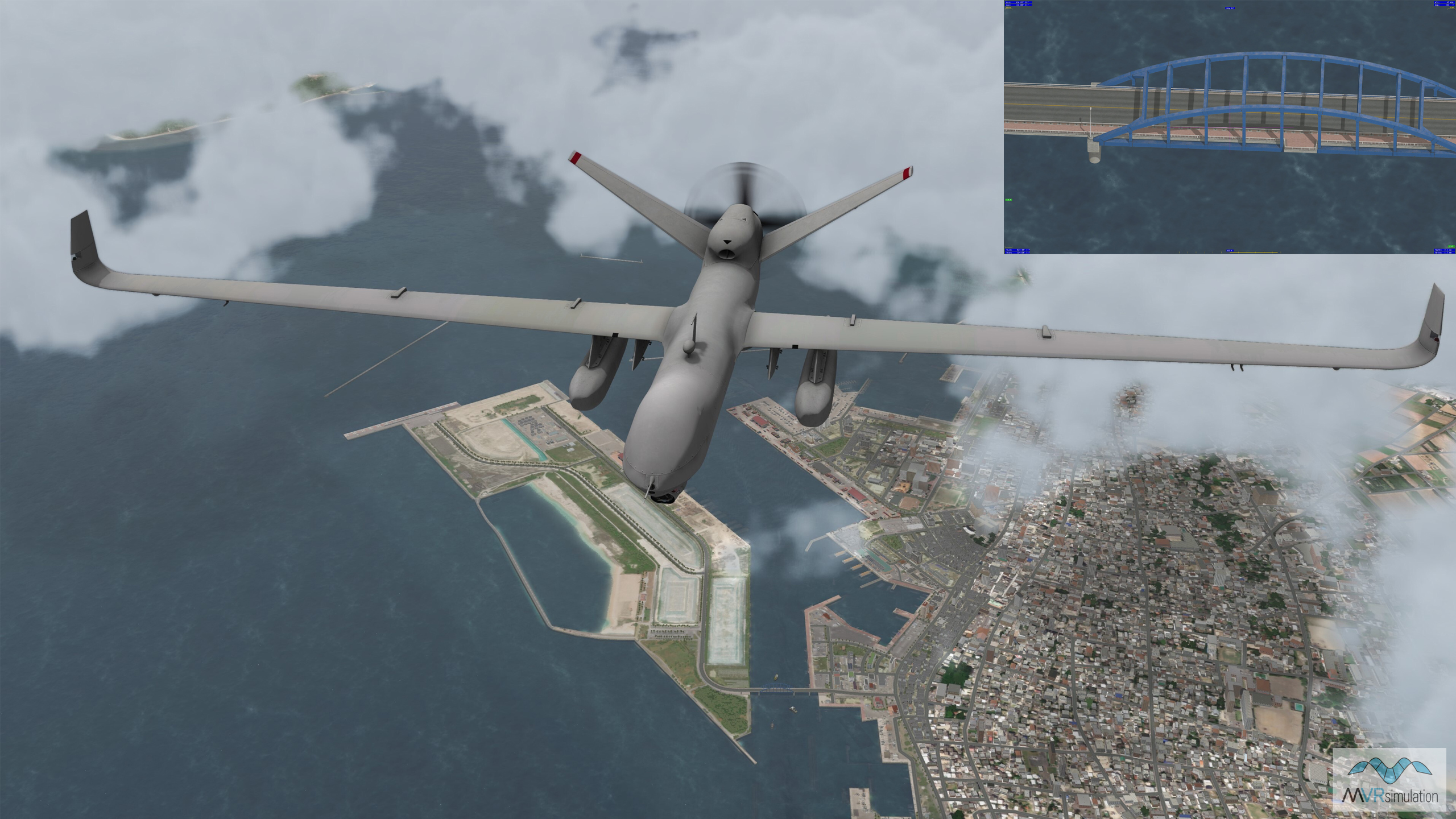
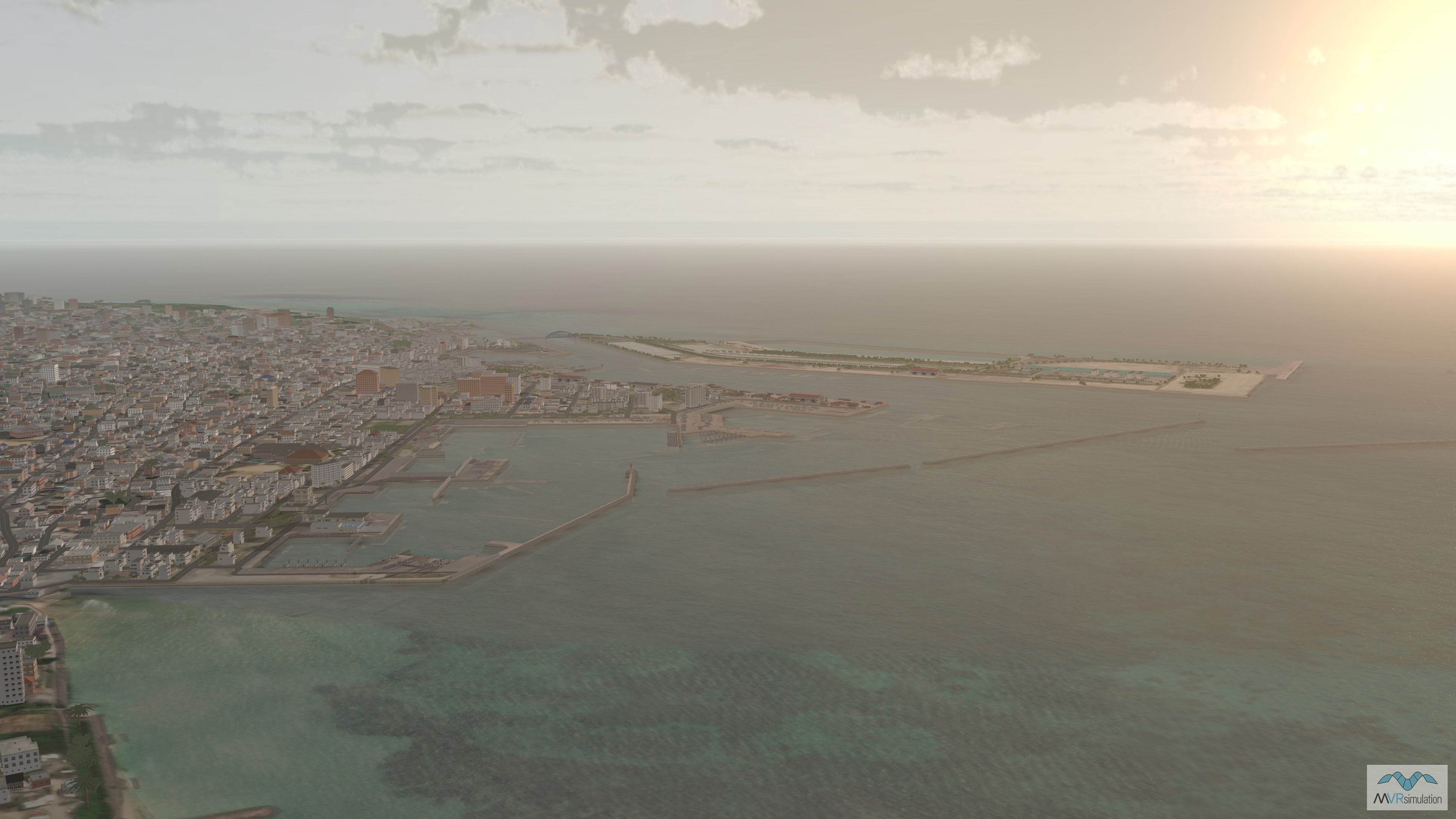
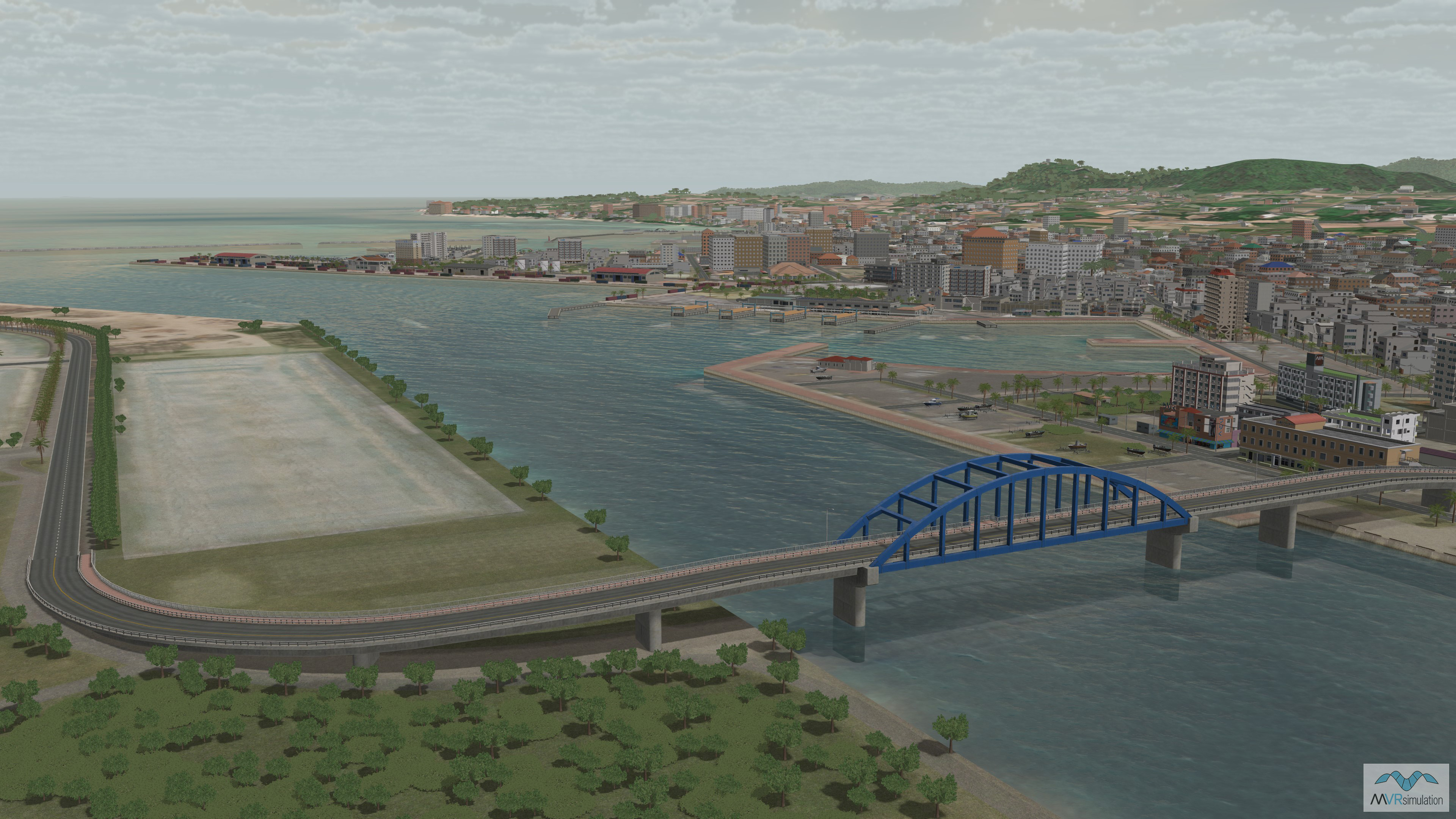
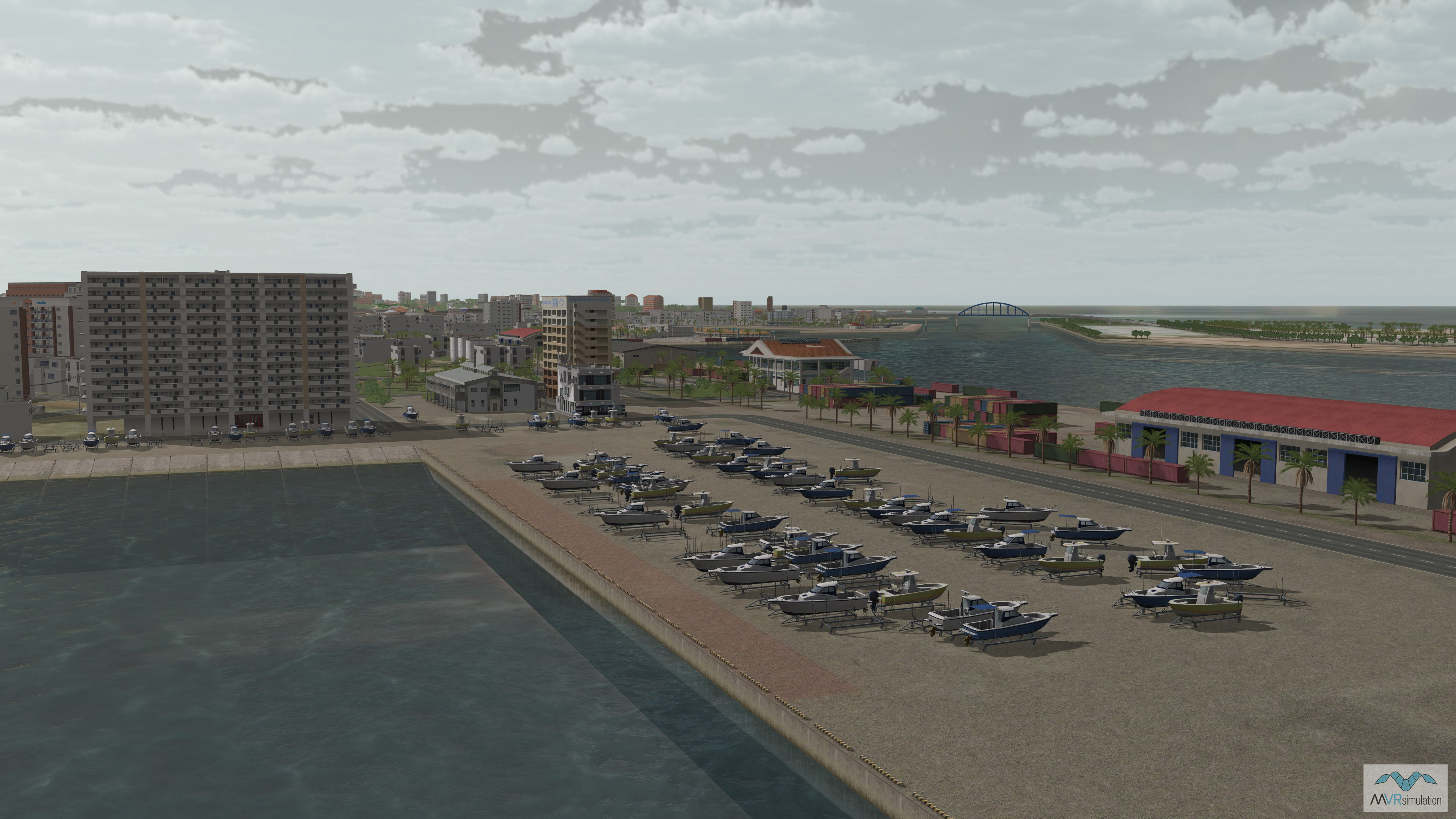
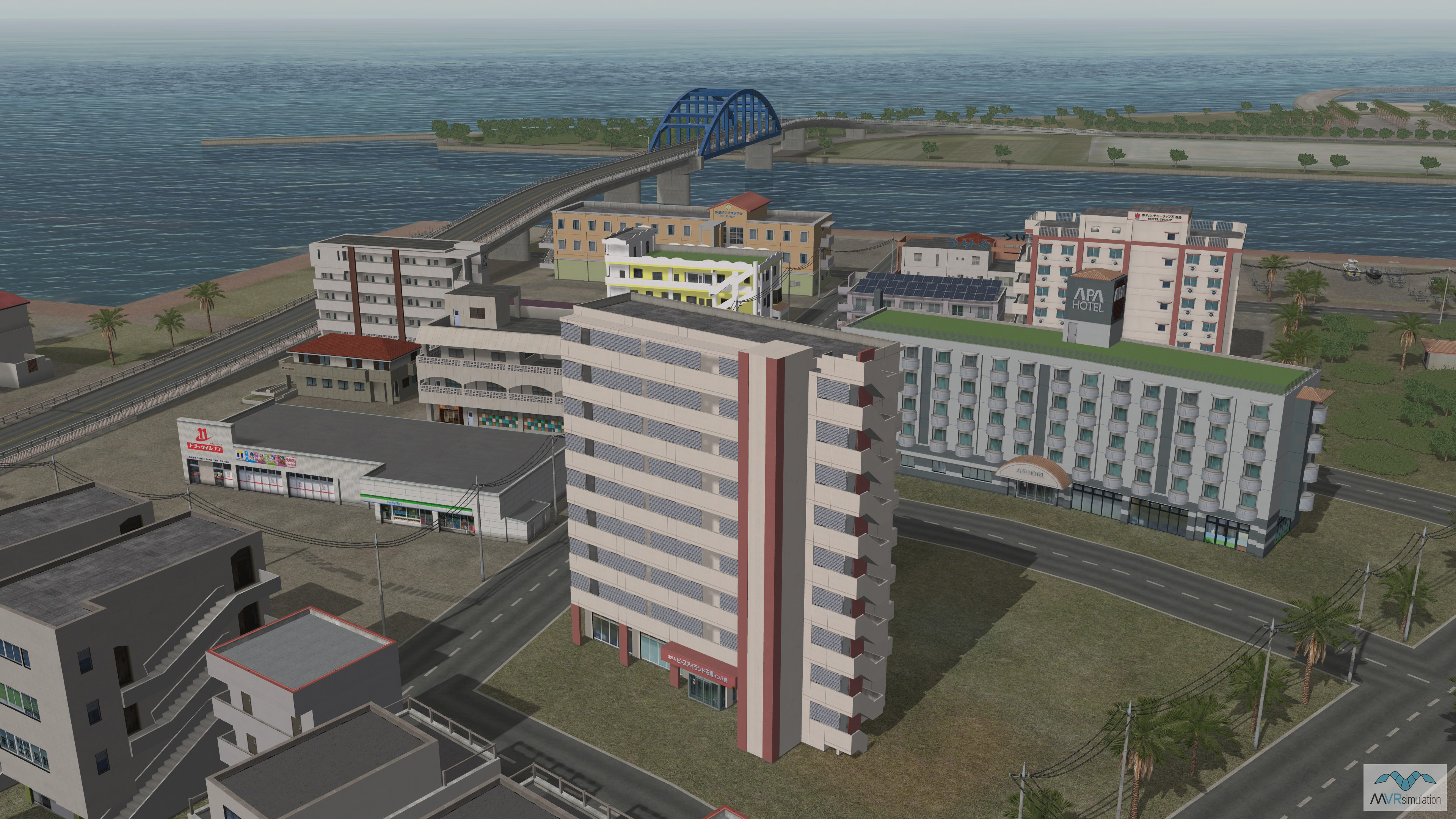
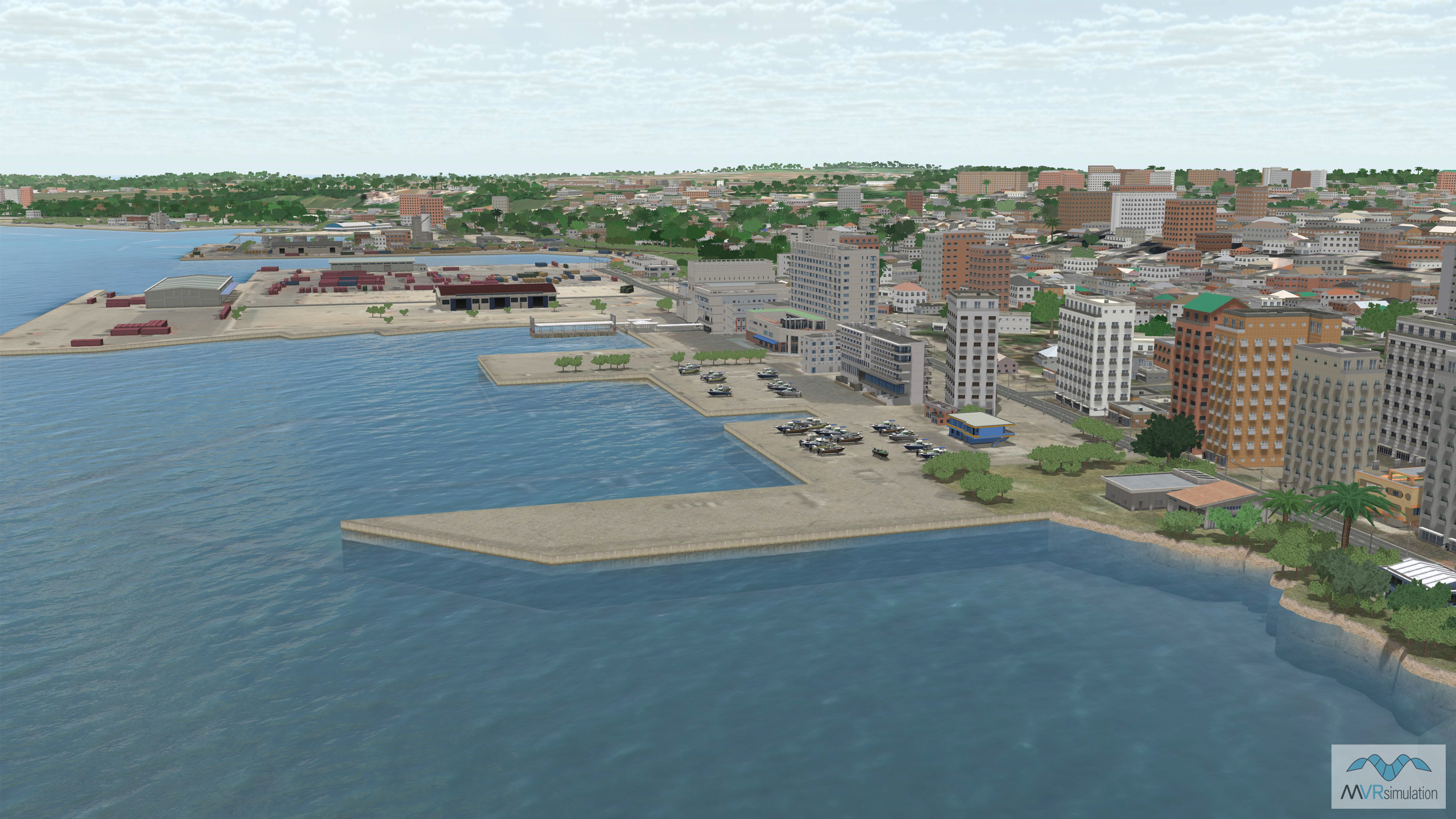
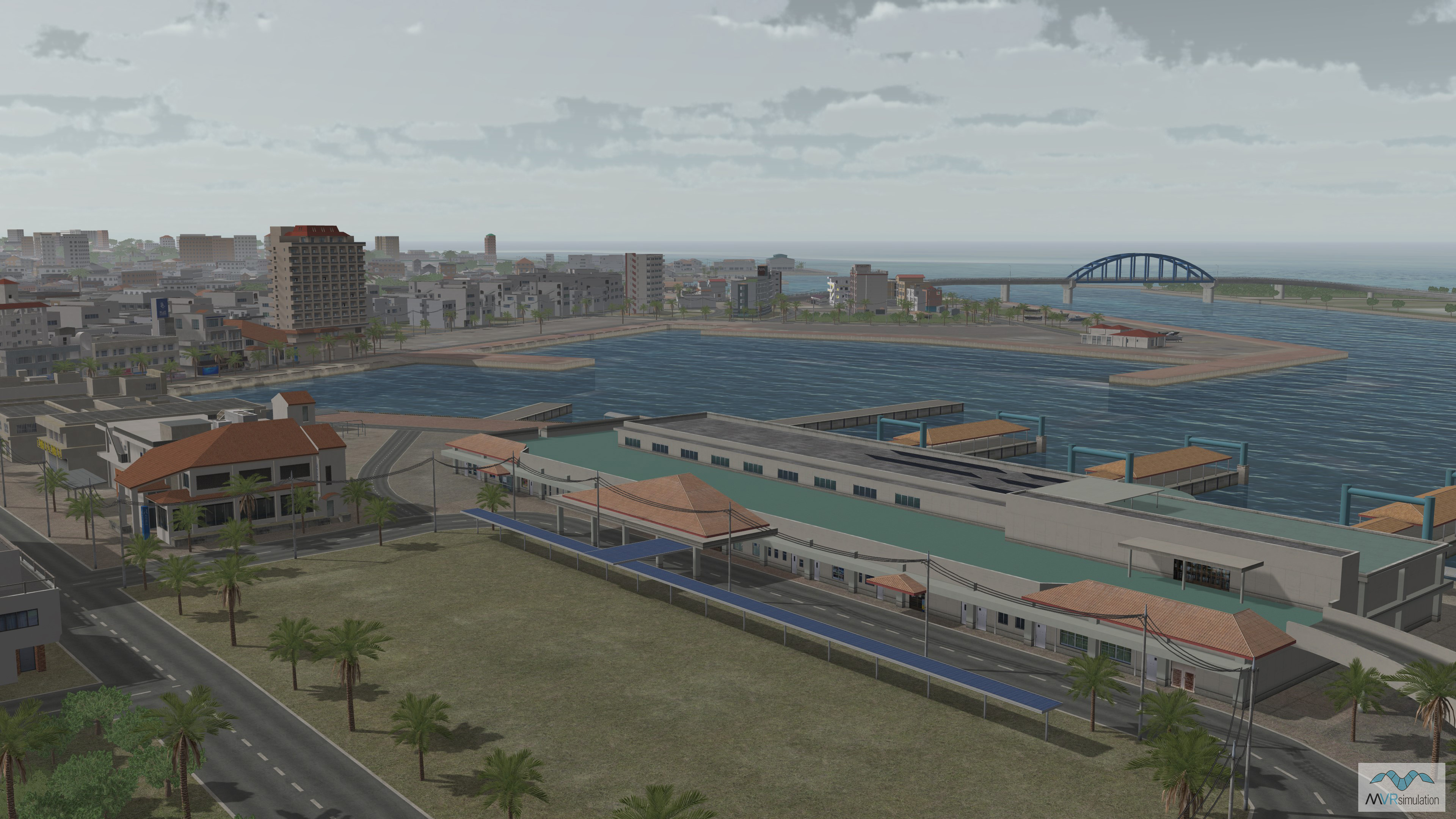
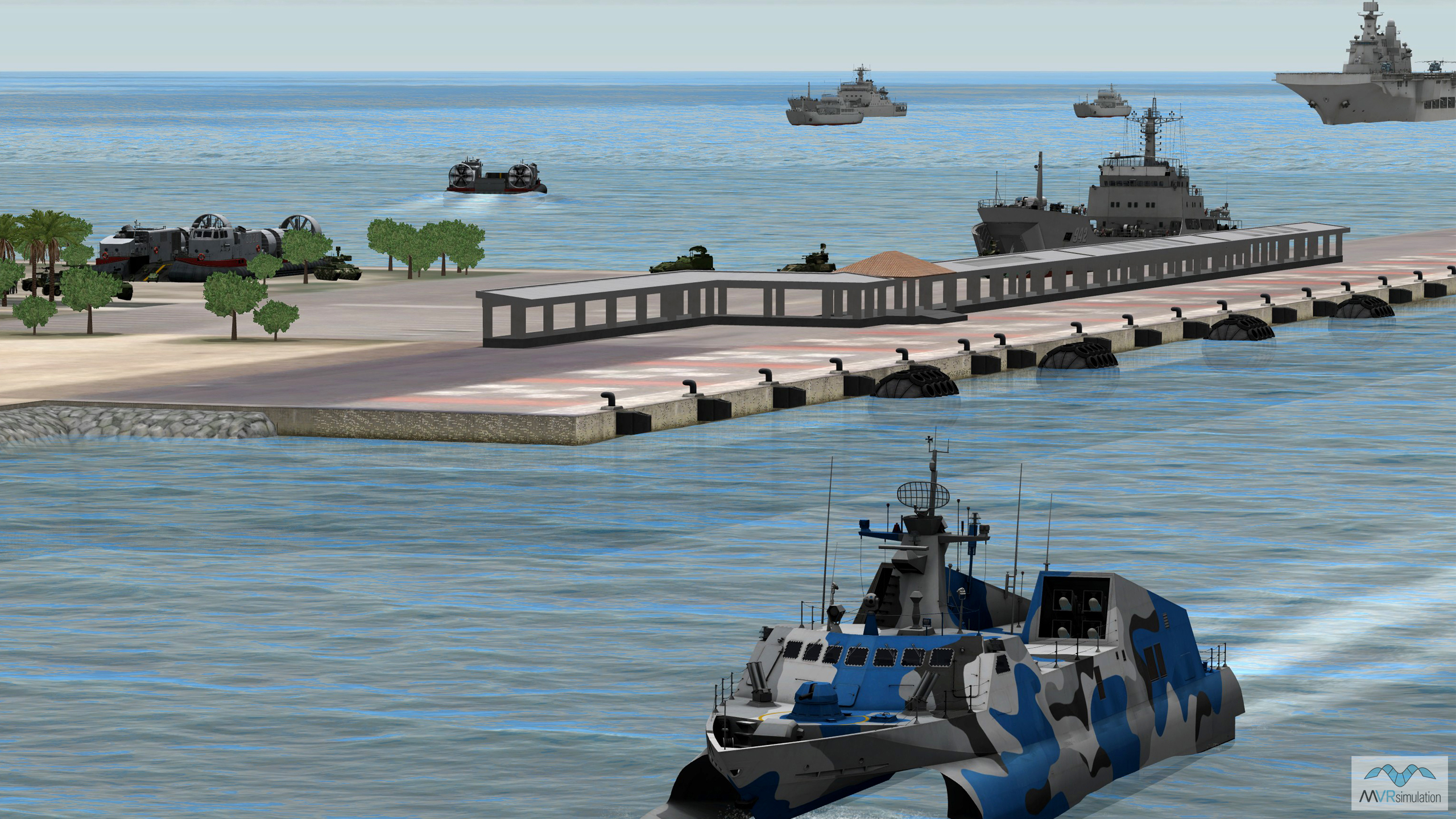
The Ishigaki terrain includes an accurate 3D replica of the Southern Gate Bridge, and a handmade geospecific inset of Ishigaki Port, which functions as a gateway for mainland Japan and other countries in Southeast Asia. The Port terrain covers an area of 5 square kilometers, and includes more than 70 unique geospecific buildings, and around 350 textures. The database includes geospecific lighthouses, breakwaters, and yacht piers; and hundreds of boats, containers, vegetation, and poles.
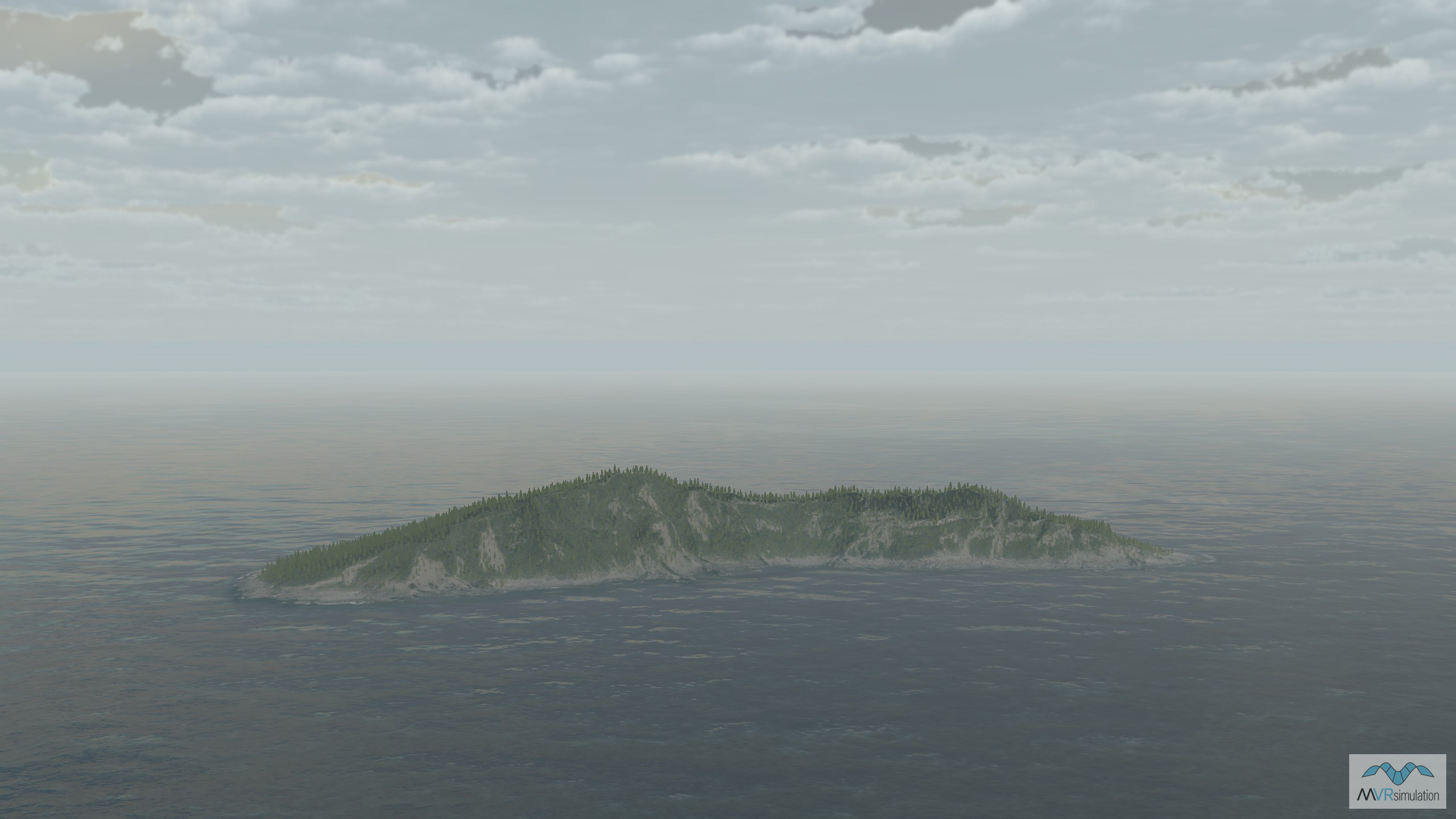
Miyako Island, situated in the southern Ryukyu Islands, between Okinawa's main island and Taiwan, spans approximately 158 square kilometers. VRSG terrain of the island includes a high-resolution 3D replica of Miyako Port, featuring several unique geospecific buildings, boats, shipping containers, powerlines, CityEngine-generated buildings, compiled-in roads, and vegetation models. A high-resolution replica of the Irabu Bridge, a 3,540-meter-long structure connecting Miyako Island to Irabu Island, is also included.
VRSG 3D models
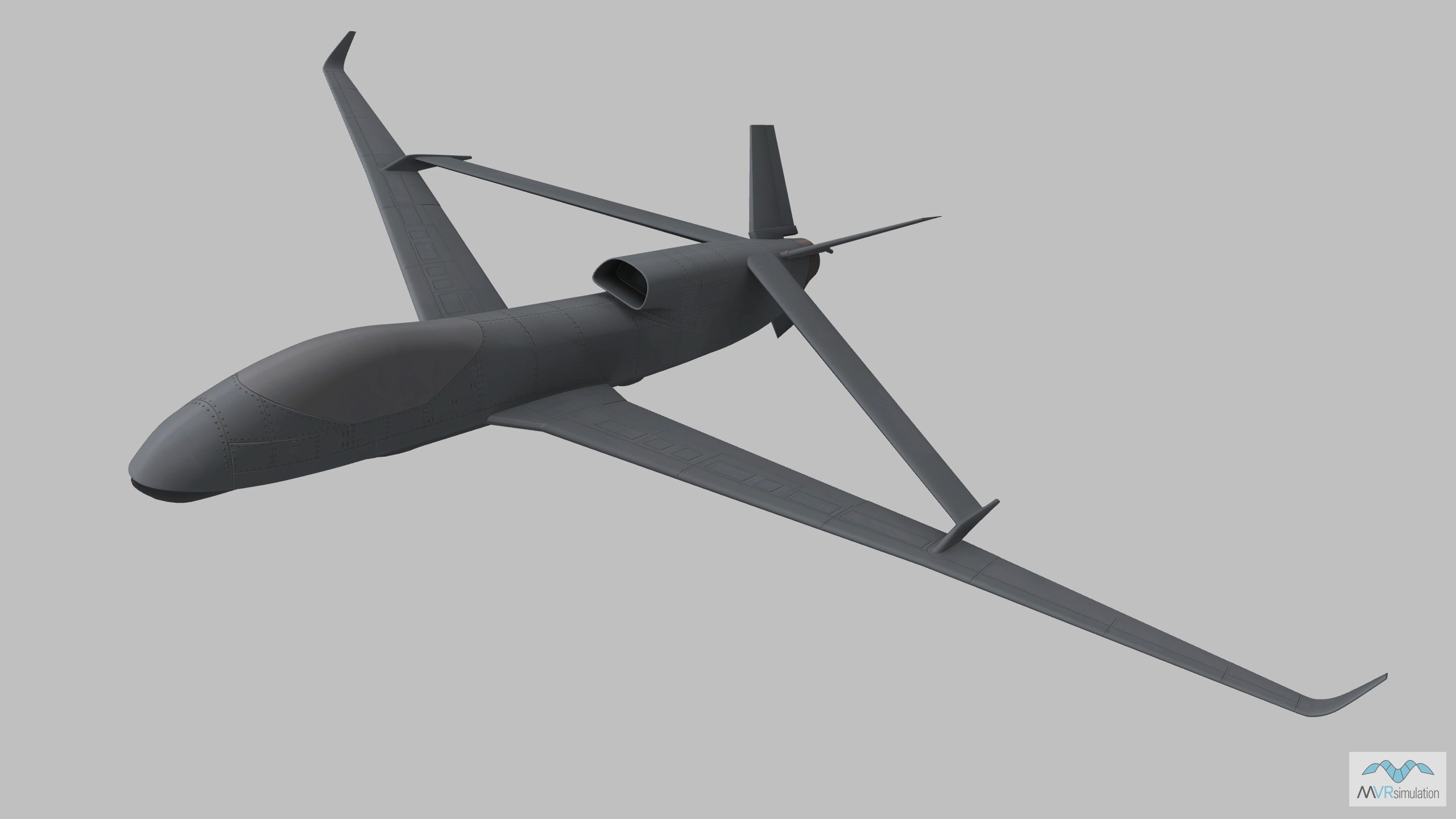
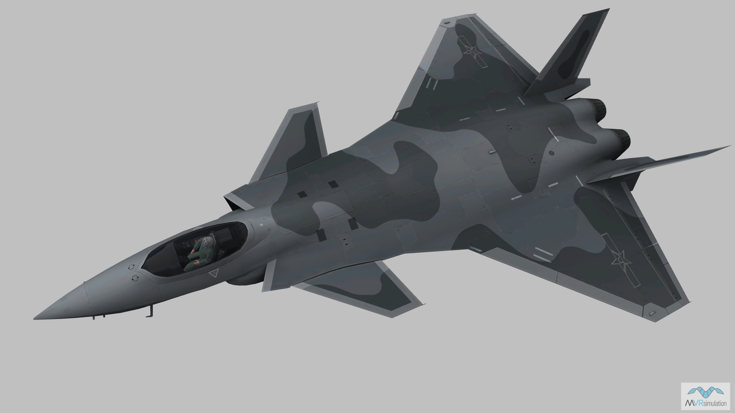
A selection of the VRSG models used in Day 3 of the scenario are below. The VRSG 3D model library features more than 10,500 visually accurate 3D models of currently deployed air, land and maritime platforms. With highly detailed geometry and multiple paint schemes, VRSG models feature articulated parts, damage states, advanced animations, and support time real-time, physics-based thermal sensor viewing within VRSG. The VRSG model library is continually updated. New and updated models are available to download by users of active software maintenance at no additional cost. Search the library here.
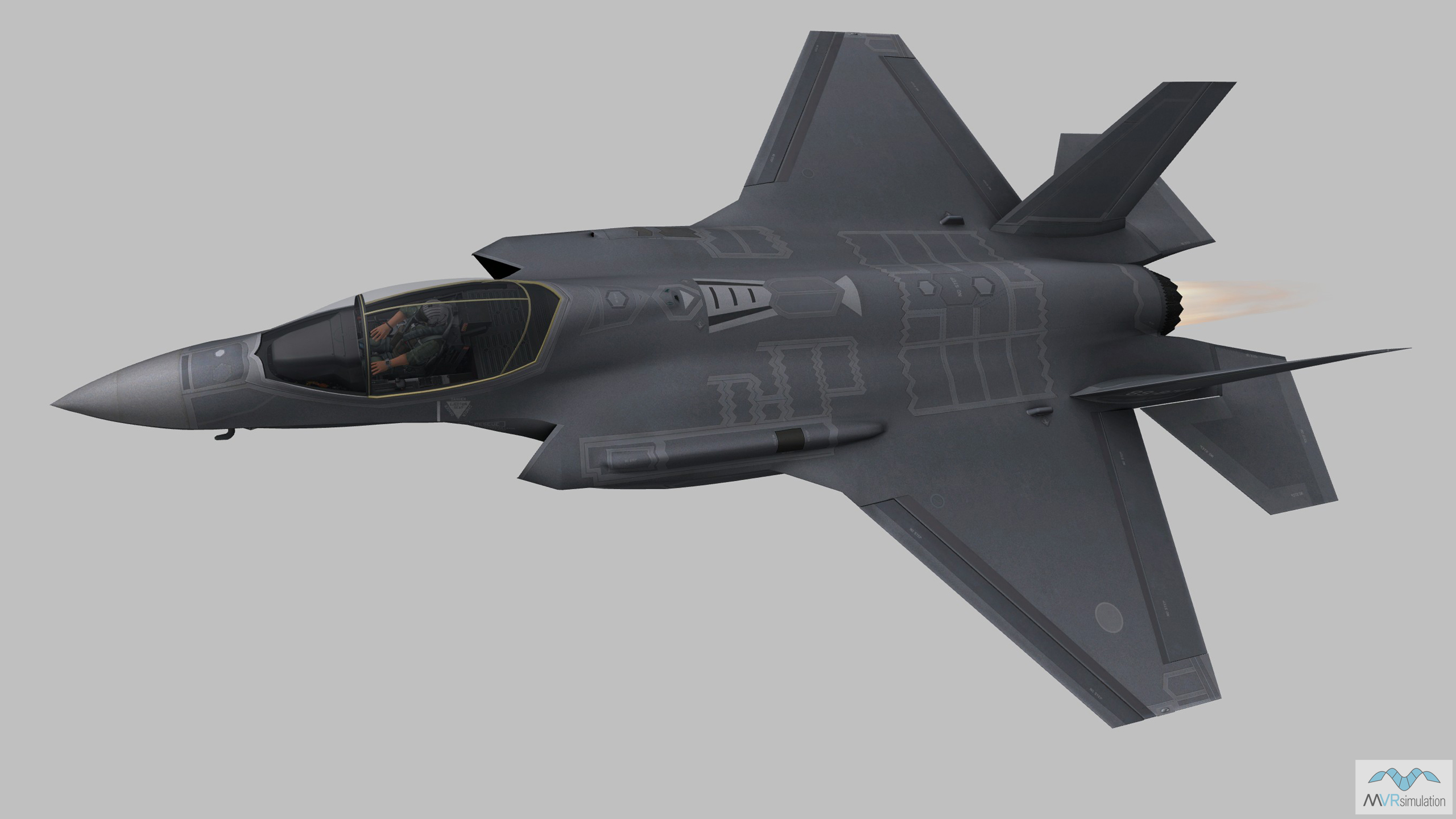
Day 4: Explore the Show Daily scenario in detail
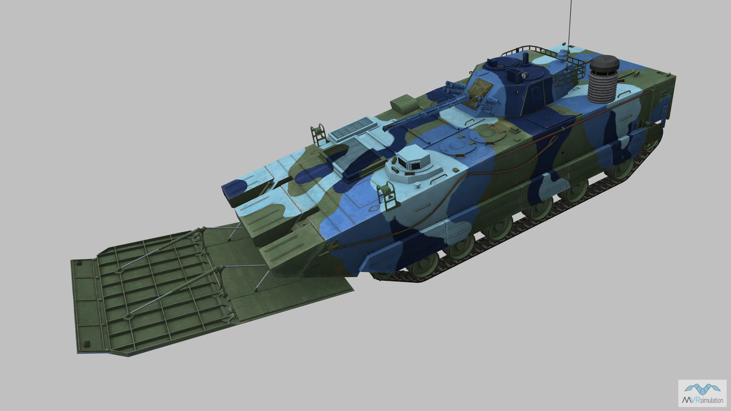
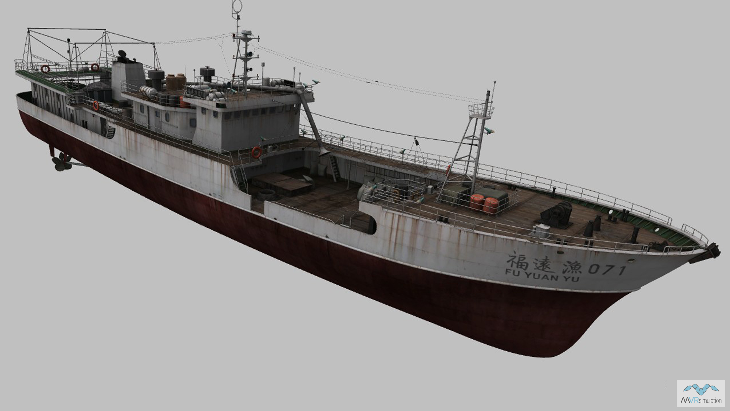
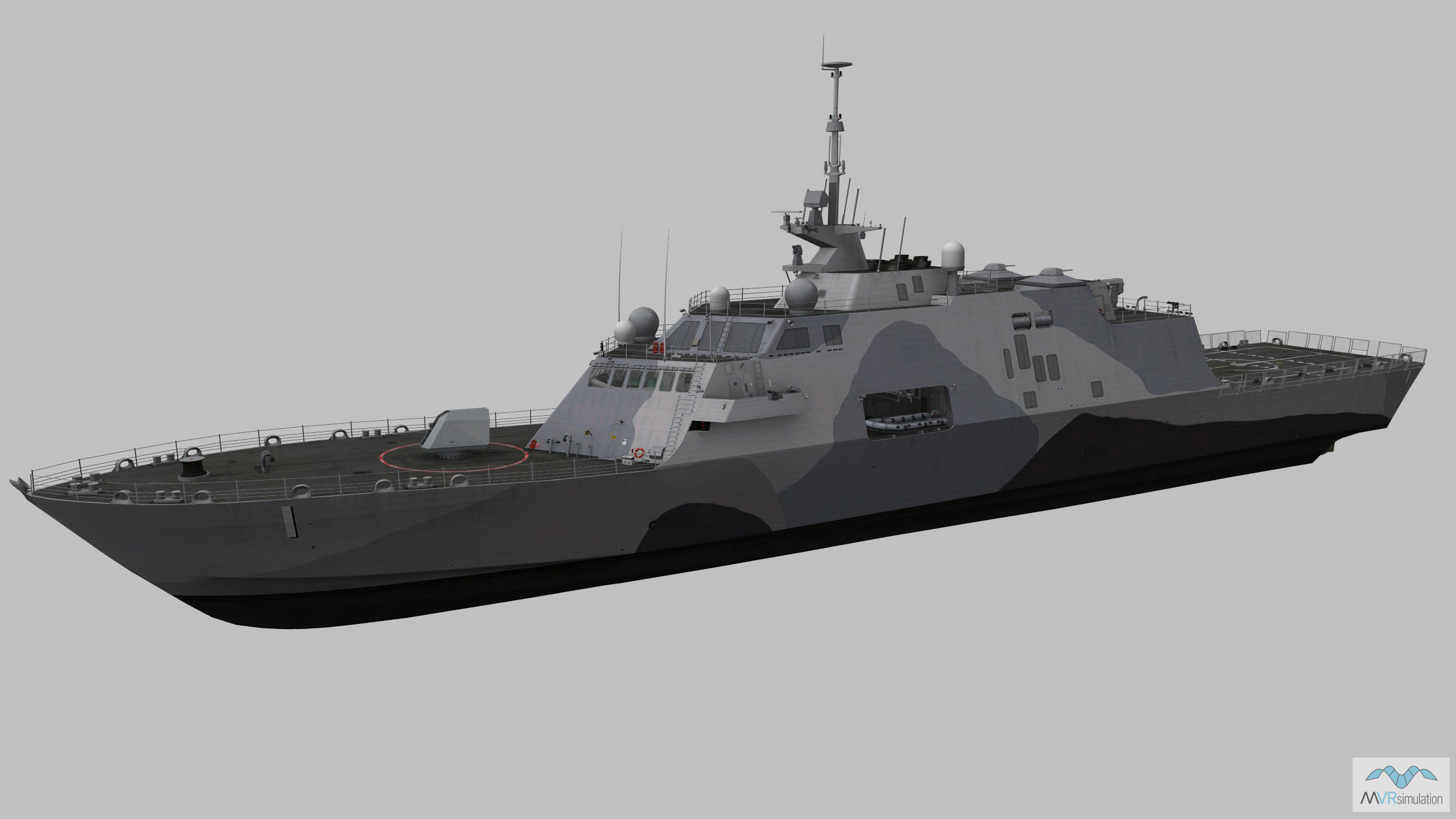
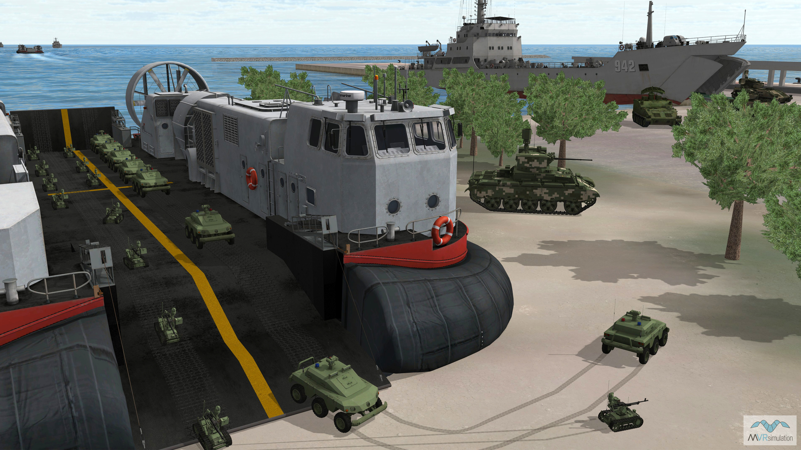
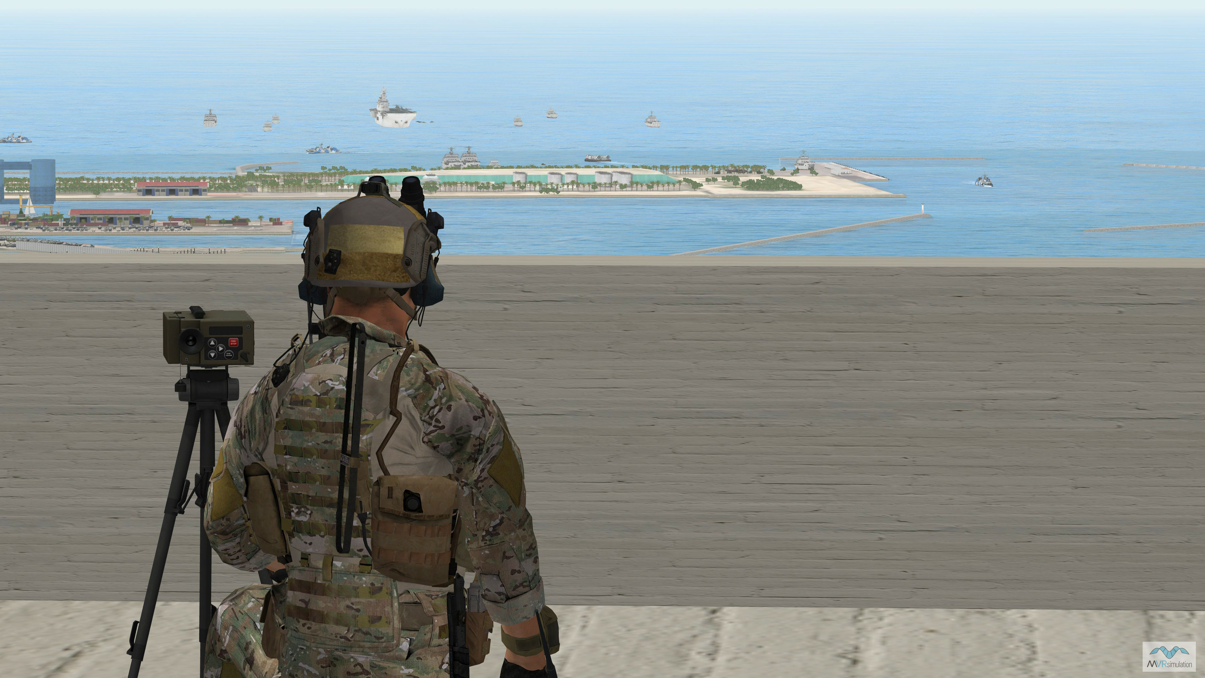
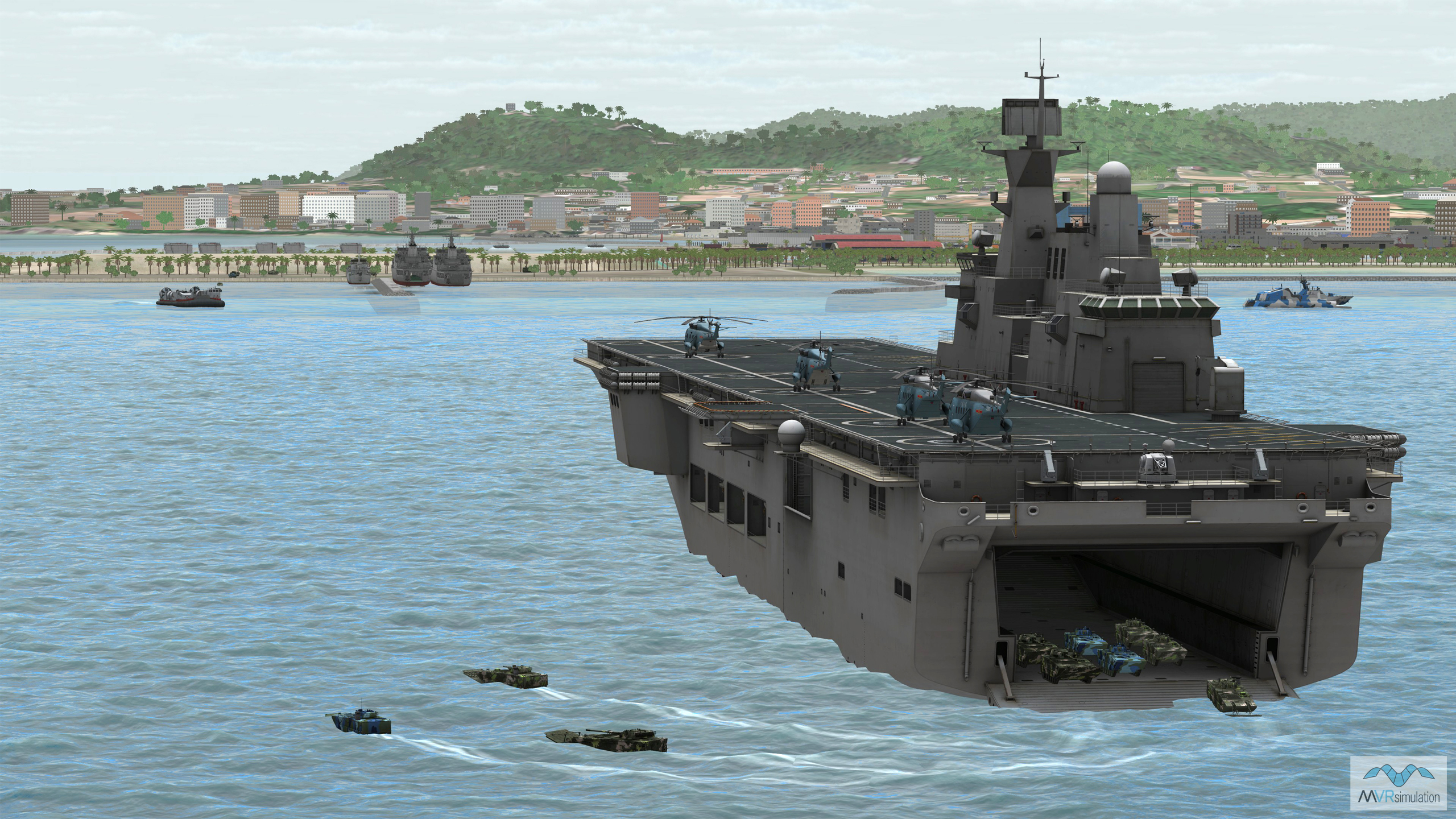
On Day 4, the exercise simulates an amphibious assault on a Pacific port city, represented by VRSG 50cm per-pixel Ishigaki, Japan, terrain. Red Force amphibious vessels swim ashore from a Landing Helicopter Dock anchored off the coast, and a Landing Craft Air Cushion (LCAC) delivers unmanned ground vehicles into the port. A missile boat provides protection in the harbor. Blue Forces are in position to begin defending the island: from an established position overlooking the port, the JTAC coordinates Joint Fires operations incorporating CAS strikes on Red Force vessels offshore. The FPV UAV team, positioned on a building rooftop in the port area, begins striking targets as they amass on the shore to prevent them crossing the Southern Gate Bridge and taking the rest of the island. A Blue Force Global Hawk RPAS loiters overhead, streaming sensor feed footage to all participants in the exercise.
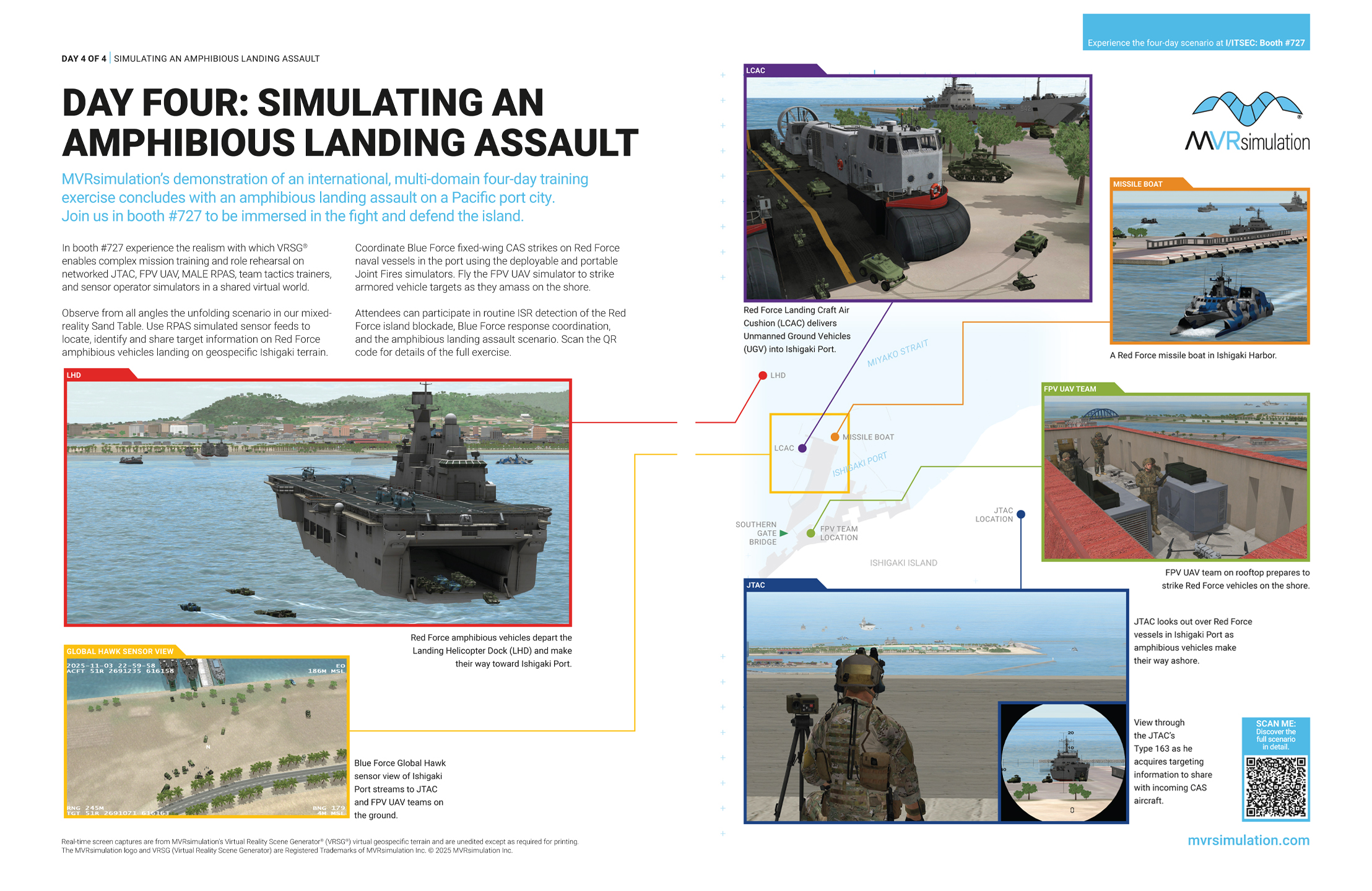
VRSG supported simulations
Day 4 continues to utilize first-person training systems, including the MVRsimulation FPV Team Trainer, and Portable Joint Fires Trainer (PJFT) and/or Deployable Joint Fires Trainer (DJFT). All of these systems integrate with semi-automated forces (SAF) software and DIS traffic to see all platforms running on networked simulators as entities within the simulated battlefield as part of Large Scale Combat Operations (LSCO) training exercises in a shared virtual environment provided by VRSG. Targets (3D VRSG model entities) in the virtual environment appear similarly to all participants. Fixed-wing aircraft trainers join the simulation, such as the MVRsimulation Part Task Mission Trainer (PTMT) to provide CAS to ground operations in coordination with JTACs.
The MALE RPAS simulator continues to stream a VRSG-generated HD-quality H.264 video sensor feed with embedded KLV metadata to the network, providing live updates as the scenario unfolds. As in Day 3, ATAK devices used by FPV UAV pilots and JTAC observers receive this feed as real-time rectified terrain on their ATAK devices, and share targeting information with all Blue Force operators on the network. JTACs direct CAS aircraft to defeat targets in the water, while FPV pilots send out sUAS to strike virtual targets on the beach in coordinated swarm attacks.
The PJFT provides an ultra-portable Joint Fires training capability.
The FPV Team Trainer provides training for groups of 4+ users.
VRSG terrain
The Day 4 scenario takes place in a Pacific port city, represented by VRSG Ishigaki, Japan, terrain. Incorporating a 3D replica of the port area, hand-built model of the Southern Gate Bridge, geospecific and geotypical buildings, roads, and detailed cultural features, VRSG Ishigaki provides a high fidelity virtual environment for multi-domain training exercises including urban, amphibious, air and land elements.
Compiled with underlying SRTM elevation data at a 30-meter elevation post spacing, the source data is blended to underlying 50cm per-pixel source imagery of Ishigaki. This means VRSG simulates the first-person virtual world for all trainees in the scenario from the same terrain – whether they are a JTAC at ground level looking at the horizon, an FPV UAV operator looking out to sea, a CAS aircraft pilot acquiring a ground target at 1,400ft, or an MQ-9 RPAS sensor operator performing overwatch at 50,000 ft – and enables all trainees to identify and lock-on to the 3D target entities that appear accurately to all participants.
VRSG 3D models
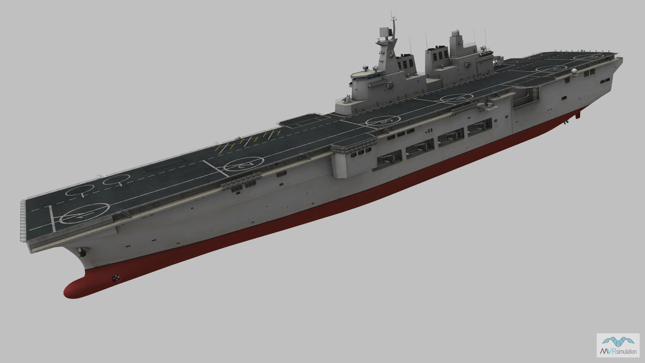
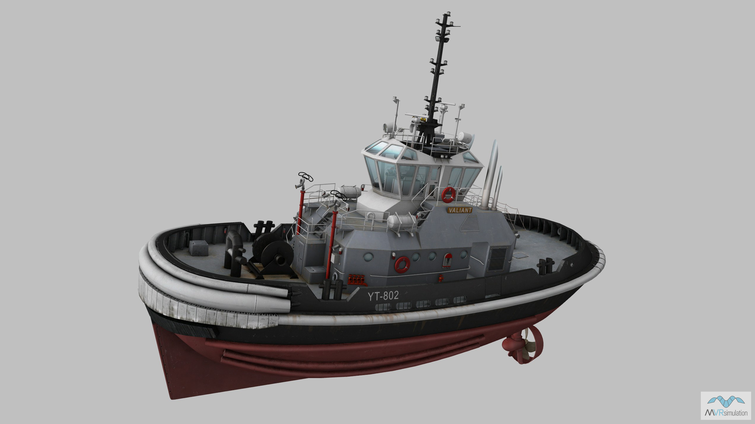
A selection of the VRSG models used in Day 4 of the scenario are below. The VRSG 3D model library features more than 10,500 visually accurate 3D models of currently deployed air, land and maritime platforms. With highly detailed geometry and multiple paint schemes, VRSG models feature articulated parts, damage states, advanced animations, and support time real-time, physics-based thermal sensor viewing within VRSG. The VRSG model library is continually updated. New and updated models are available to download by users of active software maintenance at no additional cost. Search the library here.