
Hajin, Syria

Hajin, Syria

Hajin, Syria Terrain Database Information

  • Imagery: 50cm Digital Globe blended to 1-2 meter imagery
  • Elevation: SRTM 30m
  • Terrain Drive: Asia & Middle East
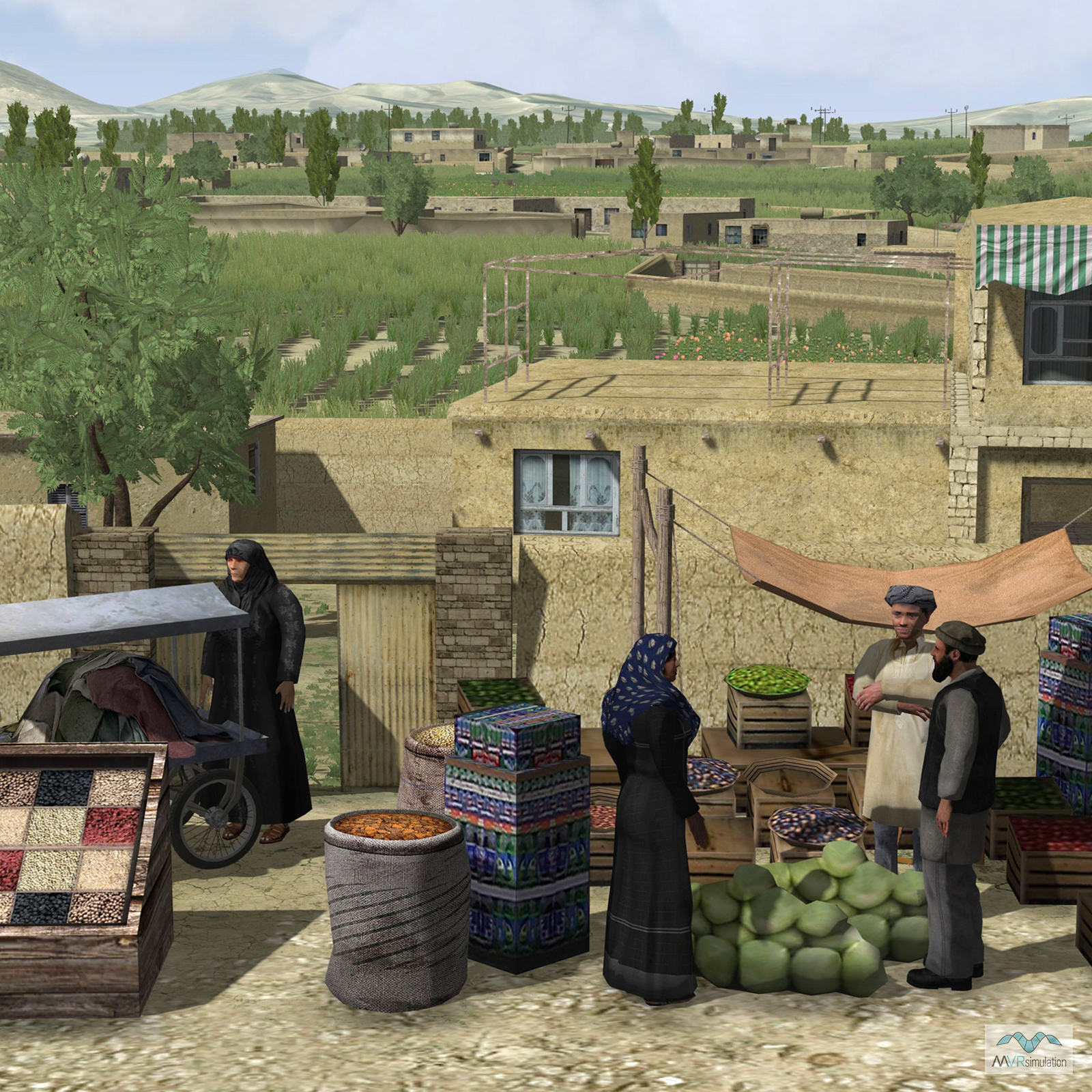
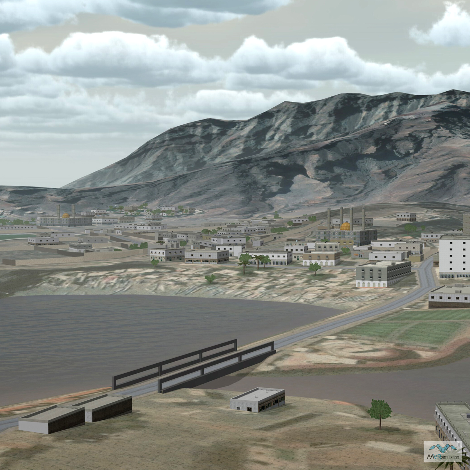
  • A dense Middle Eastern urban area situated along the Euphrates River
  • Cultural Features: Building Interiors, CityEngine (Geotypical) Buildings, Custom Models (Geospecific Buildings), Fences or Walls, Geospecific Bridge, Light Poles, Lighting for Non-Runway Areas (Streetlights), Roads, Trees, Urban Furniture (Benches, Trash Bins, etc), Utilities (Poles, Powerlines or Transmission Lines), Vehicles (Trucks, Cars, Military Equipment, etc.), Water Features (Lakes, Rivers, etc), Water Tanks/Towers
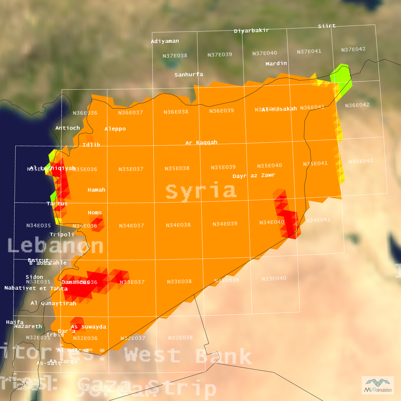
Tile Coverage Map

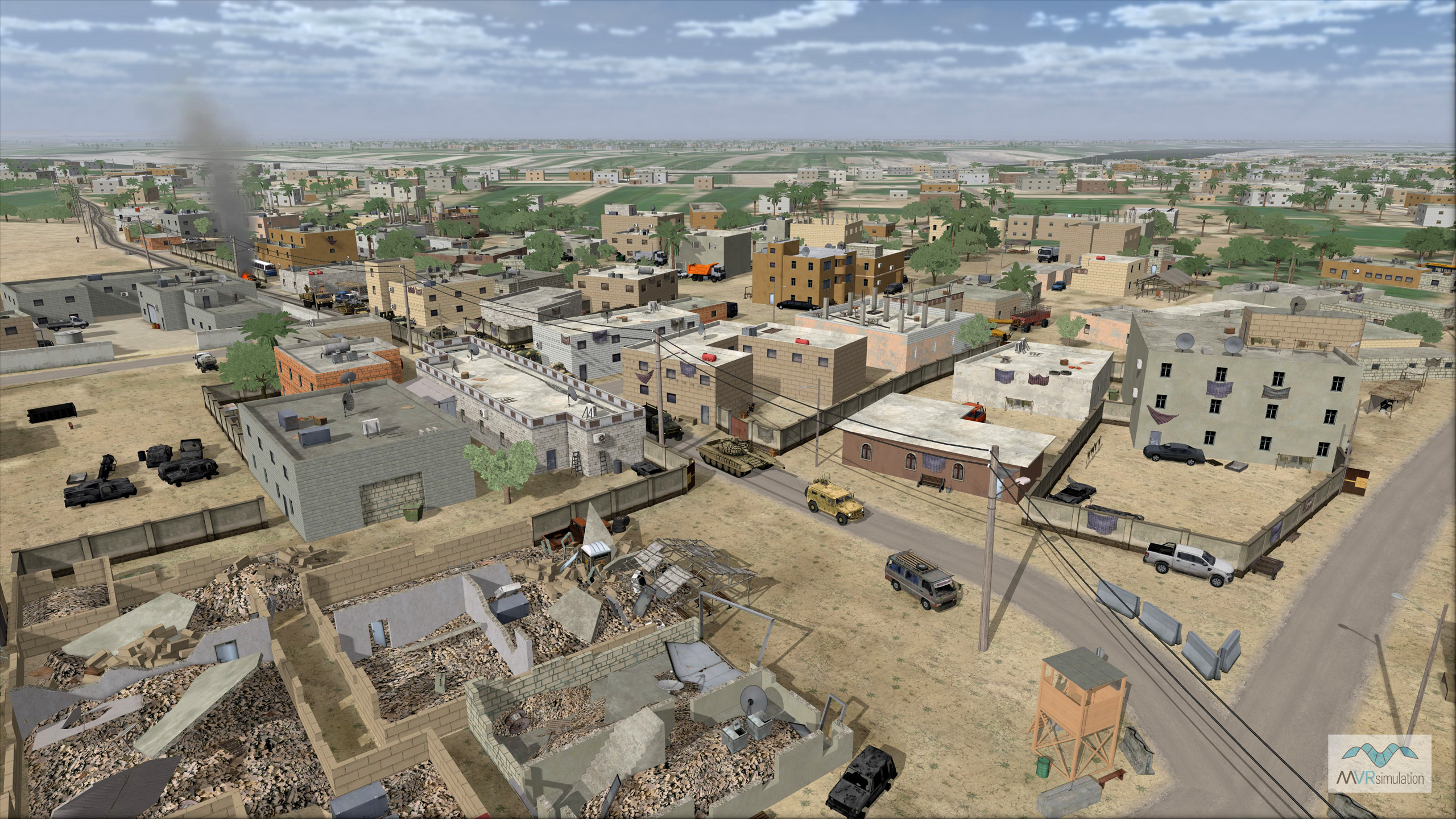
Convoy passing through an urban area of Hajin that includes damaged buildings and typical cultural 3D models.

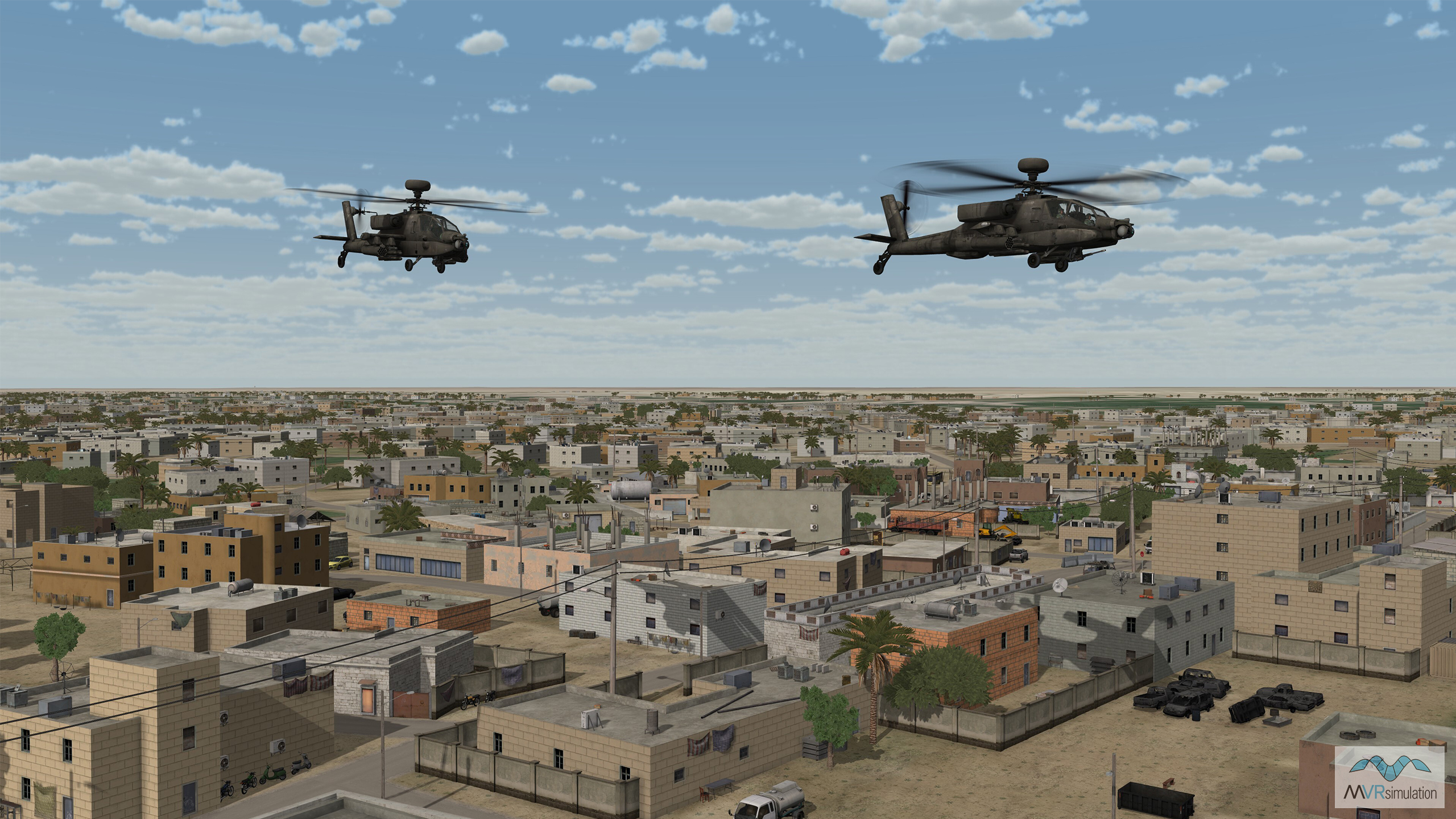
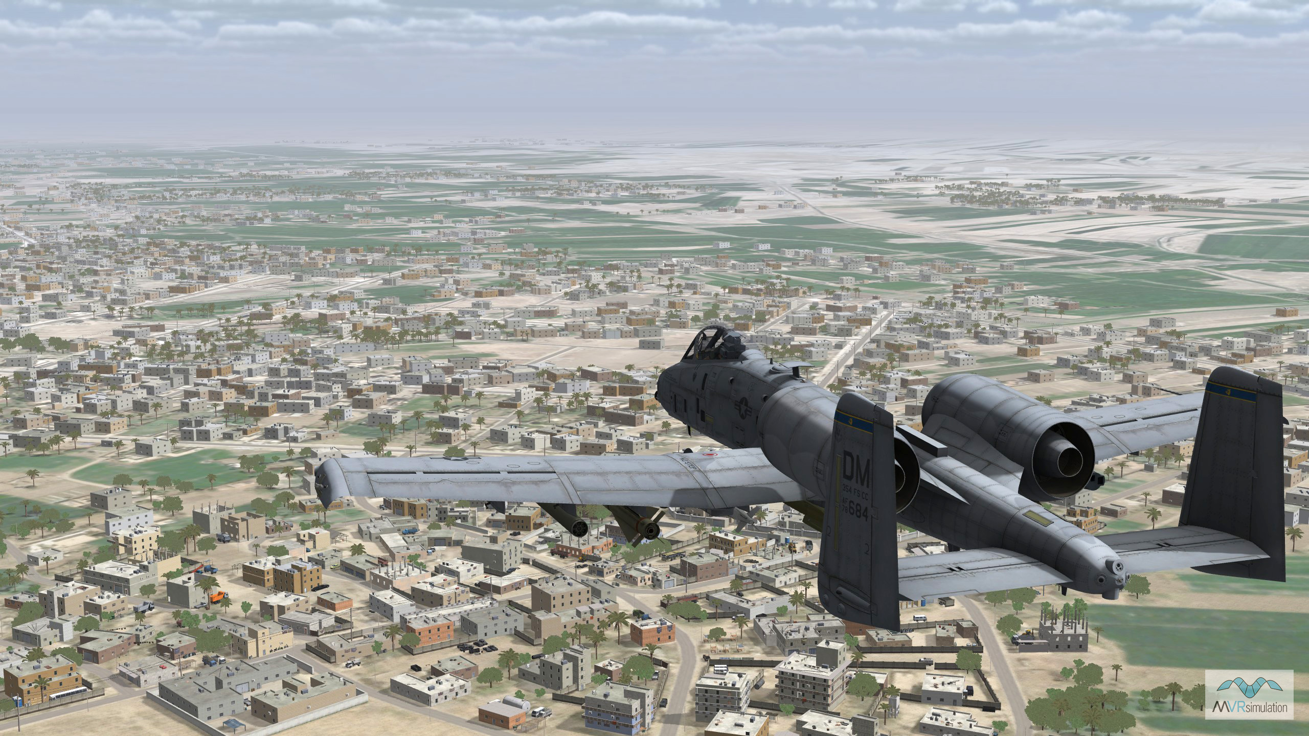
AH-64D and AH-64E helicopter models in flight over MVRsimulation's Hajin, Syira, terrain.

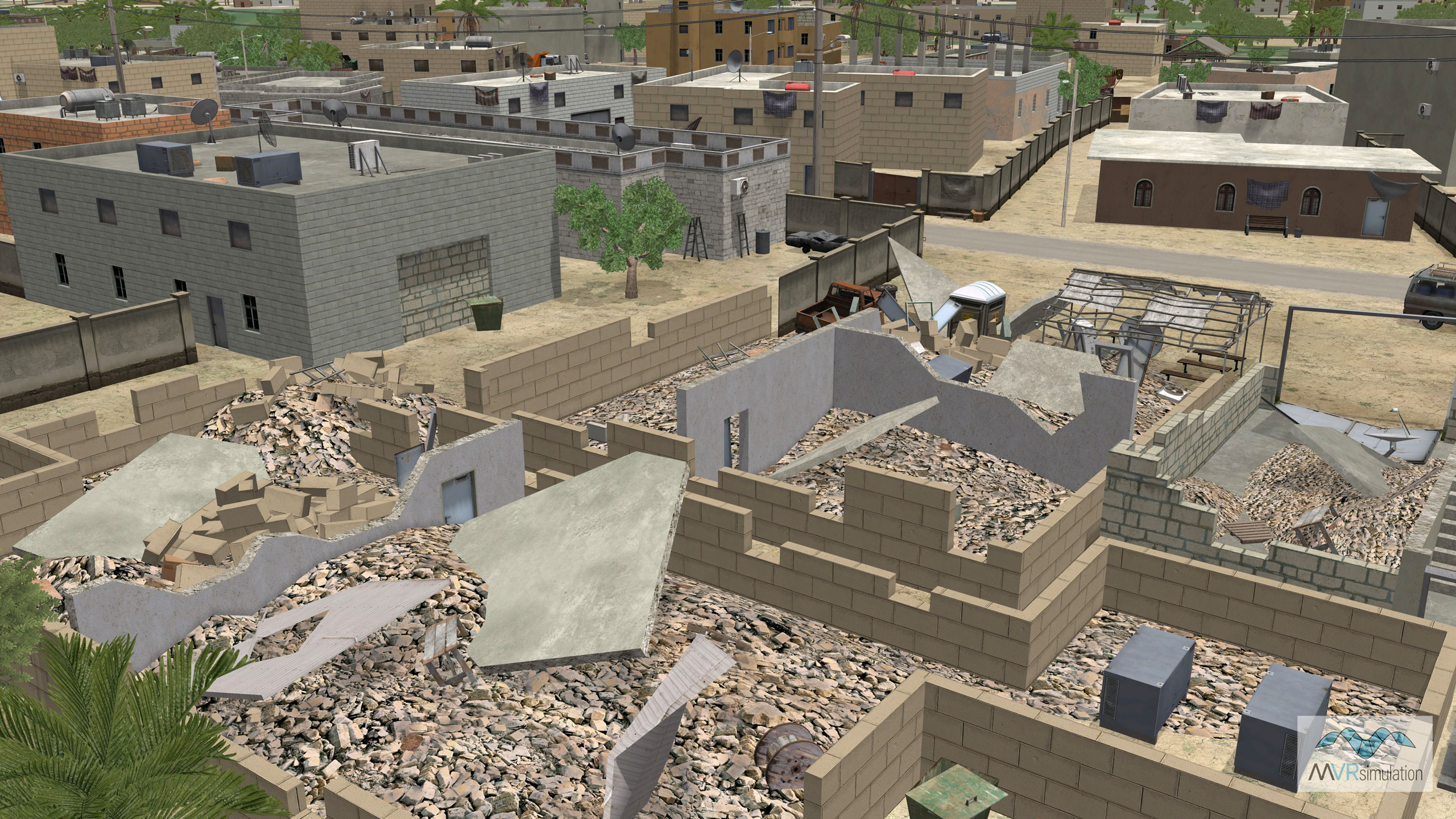
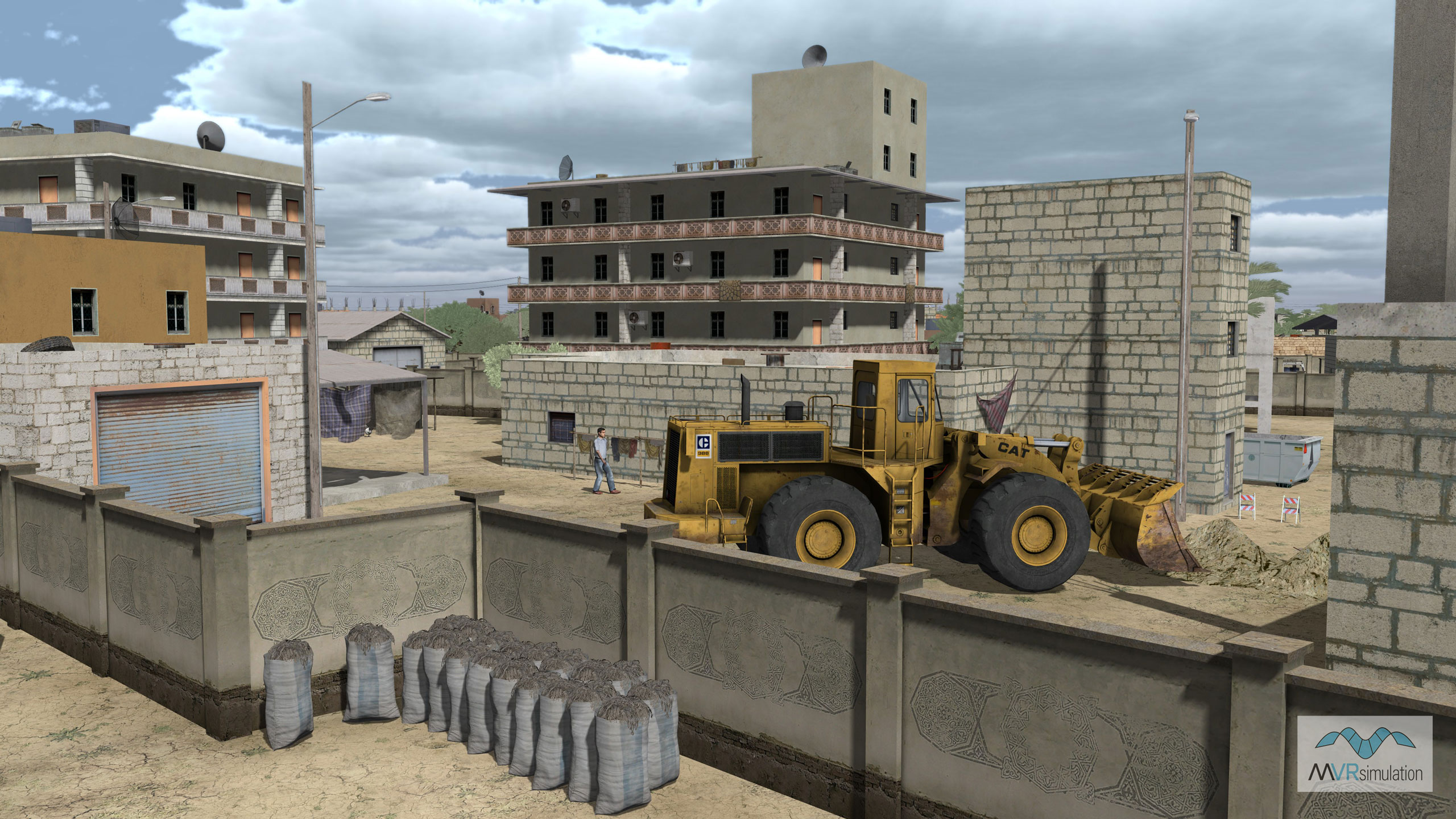
Urban area of Hajin, Syria, with several damaged building models.

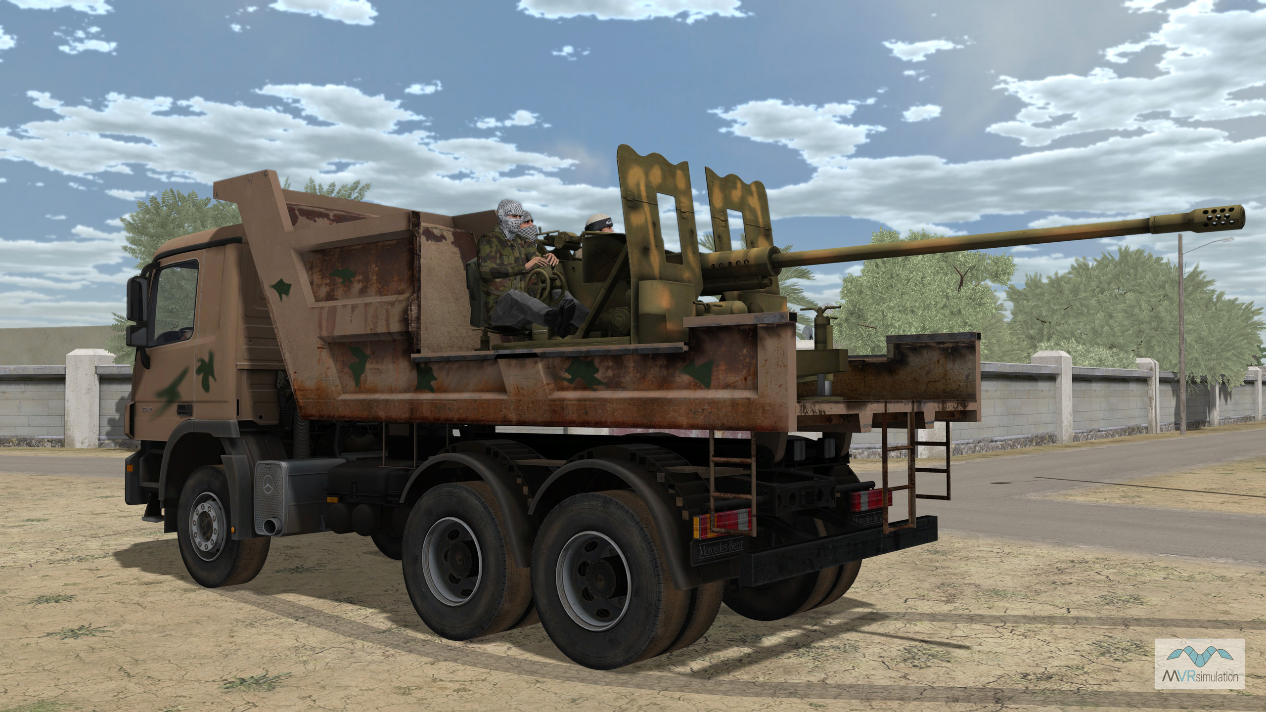
Mercedes Actros 3340 6x4 tipper technical vehicle with an S-60 anti-aircraft gun (and gunners) on geospecific terrain of Hajin, Syria.

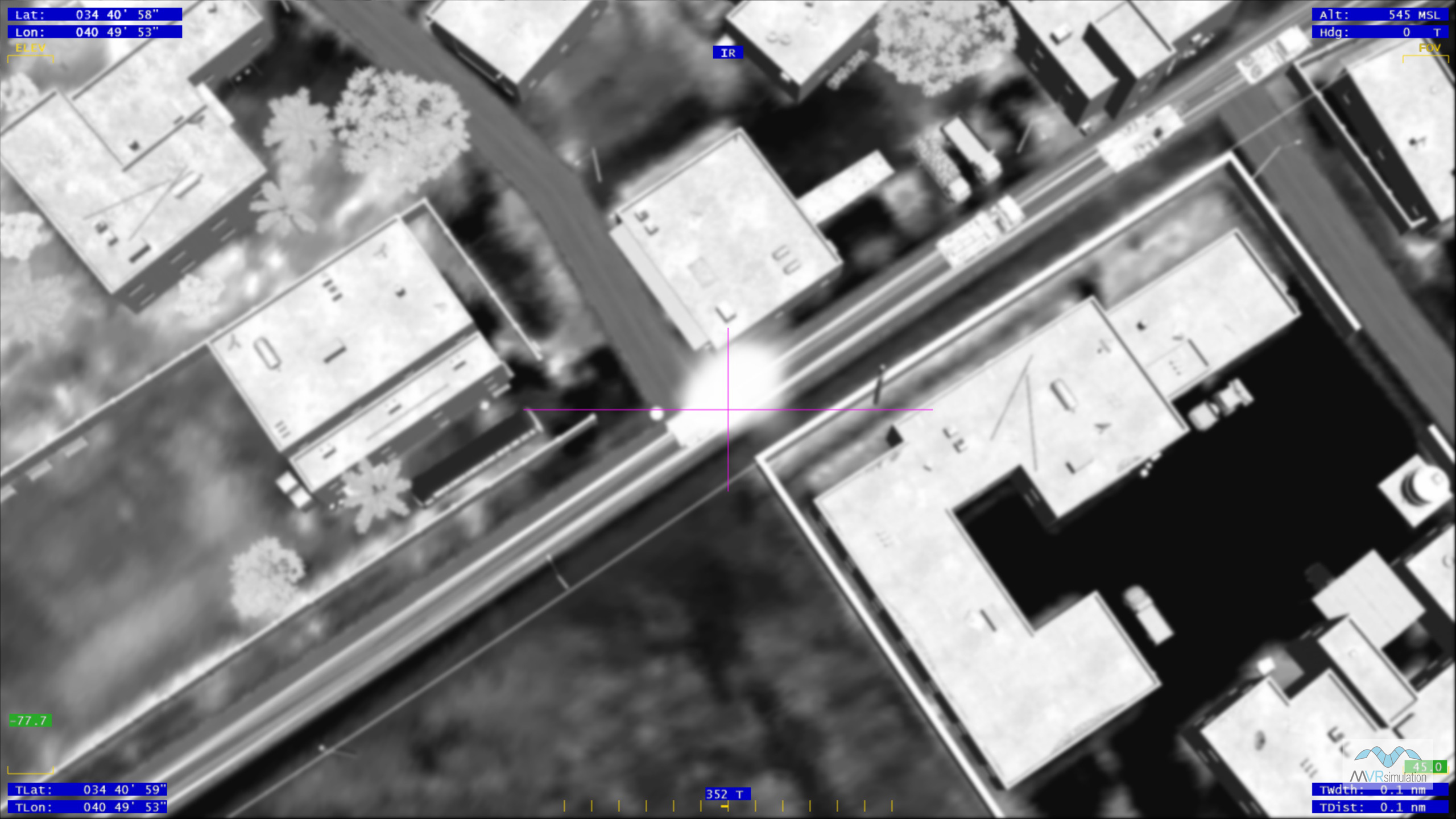
Simulated UAV / RPA sensor scene featuring a convoy under attack on the 3D virtual terrain of Hajin, Syria.

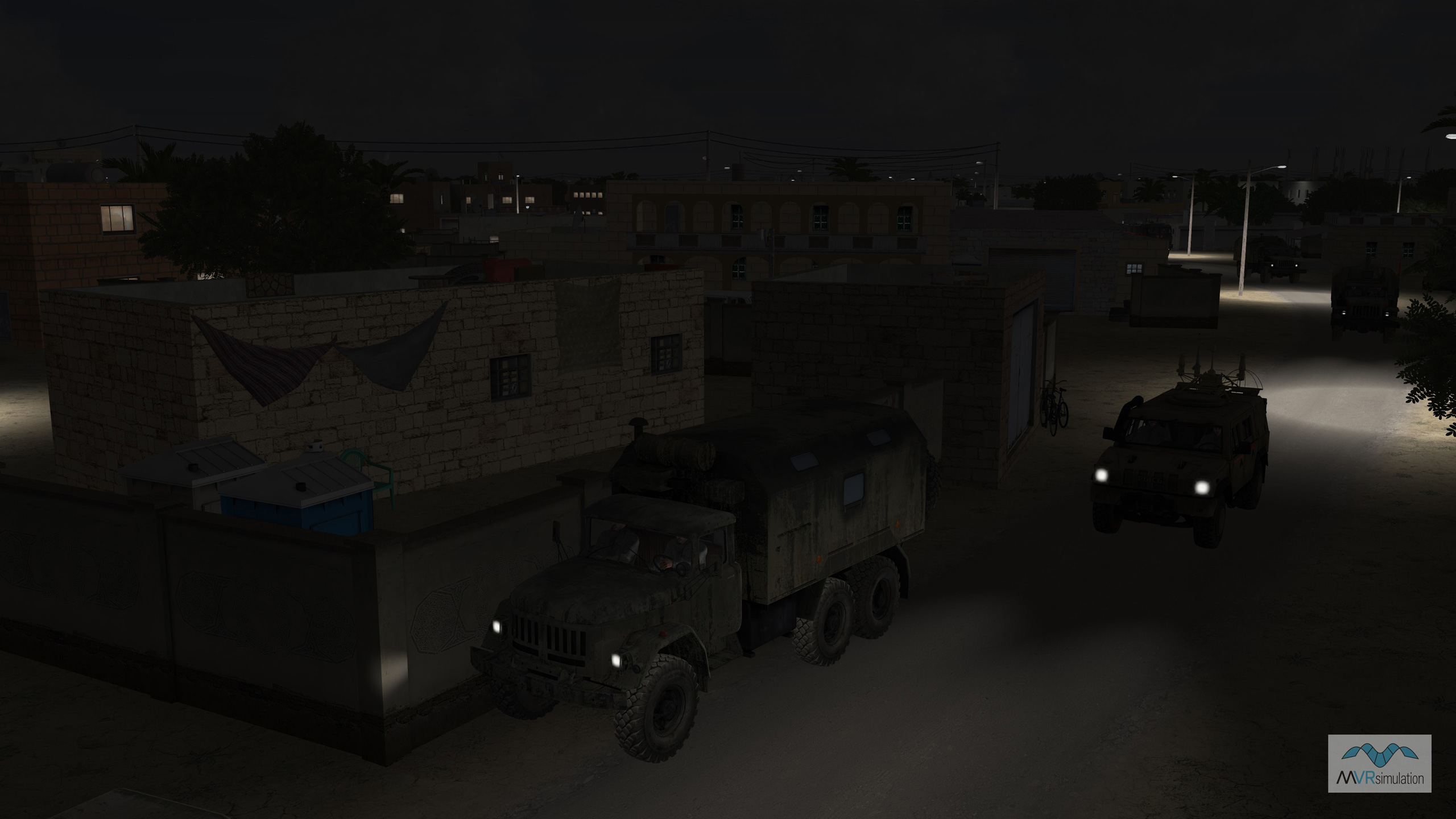
Building models contain emissive light-map textures and the vehicle headlights and the streetlights contain light lobes.

Related Terrain

EXTEND YOUR TERRAIN DATABASE


MVRsimulation Downloads Server

  • Explore and implement terrain updates
  • Download and use new 3D models
  • Stay up-to-date with VRSG features
  • Discover utilies for expanding VRSG
    Filler for Spacing

Request Account

MVRsimulation Regional Terrain Drives

  • External hard drive - regional terrian
  • Network attached storage device - whole-world terrain
  • Ready for plug and play
  • Available to customers on active maintenance
    Filler for Spacing

Request Drive

MVRsimulation Produced Custom Terrain

  • Custom terrain created by MVRsimulation's terrain team
  • Specify your desired area of interest
  • Indentify needed terrain features
  • Use your own or commercially available imagery
    Filler for Spacing

Request Quote

Create Terrain with Terrain Tools

  • Build real-time 3D terrain for VRSG using GIS technology with ArcGIS Pro
  • Designed to be user-friendly for users with basic ArcGIS knowledge
  • Use imagery, elevation, and optional vector data to create terrain
  • Compile buildings from 2D polygon footprint features using a CityEngine rule package
    Filler for Spacing

Terrain Tools

3D Terrain Database Catalog

Access our complete list of VRSG-ready Areas of Interest (AOI) without an internet connection. The 3D Terrain Database Catalog is designed for reference within secure facilities. Download and print this document to keep MVRsimulation’s global terrain data at your fingertips. For more information about acquiring these AOIs for immediate use, see the Download or Obtain tabs in this section.

Terrain Catalog