Kismayo, Somalia Terrain Database Information
- Imagery: 50 cm Digital Globe (GeoEye-1) satellite imagery
- Elevation: SRTM 30m
- Terrain Drive: Africa
- 3D modeled Airport and Port with photospecific 3D buildings and cultural models.
- Cultural Features: Apron or Ramp Areas, CityEngine (Geotypical) Buildings, Control Tower, Cultural Landmarks (Statues and Monuments), Custom Models (Geospecific Buildings), Fences or Walls, Geospecific Bridge, Hangars, Landscape Features (Shrubs, Grass, Paved Medians, etc.), Light Poles, Lighting for Non-Runway Areas (Streetlights), Military Specific Elements (Shelters, Bunkers, Watchtowers, etc.), Roads, Runway, Signs, Static Aircraft or Helicopters, Taxiways and Associated Markings, Trees, Urban Furniture (Benches, Trash Bins, etc), Utilities (Poles, Powerlines or Transmission Lines), Vehicles (Trucks, Cars, Military Equipment, etc.), Water Features (Lakes, Rivers, etc), Water Tanks/Towers
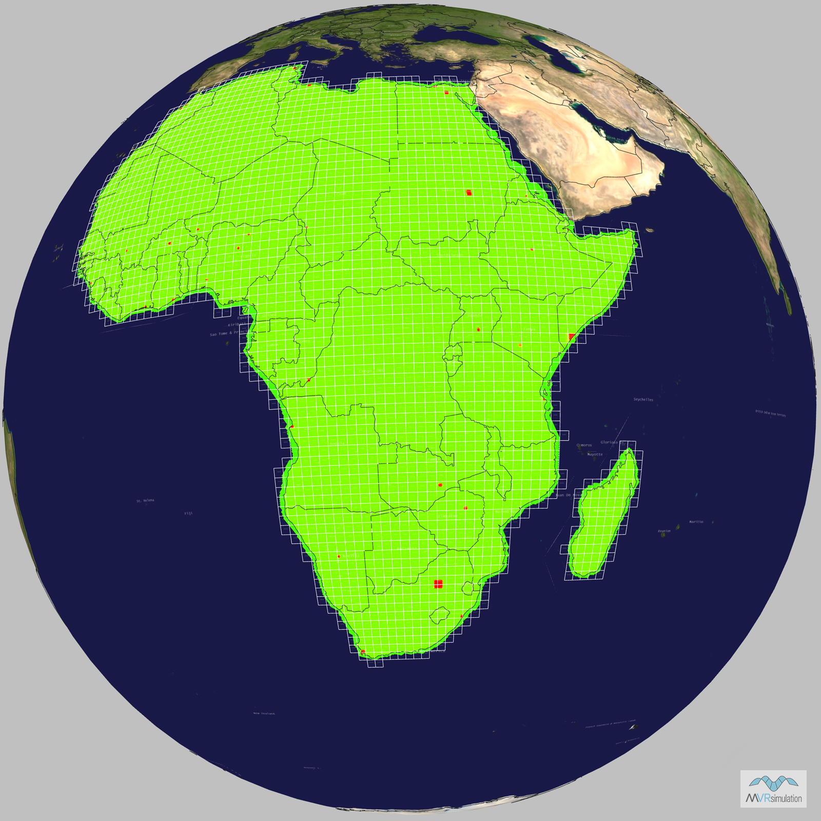
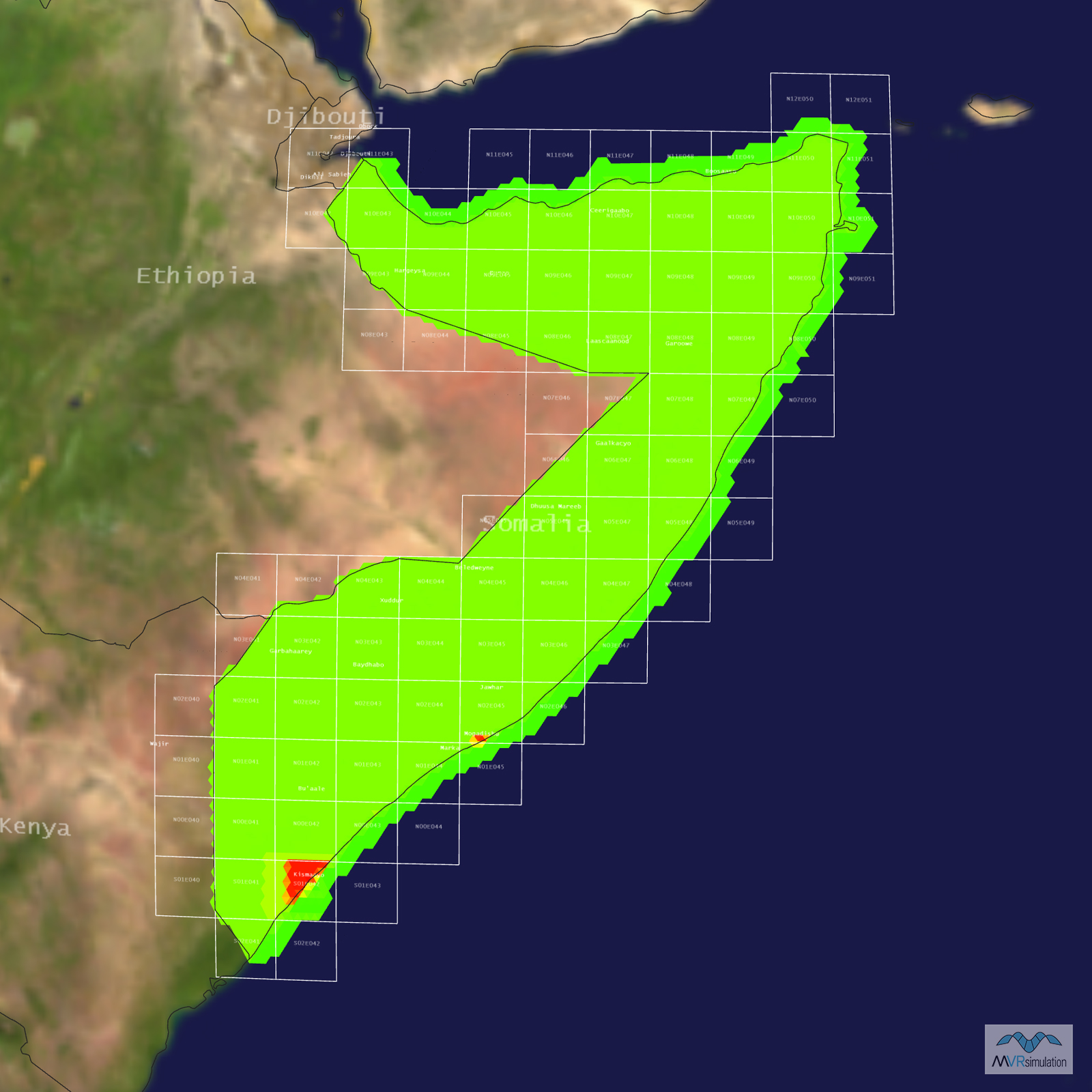
Tile Coverage Map
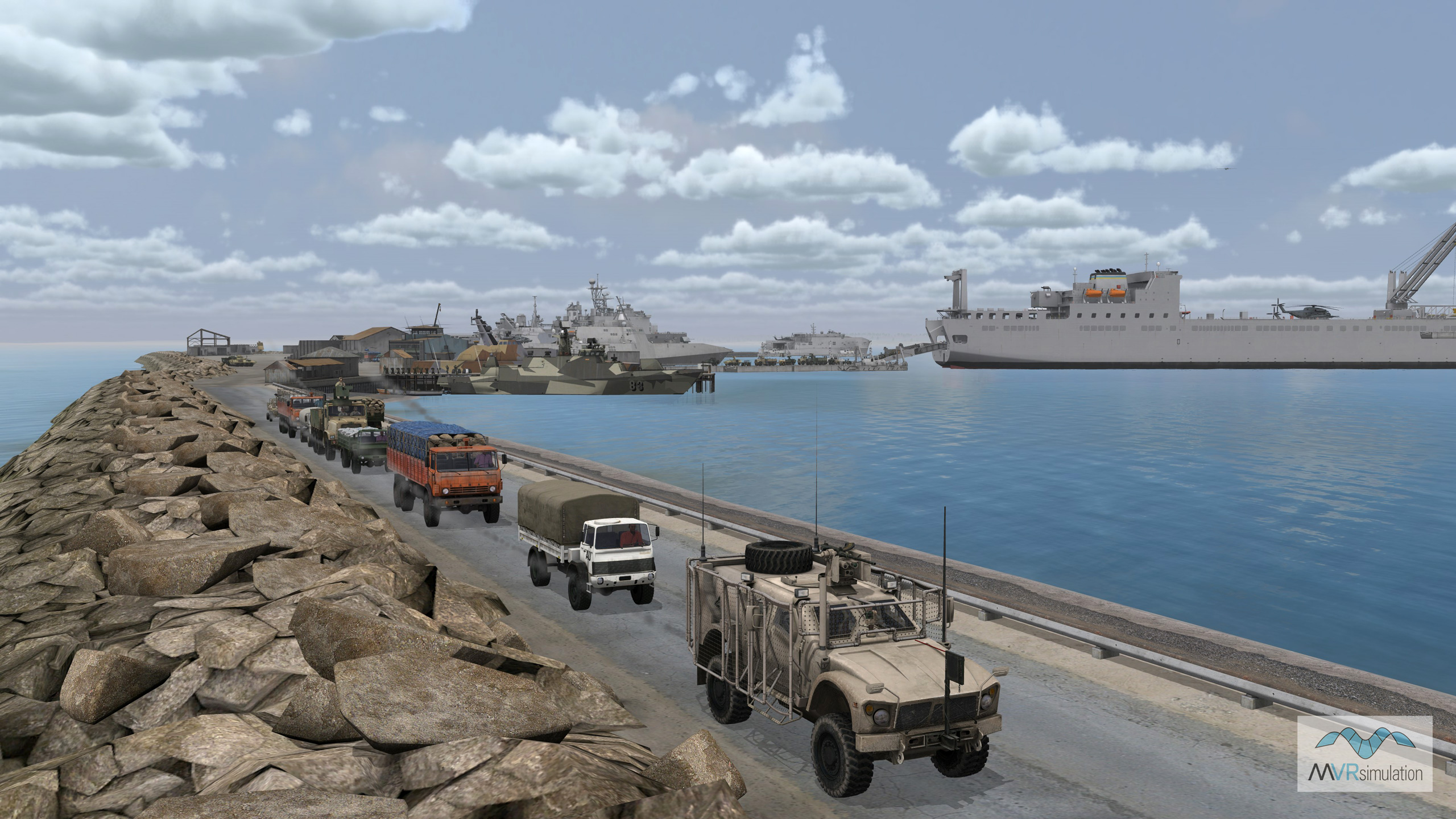
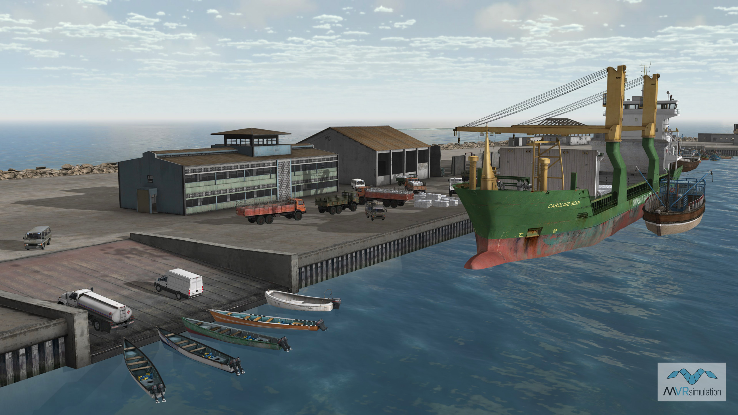
Loaded convoy leaving the port of Kismayo with military naval vessels in the background.
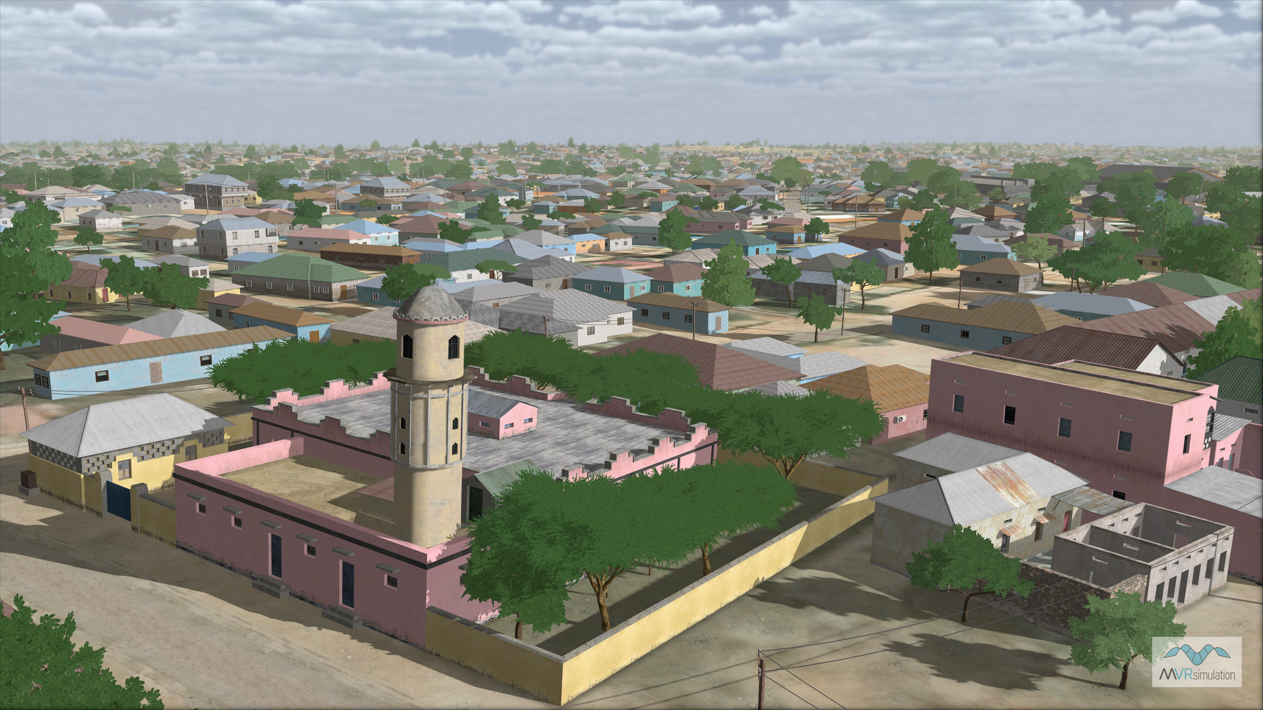
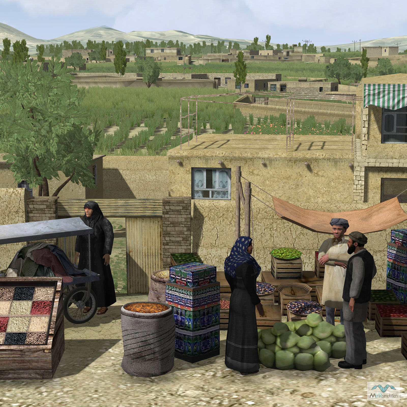
A virtual replica of Kismayo’s residential area in MVRsimulation’s VRSG, featuring geospecific and geotypical buildings modeled from real-world imagery.
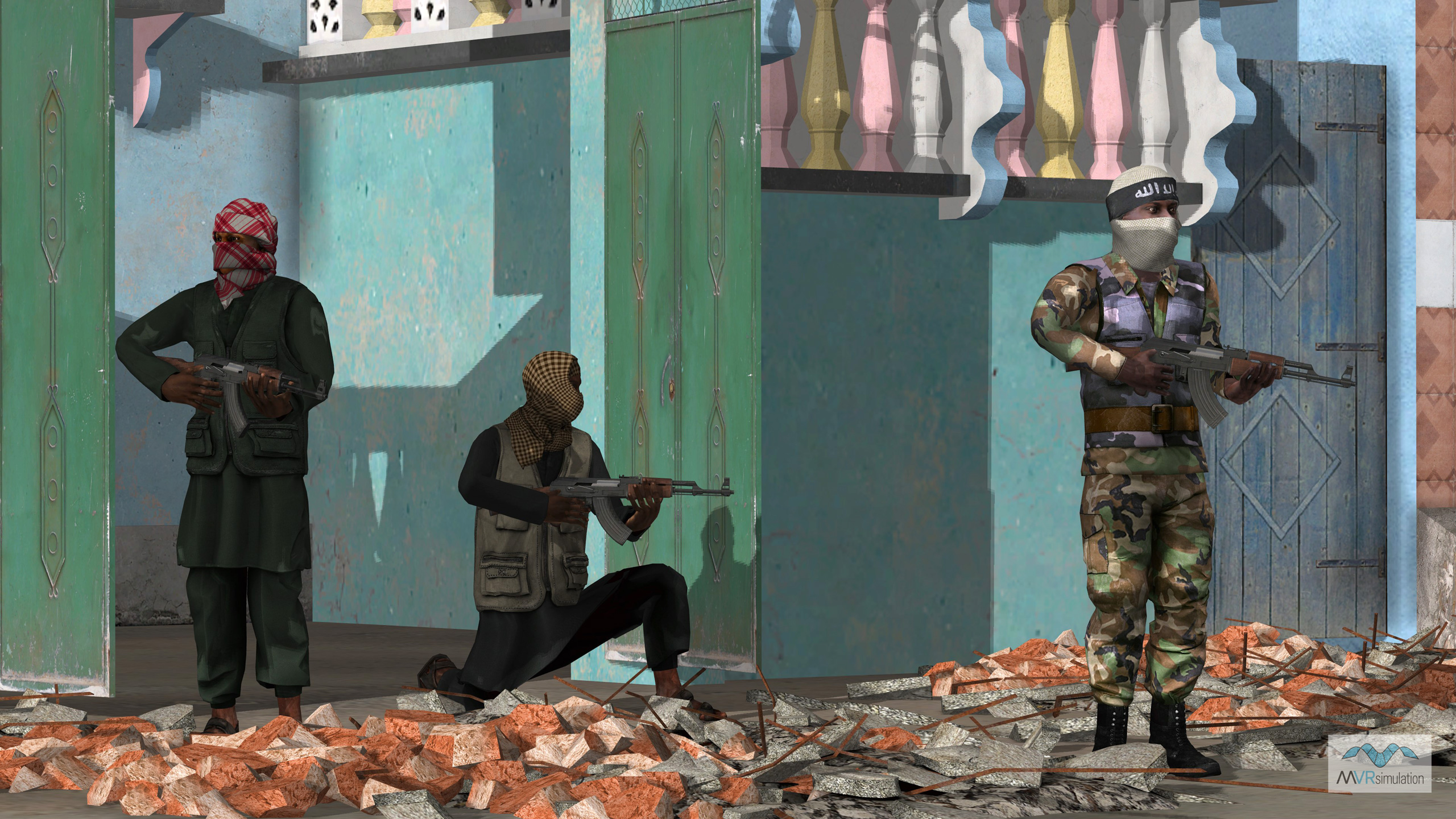
A VRSG scene showing geospecific characters based on the Al-shabaab insurgents. A set of Somali civilian, AMISON soldier, and Al Shabaab character models are included in the model libraries. The Al Shabaab characters have authentic scarf patterns on their uniforms that match actual photographs of the militants from internet sources.
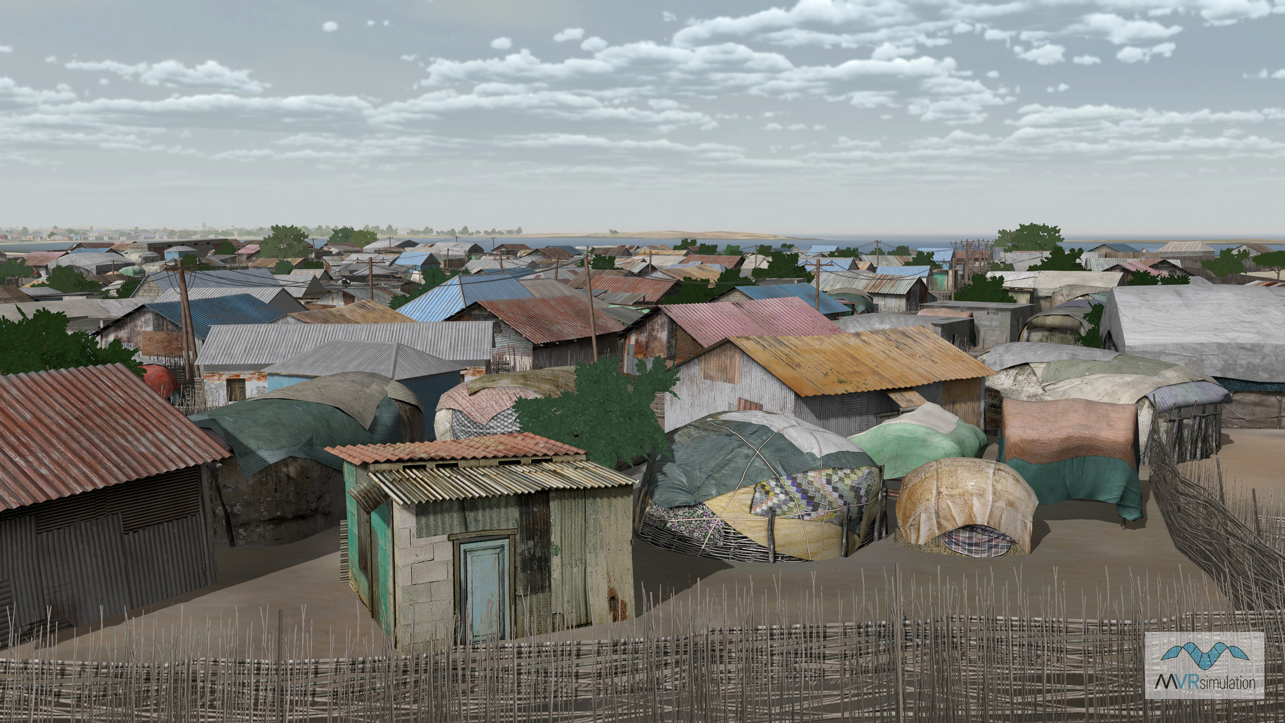
Geospecific 3D huts and fences are included in the Somalia database increasing the realism of the terrain.
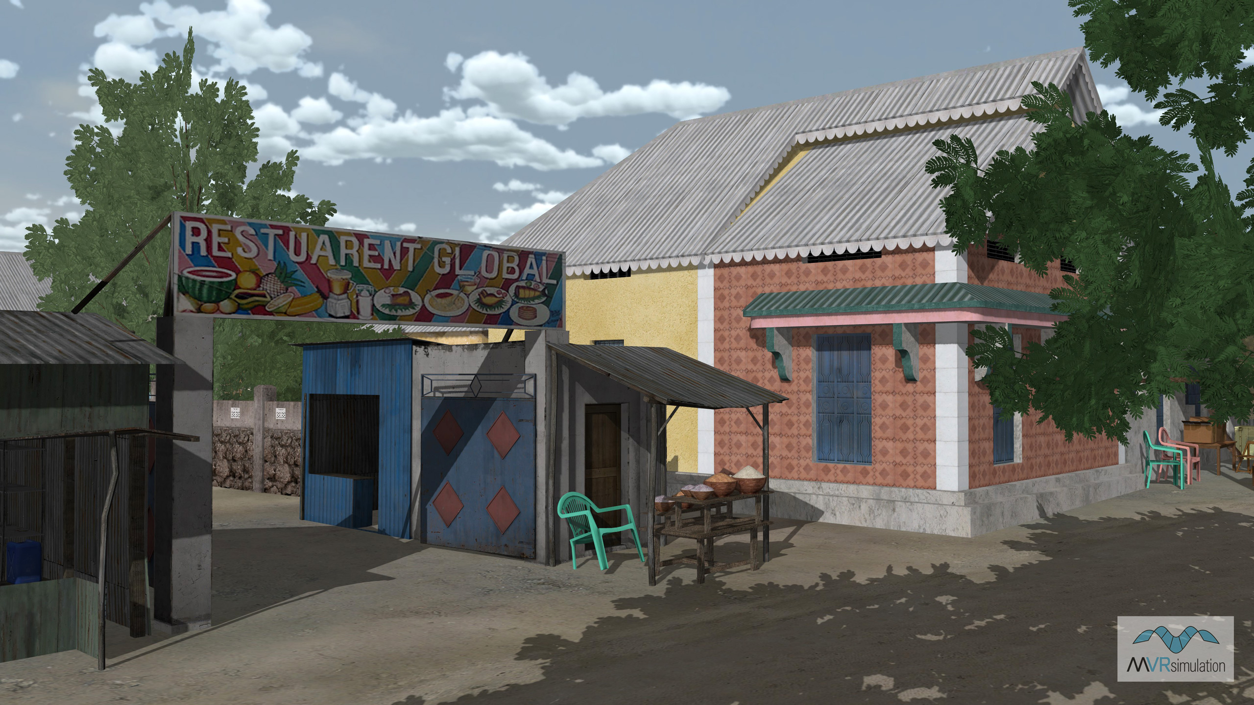
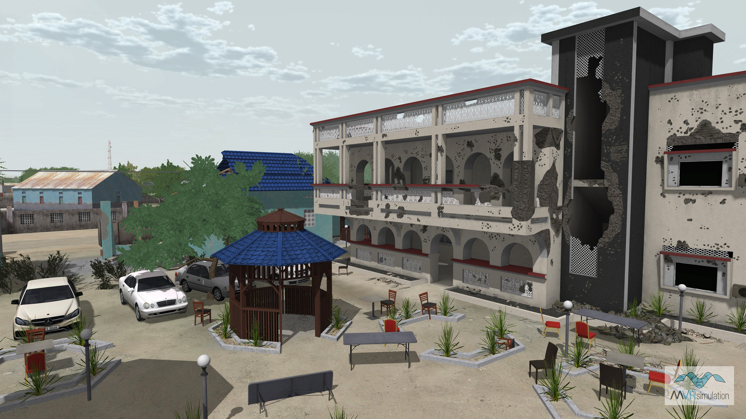
Photospecific 3D models built from ground-level photographs are included in the Somalia database.
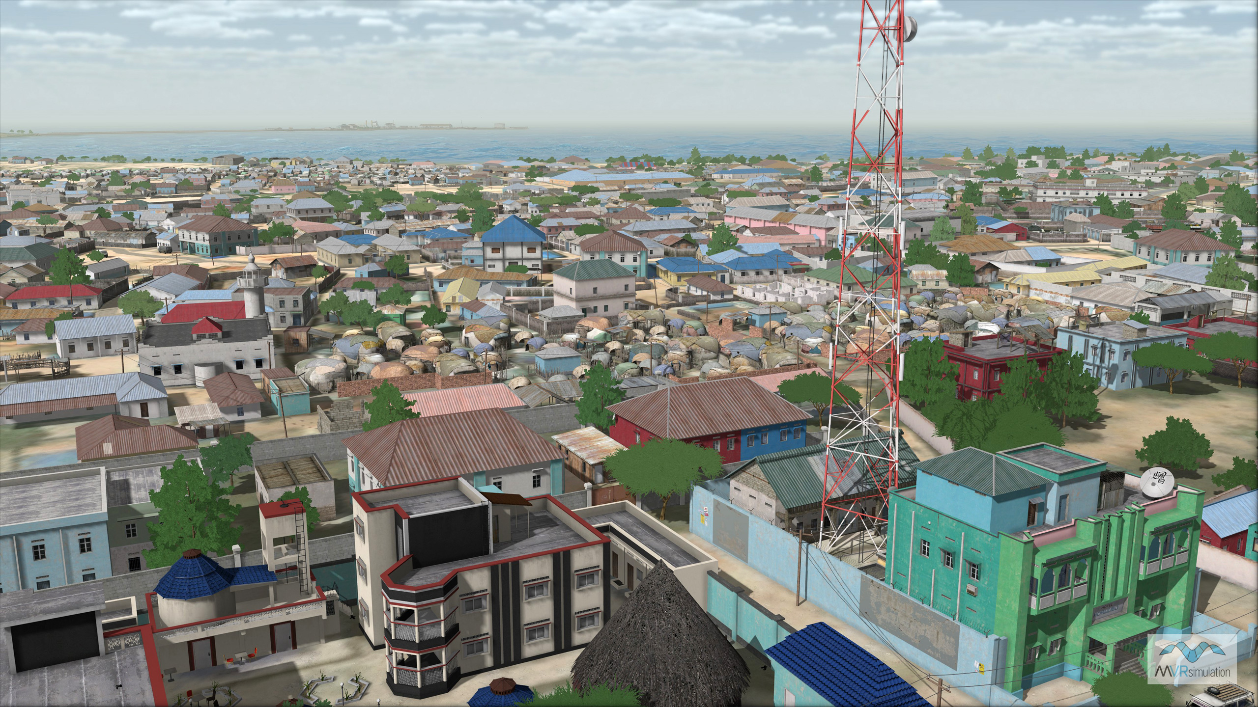
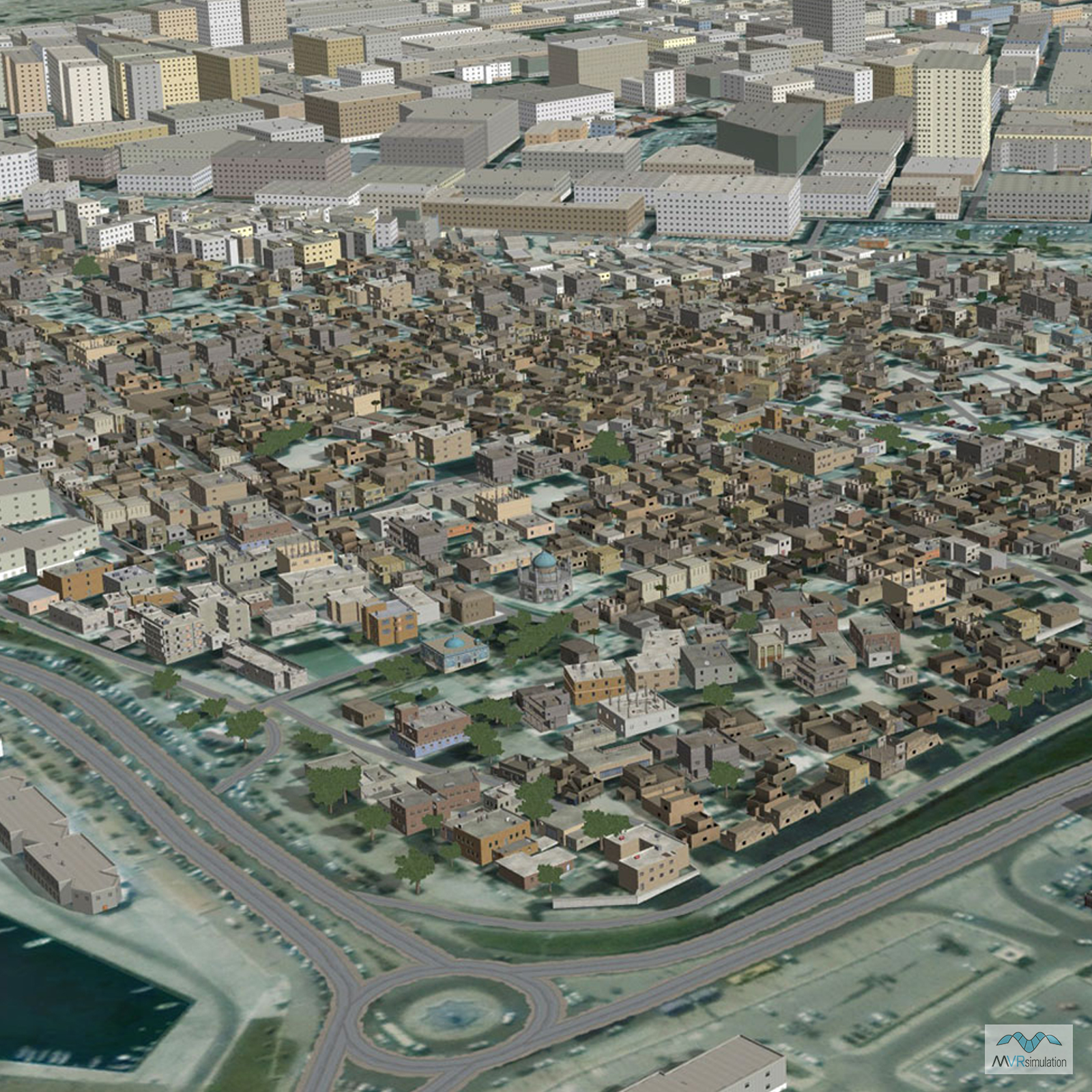
Real-time scene of the VRSG Kismayo, Somalia terrain database including communication towers, photospecific and typical buildings, urban culture and vegetation.
Purpose and Design of the Kismayo Terrain
To support evolving military training needs in the Horn of Africa, MVRsimulation developed a highly detailed 3D virtual replica of Kismayo, Somalia. This city was selected due to its diverse terrain, ranging from coastal port areas and dense urban zones to remote outskirts with an airport, making it ideal for training across a wide range of operations—from urban combat to amphibious missions.
The terrain was constructed using MVRsimulation’s proprietary tools and satellite imagery, blending high-resolution 50 cm per-pixel satellite data with broader 15-meter elevation imagery. Hundreds of geospecific culture models were created from 2,000+ GPS-tagged ground-level photos taken in Kismayo. Additional geotypical buildings were modeled to match satellite-visible footprints. The result is a terrain database of over 21,000 structures and nearly 91,000 trees, offering visual and spatial fidelity for realistic simulation.
Training Applications and Scenario Features
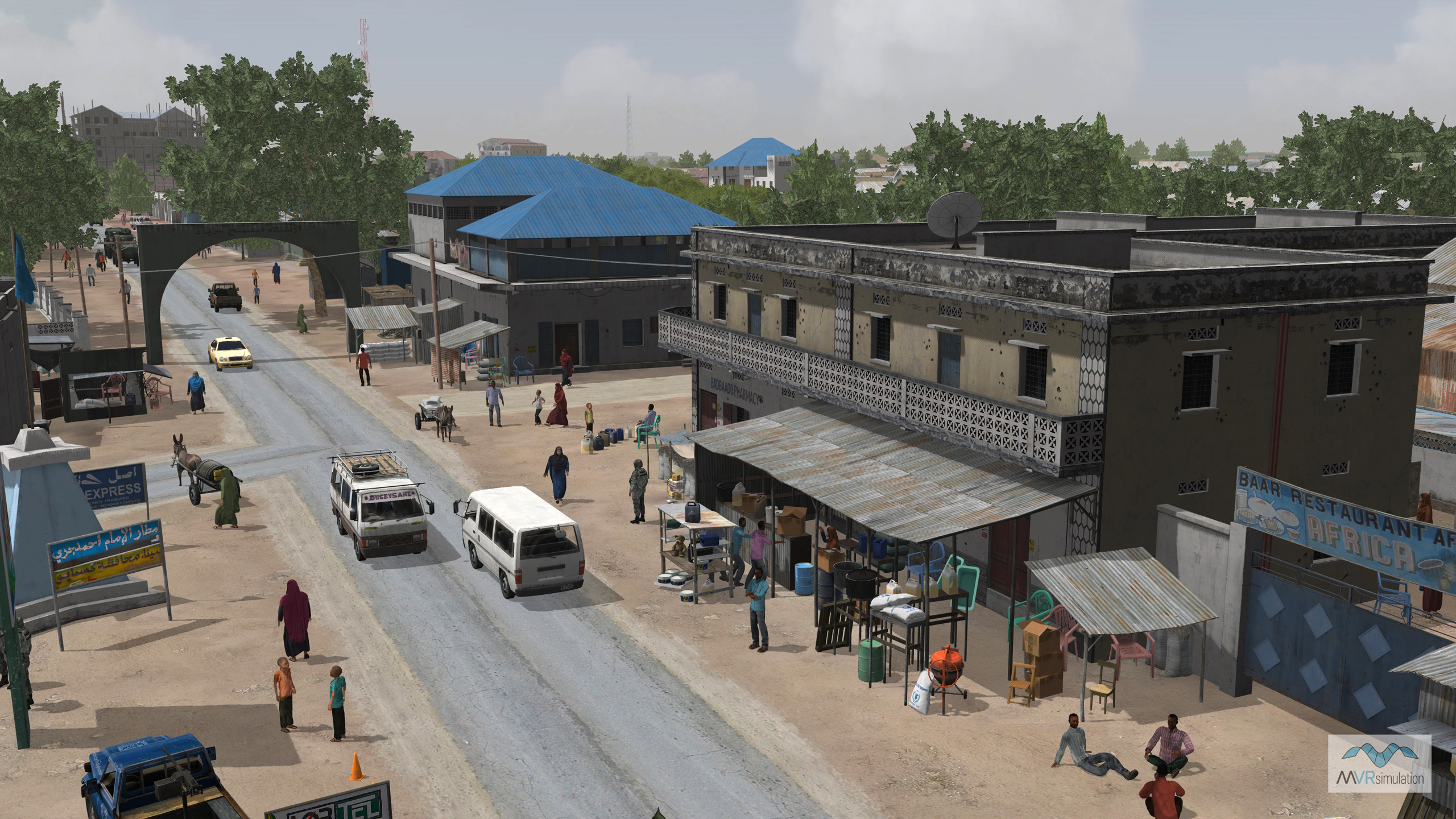
The virtual Kismayo terrain supports a variety of military training exercises. Its realism allows users to practice UAV reconnaissance, urban combat, close air support (CAS), helicopter insertions, and littoral security using actual geolocated photospecific landmarks instead of symbolic or map-based representations. Specialized cultural details include displacement camps, geospecific vehicle models, and fully modeled port structures.
Scenarios created with MVRsimulation’s Scenario Editor involve realistic civilian and militant interactions. For example, one training scenario places U.S. Special Forces alongside AMISOM troops who uncover and respond to an Al-Shabaab charcoal smuggling operation. A rich cast of character models (civilians, AMISOM, Al Shabaab with authentic attire) and dynamic elements such as human and vehicular movement help build a realistic pattern of life for immersive mission rehearsal. These scenarios are included with the Kismayo terrain database.
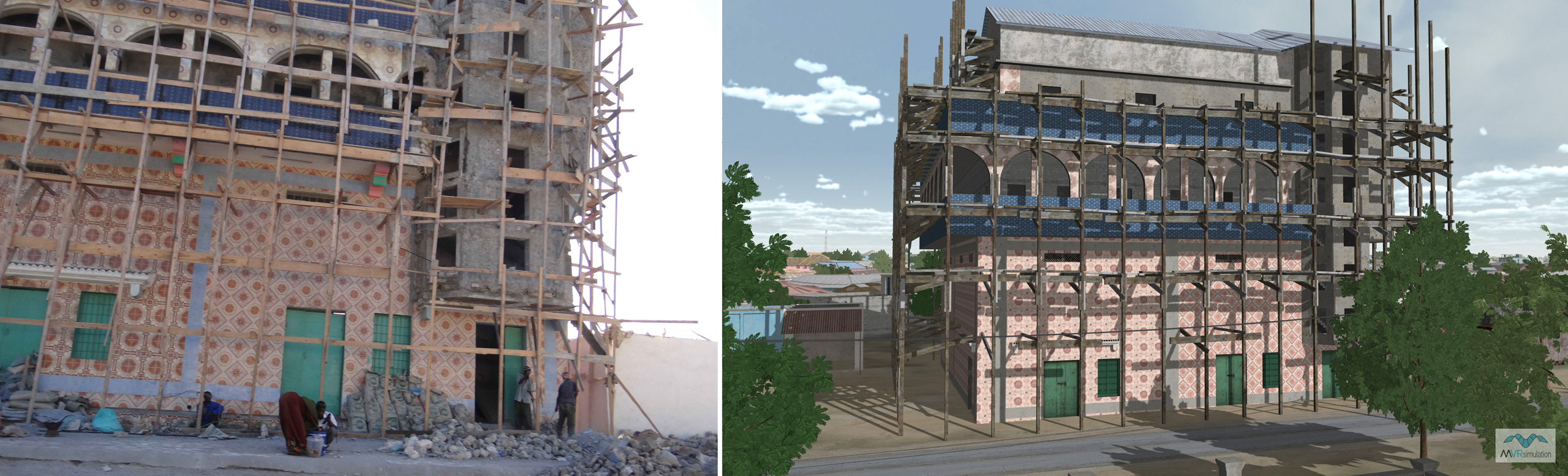
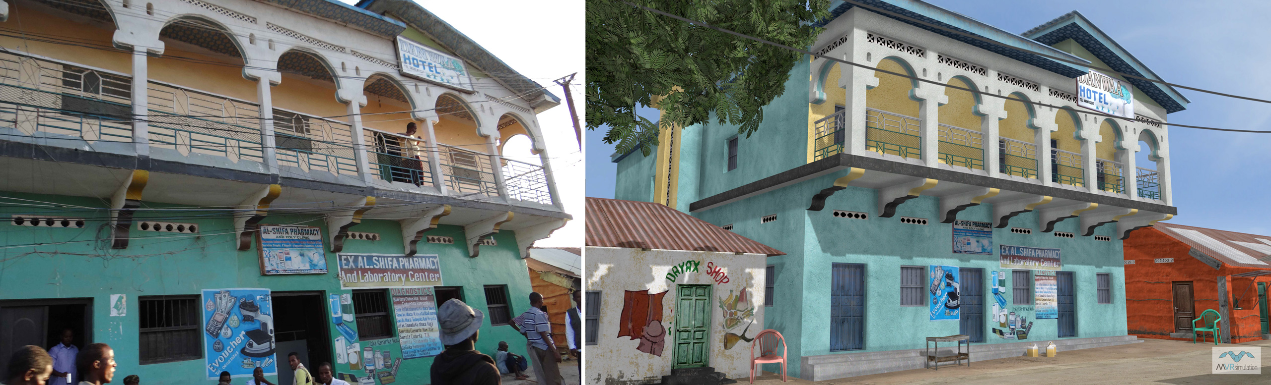
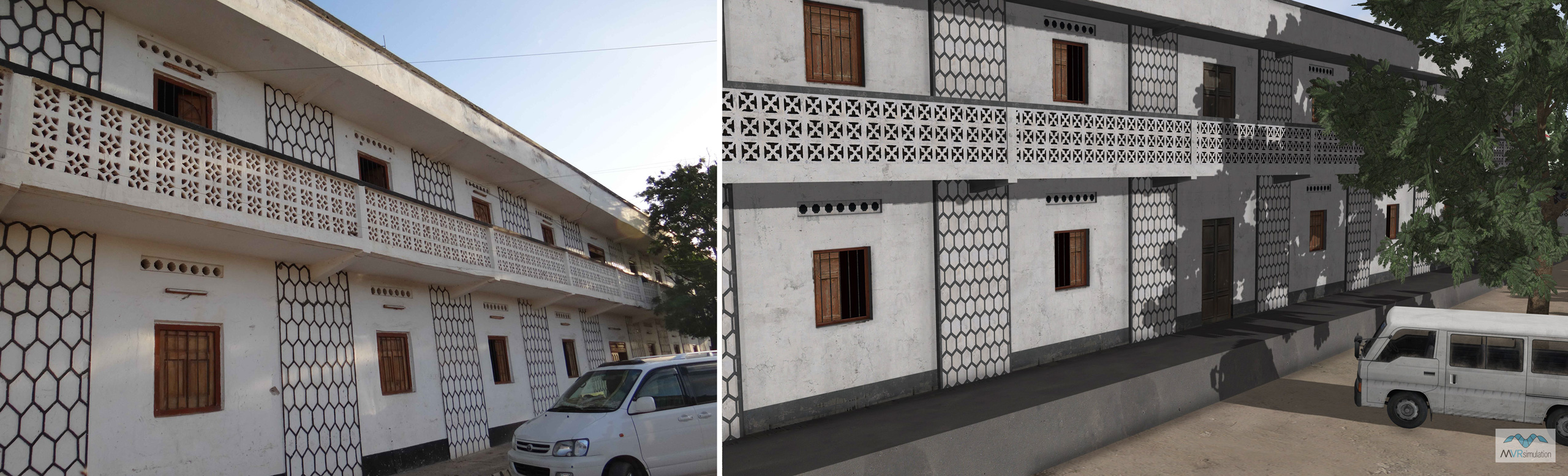
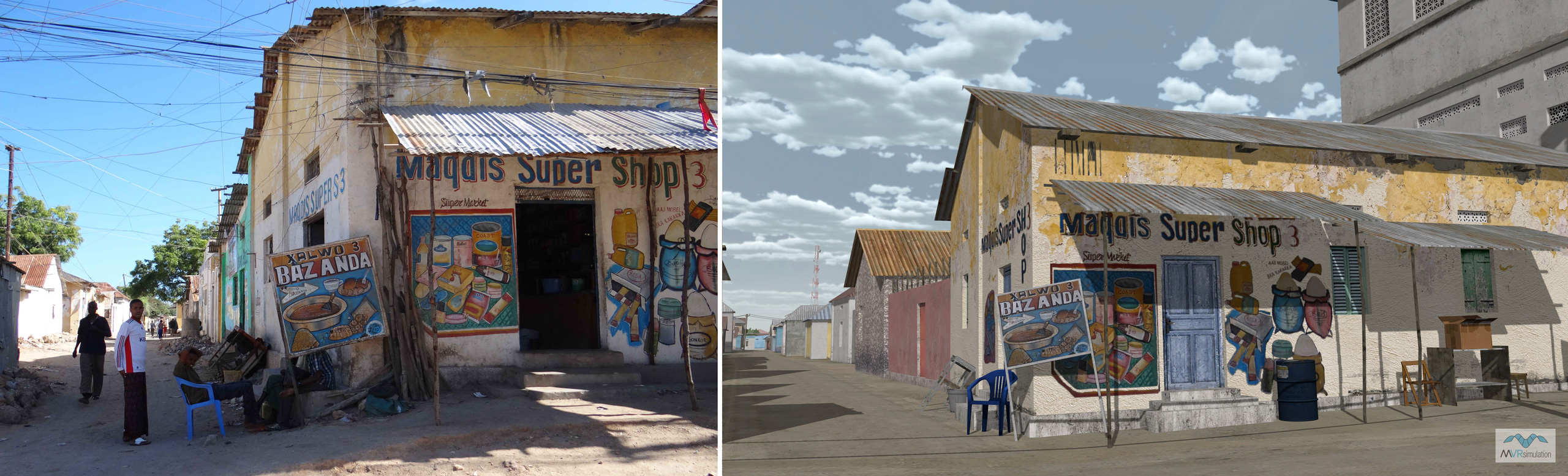
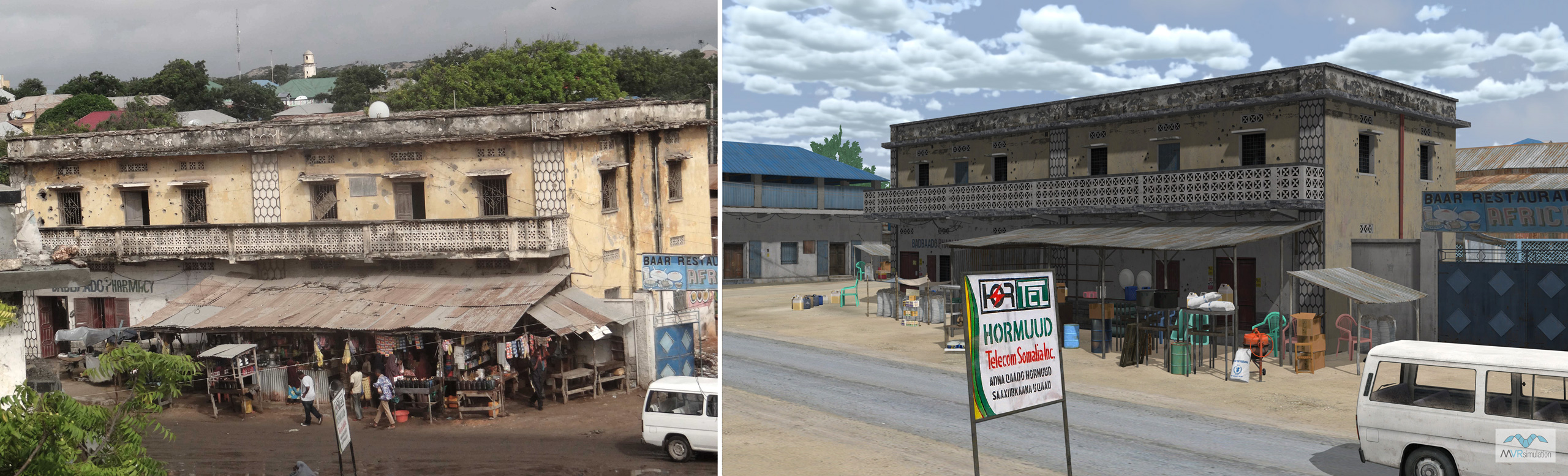
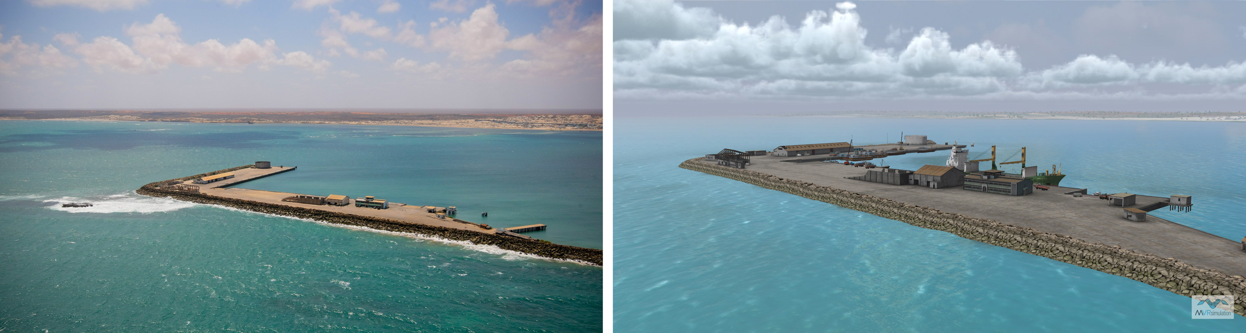
Actual and Simulated Images
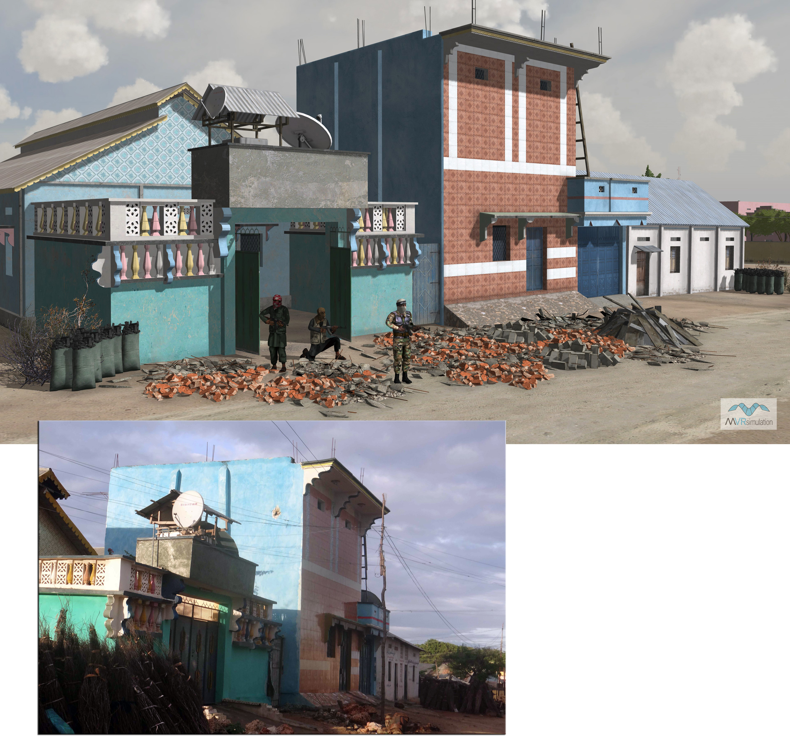
A standout feature of MVRsimulation's Kismayo terrain database is the side-by-side accuracy of the real and simulated visuals. MVRsimulation used actual ground-level photos taken throughout the city to build the geospecific and photospecific 3D models. By relying on real-world photos and GPS data, MVRsimulation ensures its virtual models not only resemble Kismayo's architectural style but are placed with geographic precision.
This geospecific realism is critical for military personnel to practice with terrain features they might encounter in actual deployments, thereby improving situational awareness and mission readiness. The following comparison images highlight the high-fidelity modeling of cultural features like buildings, huts, vehicles, and ports.
Photos of Kismayo, Somalia
VRSG screen captures of the same scene