Ft. Irwin NTC/ Tiefort City Terrain Database Information
- Imagery:
Bicycle Lake Army Airfield: 25cm
Tiefort City: 35cm
Fort Irwin: 50cm - Elevation: 30 mpp (NED) and 90 mpp (DTED1) elevation data
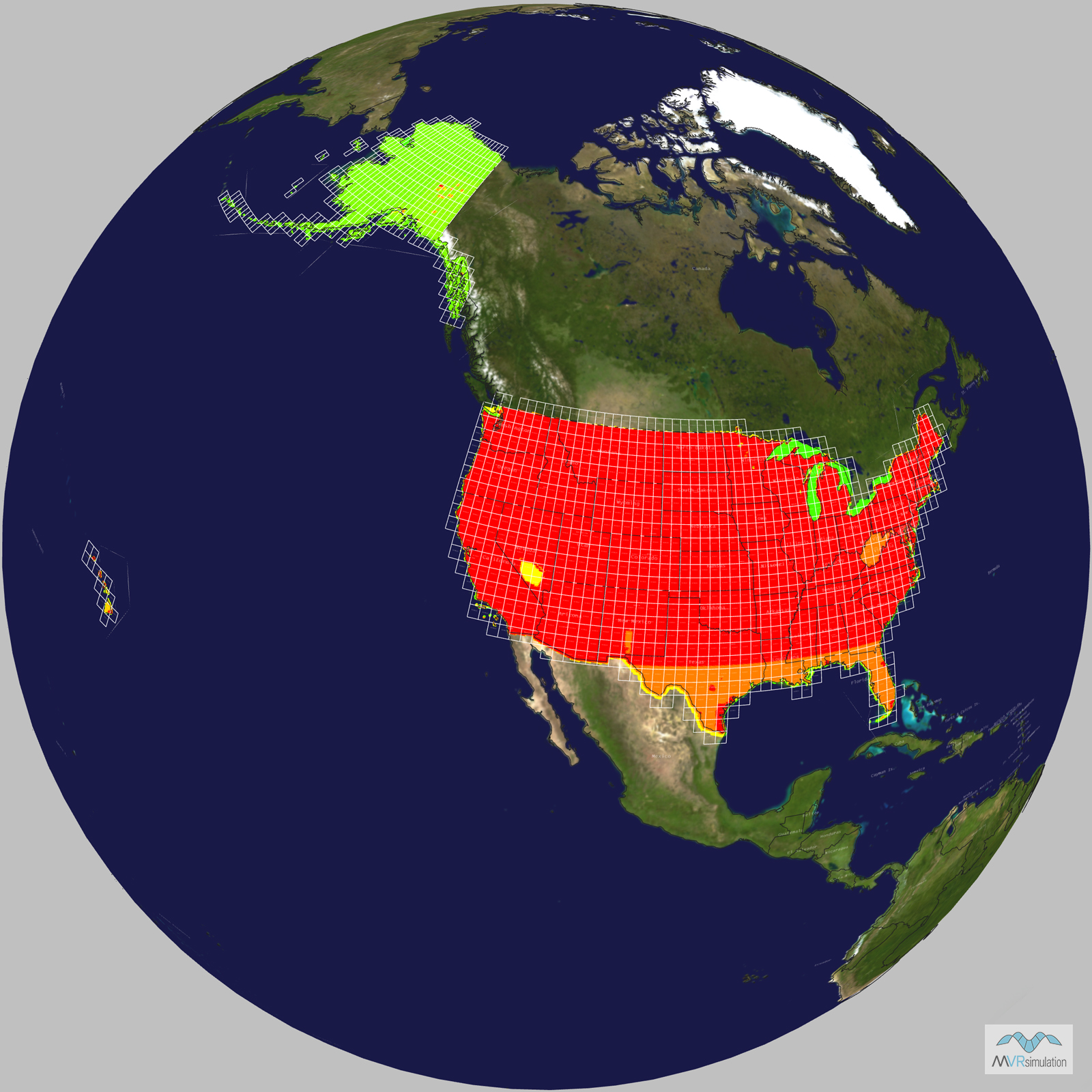
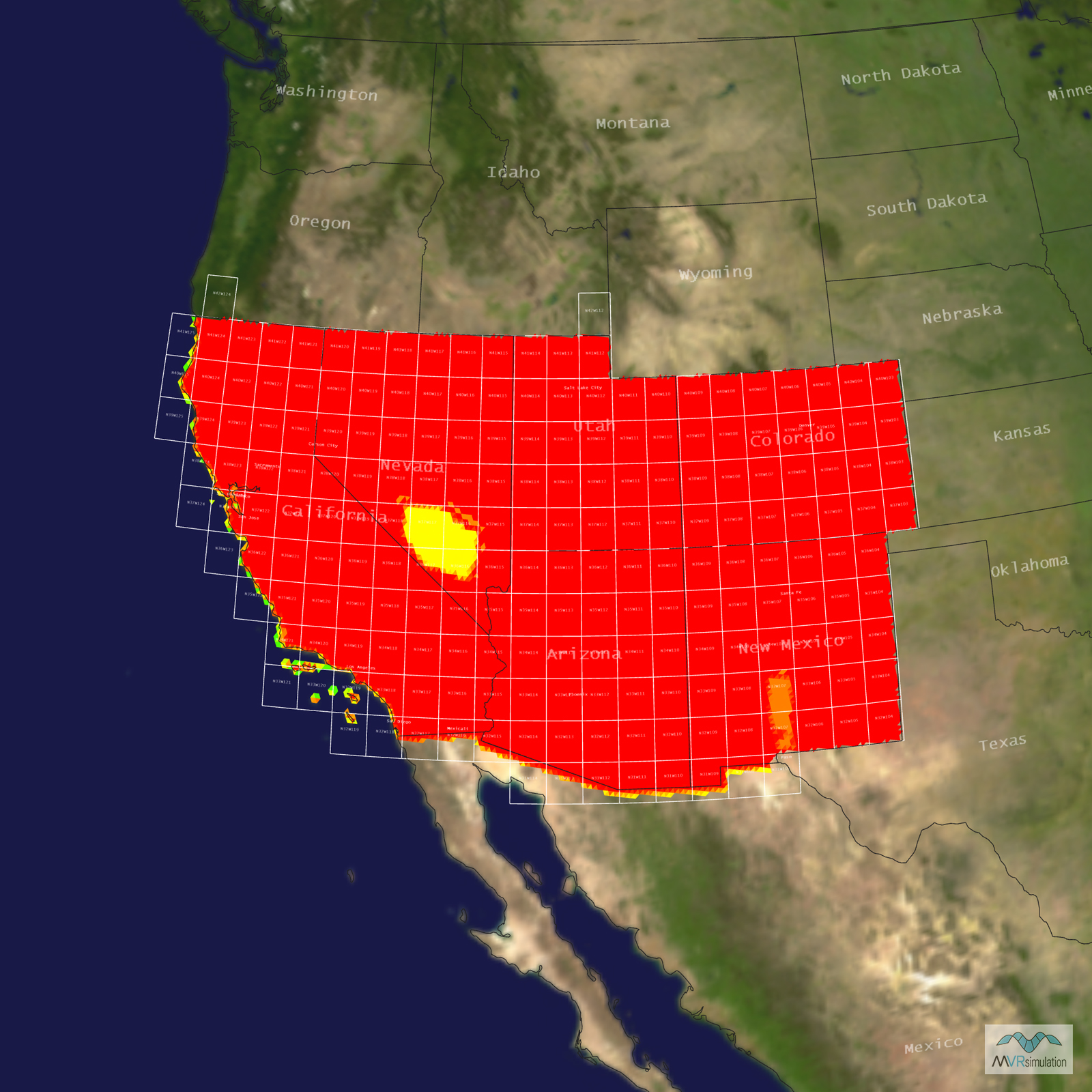
- Terrain Drive: CONUS Southwest
- Cultural Features: Building Interiors, CityEngine/Geotypical Buildings, Custom Models (Geospecific Buildings), Fences or Walls, Landscape Features (Shrubs, Grass, Paved Medians, etc.), Lighting for Non-Runway Areas (Streetlights), Military Specific Elements (Shelters, Bunkers, Watchtowers, etc.), Roads, Runway Lights, Signs, Trees, Urban Furniture (Benches, Trash Bins, etc), Utilities (Poles, Powerlines or Transmission Lines)
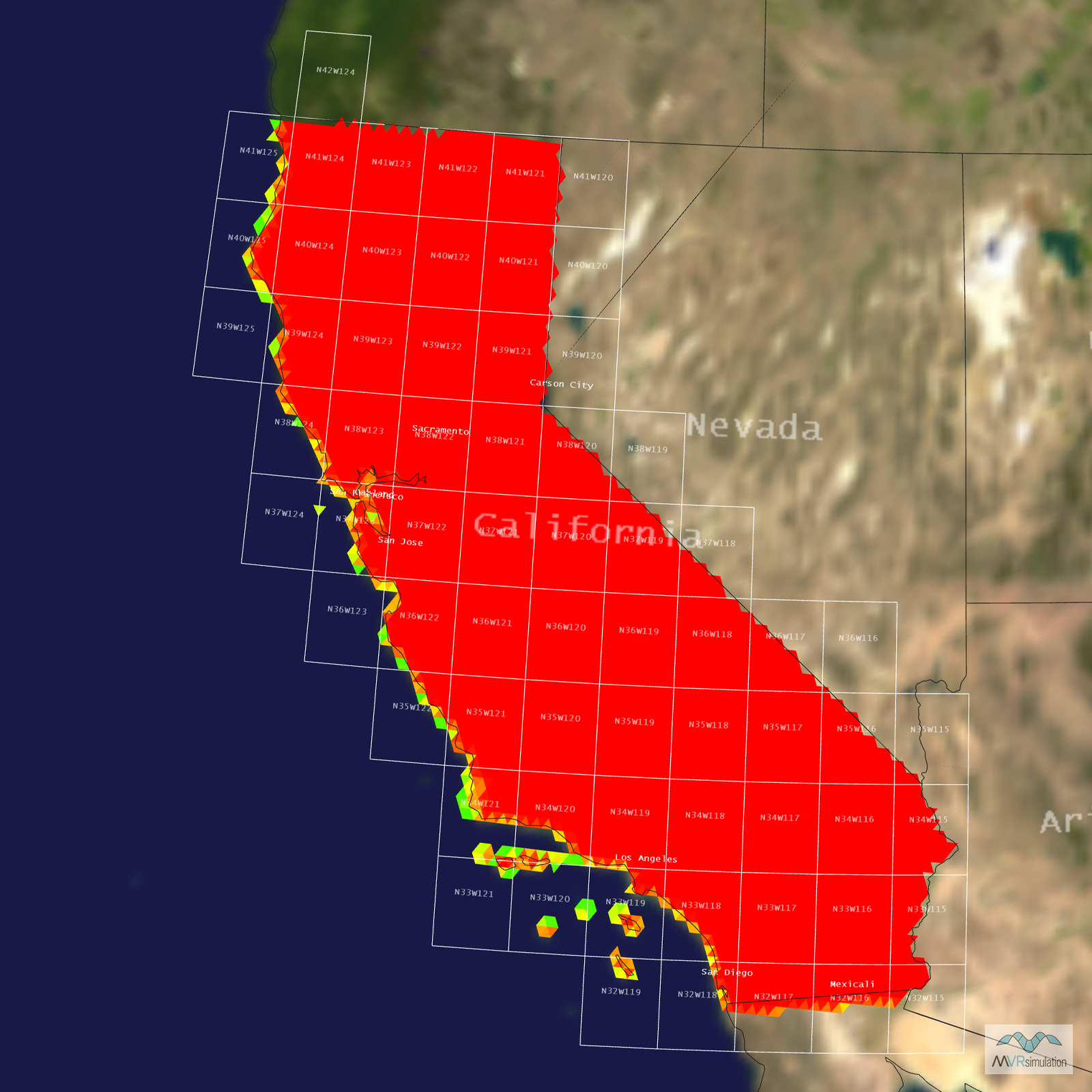
Tile Coverage Map
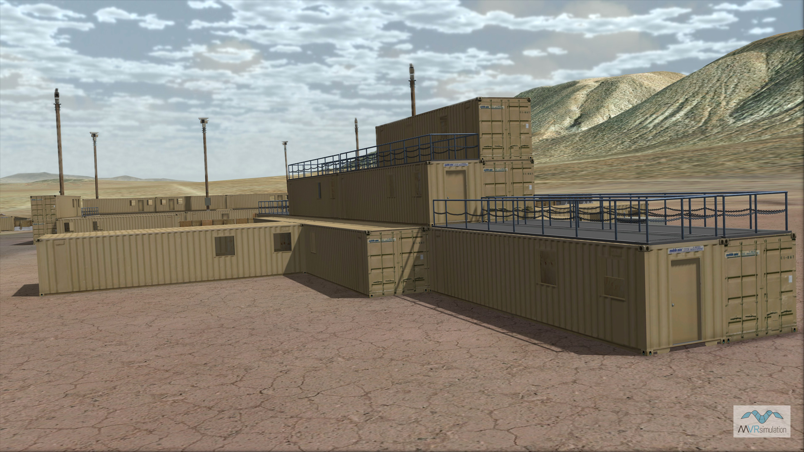
MVRsimulation VRSG real-time scene of multi-level Tiefort City structure on the virtual Ft. Irwin / NTC terrain.
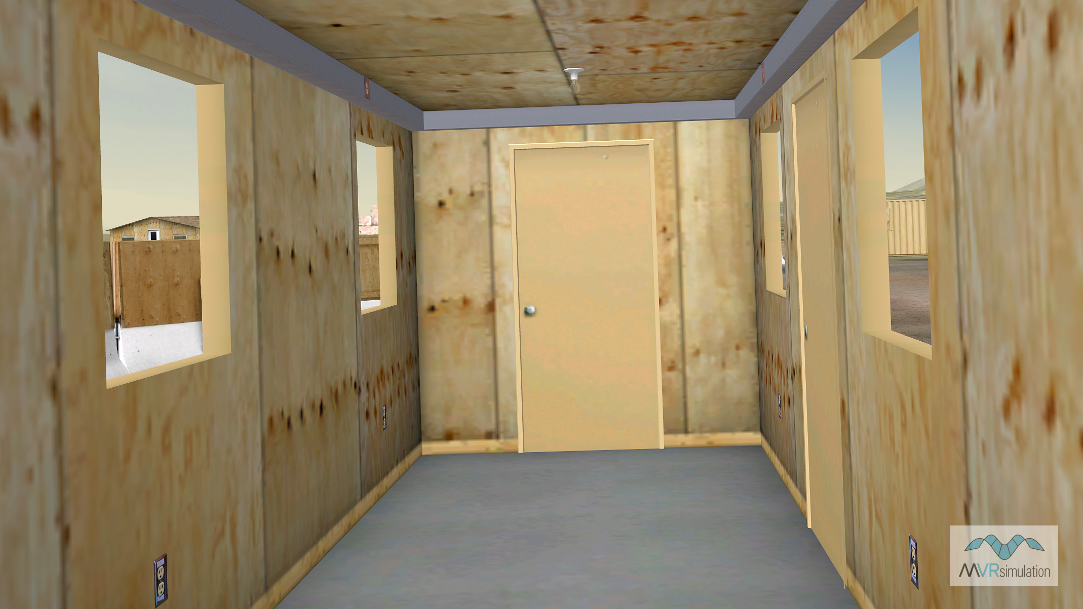
3D modeled interiors of the geospecific buildings to support urban operations training.
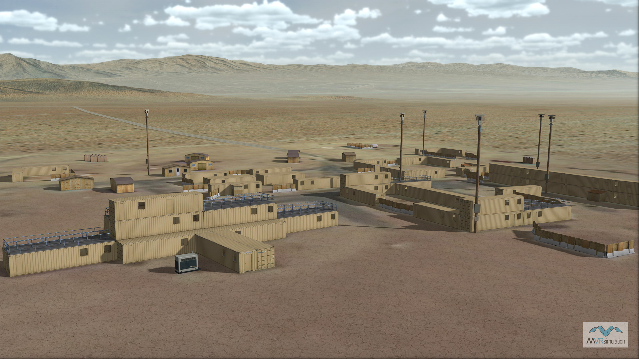
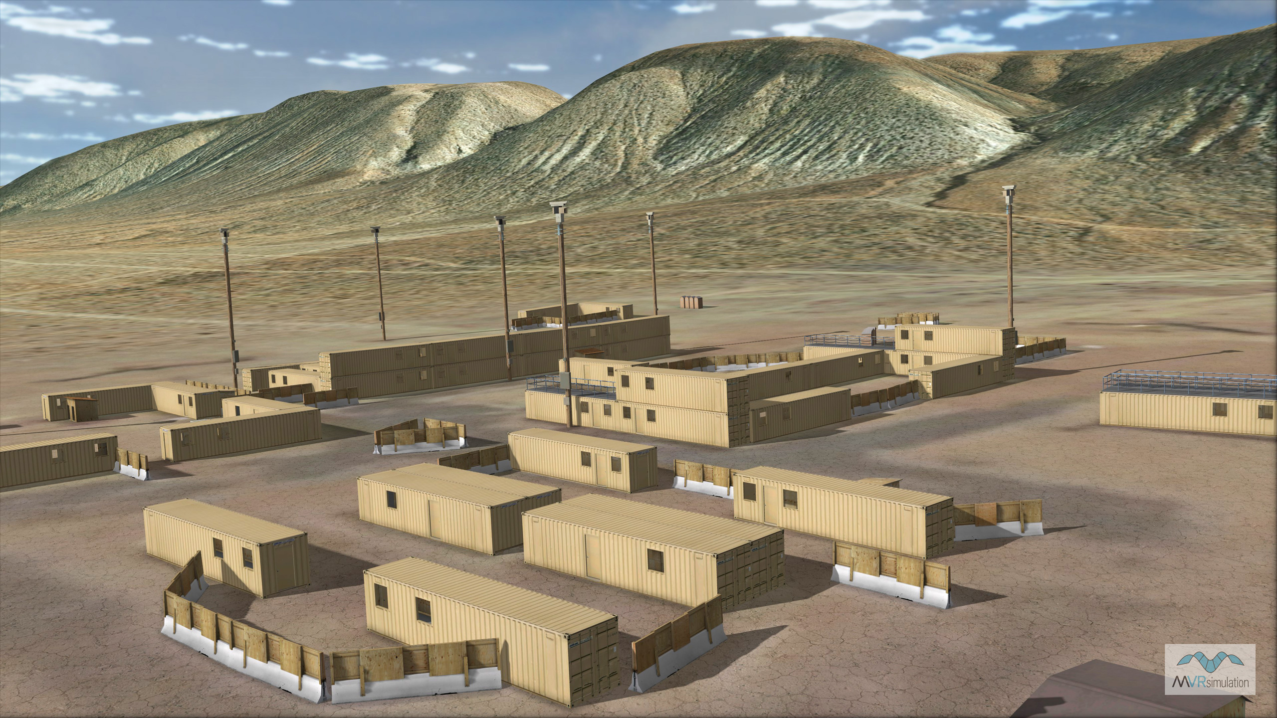
MVRsimulation VRSG real-time overview of the Tiefort City MOUT site on the virtual Ft. Irwin / NTC terrain.
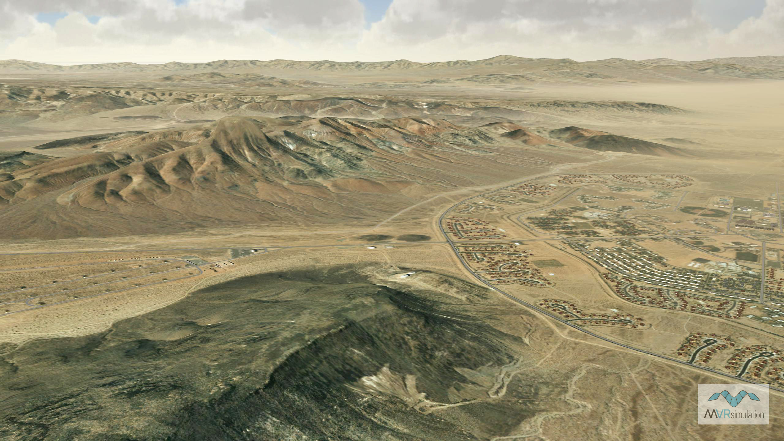
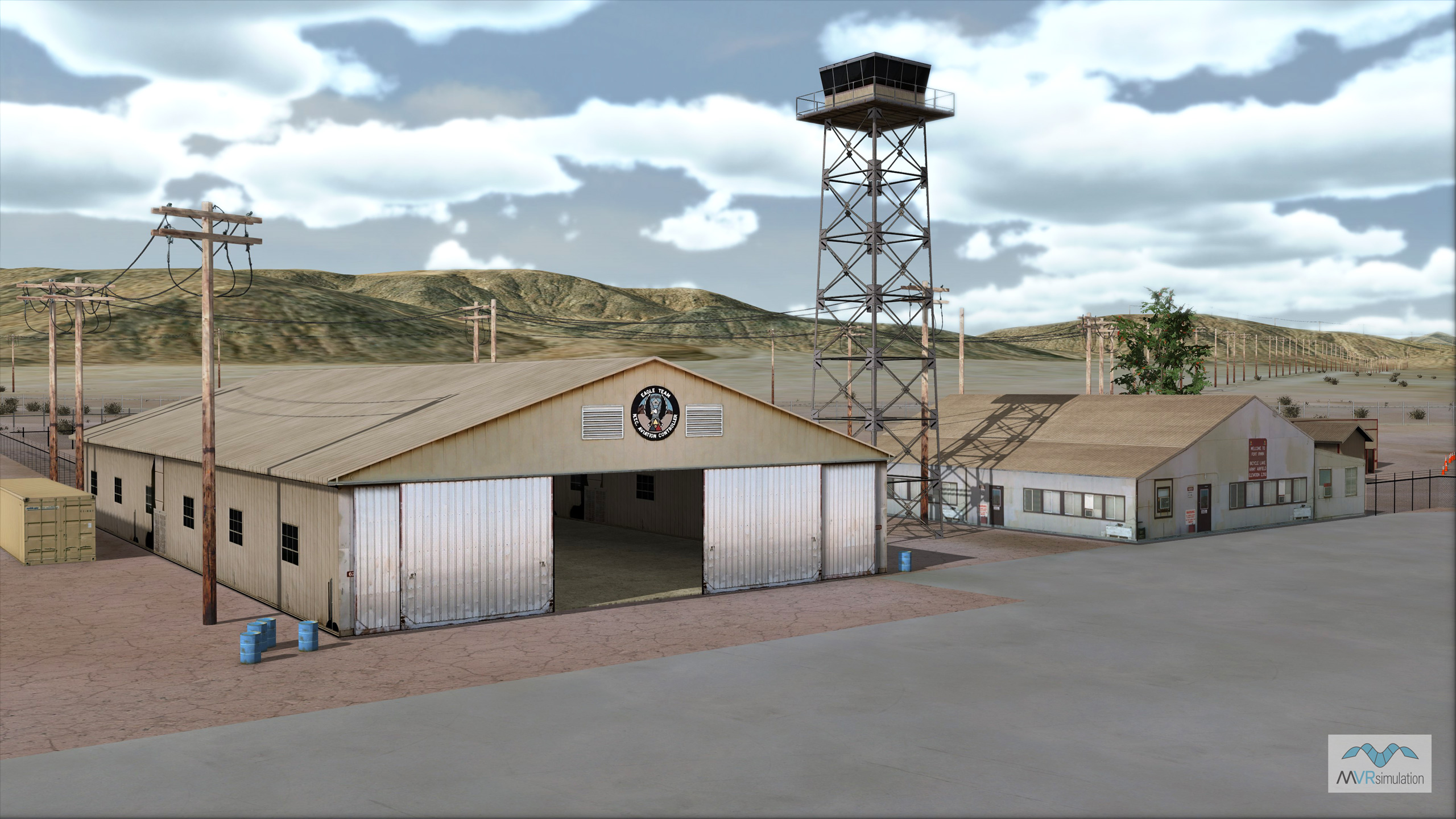
MVRsimulation VRSG real-time scene of the Bicycle Lake area of the virtual Ft. Irwin / NTC terrain.
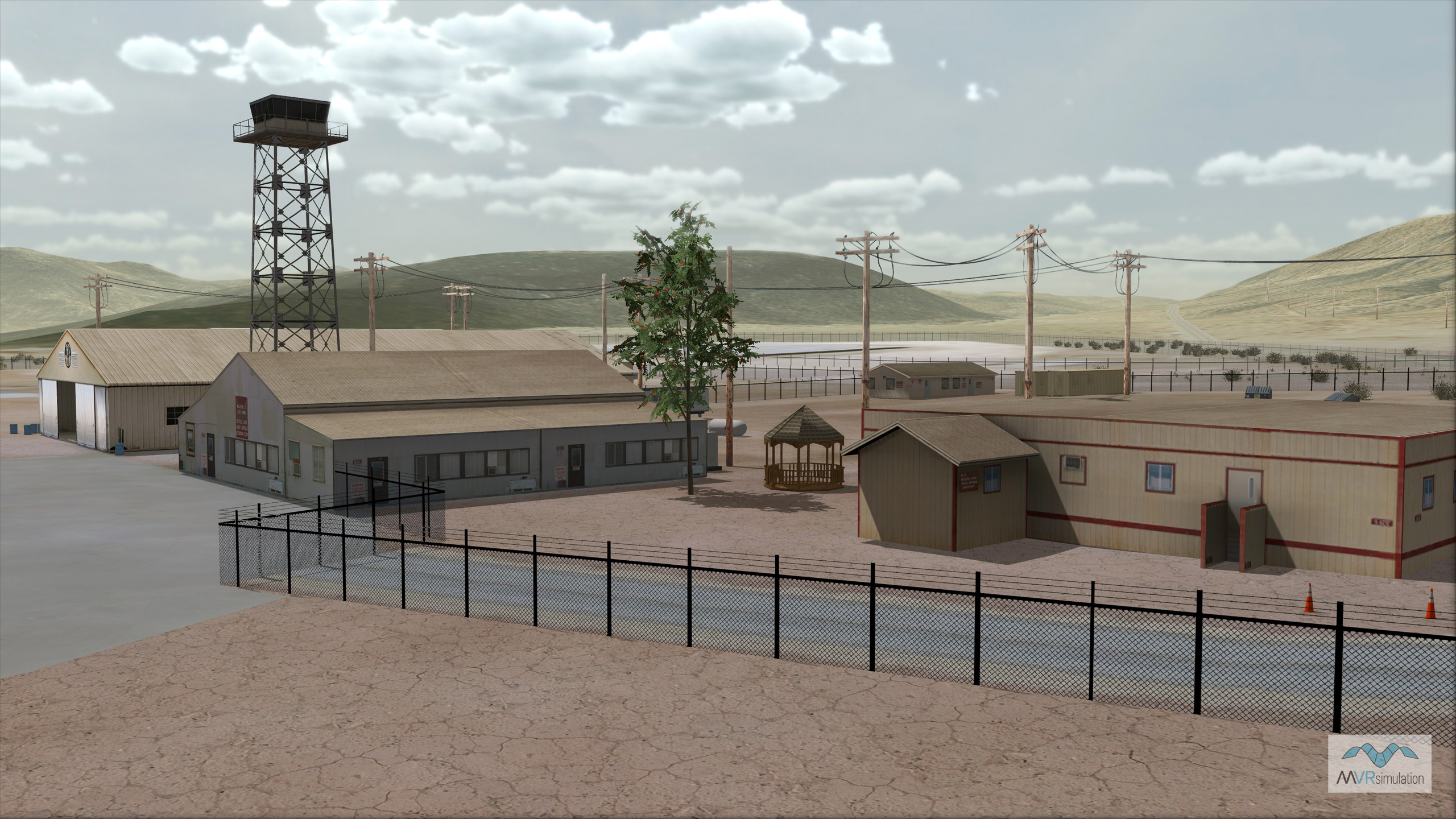
MVRsimulation VRSG real-time scene of the Bicycle Lake area of the virtual Ft. Irwin / NTC terrain.
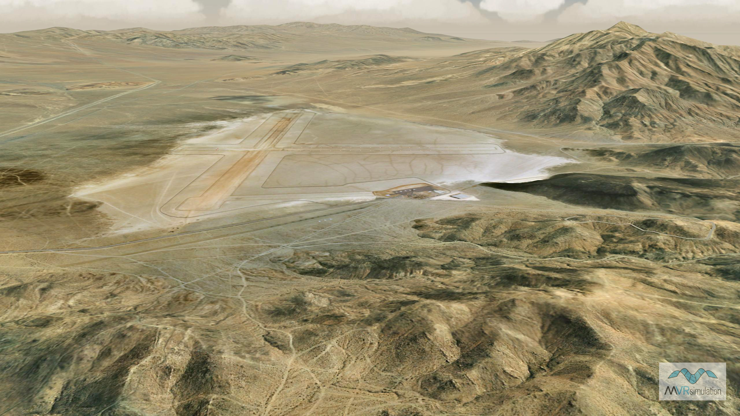
MVRsimulation VRSG real-time scene of the Bicycle Lake area of the virtual Ft. Irwin / NTC terrain.
High-Fidelity NTC for Army Readiness
MVRsimulation has developed an enhanced virtual National Training Center (NTC) terrain for use with VRSG. This database, built with MVRsimulation's Terrain Tools for ArcGIS® Pro, features key areas like the Bicycle Lake Army Airfield and the Tiefort City Mobile Military Operations in Urban Terrain (MOUT) site. The NTC at Ft. Irwin, CA, is central to U.S. armed ground forces' live fire and maneuver training. MVRsimulation's virtual Ft. Irwin terrain database provides essential simulator-based training. This enables critical training repetition and allows soldiers to continue mission rehearsals even when the physical MOUT environment is unavailable, ensuring sustained readiness before live rotations.
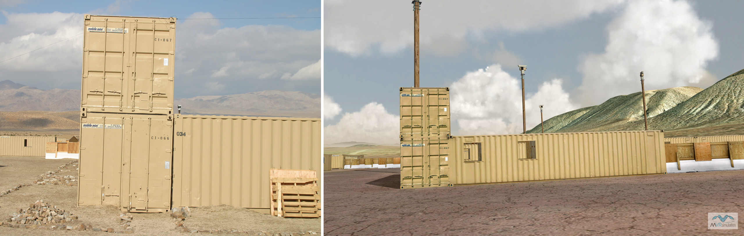
A significant highlight is the meticulously replicated Tiefort City MOUT site, NTC's largest urban training ground, designed for desert and urban combat preparation. Composed of reconfigurable, modular plywood structures that mimic shipping containers, this site supports realistic scenarios such as ambushes and house-to-house searches. MVRsimulation's virtual Tiefort City accurately captures these details with custom-created models based on real-world photographs, featuring articulated doors and other authentic cultural elements ensuring highly realistic and immersive pre-deployment training.
The comparison images below are of a photograph of an actual mobile MOUT unit on the left and a VRSG screenshot with the MVRsimulation model of the unit on the right.