Fort Huachuca Terrain Database Information
- Imagery:
Black Tower training center: 25cm
Ft. Huachuca: 30cm - Elevation: NED 10 with Lidar data used for the airfield
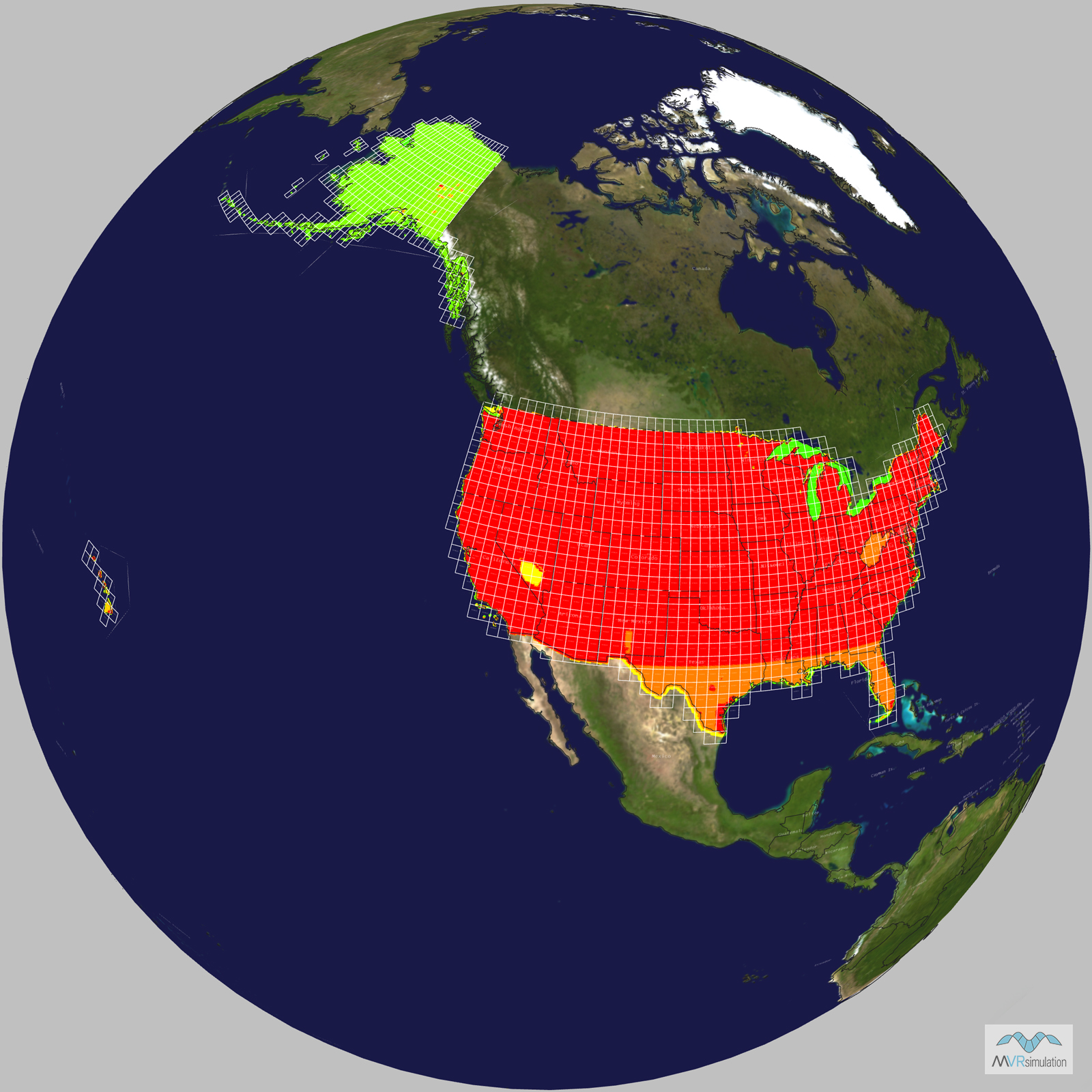
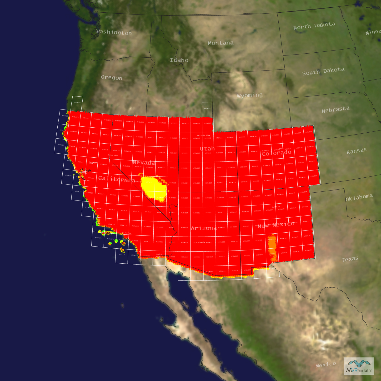
- Terrain Drive: CONUS Southwest
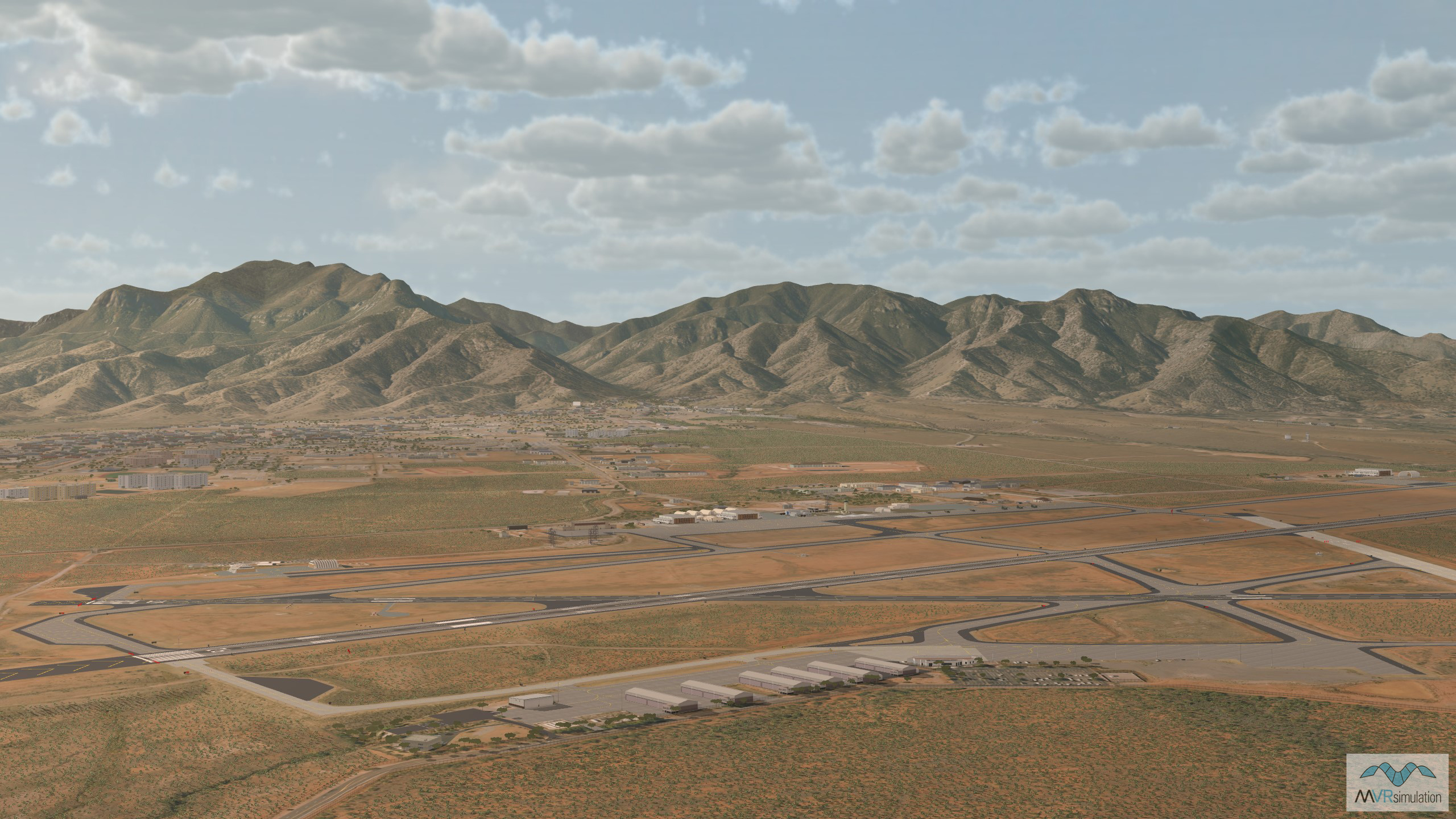
- Detailed model of Sierra Vista Airport/Libby Army Airfield (KFHU), and the surrounding area of Sierra Vista, Arizona
- Pioneer & Rugge-Hamilton UAS Runways
- Fort Huachuca is home to the U.S. Army Intelligence Center of Excellence and Black Tower military training facility.
- Cultural Features: CityEngine/Geotypical Buildings, Control Tower, Custom Models (Geospecific Buildings), Fences or Walls, Hangars, Landscape Features (Shrubs, Grass, Paved Medians, etc.), Light Poles, Lighting for Non-Runway Areas (Streetlights), Navigation Aids, Roads, Runway, Runway Lights, Signs, Taxiways and Associated Markings, Trees, Utilities (Poles, Powerlines or Transmission Lines)
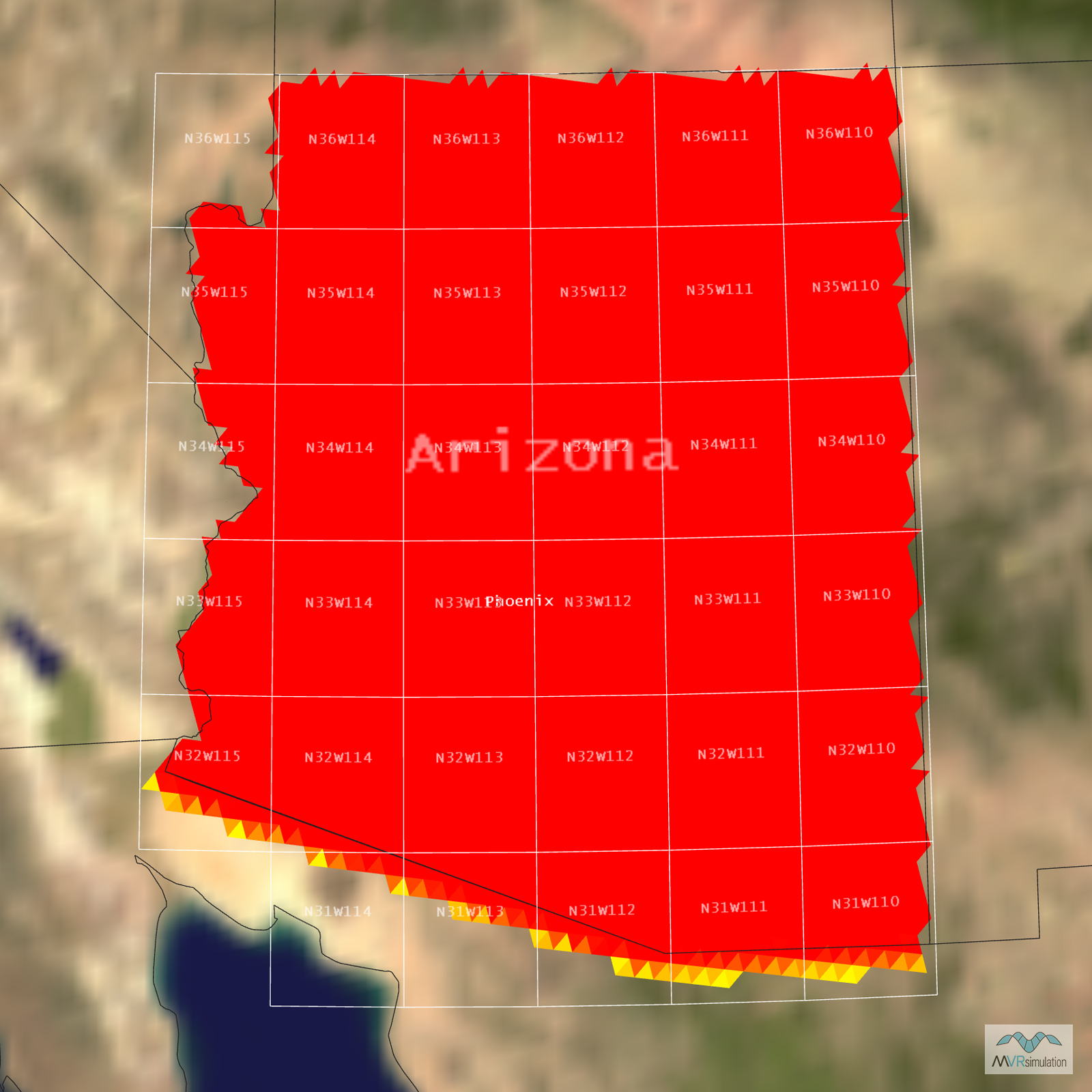
Tile Coverage Map
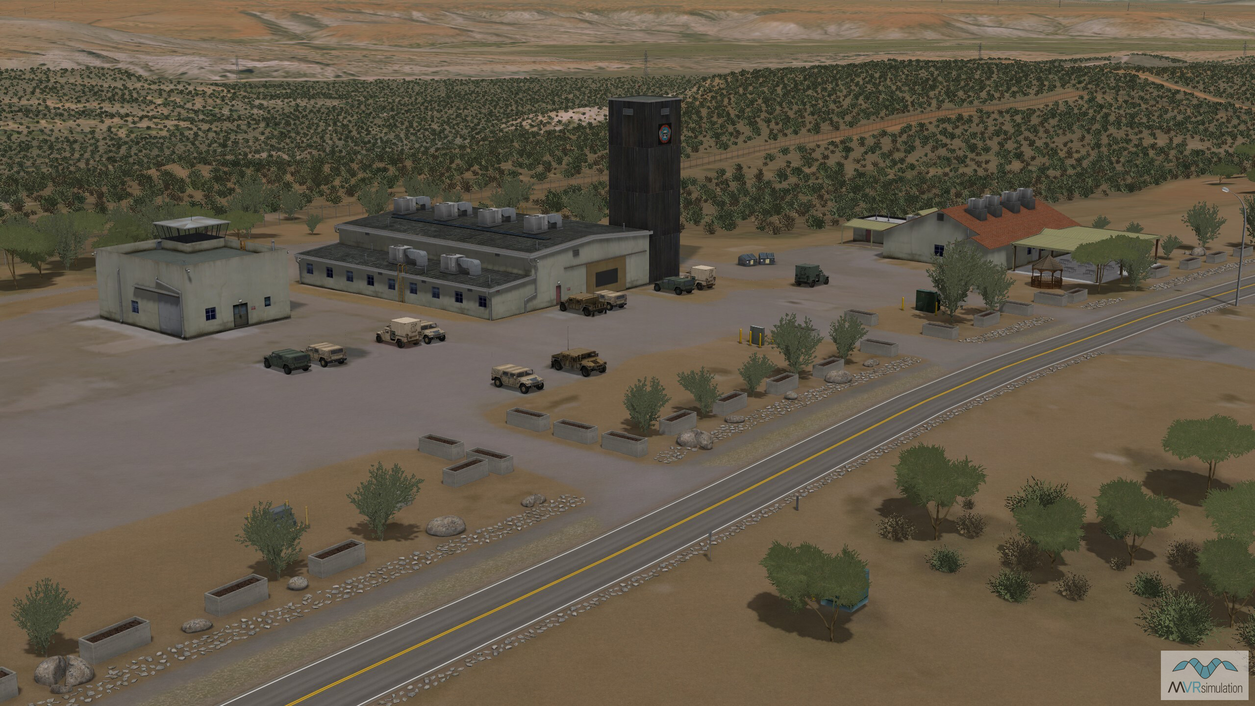
The Ft. Huachuca Black Tower complex is used for training, testing and evaluating unmanned aerial systems (UAS).
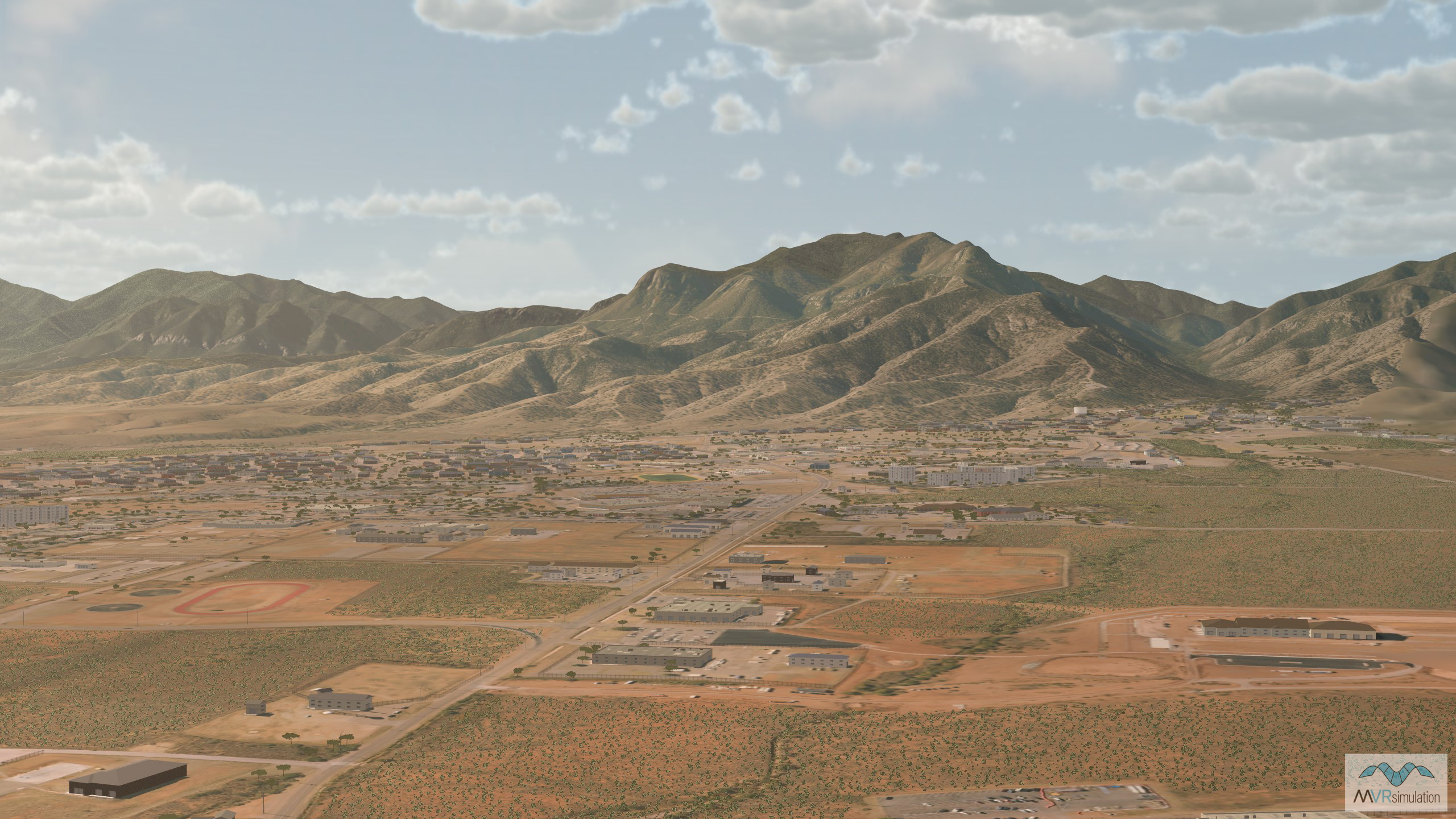
VRSG's Fort Huachuca terrain database, a U.S. Army installation located in the southeastern Arizona desert.
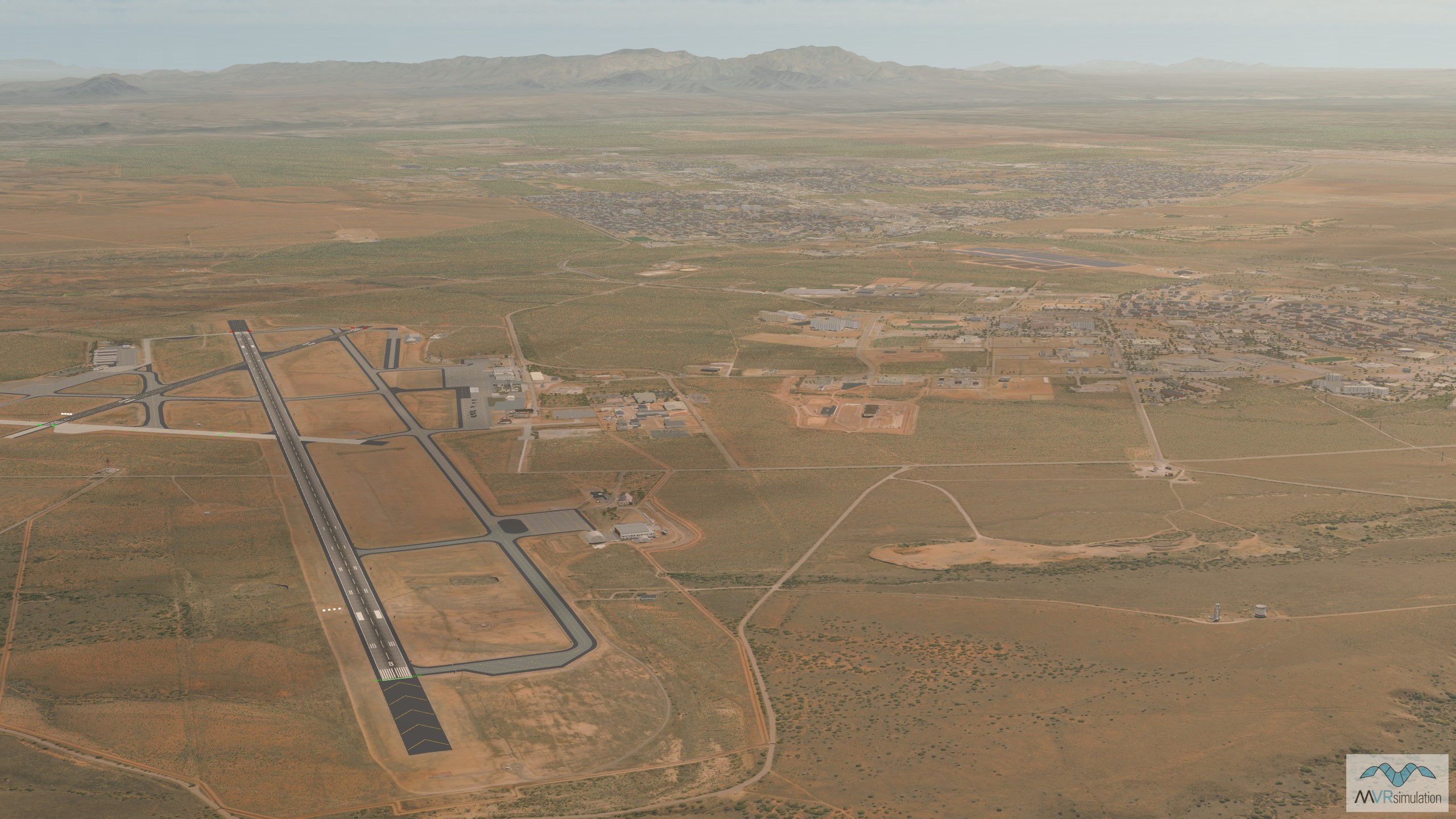
VRSG's 3D terrain model of Libby Army Airfield (KFHU) and the surrounding area of Sierra Vista, Arizona.
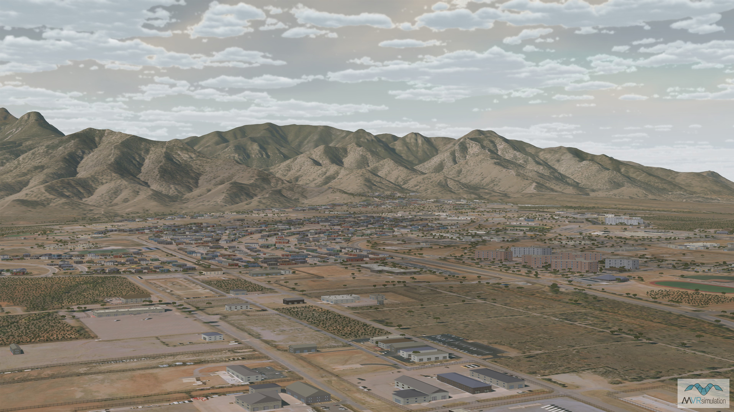
VRSG's Fort Huachuca terrain with view of the surrounding area of Sierra Vista, Arizona.
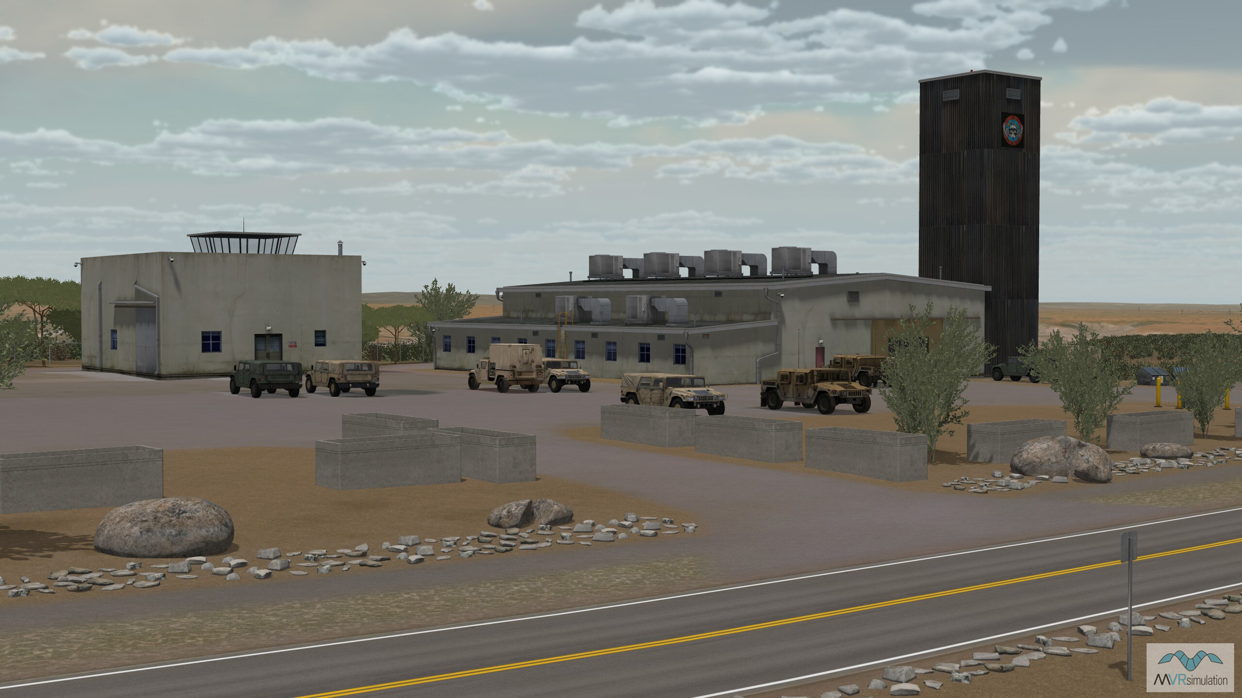
VRSG's Ft. Huachuca terrain database with geospecific model of the Black Tower training center with
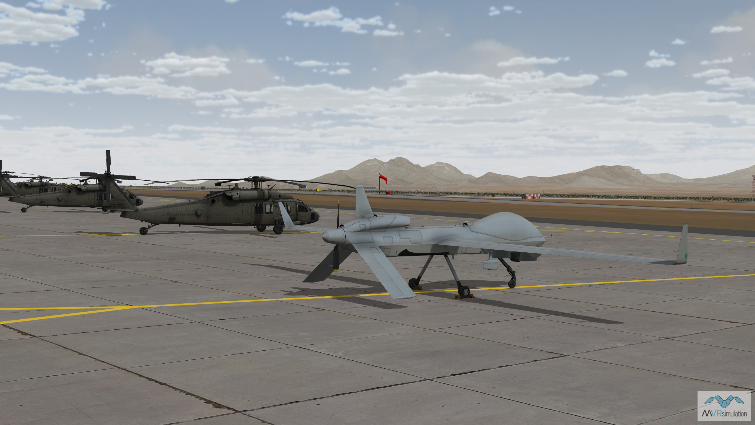
MVRsimulation's MQ-1C Gray Eagle model from the extensive VRSG 3D Model Library sitting on the tarmac in the Ft. Huachuca terrain.
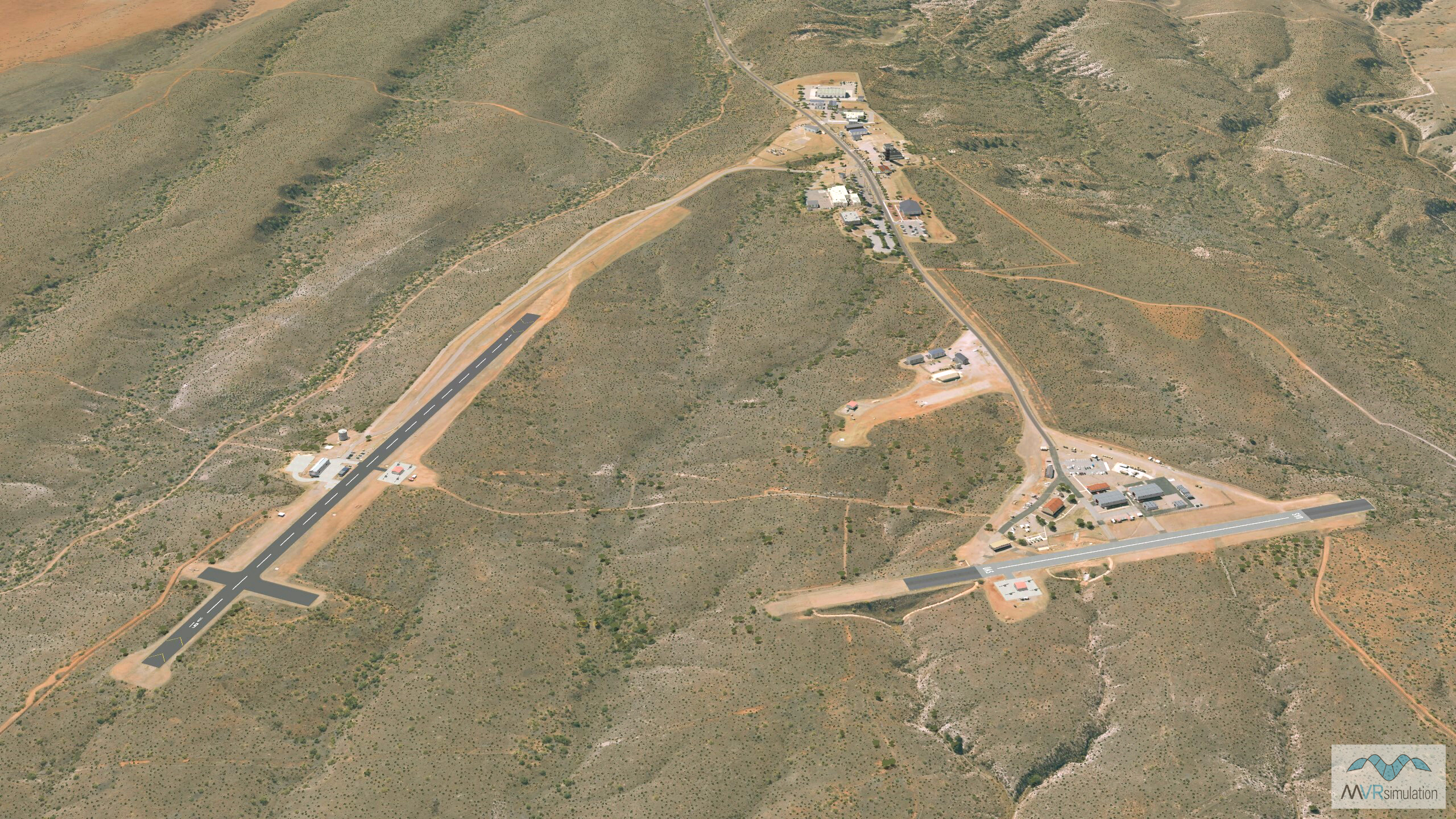
Pioneer & Rugge-Hamilton UAS Runways located at the Black Tower Complex at Fort Huachuca, Arizona.