
Aberdeen Proving Ground MOUT Site Terrain Database Information
- Imagery: 15cm
- Elevation: Ned 10m
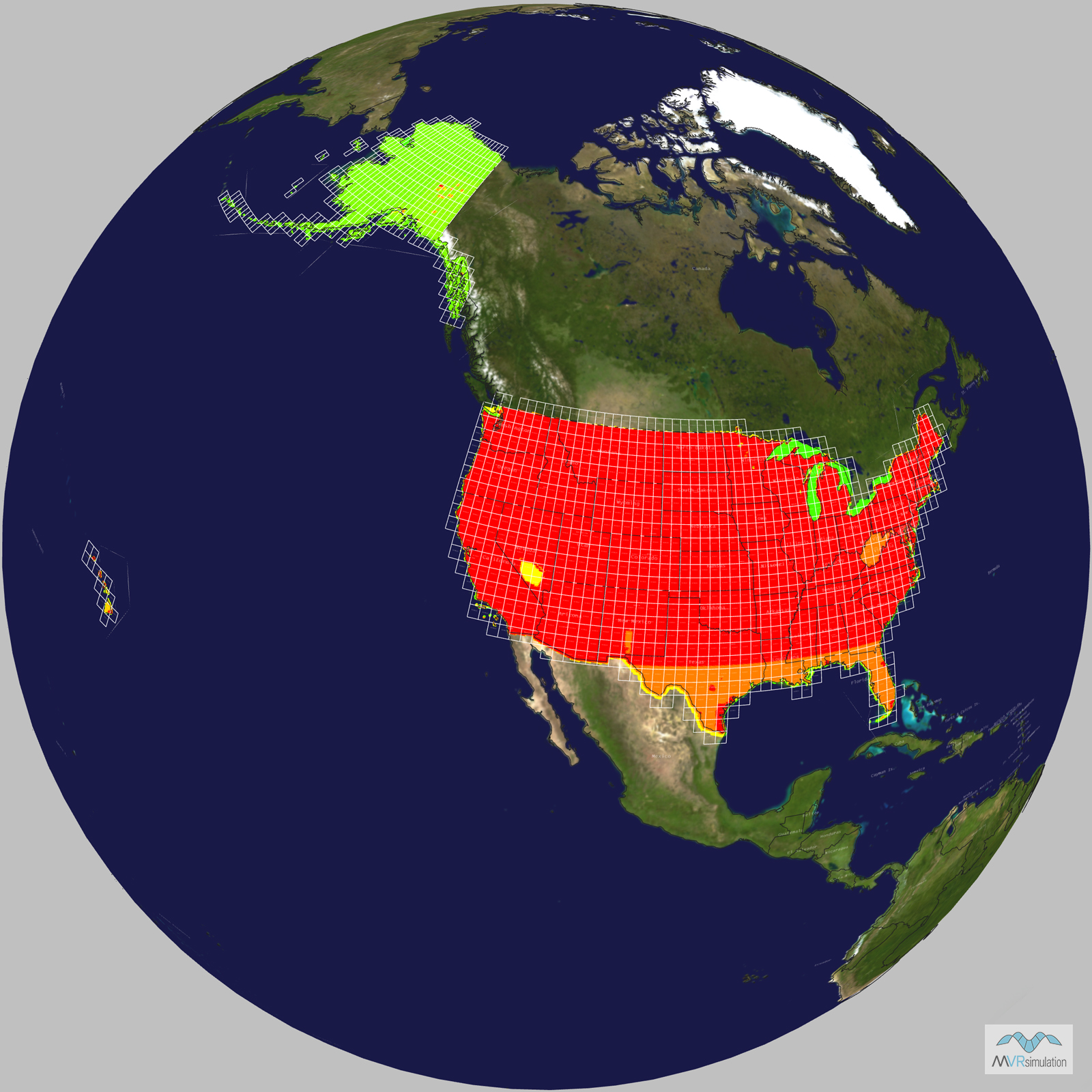
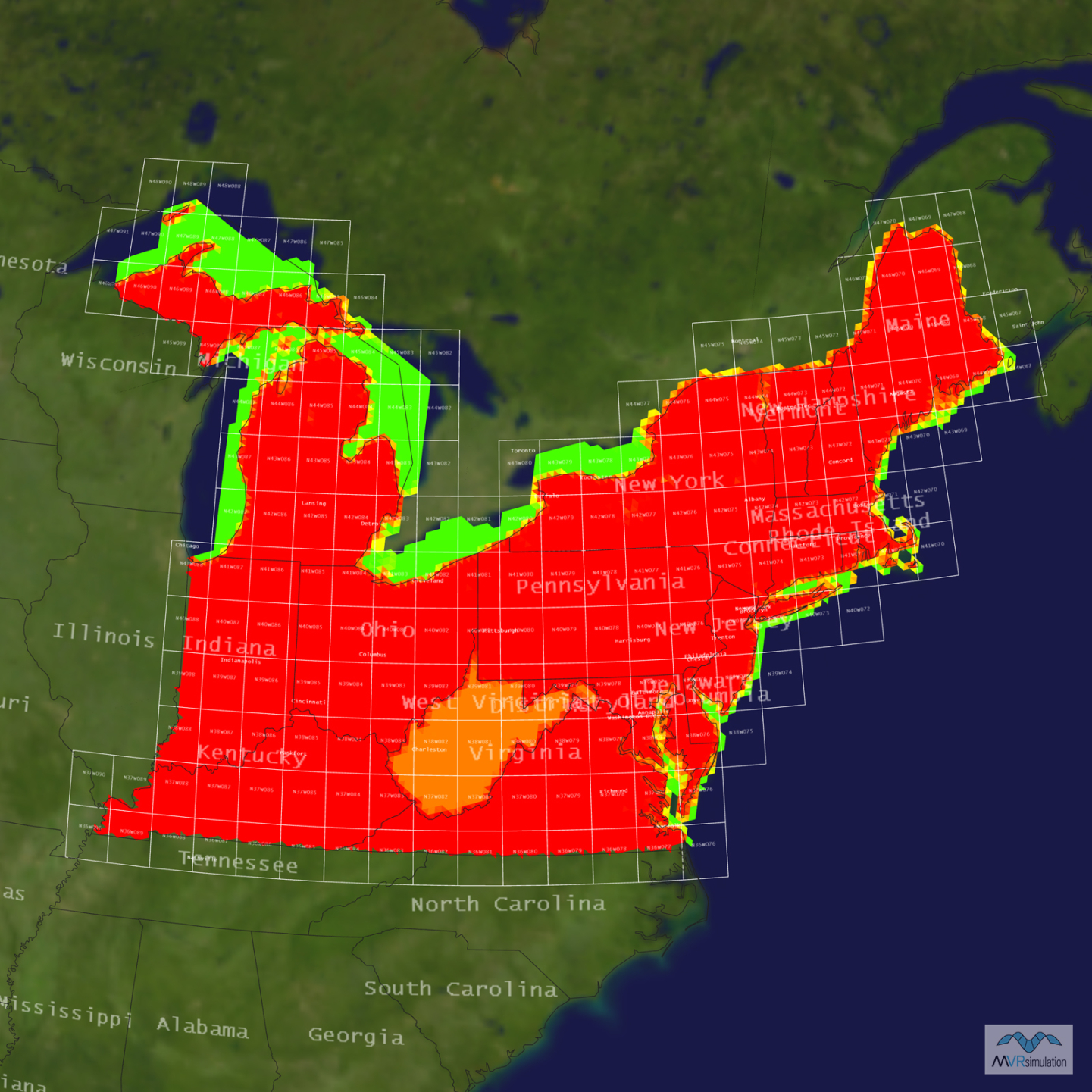
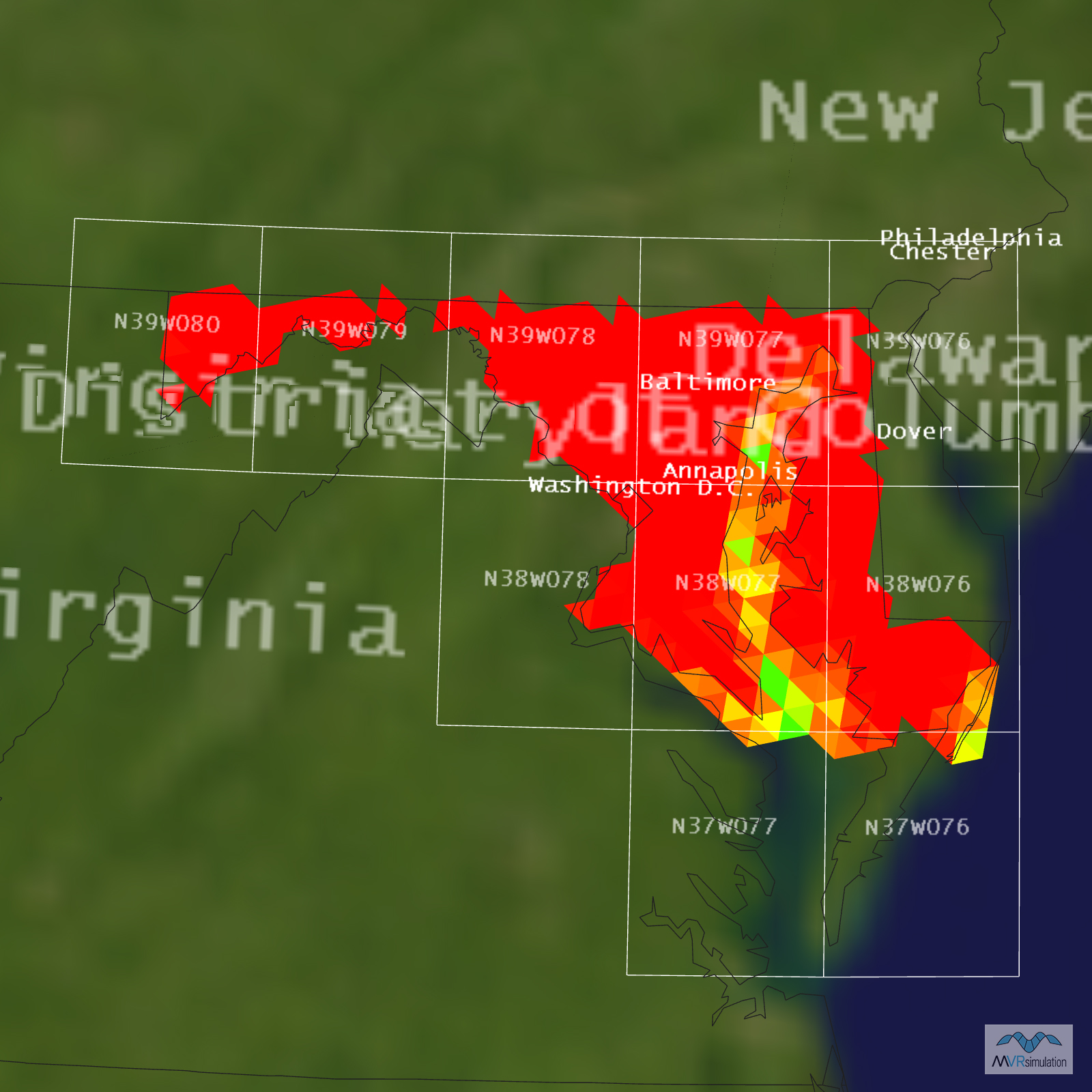
- Terrain Drive: CONUS Northeast
- Cultural Features: Building Interiors, Custom Models (Geospecific Buildings), Fences or Walls, Light Poles, Lighting for Non-Runway Areas (Streetlights), Trees, Utilities (Poles, Powerlines or Transmission Lines), Water Features (Lakes, Rivers, etc)
Tile Coverage Map
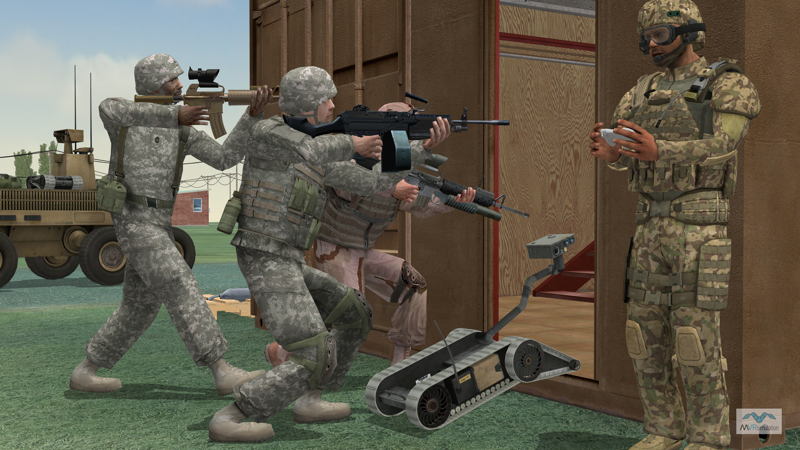
MVRsimulation VRSG real-time scene featuring soldiers and an SUGV at the entrance of a structure on the virtual ATC Mulberry Point MOUT site at Aberdeen Proving Ground.
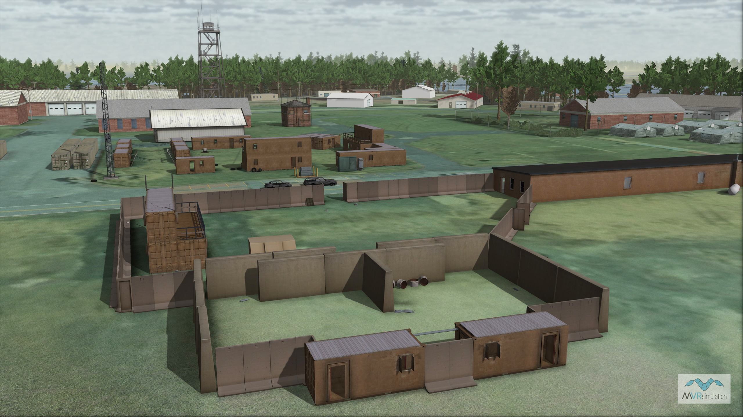
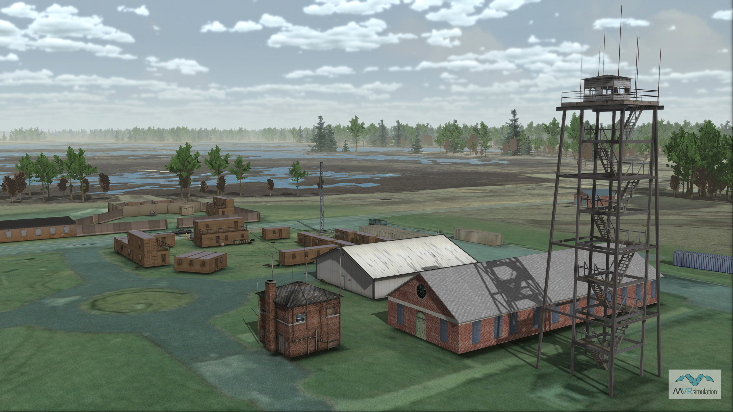
MVRsimulation VRSG real-time scene of the 3D replica of the Mulberry Point MOUT site on the Aberdeen Test Center (ATC) terrain.
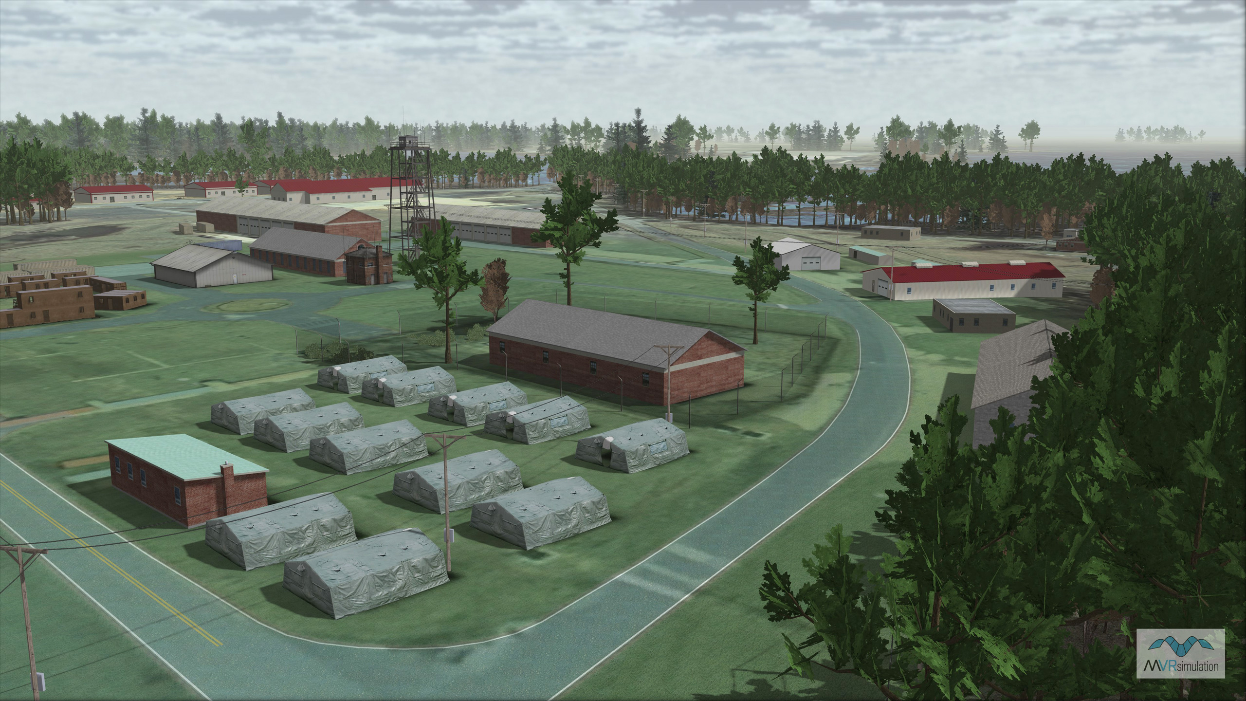
MVRsimulation VRSG real-time scene of the 3D replica of the Mulberry Point MOUT site on the Aberdeen Test Center (ATC) terrain.
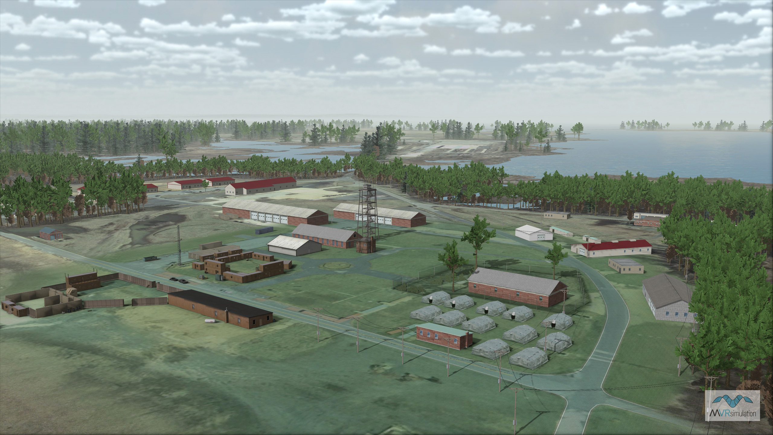
MVRsimulation VRSG real-time aerial view of the virtual ATC Mulberry Point MOUT site at Aberdeen Proving Ground.
Mission Readiness Through Realistic Simulation
MVRsimulation offers a geospecific, high-resolution virtual training environment of the Aberdeen Proving Ground (APG) in Harford County, Maryland. This 350 sq km terrain focuses on the Mulberry Point MOUT site at the Aberdeen Test Center (ATC), a diverse Department of Defense test site. Our virtual replica mirrors the real-world Soldier Systems Test Facility, enabling warfighters to conduct realistic mission rehearsal and test a broad spectrum of military systems in a highly accurate urban setting. This makes it an ideal environment for complex simulations, such as prototyping the interaction of small unmanned ground vehicles with infantry.
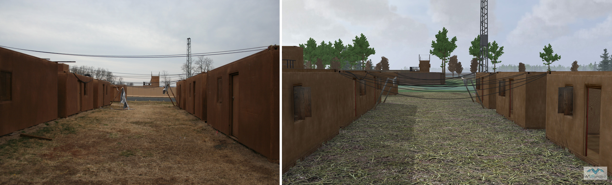
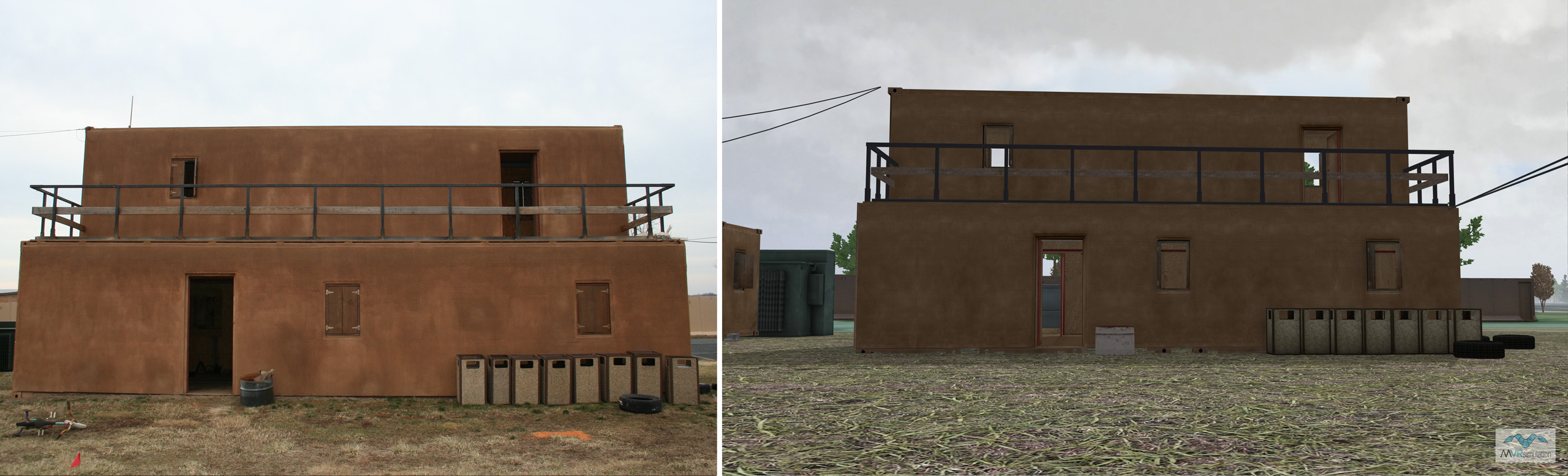
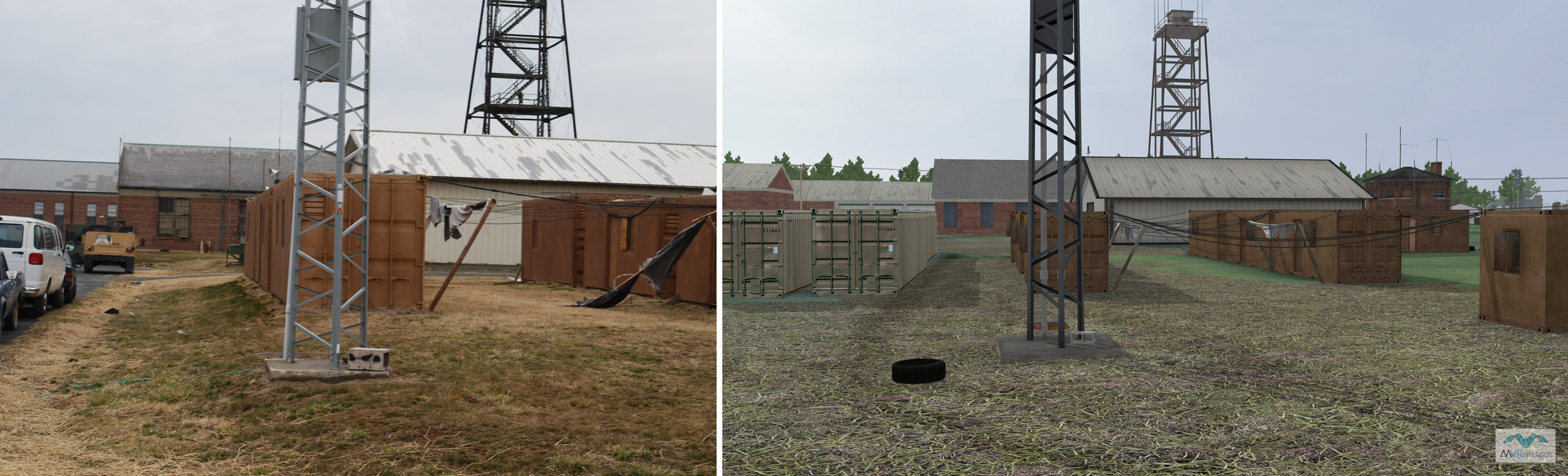
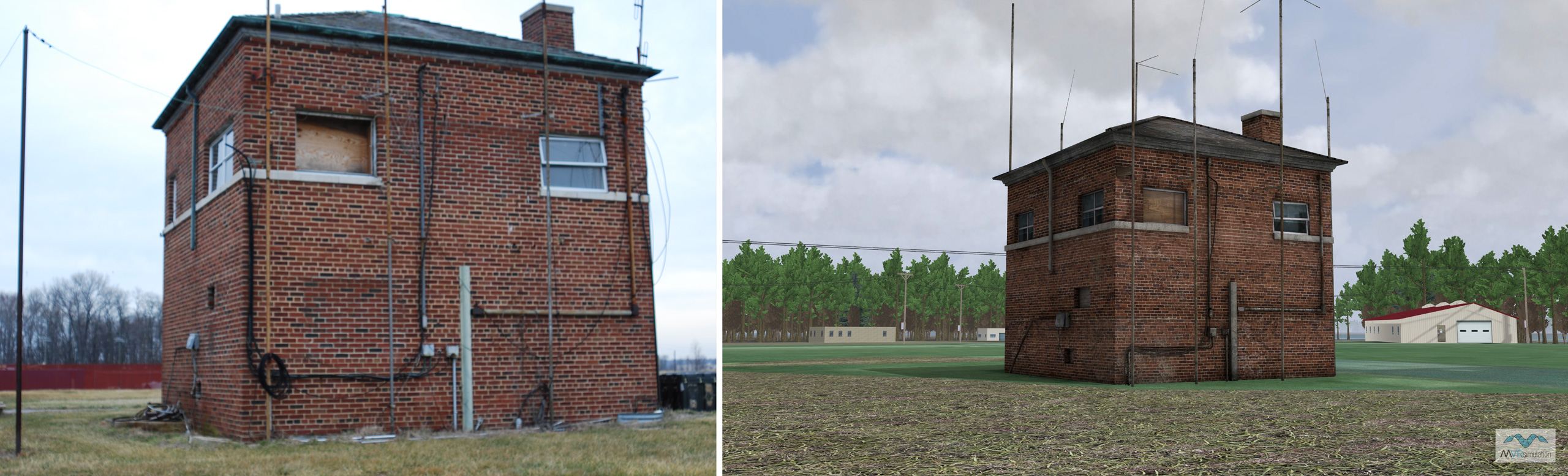
The round-earth VRSG terrain was constructed from 0.15 mpp source imagery and 8-meter post elevation data, extending to include nearby cultural sites like BWI Thurgood Marshall and Martin State airports. The virtual MOUT site features over 20 site-specific structures, meticulously built using industry-standard modeling tools. To achieve unparalleled realism, these models were created with textures from high-resolution, ground-level photographs taken on location. All MOUT buildings contain fully modeled interiors with articulated doors and windows for immersive close-quarters training.
The environment is densely populated with trees, power lines, fences, and other cultural details that match the real-world site. The terrain’s high-resolution coastline on the Chesapeake Bay transitions seamlessly to VRSG’s animated, multi-textured water for comprehensive land and littoral operations. All custom 3D models used in this database were placed with Scenario Editor and are available in MVRsimulation's 3D model libraries.
Photos of the Aberdeen Proving Ground MOUT Site
VRSG screen captures of the same scene