Washington D.C. Terrain Database Information
- Imagery: 1m
- Elevation: NED 10m
- Terrain Drive: CONUS Northeast
- Key Landmarks: the White House, Capitol Building, Lincoln and Washington Memorials
- Includes the Potomac River with 3D water textures.
- Cultural Features: Cultural Landmarks (Statues and Monuments), Custom Models (Geospecific Buildings), Roads, Trees, Water Features (Lakes, Rivers, etc)
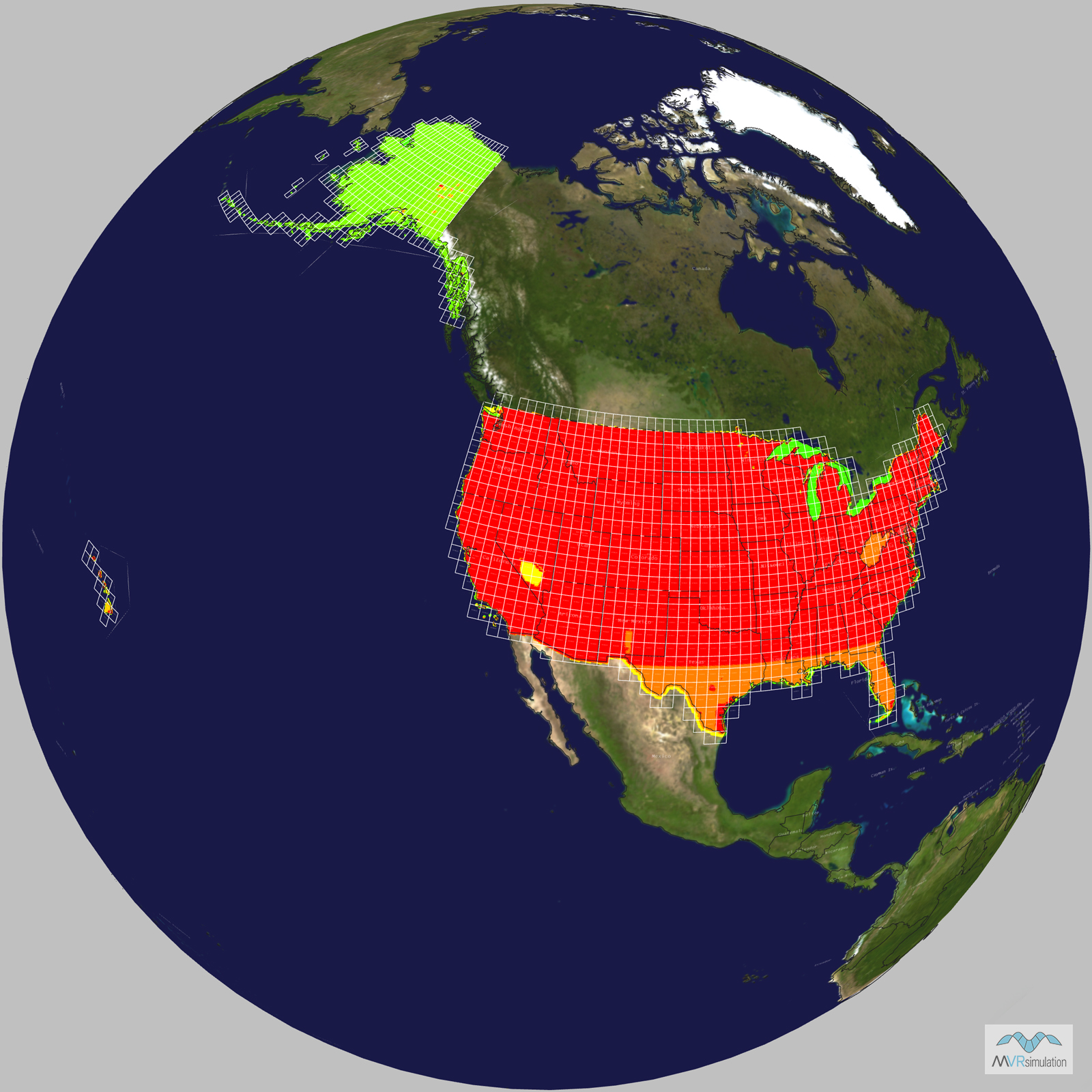
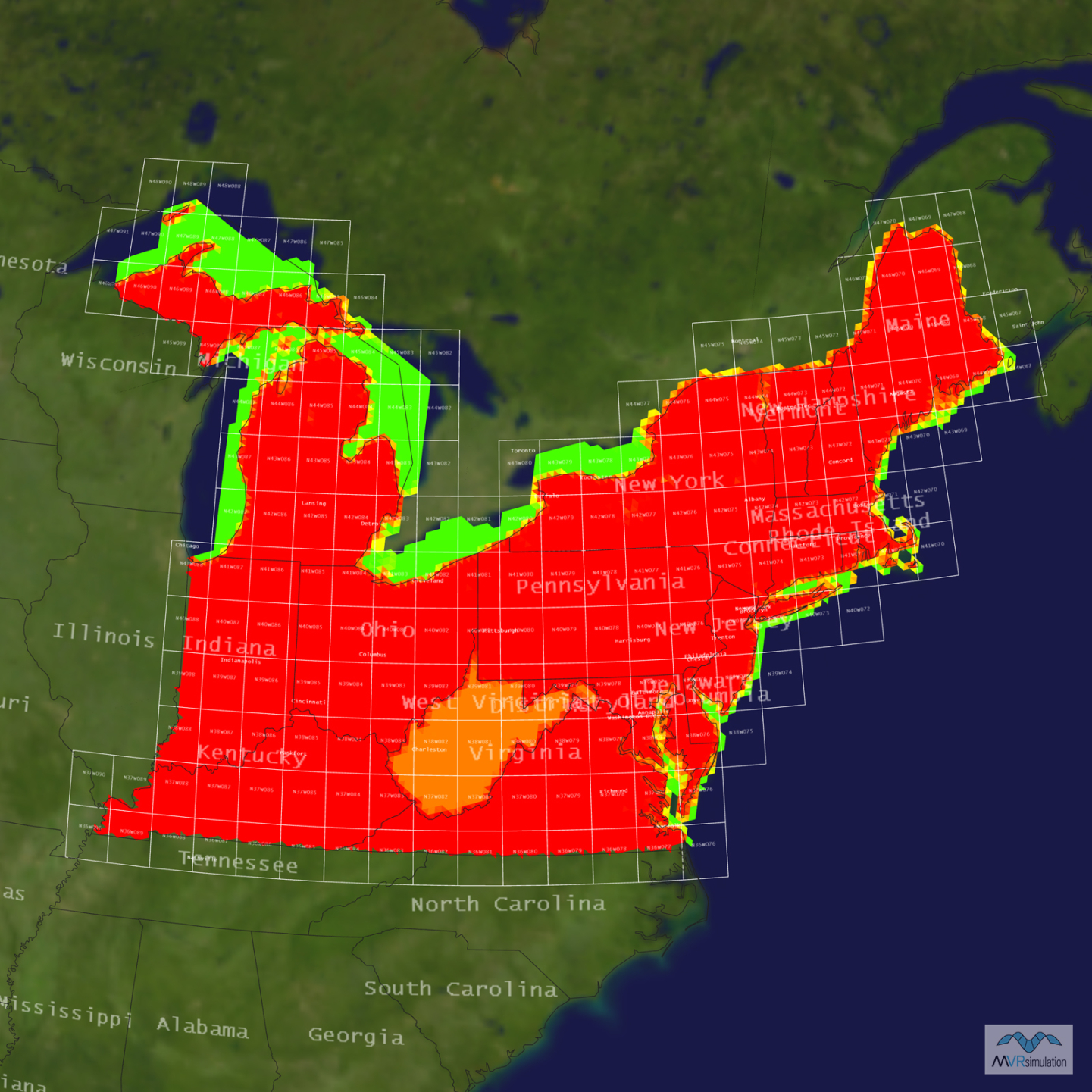
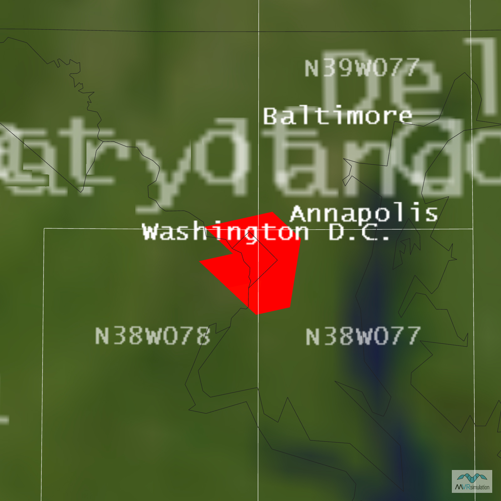
Tile Coverage Map
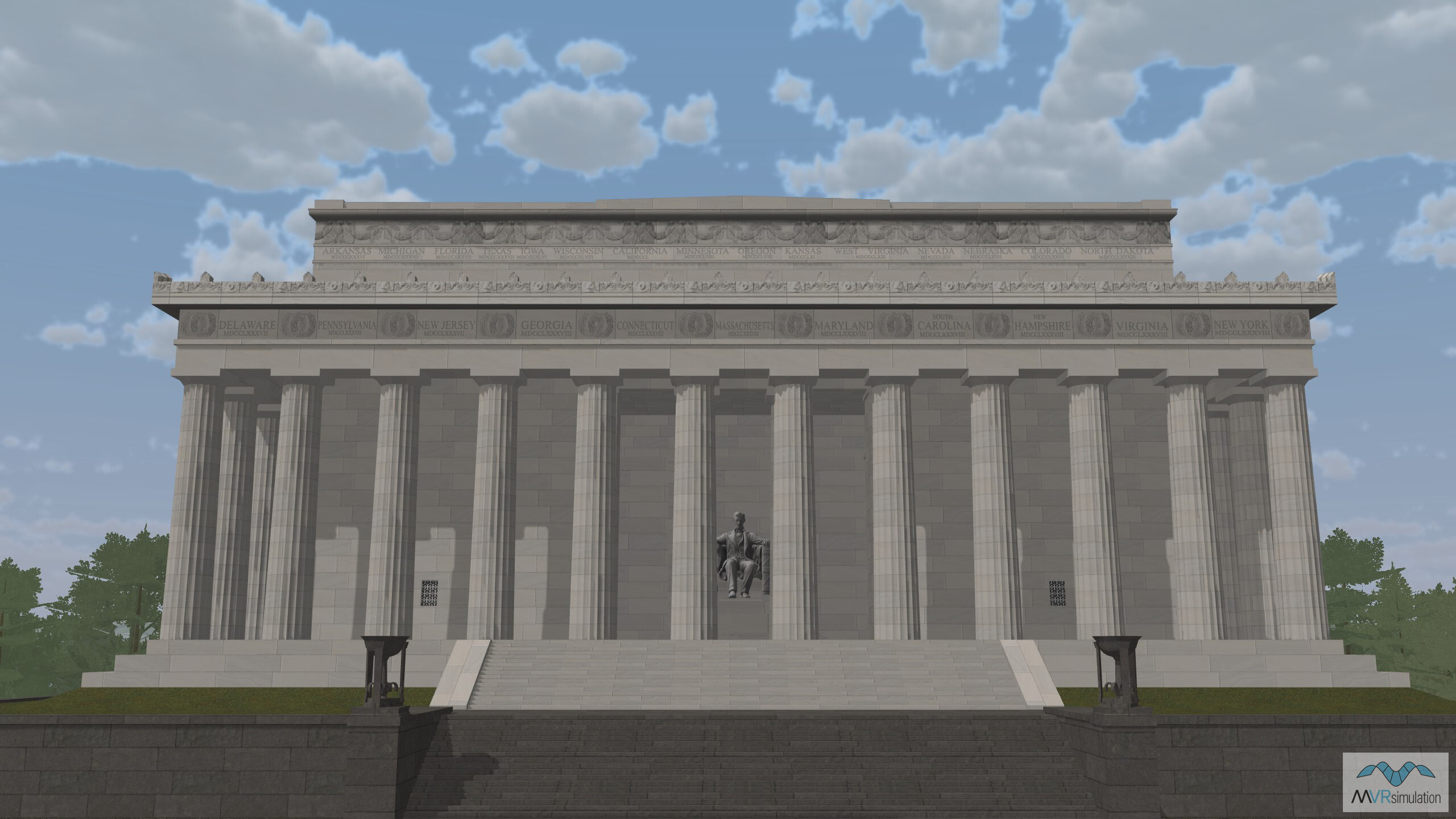
The Lincoln Memorial in VRSG's Washington D.C. terrain database.
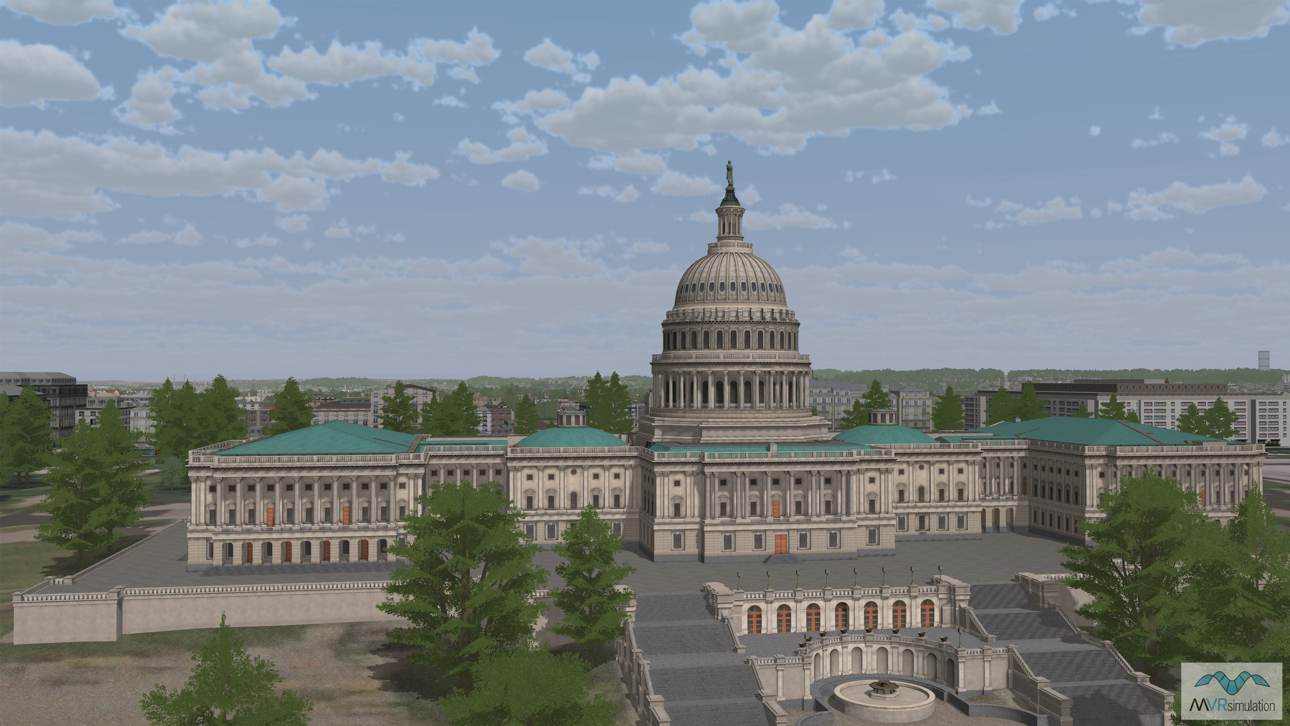
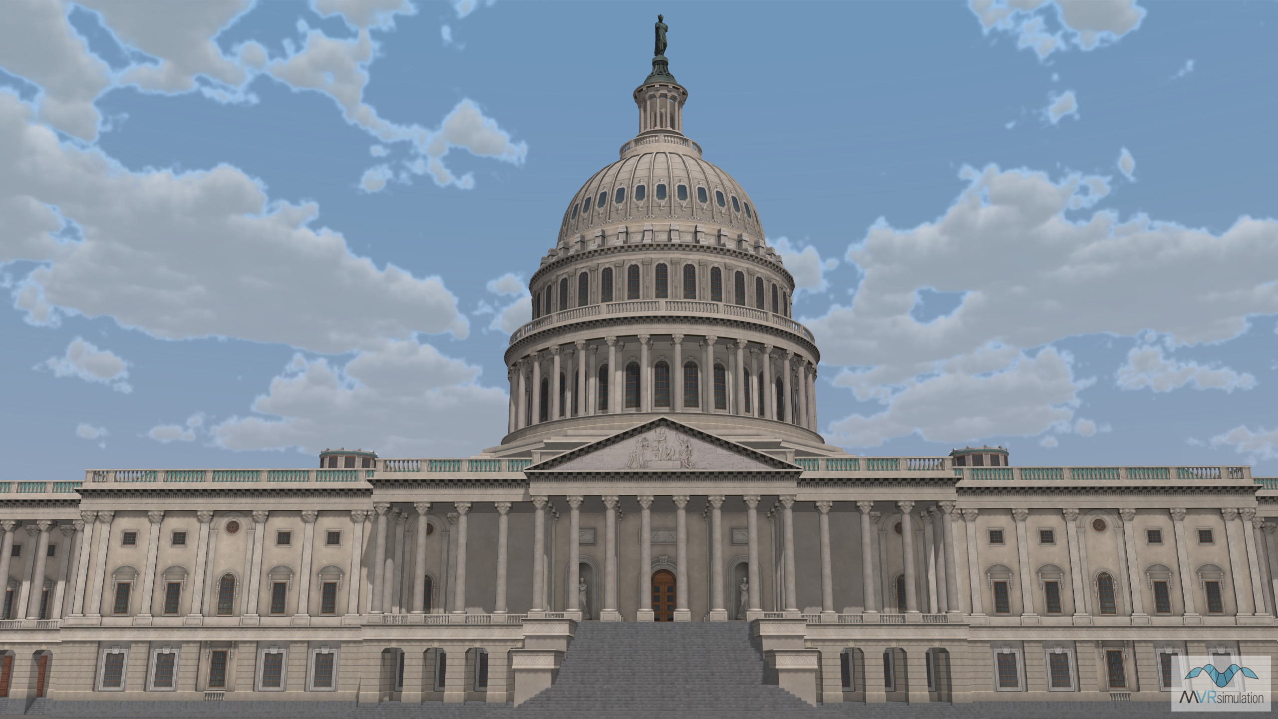
The United States Capitol is one of a number of models placed within VRSG's Washington D.C. metro area terrain dataset.
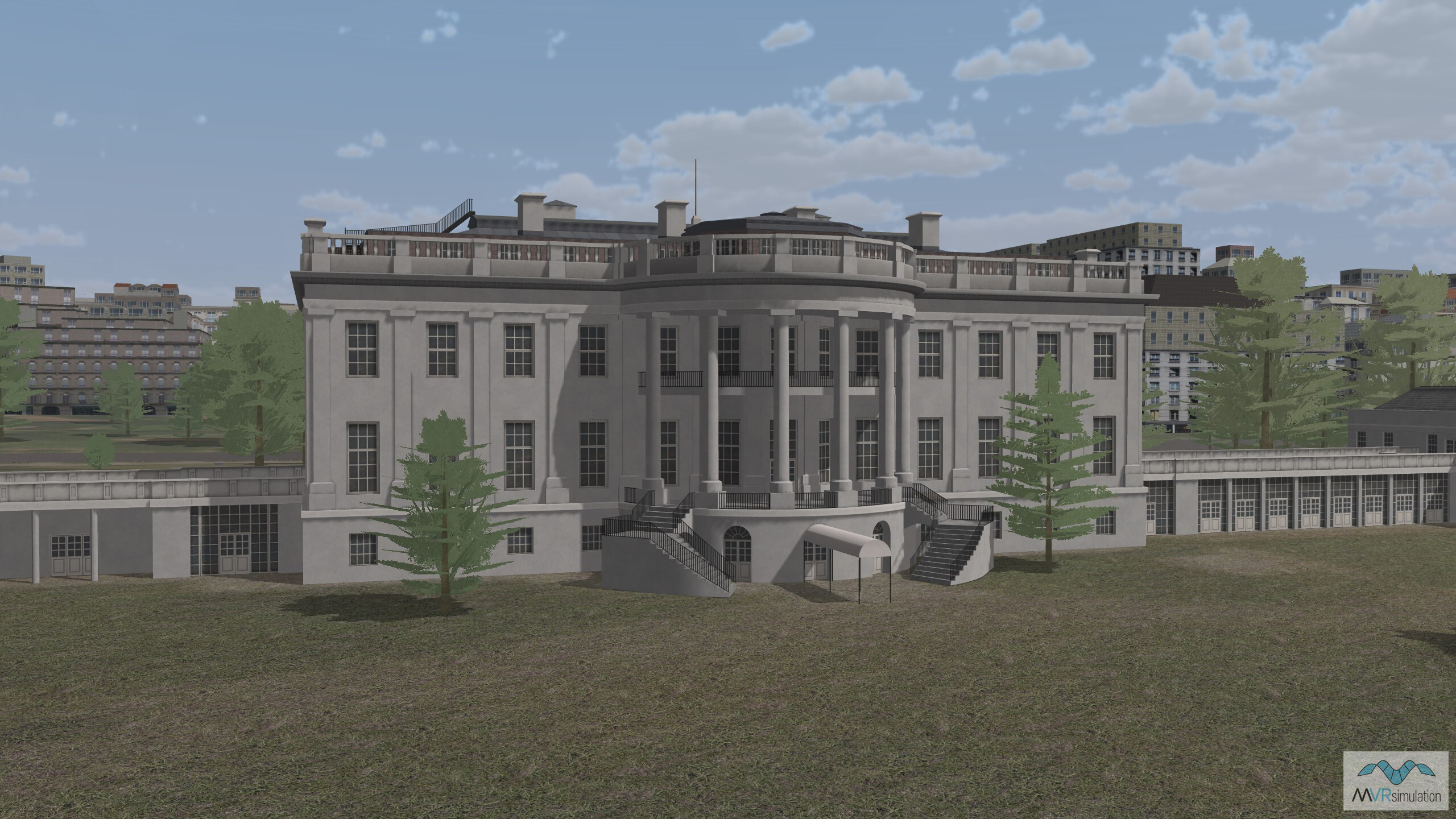
The White House in VRSG's Washington D.C. terrain dataset.
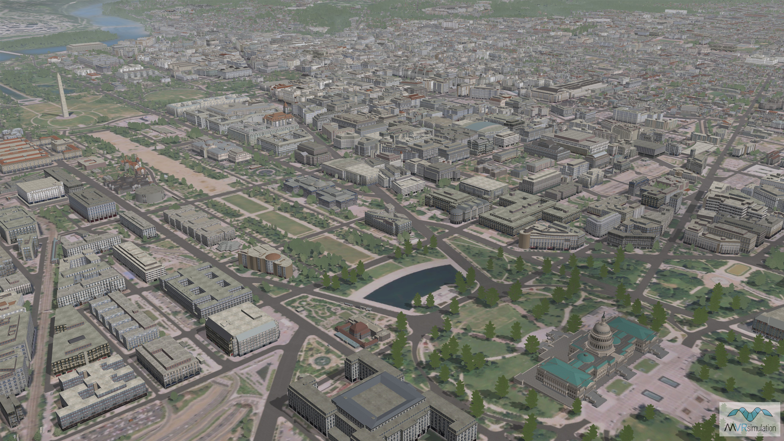
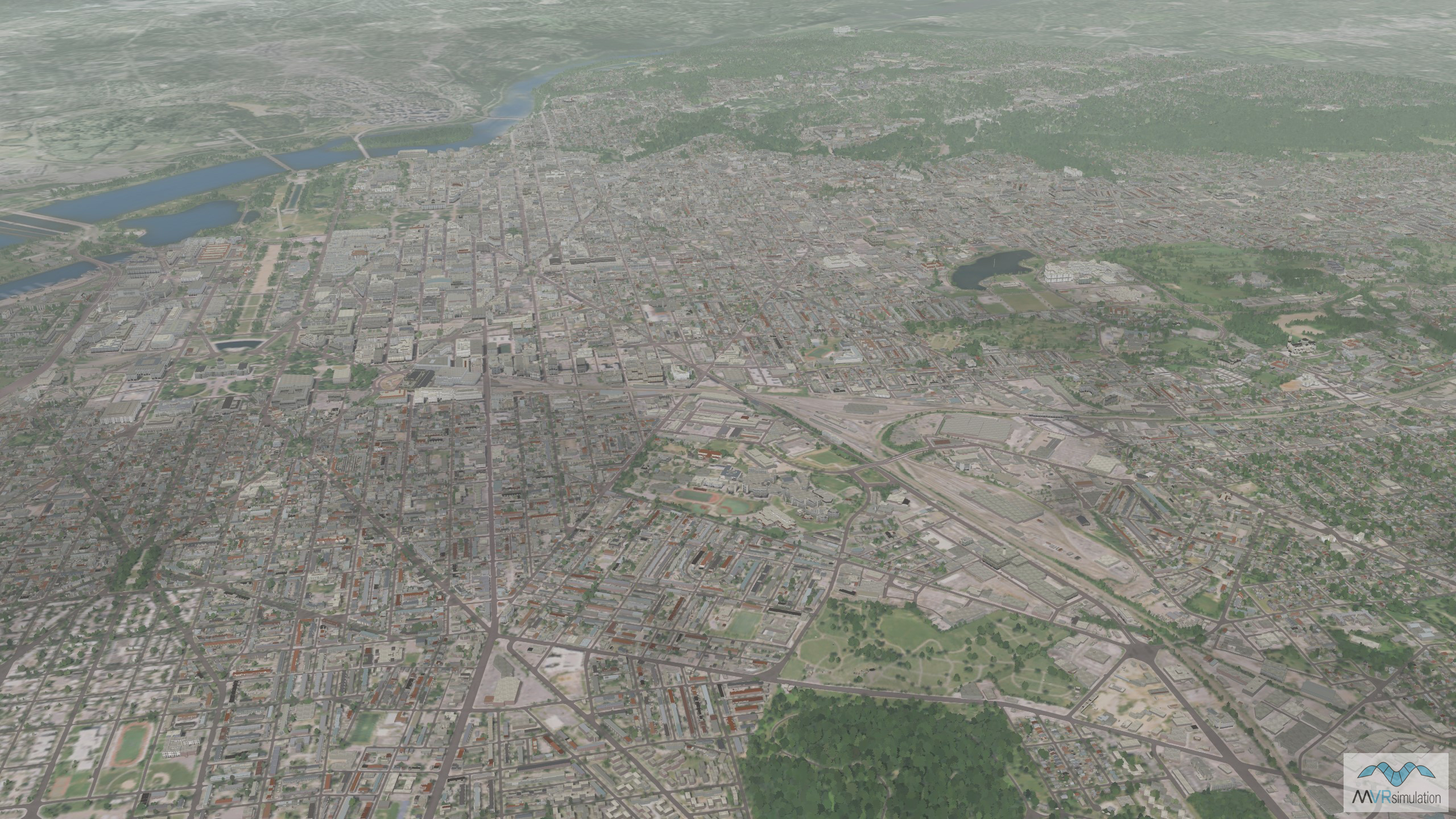
MVRsimulation's VRSG terrain of the Washington D.C. metro area.
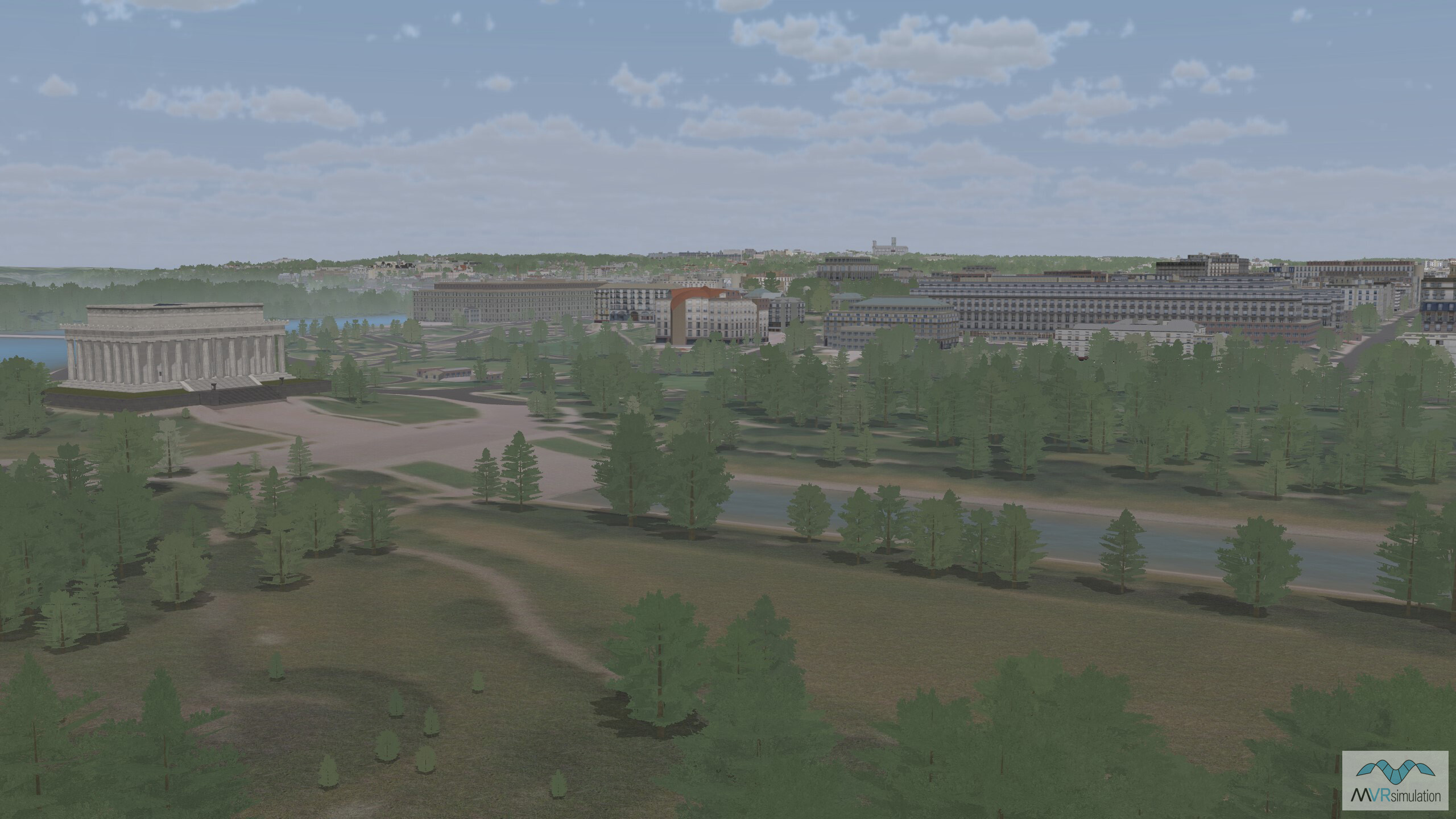
A view of the Lincoln Memorial in VRSG's Washington D.C. terrain dataset.
MVRsimulation developed terrain for the Washington D.C. metro area that includes untextured buildings initially provided by CyberCity 3D, then textured using ESRI's CityEngine software.