Albacete, Spain Terrain Database Information
- Imagery: 40cm
- Elevation: 10 meter elevation of the airfield blended to an underlying 30 meter elevation
- Terrain Drive: Europe
- Castilla-La Mancha region of southeastern Spain.
- Including Los Llanos Albacete Air Base (LEAB), the home of the NATO Tactical Leadership Programme (TLP). The TLP has a training facility with 30 Part Task Mission Trainers.
- Cultural Features: Apron or Ramp Areas, CityEngine (Geotypical) Buildings, Control Tower, Custom Models (Geospecific Buildings), Hangars, Landscape Features (Shrubs, Grass, Paved Medians, etc.), Light Poles, Lighting for Non-Runway Areas (Streetlights), Navigation Aids, Roads, Runway, Runway Lights, Signs, Taxiways and Associated Markings, Trees, Vehicles (Trucks, Cars, Military Equipment, etc.), Windsocks
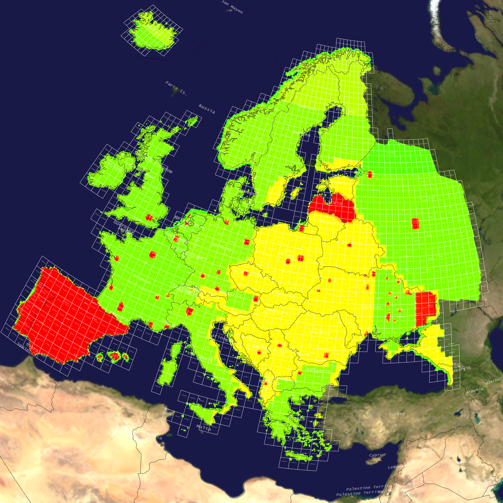
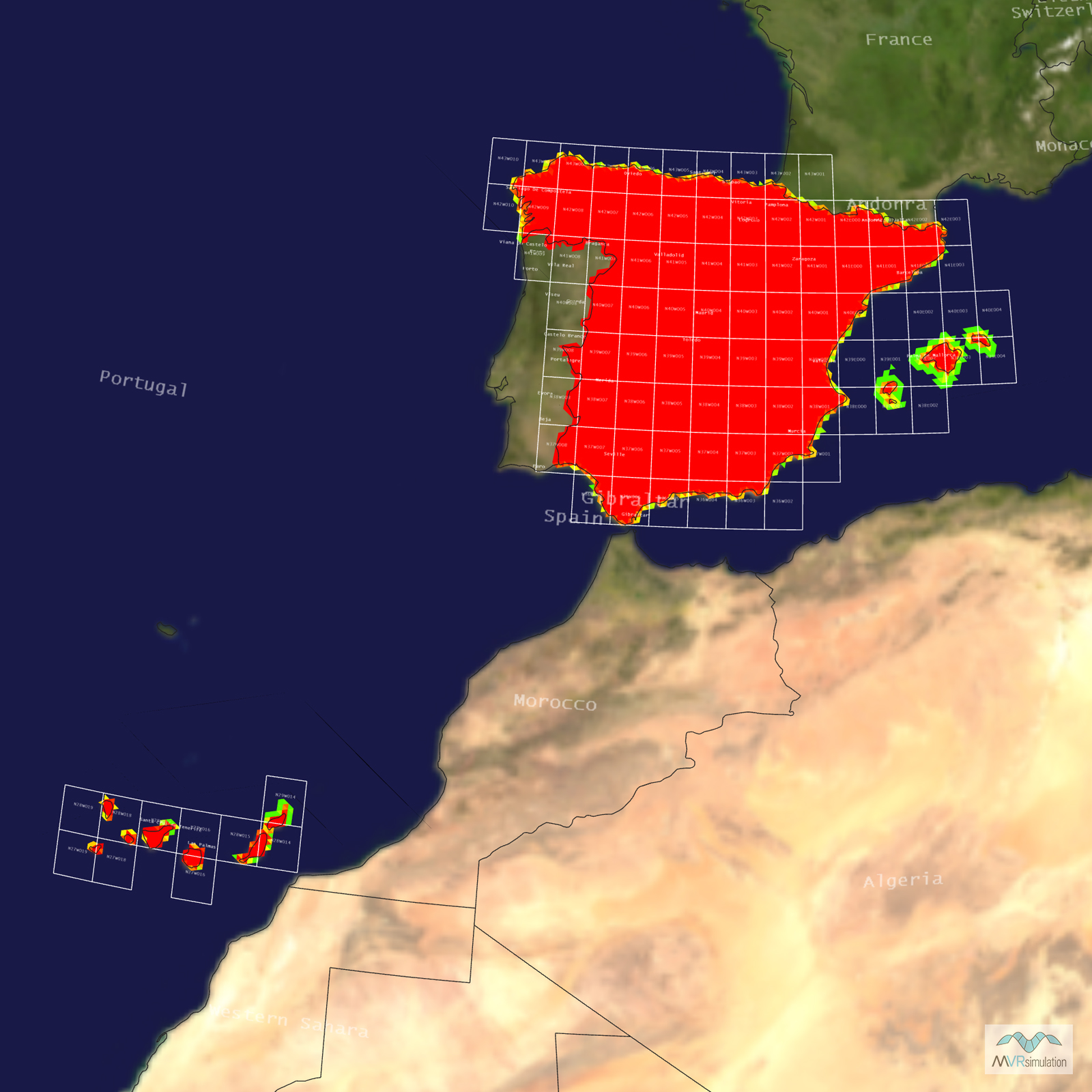
Tile Coverage Map
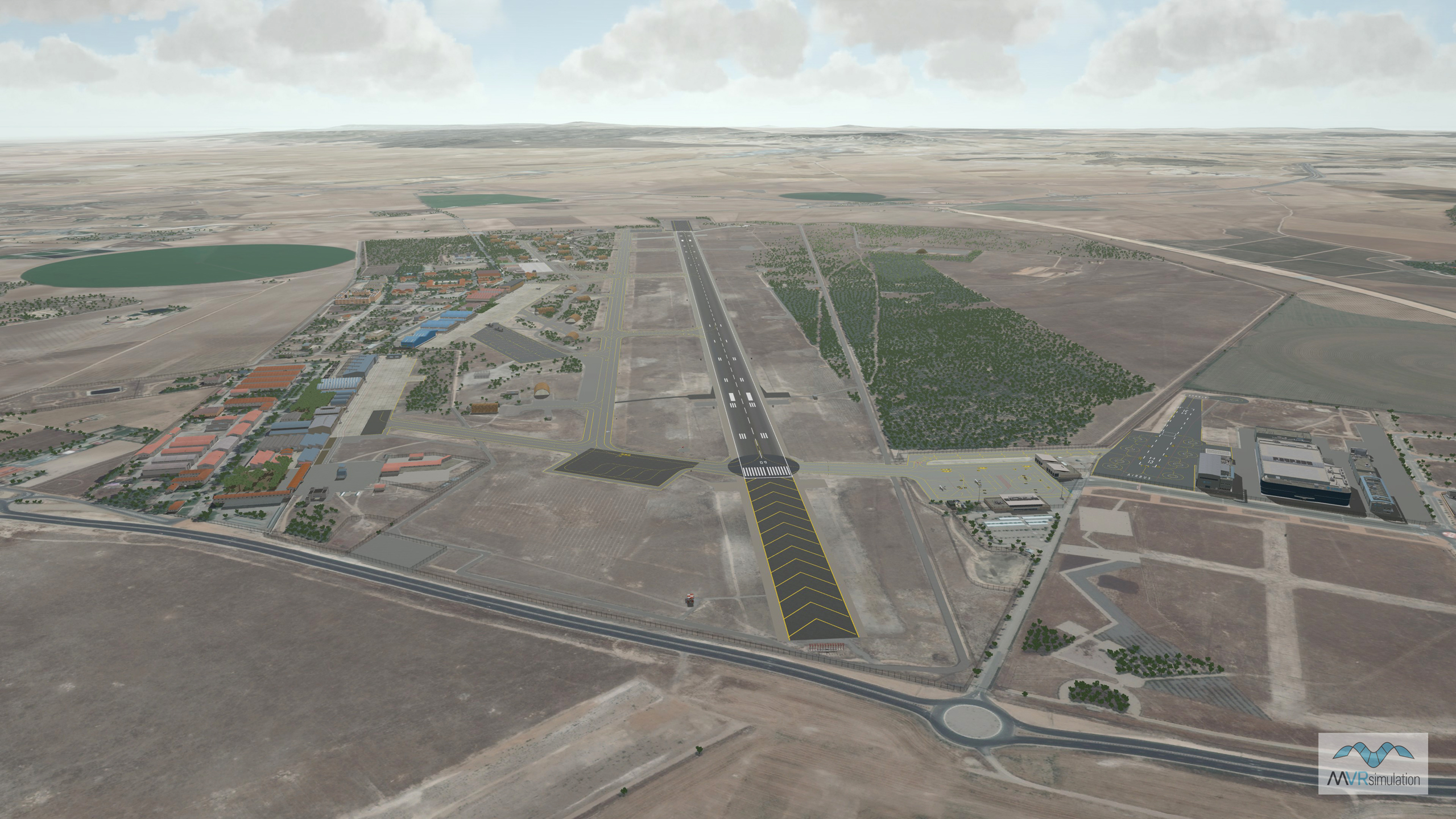
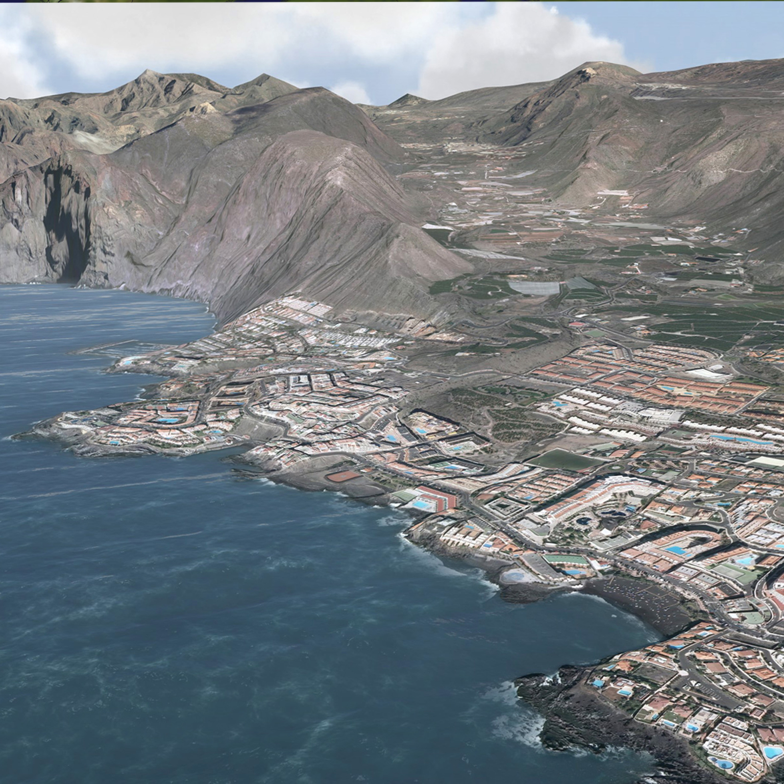
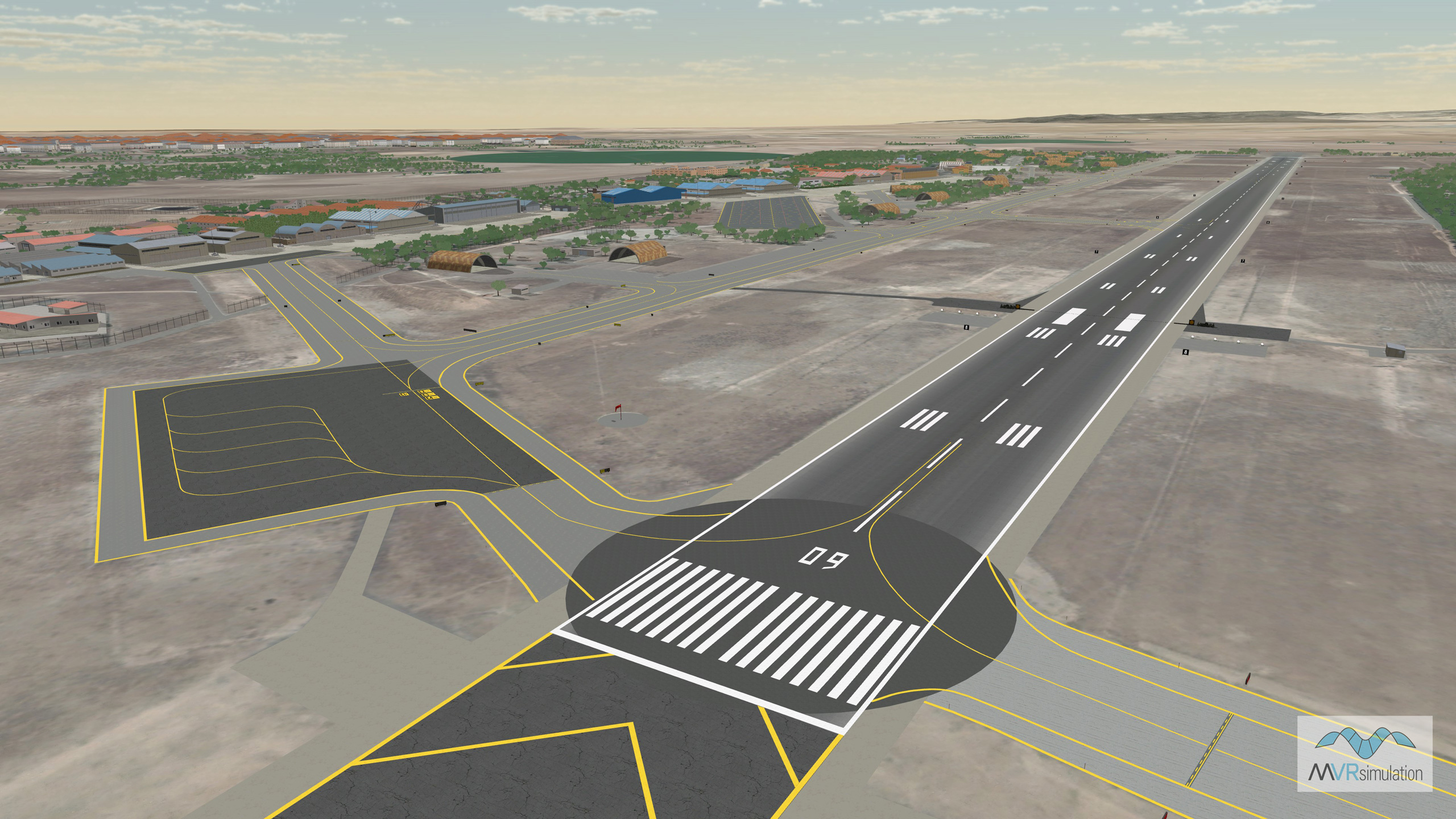
MVRsimulation VRSG real-time scene featuring a 3D replica of Los Llanos Albacete Air Base (LEAB), located in Albacete province, in the Castilla-La Mancha region of southeastern Spain.
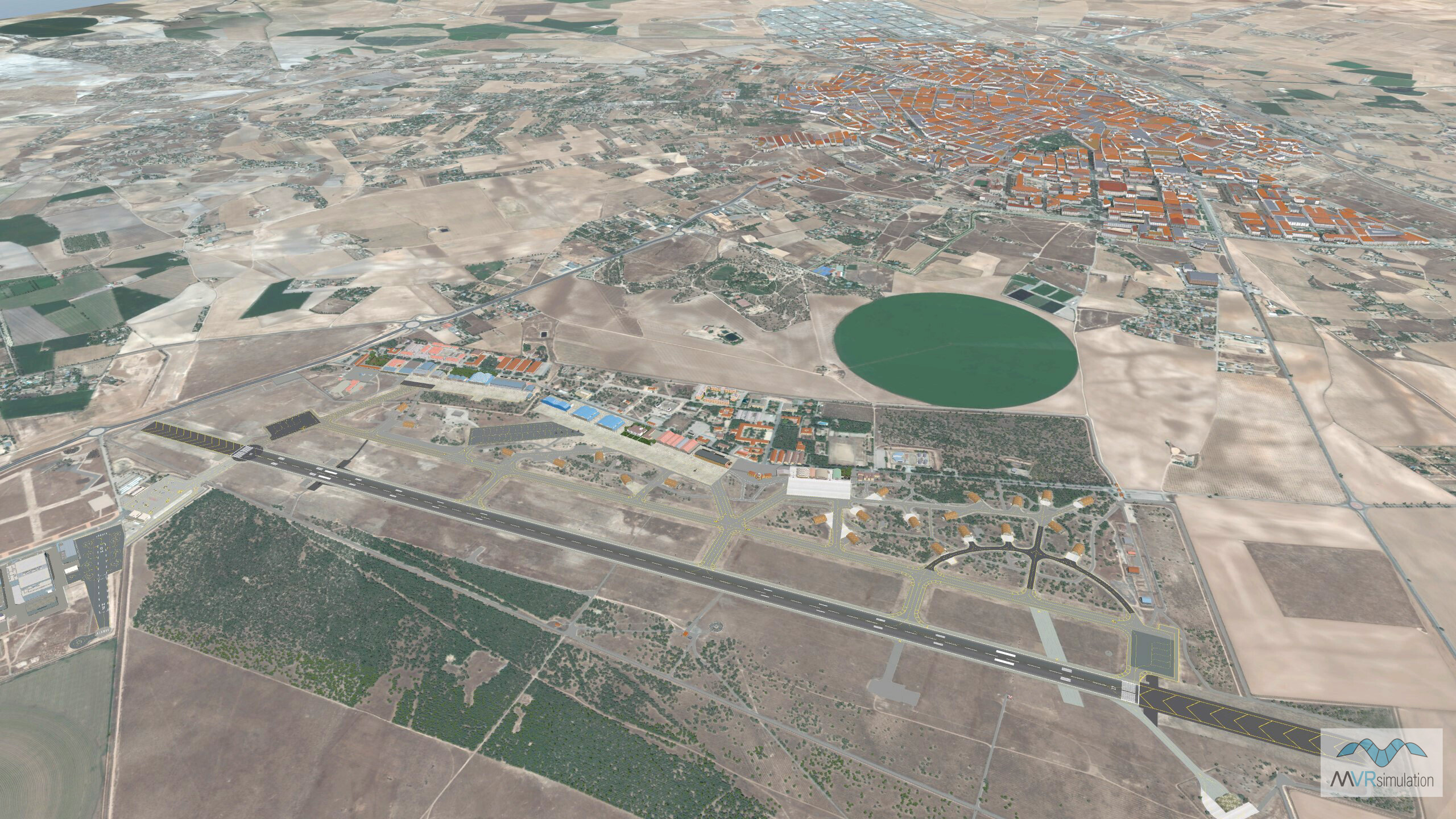
MVRsimulation VRSG real-time scene featuring a 3D replica of Los Llanos Albacete Air Base (LEAB) located in Albacete province, in the Castilla-La Mancha region of southeastern Spain.
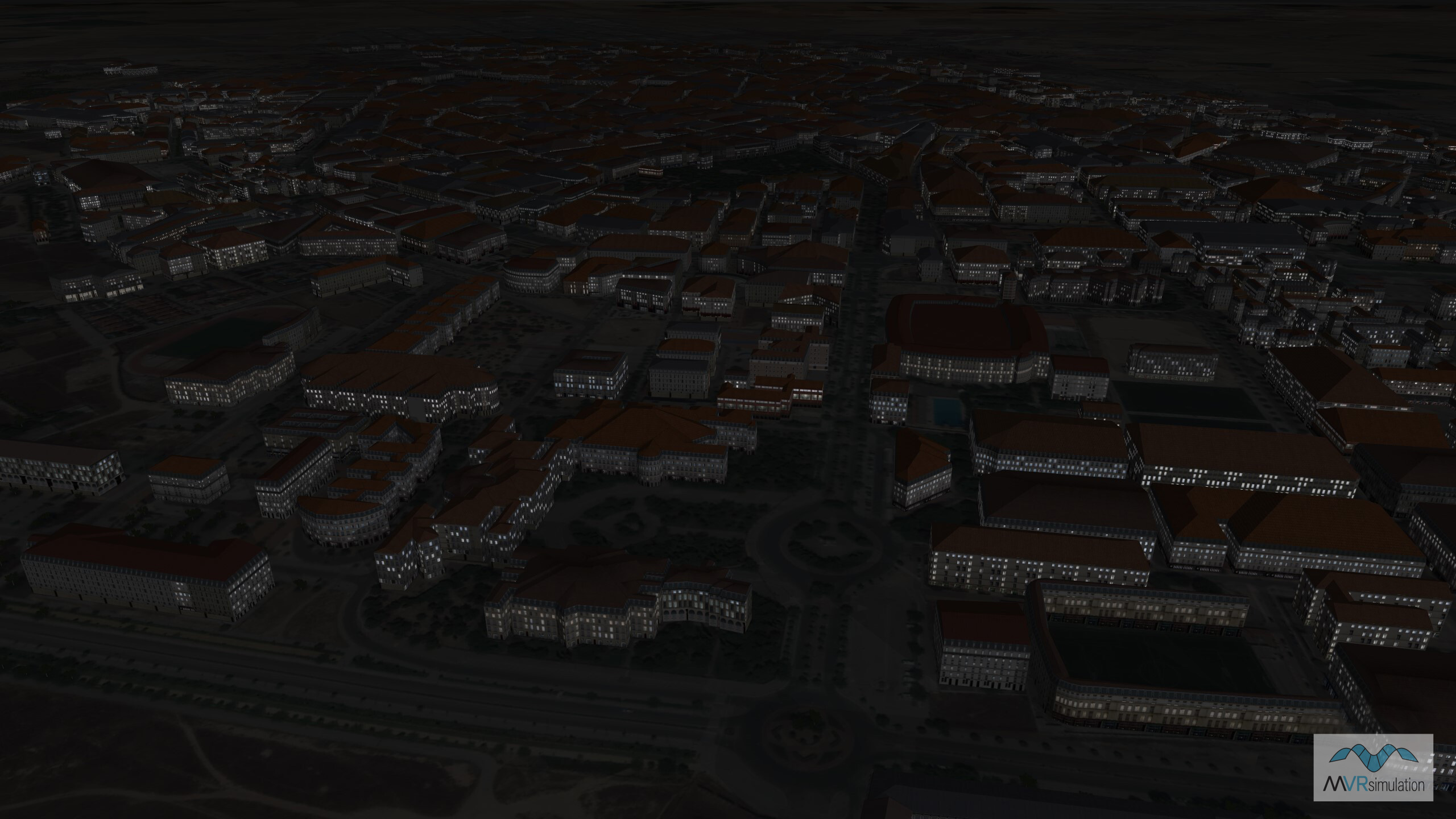
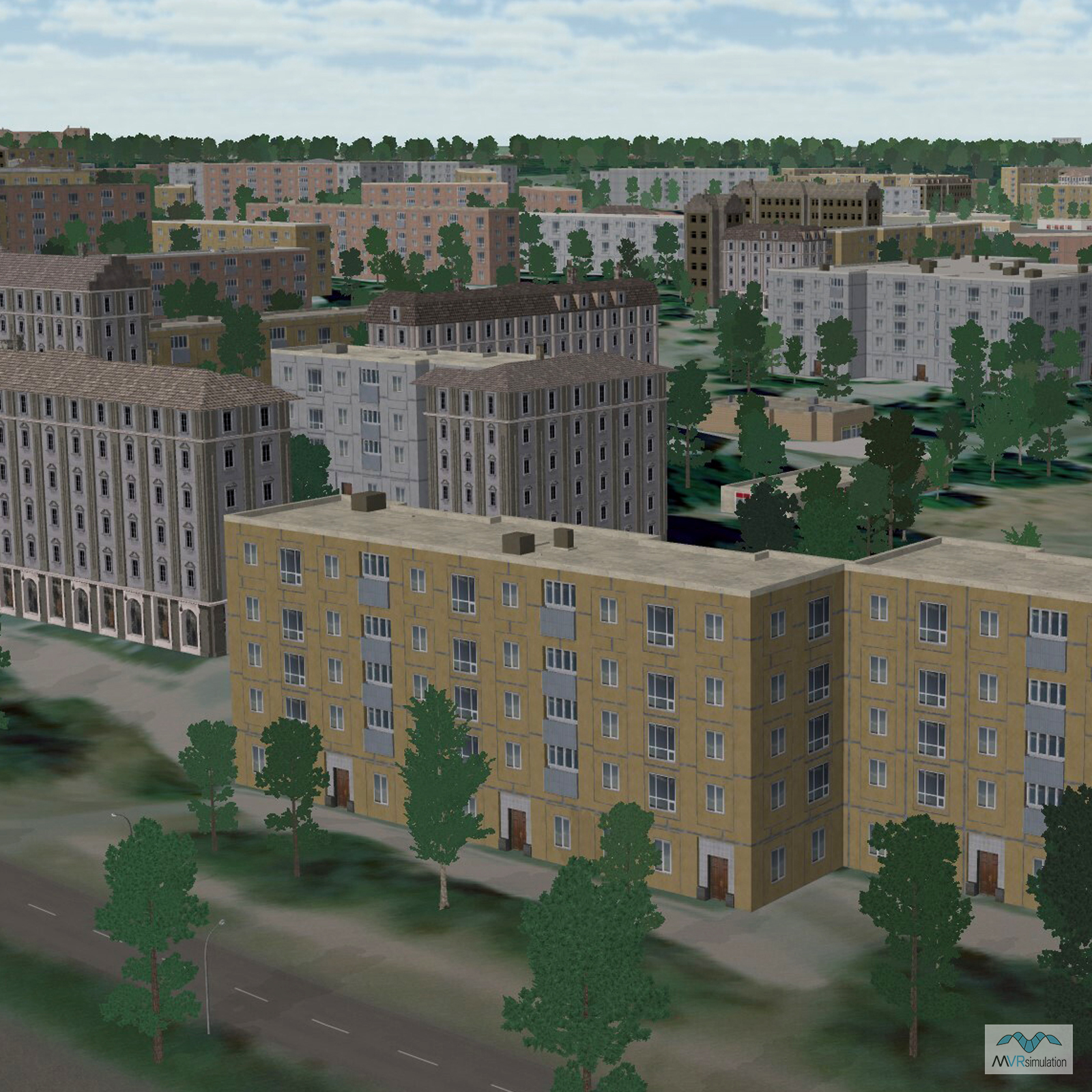
MVRsimulation VRSG real-time night scene featuring illuminated buildings on the 3D replica of Los Llanos Albacete Air Base (LEAB).

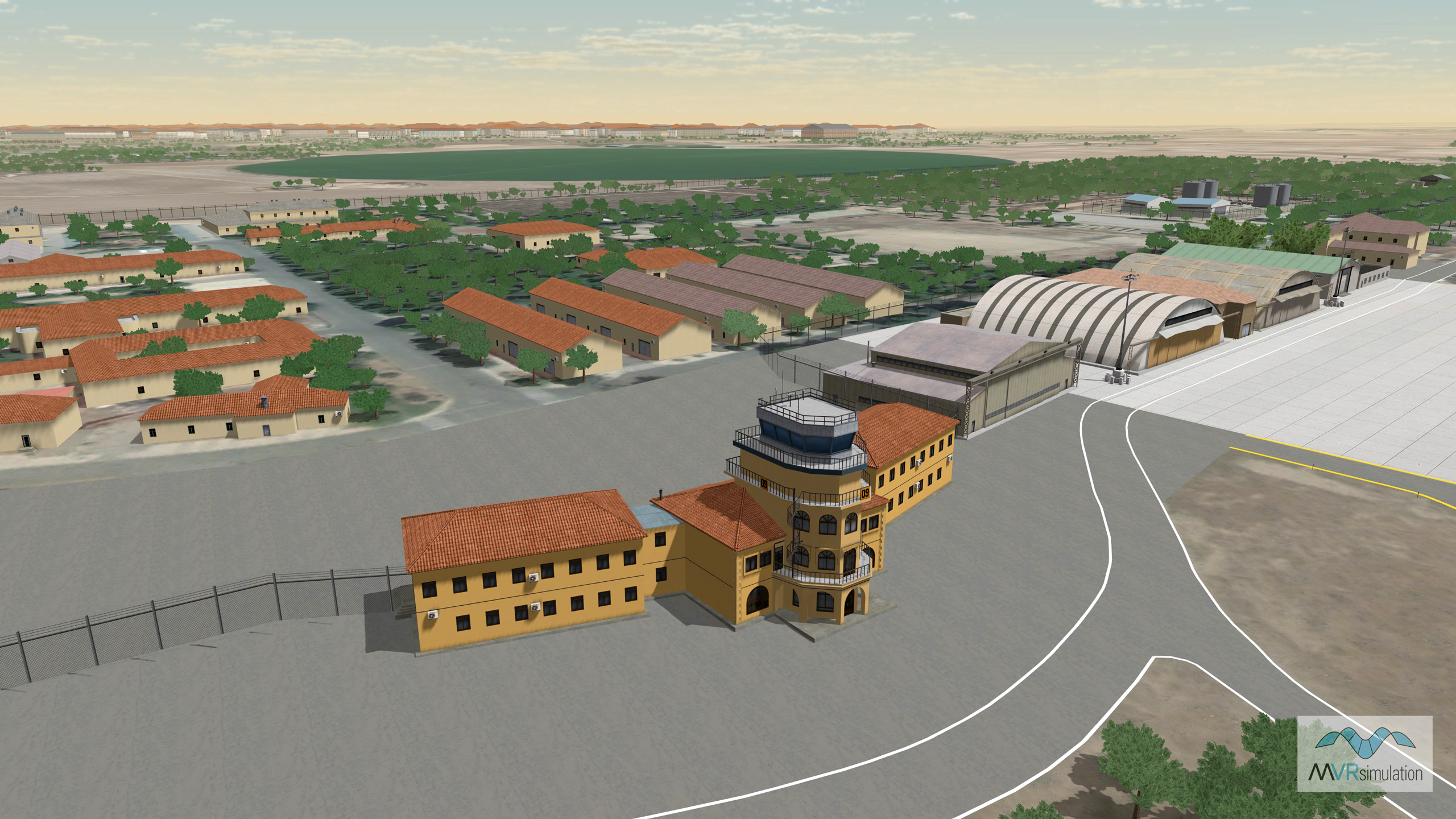
MVRsimulation VRSG real-time scene featuring a 3D replica of the Los Llanos Albacete Air Base (LEAB), Albacete province in southeastern Spain.
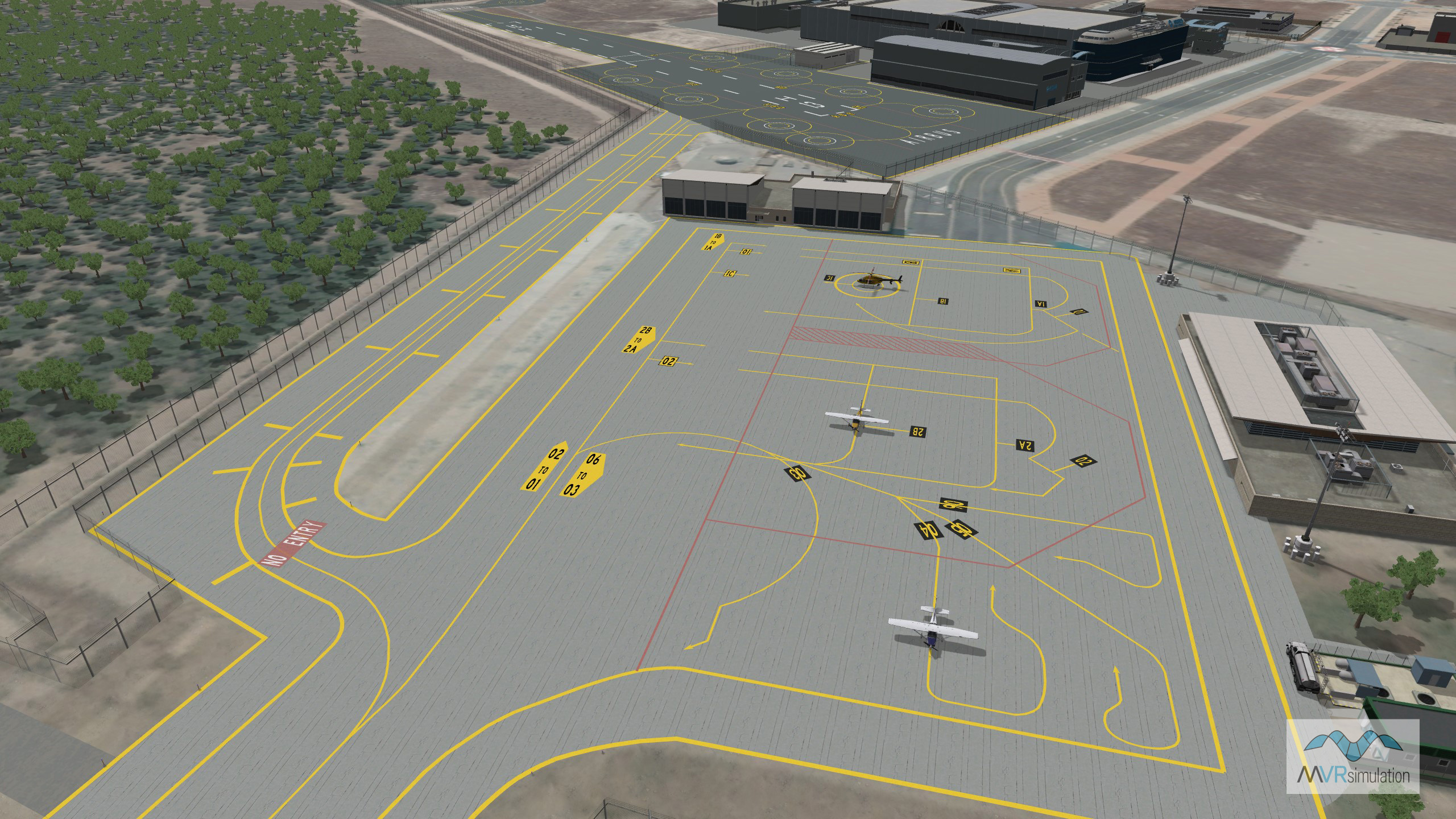
MVRsimulation VRSG real-time scene featuring a 3D replica of the Los Llanos Albacete Air Base (LEAB), Albacete province in southeastern Spain.
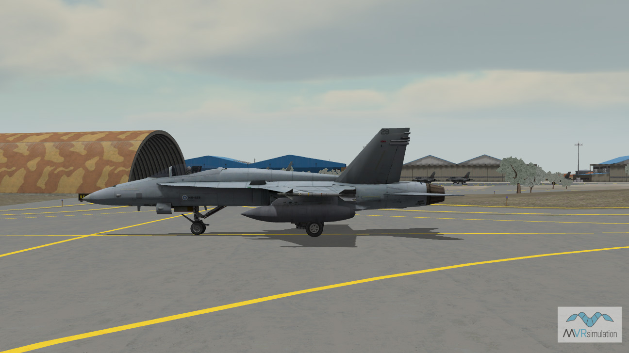
MVRsimulation VRSG real-time scene of a Finnish FA-18C entity taxiing on the 3D replica of Los Llanos Air Base.
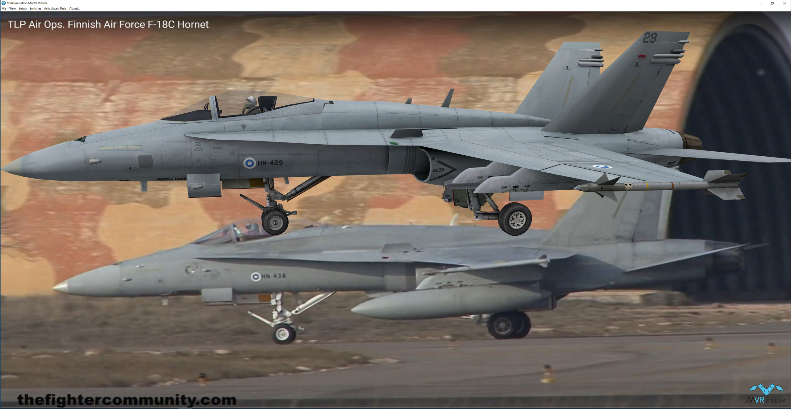
MVRsimulation's Finnish F-18C model displayed in the Model Viewer, against a background reference still image taken from a publicly available video of an actual Finnish Air Force F-18C Hornets taking off and landing from Los Llanos Air Base during one of the TLP courses. (Photo/video credit: Alejandro Afonso/thefightercommunity.com.)