
Interoperability With SAF Systems
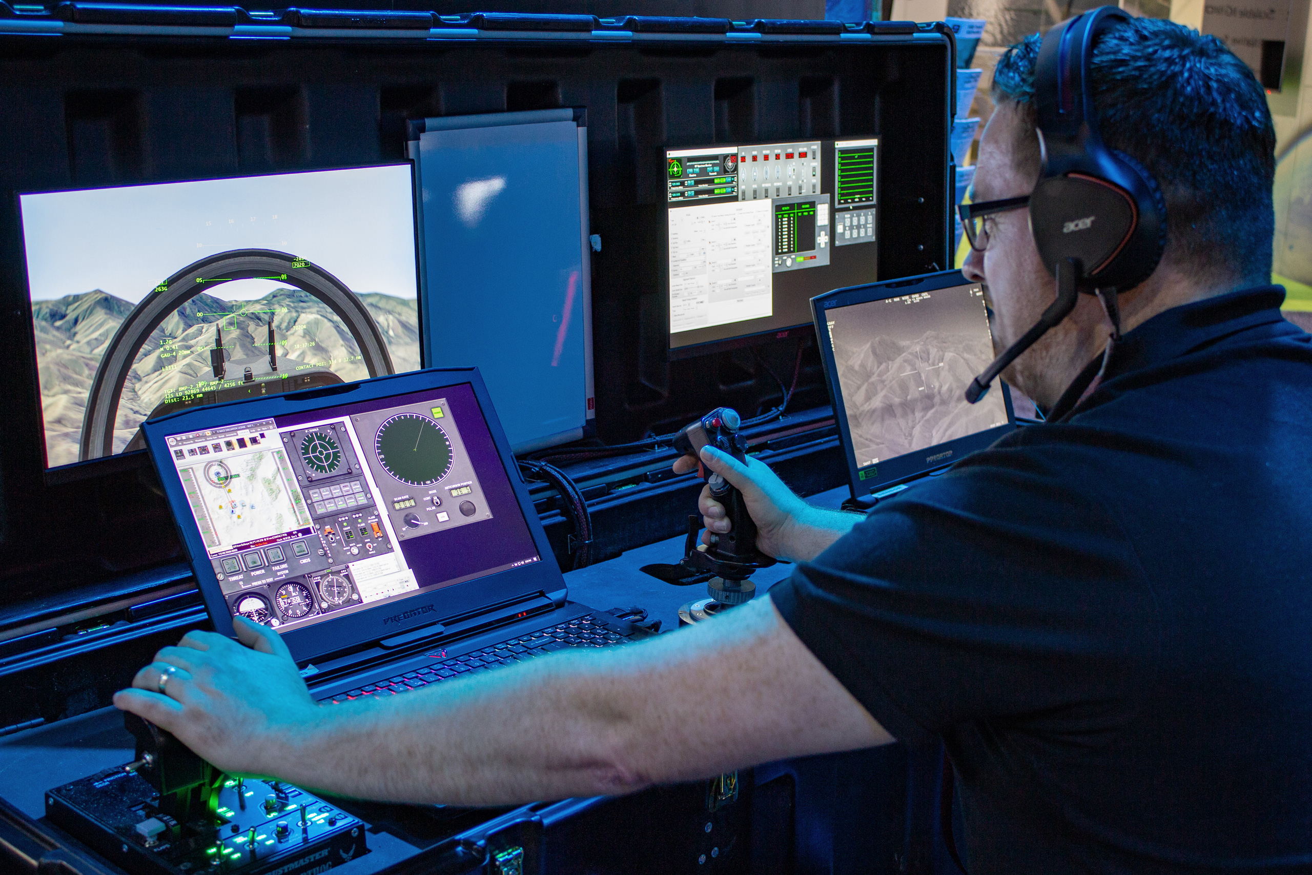
MVRsimulation's DJFT aircrew station with VRSG and BSI's Modern Air Combat Environment (MACE). VRSG is rendering the out-the-window view and the sensor view on the far right.
MVRsimulation VRSG is completely interoperable with many semi-automated forces (SAF) systems, which are common artificially intelligent entity generators used in the simulation industry.
As a DIS-based simulation application, VRSG is compatible with SAF applications such as OneSAF, JointSAF, XCITE, the U.S. Navy's Next-Generation Threat System (NGTS), and commercial systems such as BattleSpace Simulations' (BSI's) Modern Air Combat Environment (MACE). Systems such as MACE and XCITE, which can utilize MVRsimulation's round-earth VRSG terrain tiles for their elevation source, can achieve fully correlated databases without the need for ground-clamping.
Databases derived from third-party products, such as Presagis Terra Vista, can also achieve full correlation, provided the VRSG terrain tiles are produced from the OpenFlight output from the same Terra Vista project that rendered the SAF representation of the database.
The following images show a side-by-side comparison of MVRsimulation's Afghanistan terrain in BSI's MACE. On the left is MACE's 2D map display of the SAF Afghanistan database, which is correlated with the MACE's 3D view on the right, which is provided by VRSG:
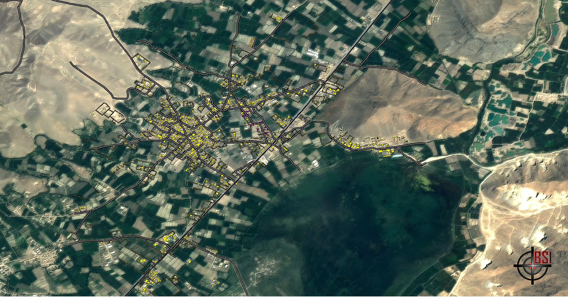
A 2D SAF aerial view of a portion of MVRsimulation's Afghanistan database rendered in BSI MACE. Image courtesy of BSI.
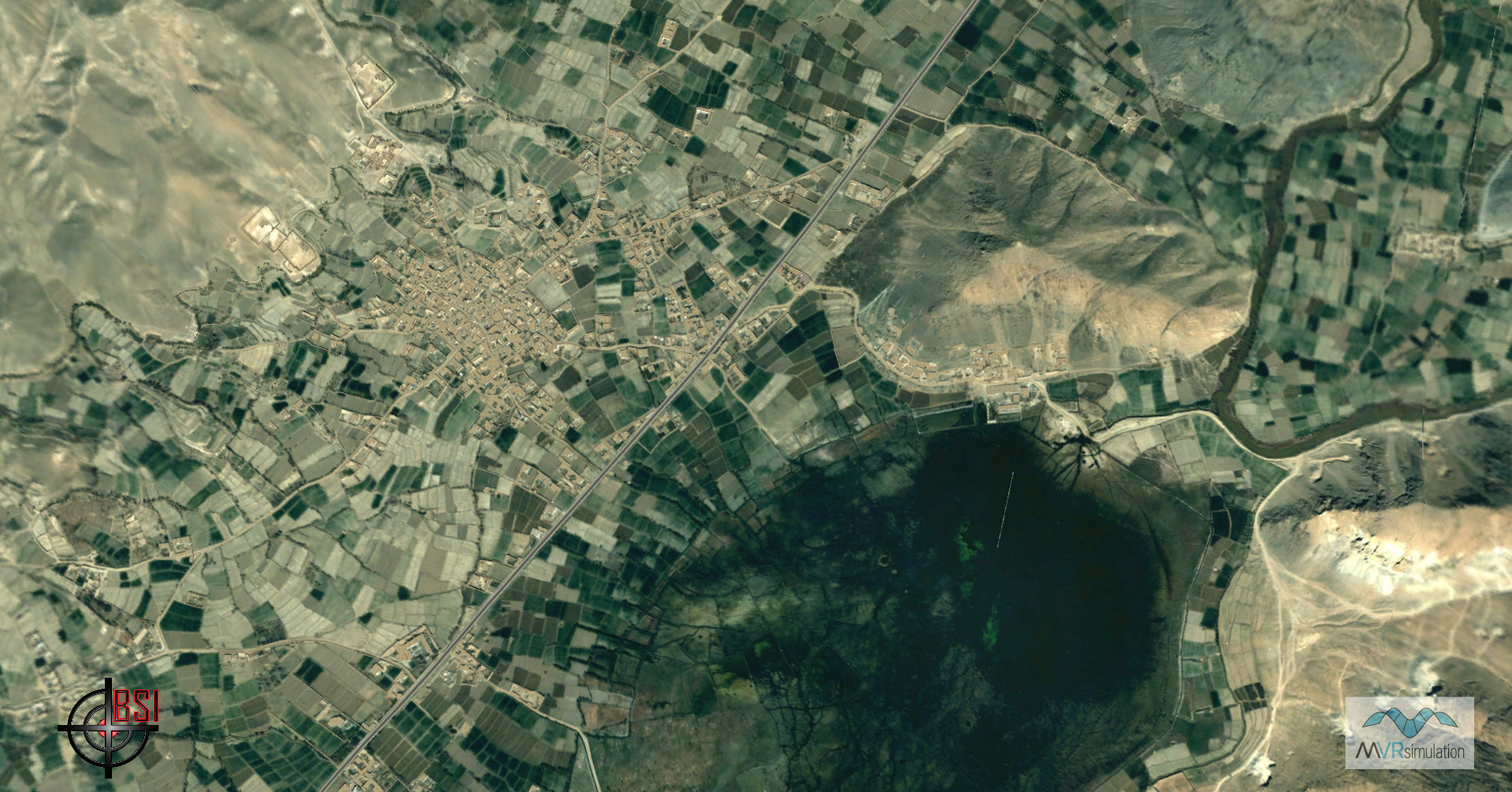
MVRsimulation VRSG providing the 3D view of the correlated 2D MACE database from the same source data. Image courtesy of BSI.
VRSG and MACE share several specific interoperability features:
- MACE renders a Heads-Up Display (HUD) overlay on the VRSG view for use with MACE's flyable flight models.
- MACE provides remote VRSG camera control (including both UAV camera and targeting pod capabilities) via USB-based HOTAS devices such as the Thrustmaster Warthog joystick.
- During a simulation mission, MACE sends date and time-of-day changes to VRSG.
- MACE can control VRSG's environment settings and sky models.
- MACE can use MVRsimulation's round-earth VRSG terrain tiles as an elevation data source, resulting in perfect elevation correlation between MACE and VRSG.
The next two images of a mission exercise on MVRsimulation's Afghanistan database rendered in BSI MACE compare the MACE mission planning tools on 2D map display of the correlated SAF database (left) with the VRSG 3D view (right). Images courtesy of BSI.
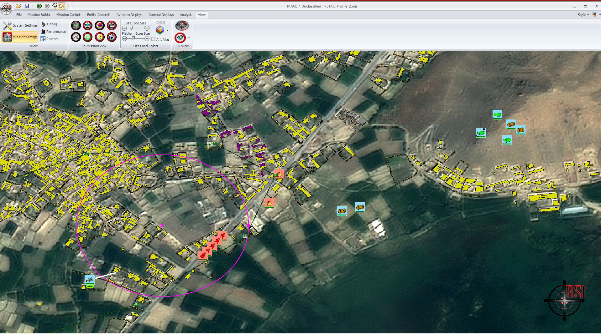
A mission exercise on MVRsimulation's Afghanistan database rendered on a 2D map display in BSI MACE, with mission planning tools. The correlated SAF database uses the same source data as the 3D VRSG view. Image courtesy of BSI.
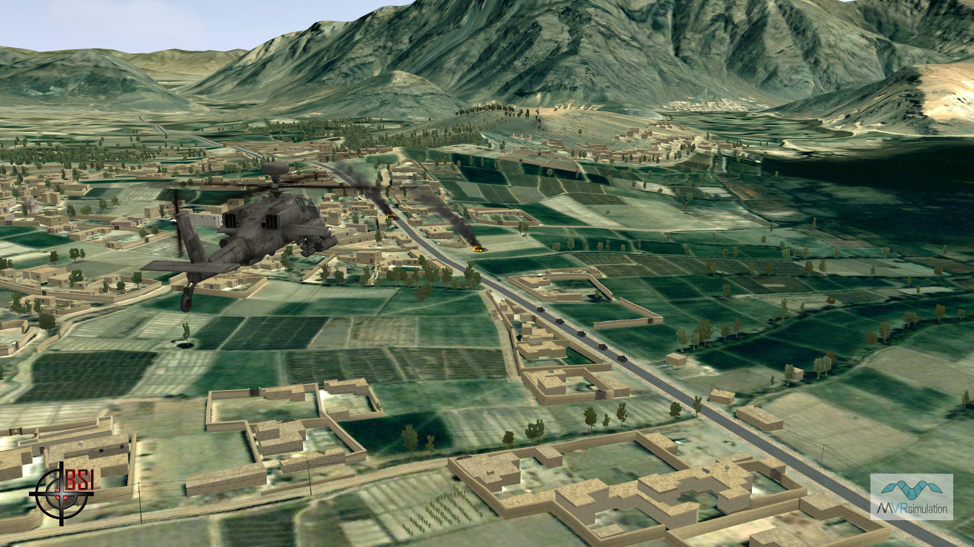
A mission exercise on MVRsimulation's Afghanistan database rendered in BSI MACE's 3D view, the view provided by VRSG.