
MVRsimulation North America 3D Terrain

MVRsimulation's seamless 3D terrain of the continent of North America (excluding USA) is constructed with natural color imagery ranging from 0.60 to 15 meter-per-pixel (mpp) resolution and with 3-arcsecond STRM elevation source data.
Note: Descriptions of terrain drives that contain 1 meter mpp resolution virtual terrain of regions of Continental US plus Alaska and Hawaii (CONUS++) can be found here.
Covering an area over 575 million sq km, the North America terrain includes 60 cm high-resolution natural color insets of insets of many capital cities and others cities of interest. Built with MVRsimulation’s Terrain Tools for Esri® ArcGIS®, the round-earth terrain tiles are for visualizing in MVRsimulation Virtual Reality Scene Generator (VRSG).
These tiles, which reside in a geocentric coordinate system. are suitable for real-time visualization and simulation applications such as synthetic vision, glass-cockpit displays, intelligence surveillance, and reconnaissance (ISR) applications, close-air-support (CAS) exercises, and fixed-wing cockpit simulation.
The North America 3D terrain is "Additional Materials" and is provided "as is" as described in our license agreement. Although MVRsimulation might modify or enhance the original source imagery, some visual artifacts from the source imagery might remain in the terrain tiles.
Geographic Coverage by Imagery Resolution
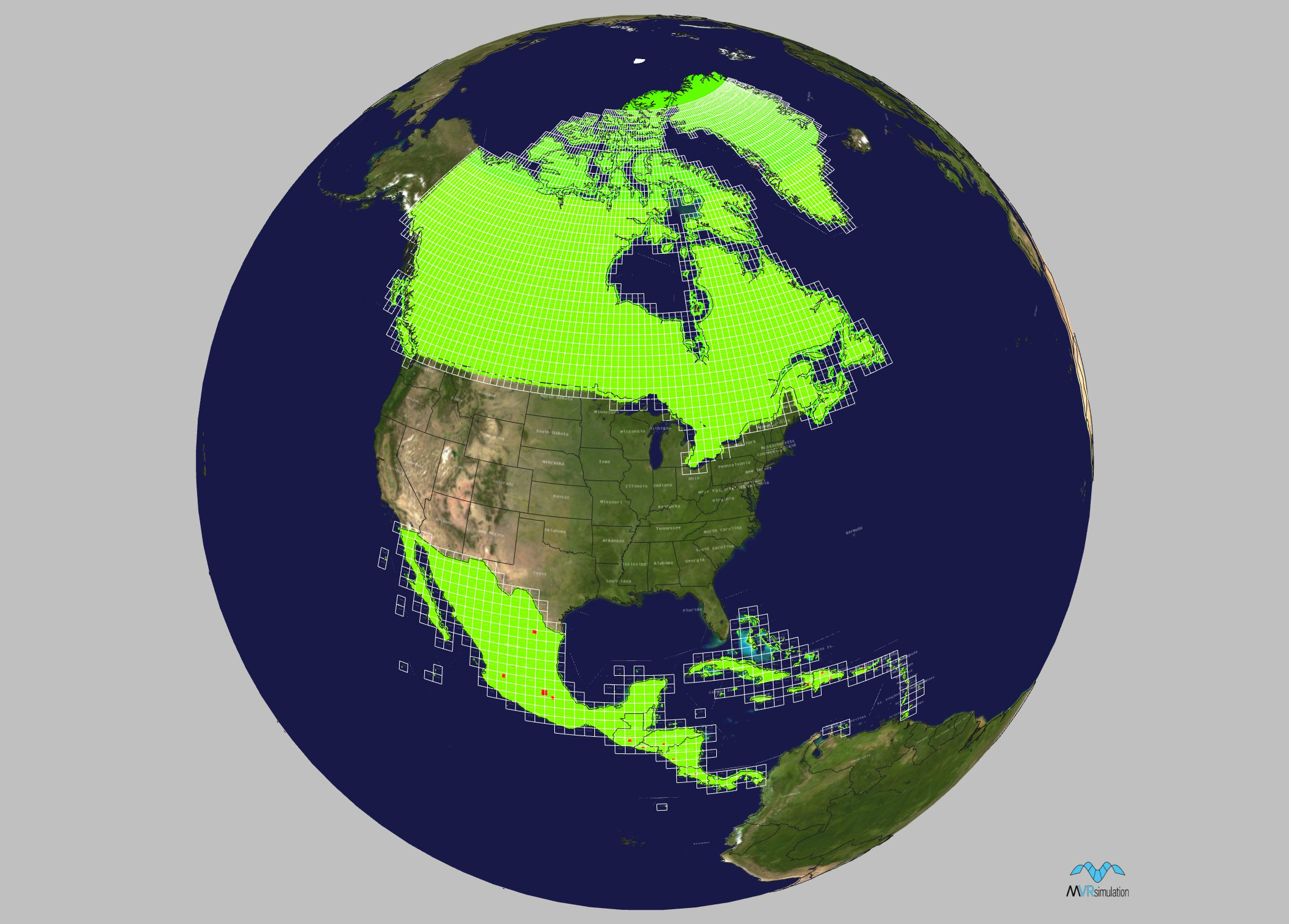
The following symbolic representation shows the geographic coverage of this 3D dataset’s terrain tiles of North America, excluding USA. This tile coverage map was generated with MVRsimulation’s Model Viewer. The areas in green indicate 15 mpp imagery, the orange-brown areas indicate 1 mpp resolution imagery, and the bright red areas indicate imagery resolution of less than 1 mpp.
Specifications
Below are specifications for MVRsimulation’s North America terrain dataset (excluding USA) in round-earth VRSG terrain format (MDS).
Dataset size: 575 million sq km
Size on disk: 602 GB
Terrain post spacing: 60 meters-per-post (subsampled from 90 meter source)
Elevation source data: 3-arcseconds (90 meter)
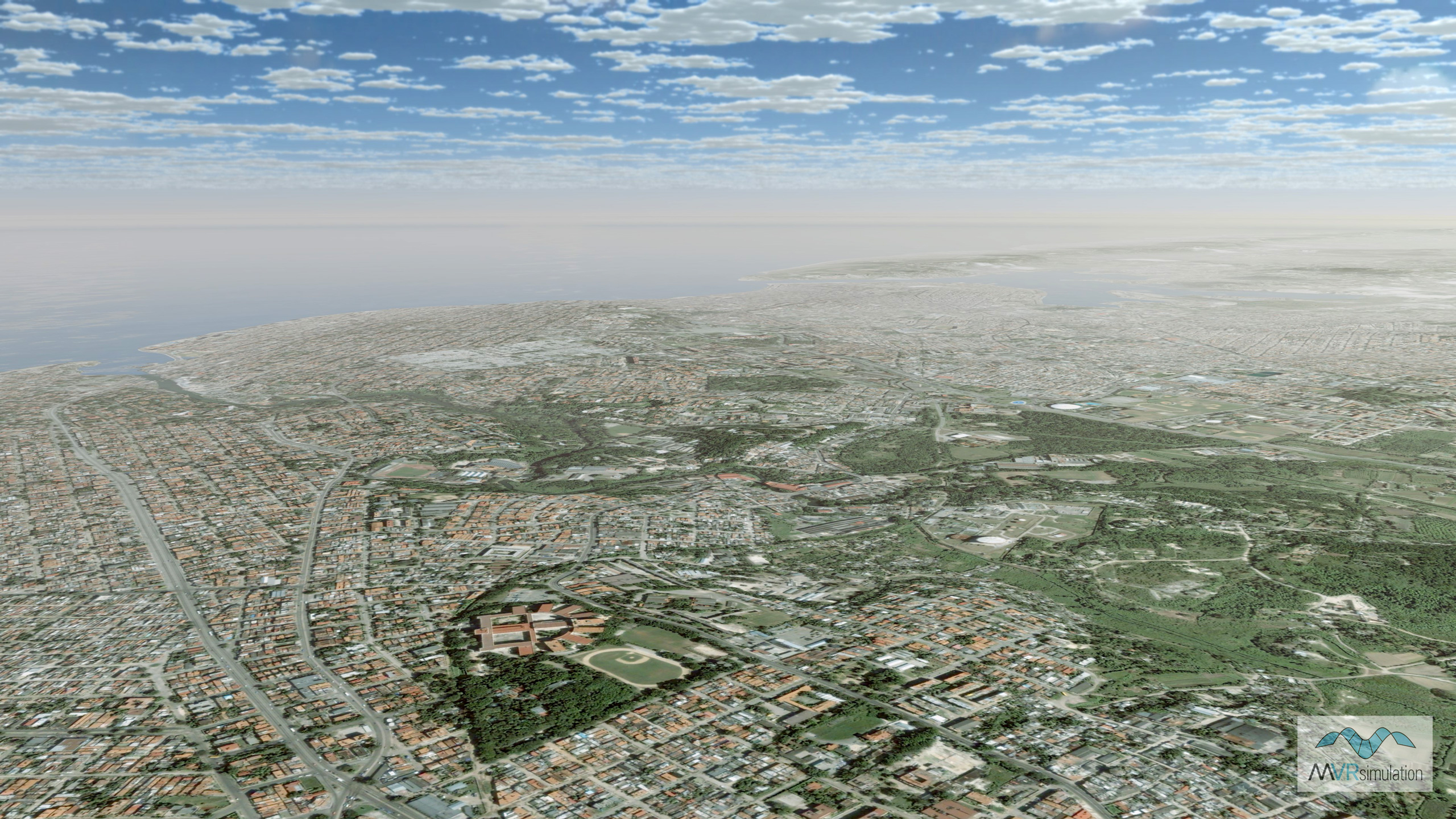
Imagery source data: 15 meter-per-pixel NaturalVue imagery, with 60 cm high-resolution natural color insets of:
- Havana, Cuba
- Santa Domingo and Santiago De Los Caballeros, Dominican Republic
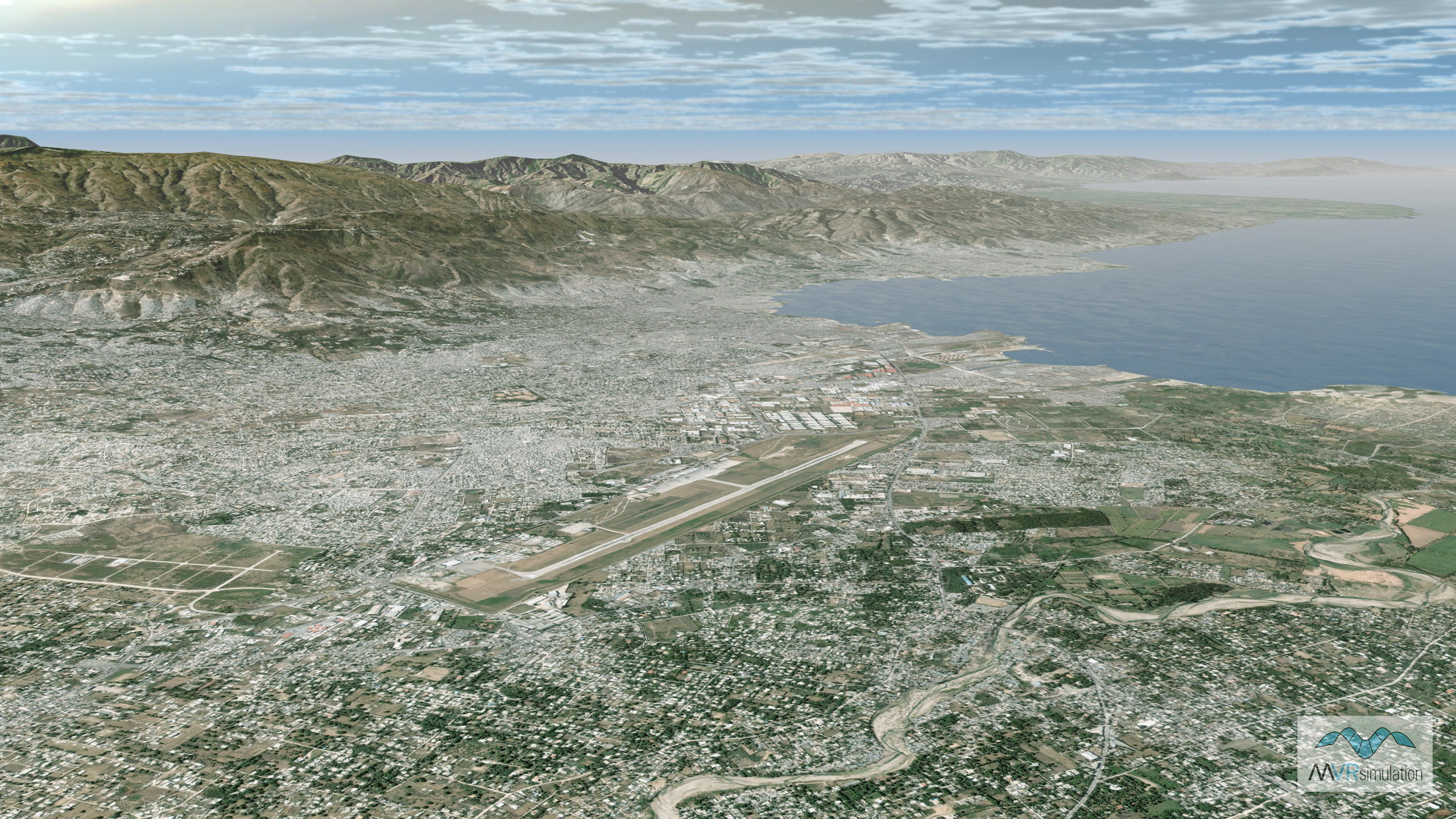
- Port-au-Prince, Haiti
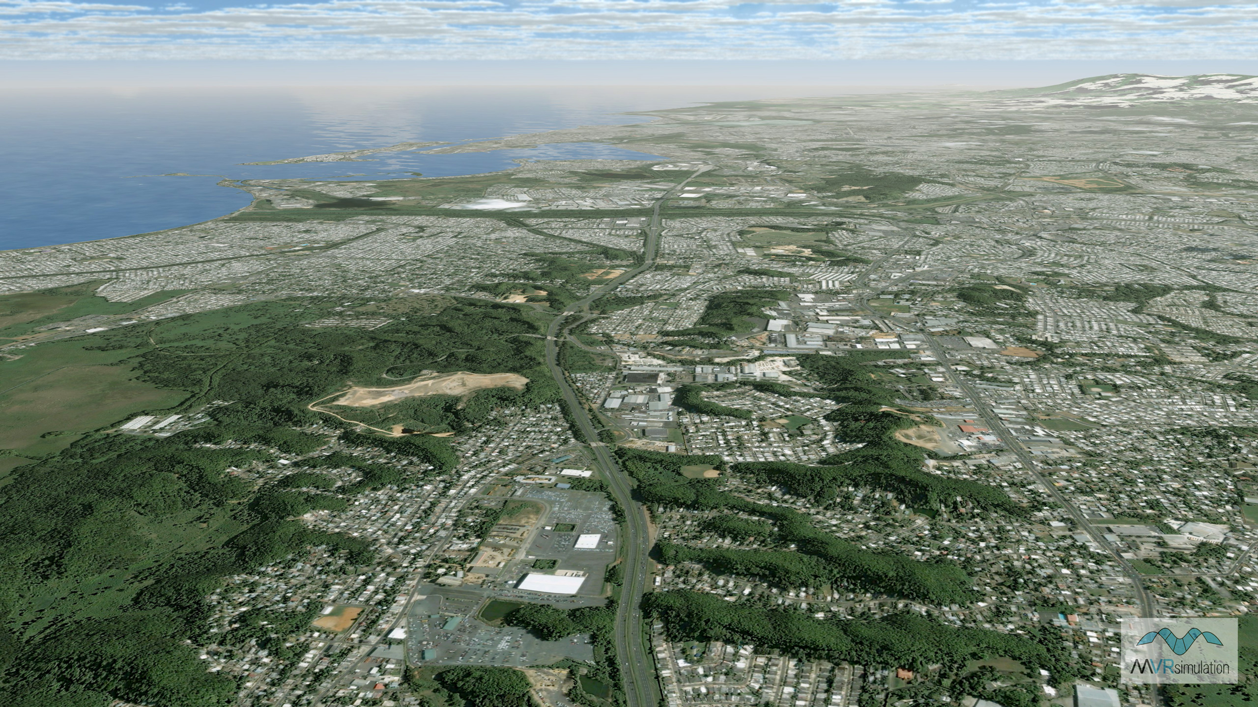
- San Juan, Puerto Rico
- San Jose, Costa Rica
- San Salvador, El Salvador
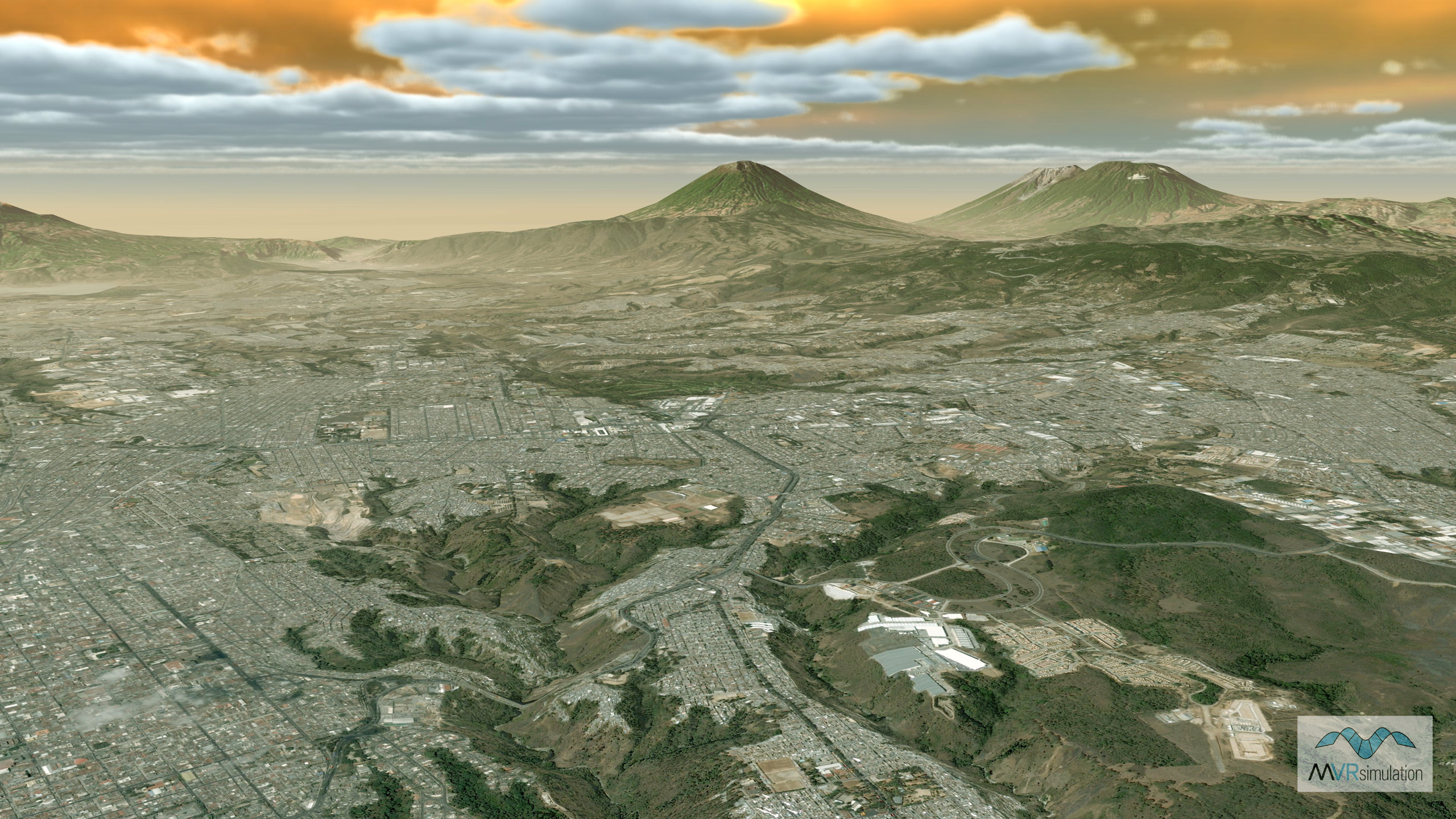
- Guatemala City, Guatemala
- Tegucigalpa, Honduras
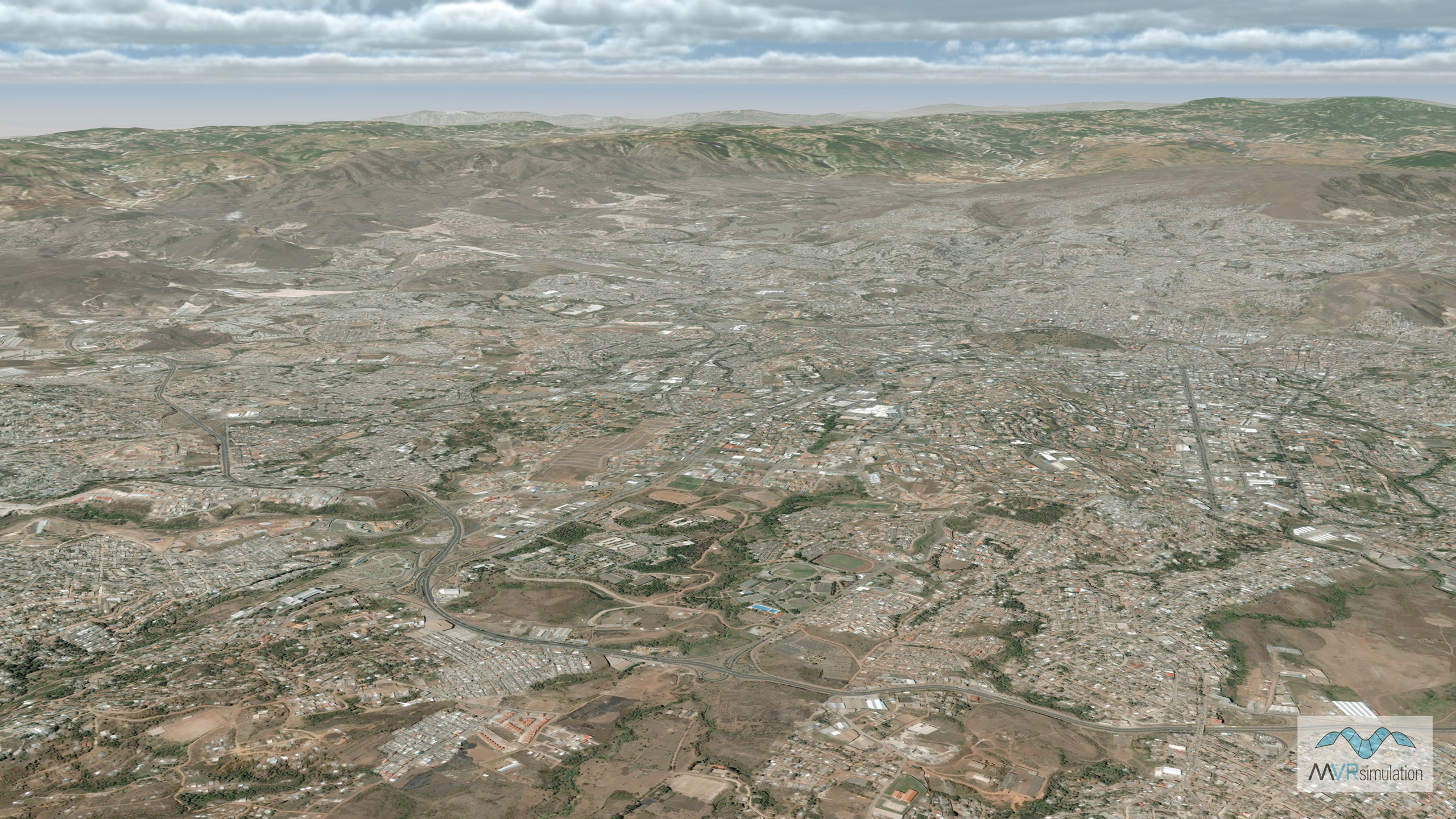
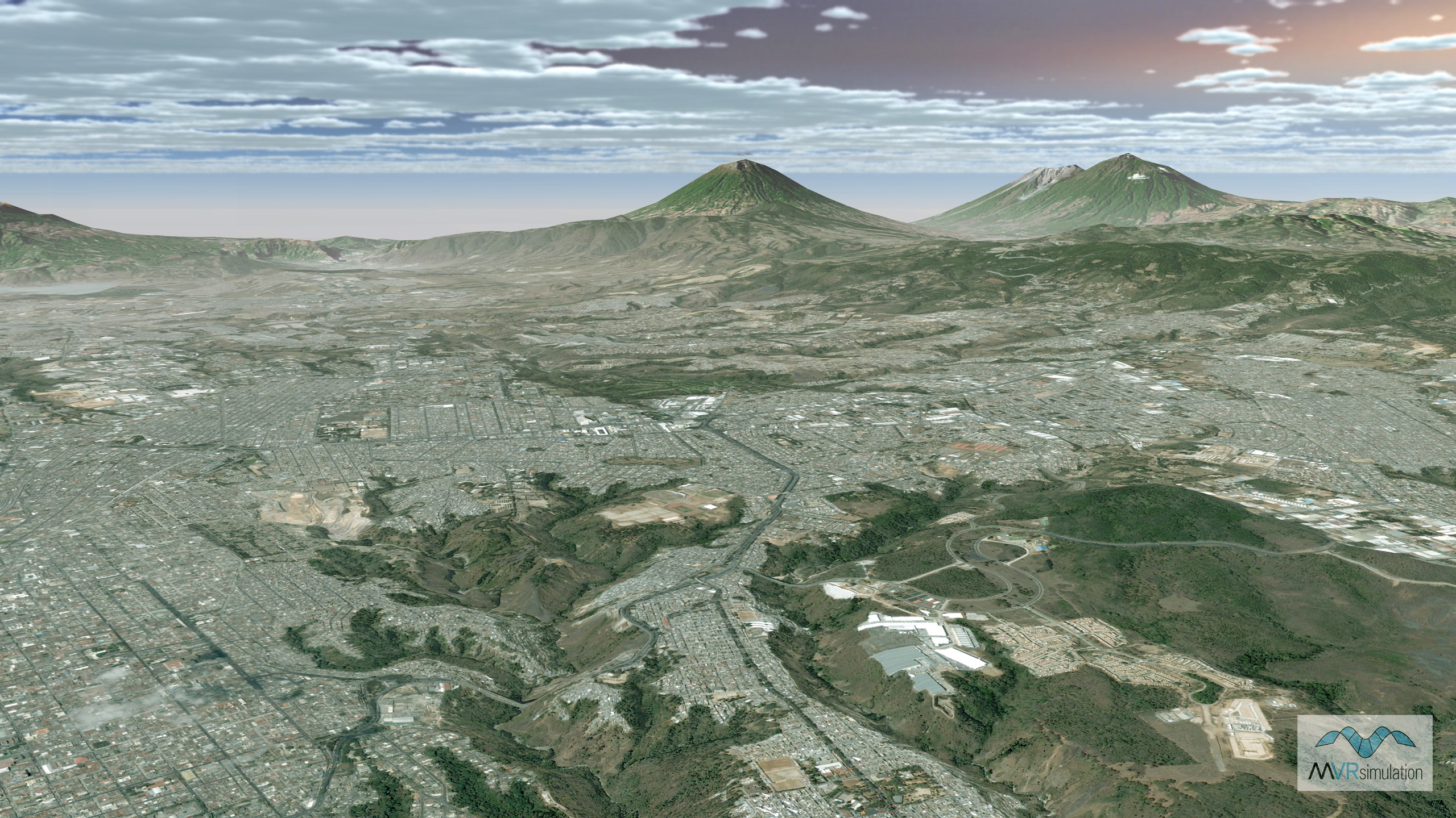
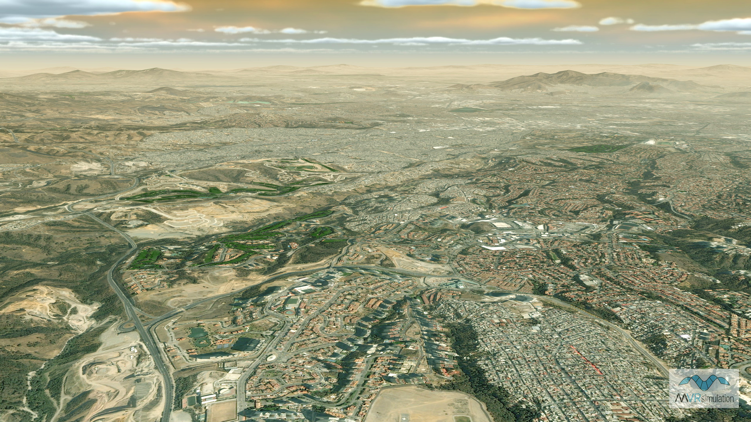
- Aguascalientes, Guadalajara, Mexico City, Monterrey, and Puebla, Mexico
- Managua, Nicaragua
Delivery
MVRsimulation's North America 3D terrain is delivered on an external hard drive. The terrain is provided in MVRsimulation's round-earth VRSG terrain format and will only run with a valid VRSG version 6 software license with valid software maintenance. A fee covers processing large quantities of data into VRSG terrain format and hard drive distribution media.
MVRsimulation's North America 3D terrain is available for purchase to customers who are US Government agencies or contractors (for official use only). Customers can duplicate the data at their discretion as long as the data is used in conjunction with a valid VRSG license.
You can request a quote for this 3D terrain directly from MVRsimulation by consulting the price list and then filling out the quote request form.