Albuquerque International Sunport Airport (KABQ) Terrain Database Information
- Imagery: 15cm
- Elevation: Interpolated NED 1/3 (10m) and DTED1, to match FAA airfield elevations with at least 95% accuracy
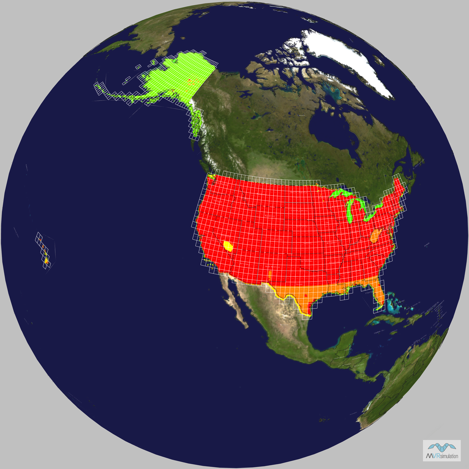
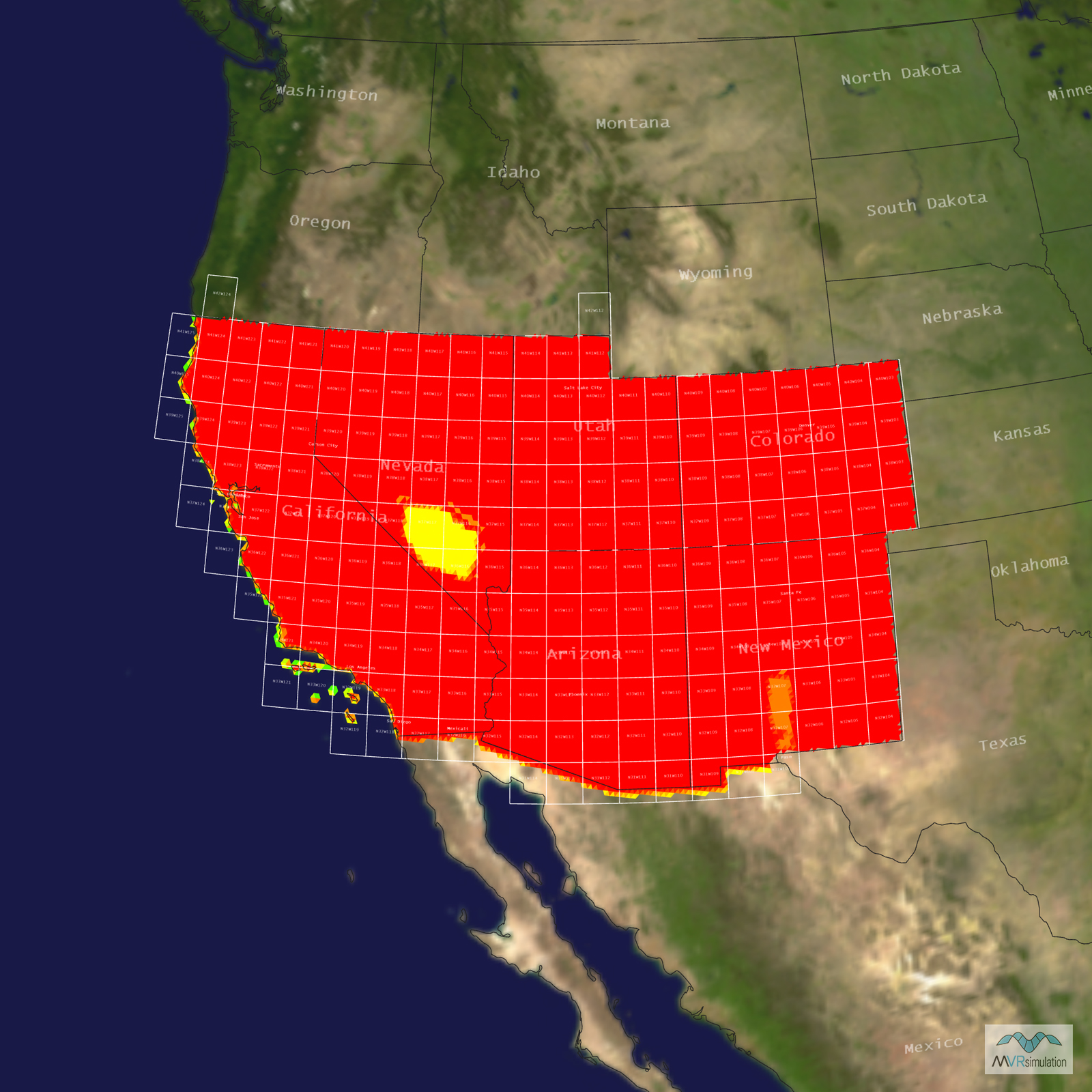
- Terrain Drive: CONUS Southwest
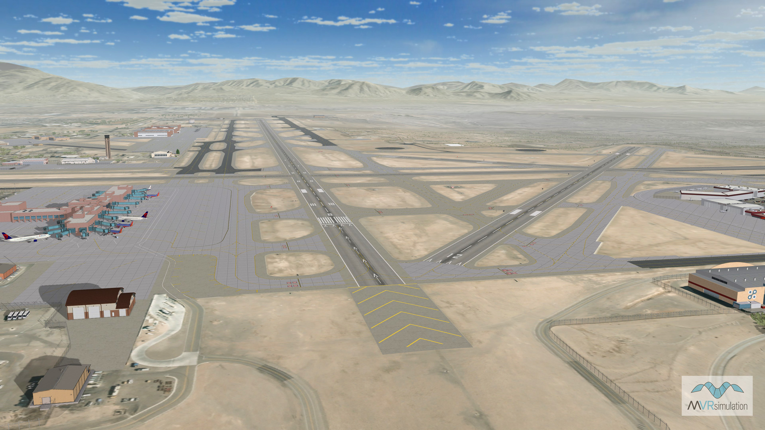
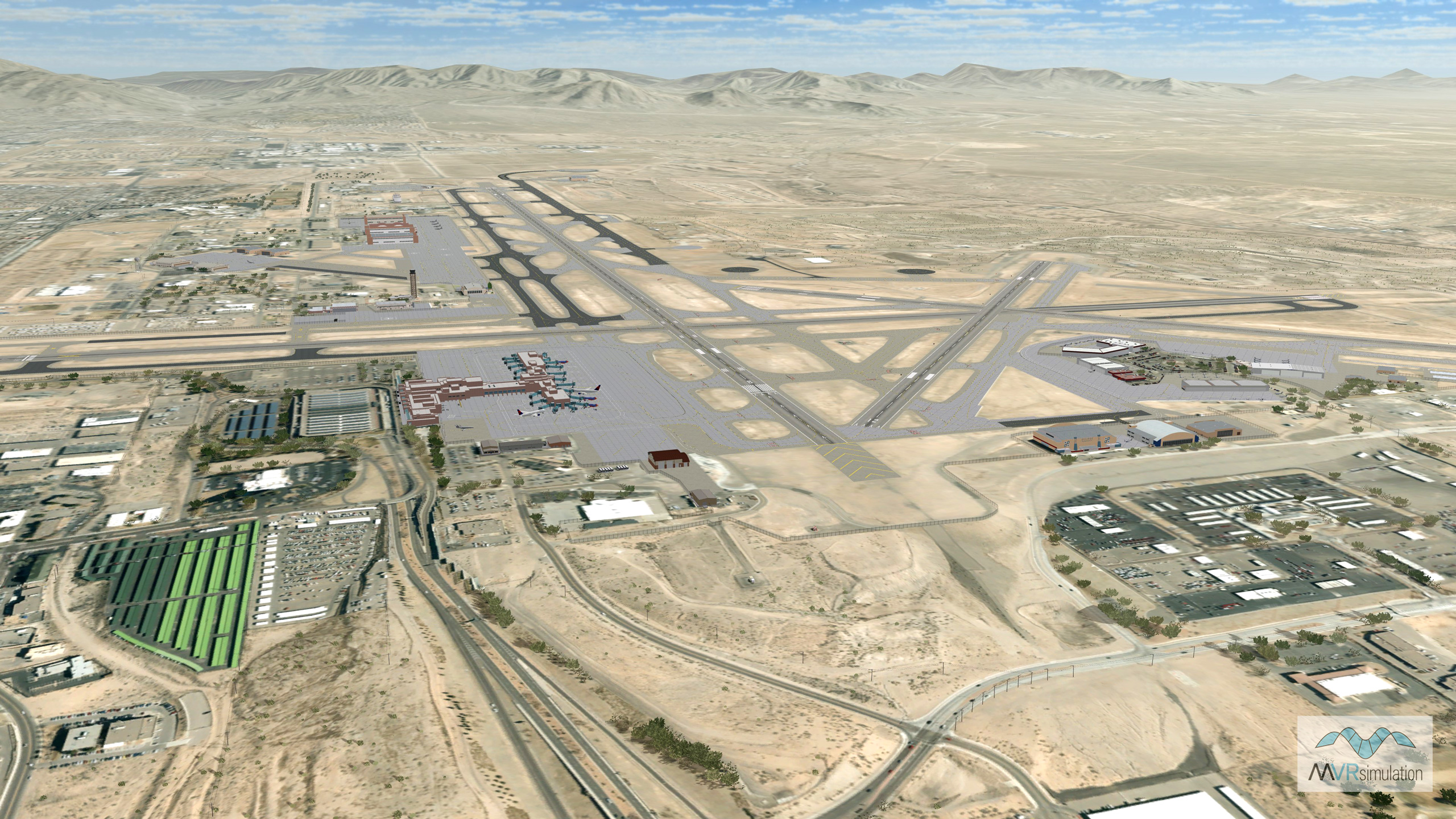
- Kirtland Air Force Base & Albuquerque International Sunport
- Cultural Features: Apron or Ramp Areas, Control Tower, Custom Models (Geospecific Buildings), Hangars, Light Poles, Runway, Runway Lights, Static Aircraft or Helicopters, Taxiways and Associated Markings, Trees, Water Tanks/Towers
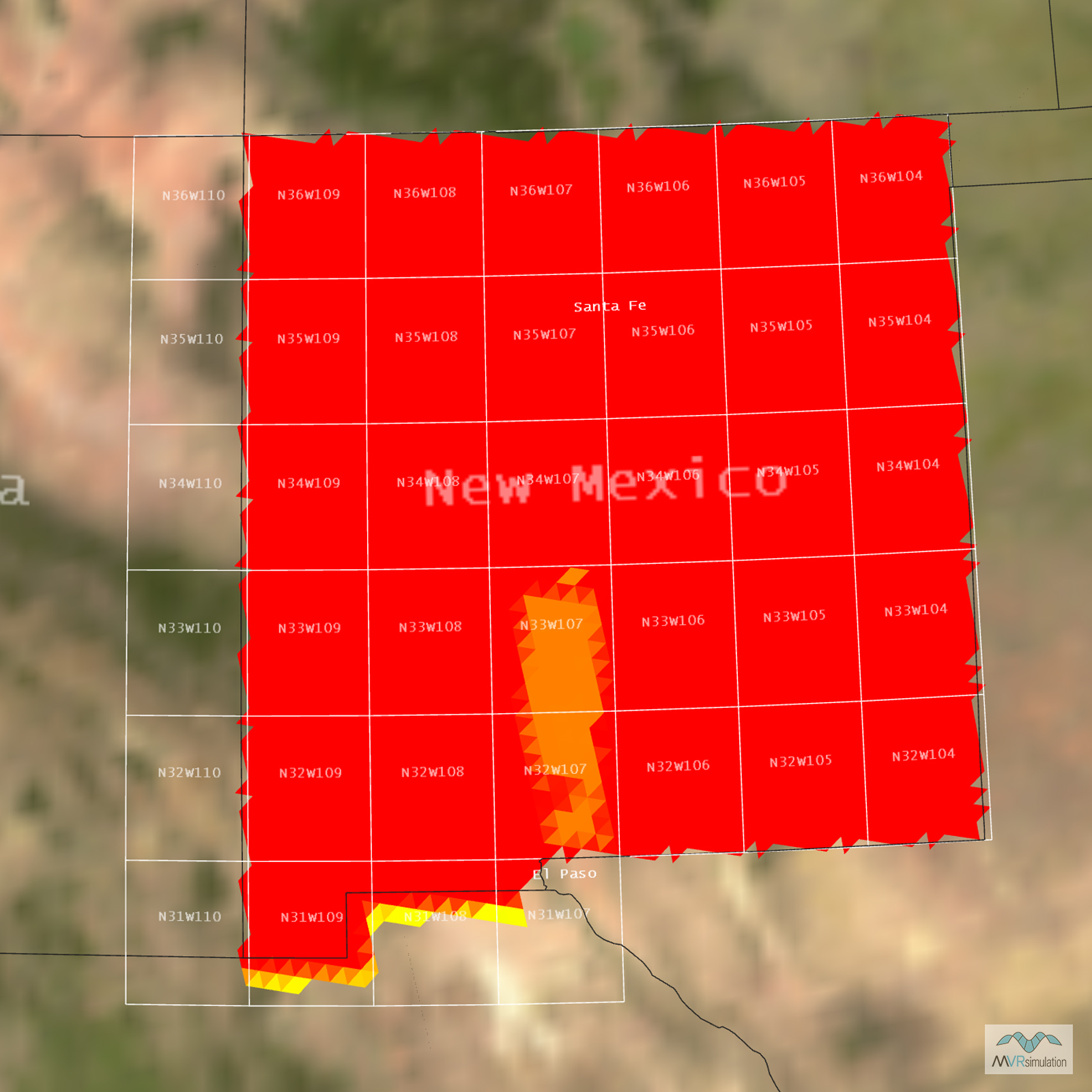
Tile Coverage Map
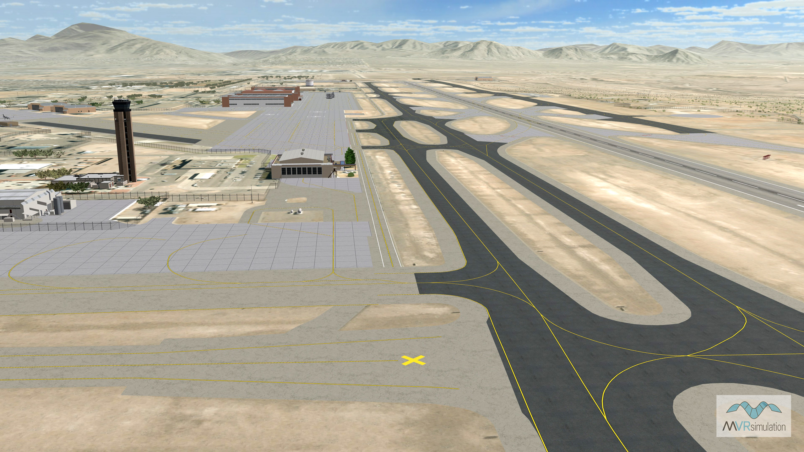
MVRsimulation VRSG scene of Kirtland Air Force Base /Albuquerque International Sunport (KABQ) runway area with geospecific control tower and 17 other geospecific buildings.
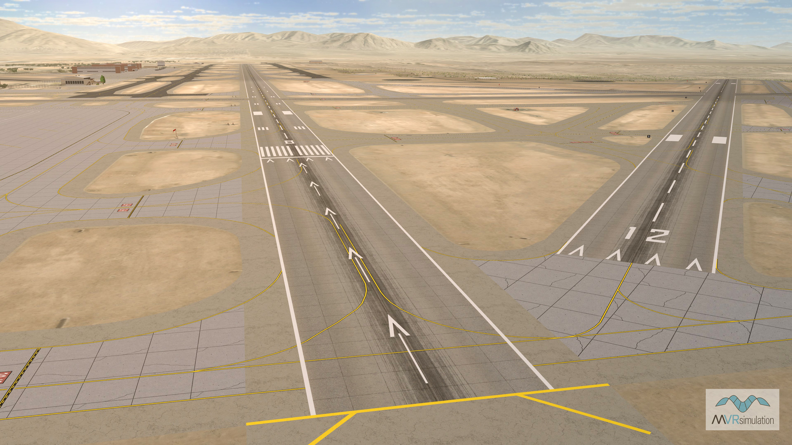
MVRsimulation VRSG scene of the Kirtland Air Force Base and Albuquerque International Sunport (KABQ) runway area.
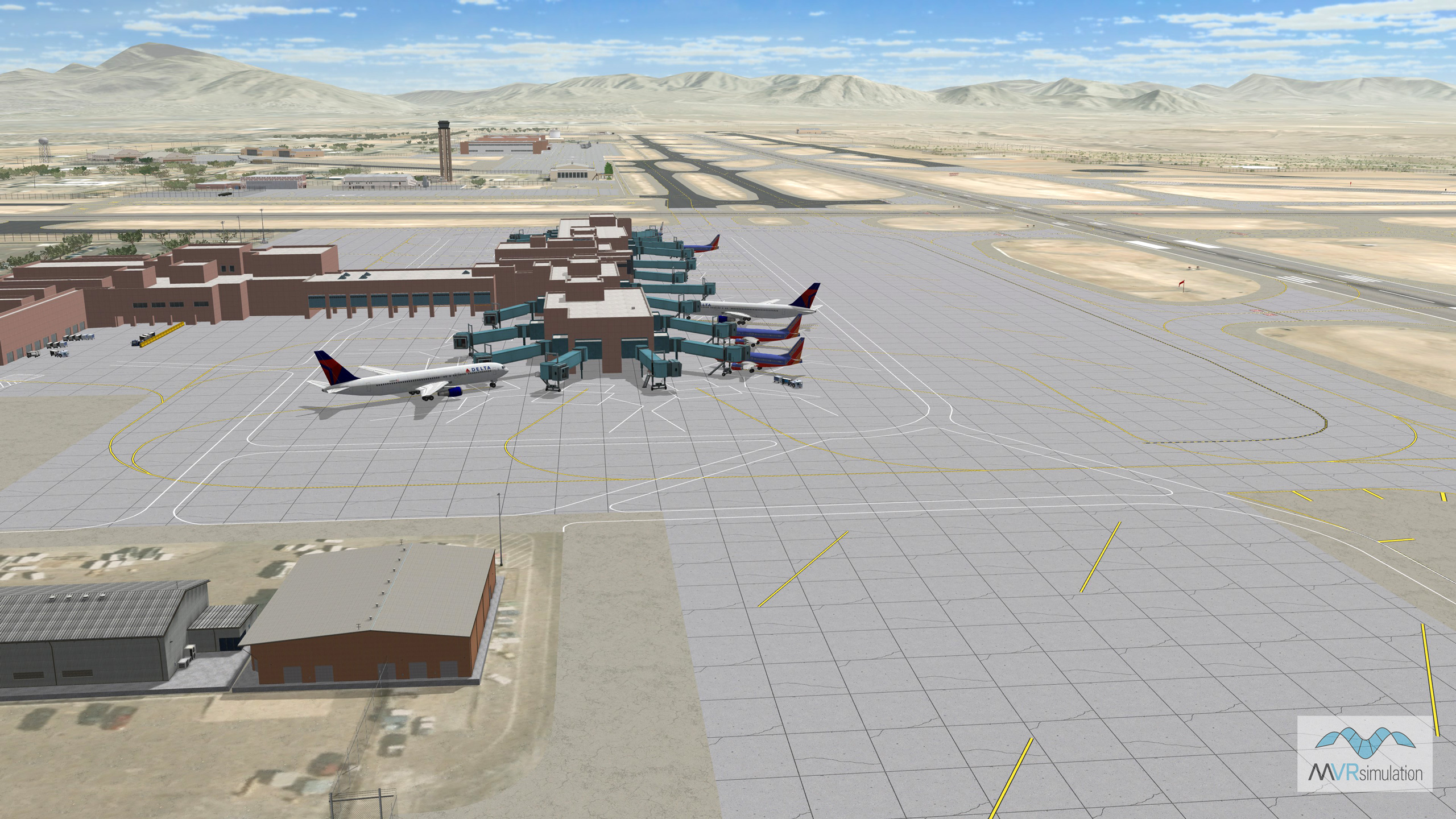
MVRsimulation VRSG scene of the Kirtland Air Force Base and Albuquerque International Sunport (KABQ) terminal and tarmac area.