Leschi Town MOUT Site at Joint Base Lewis-McChord Terrain Database Information
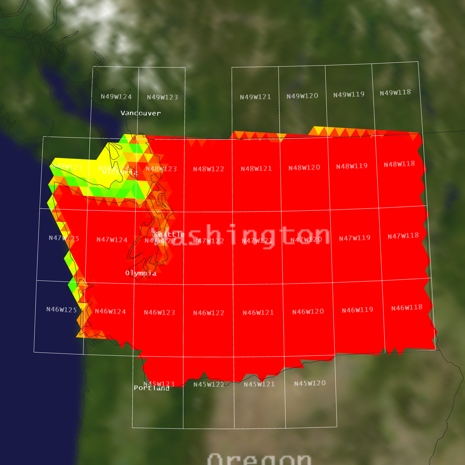
- Imagery: 30cm
- Elevation: NED 10m
- Terrain Drive: CONUS Northwest
- Cultural Features: Bridge(s) Geospecific/Geotypical, Building Interiors, Custom Models (Geospecific Buildings), Fences or Walls, Landscape Features (Shrubs, Grass, Paved Medians, etc.), Light Poles, Lighting for Non-Runway Areas (Streetlights), Roads, Signs, Trees, Urban Furniture (Benches, Trash Bins, etc), Utilities (Poles, Powerlines or Transmission Lines)
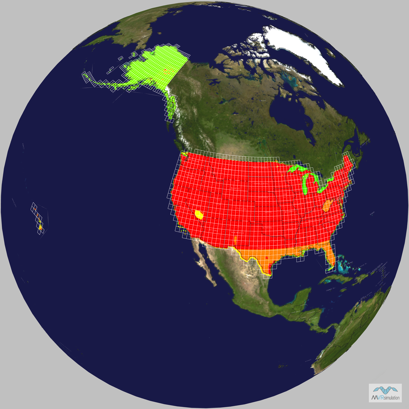
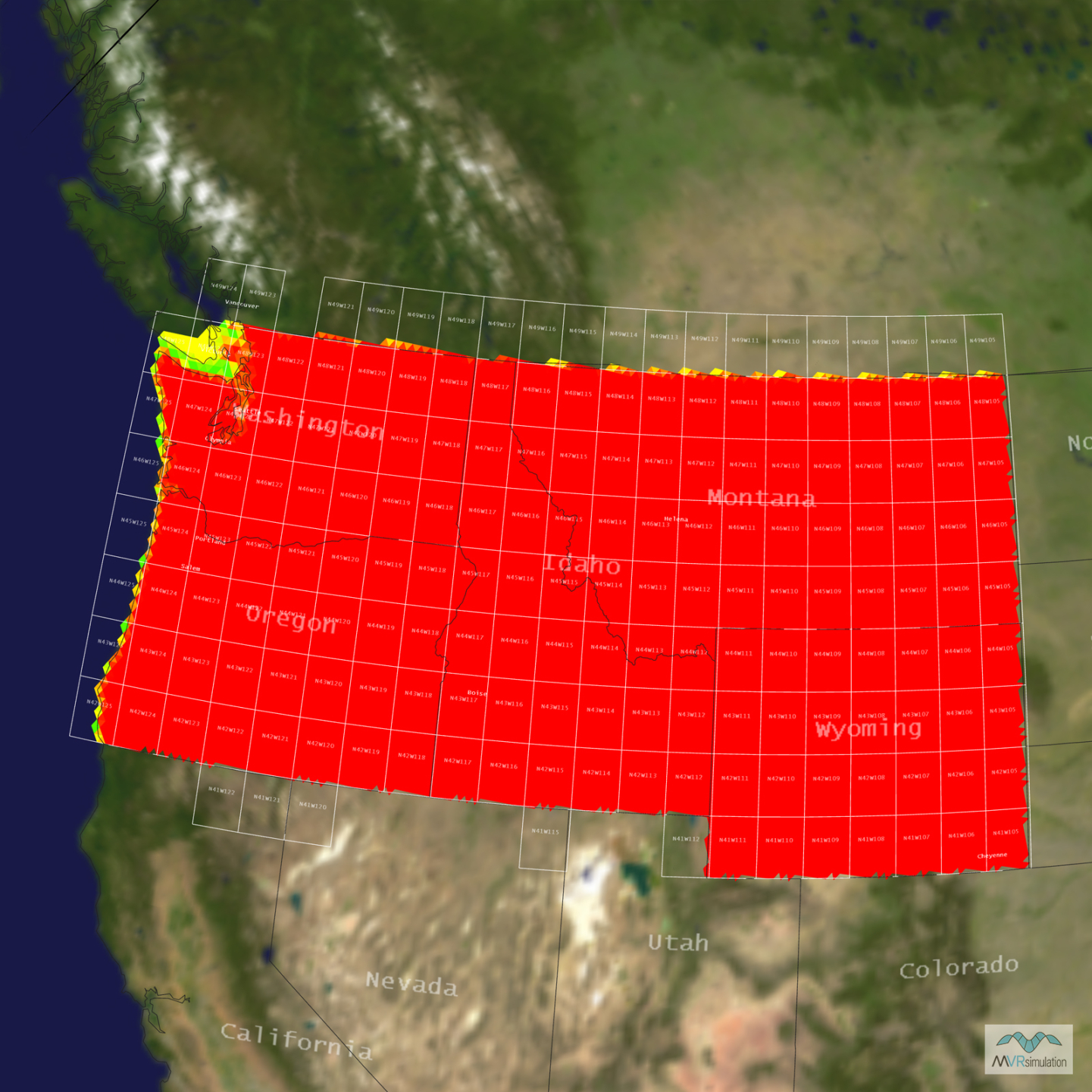
Tile Coverage Map
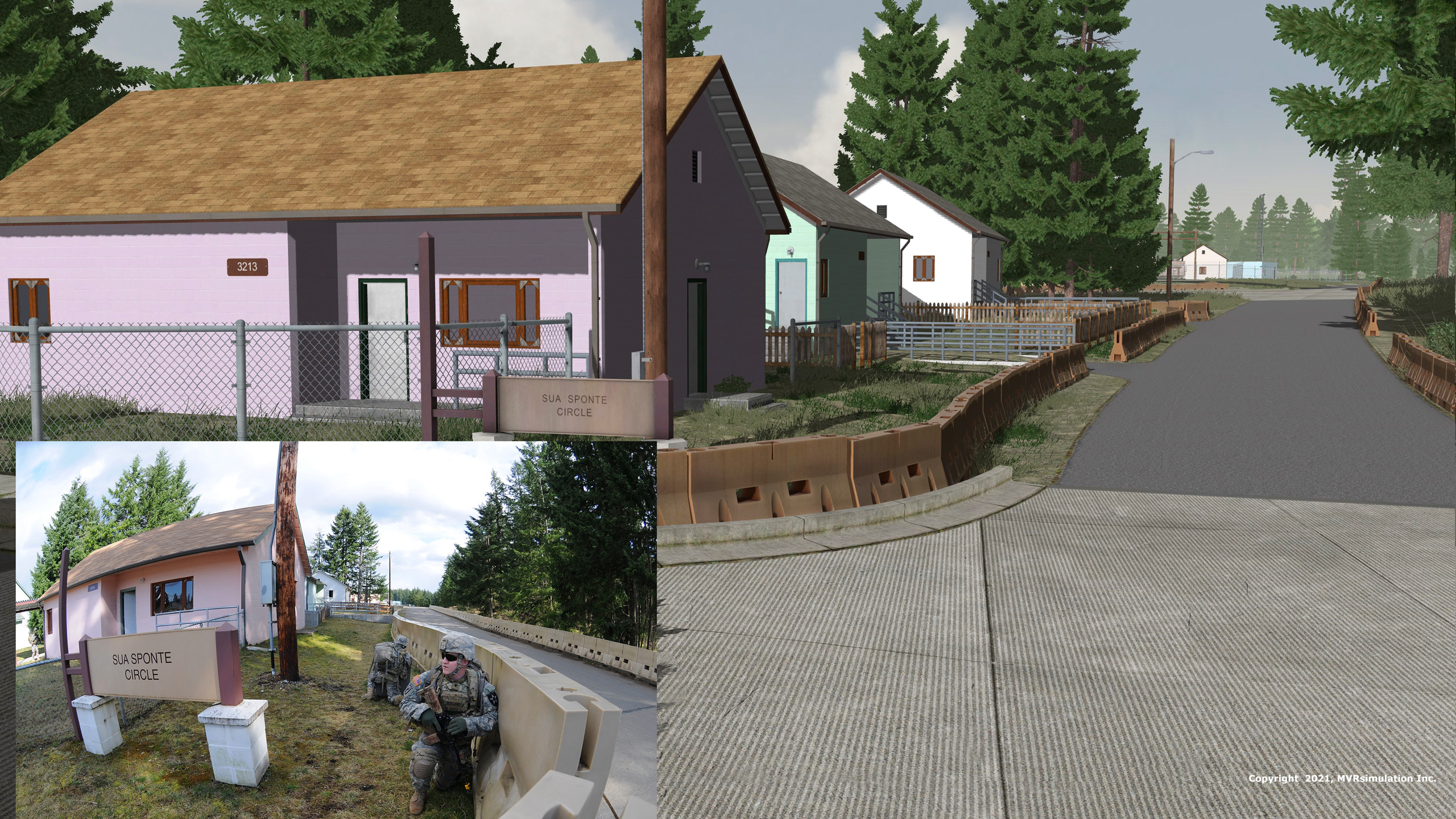
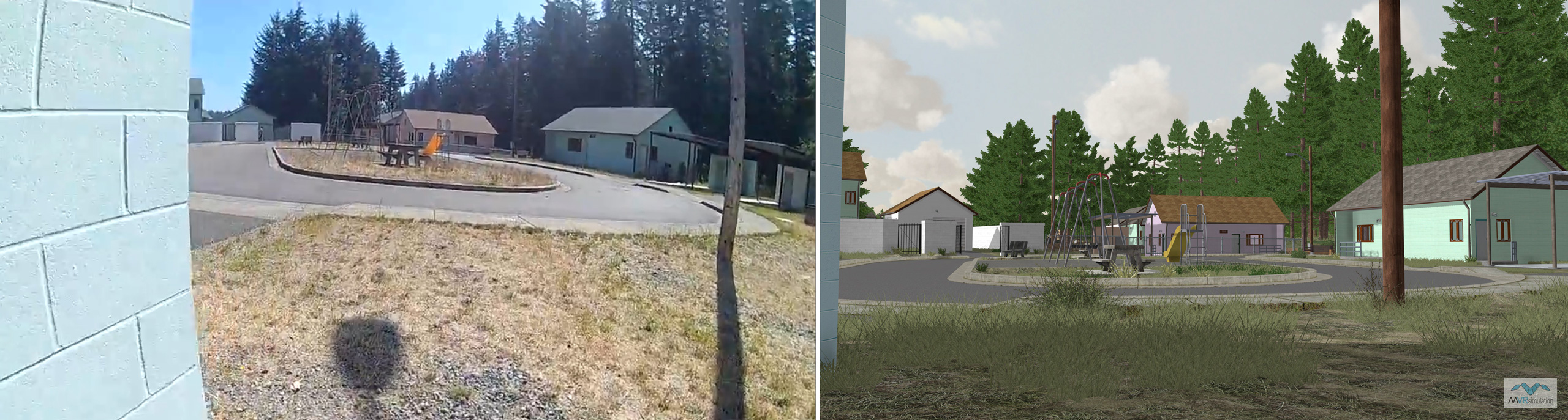
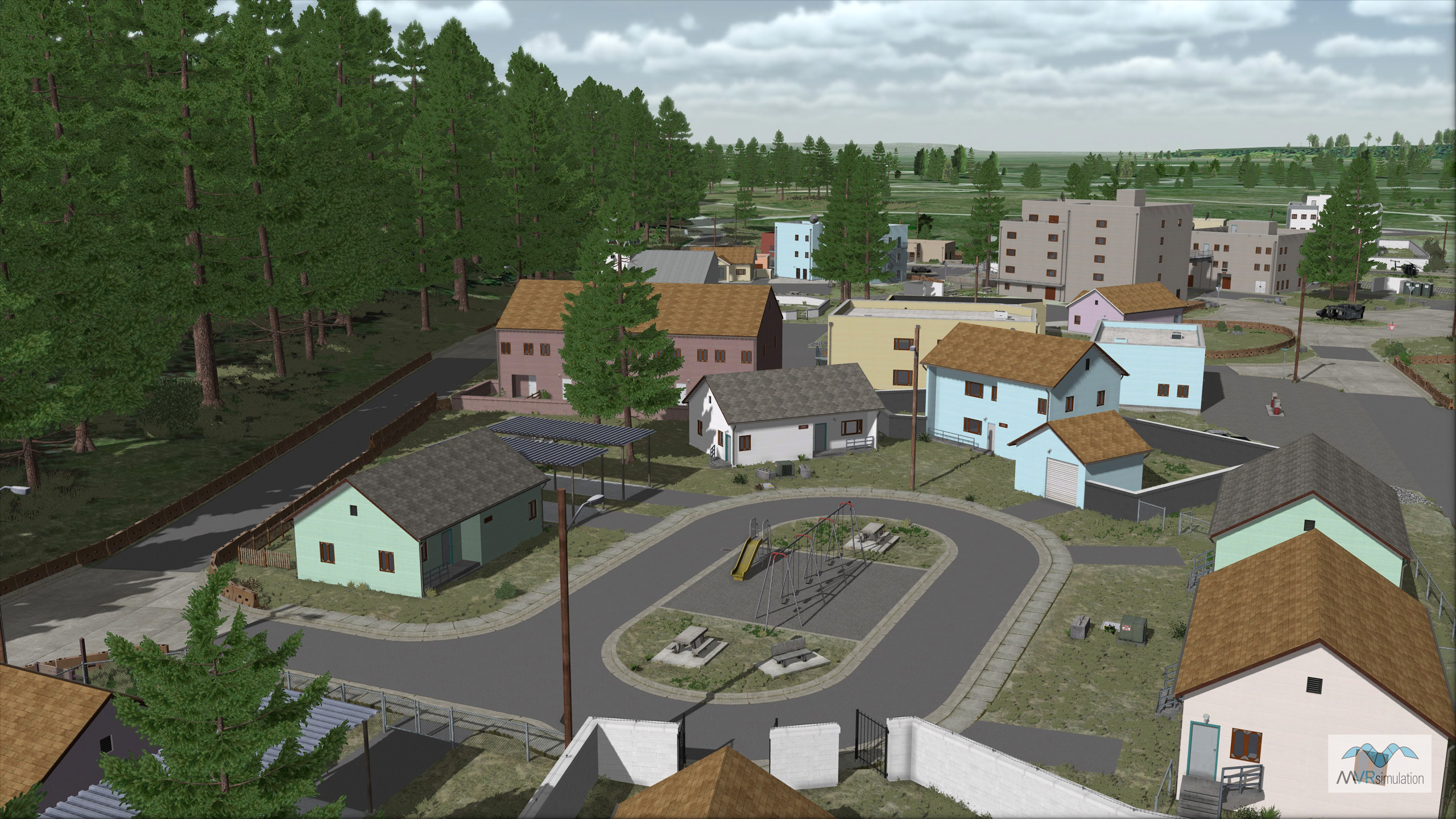
MVRsimulation VRSG scene of the Sua Sponte Circle area of virtual Leschi Town with an inset photo of the actual area.
MVRsimulation VRSG scene of a commercial section of the virtual Leschi Town training site.
MVRsimulation VRSG scene of the various surfaces and cultural elements of the virtual Leschi Town training site.
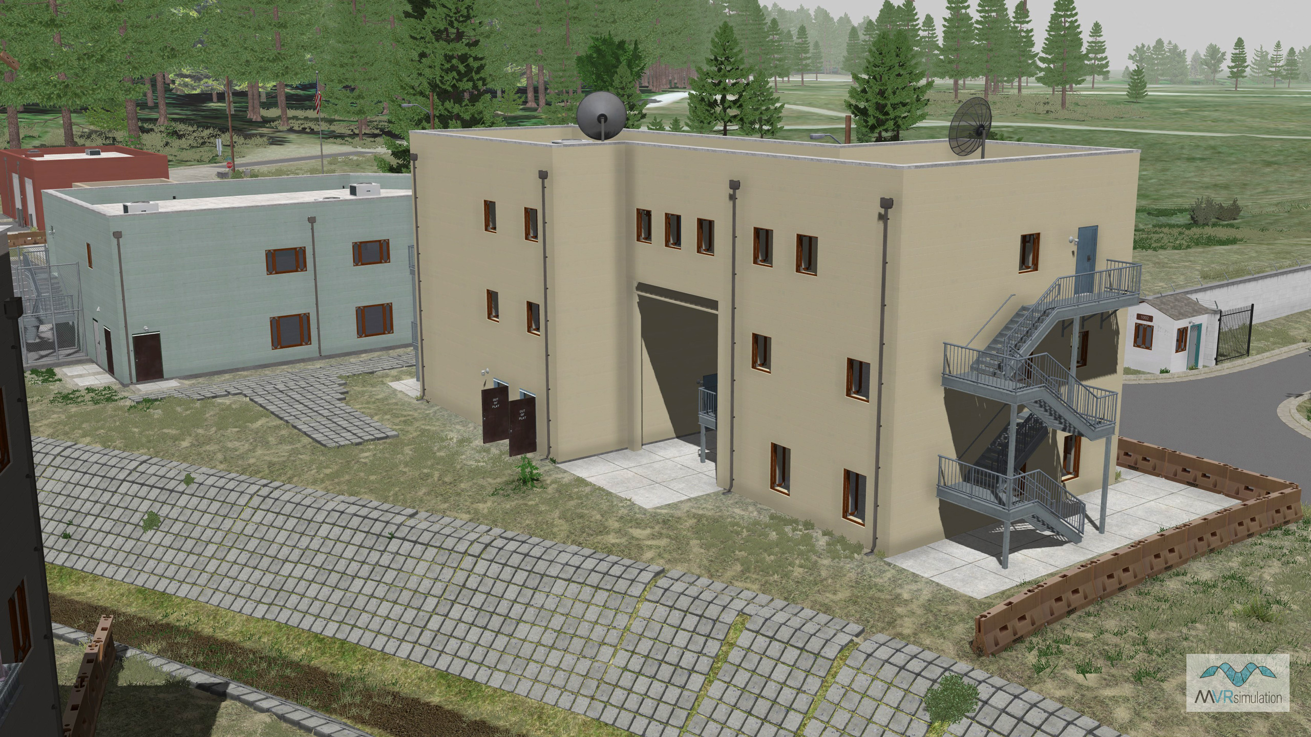
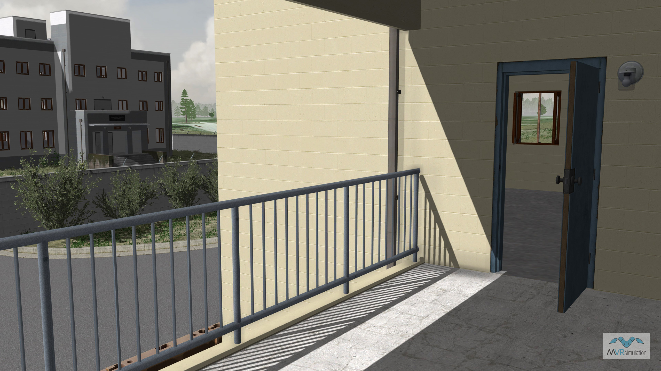
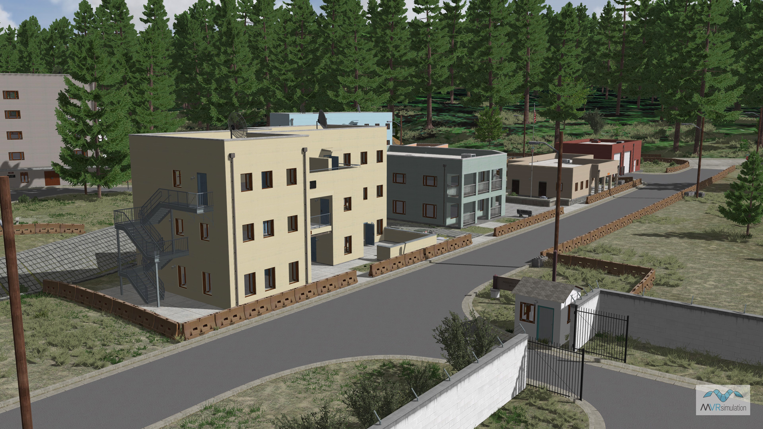
MVRsimulation VRSG scene of virtual Leschi Town with multi-level structures, modeled rooftops, and doors and windows that open.
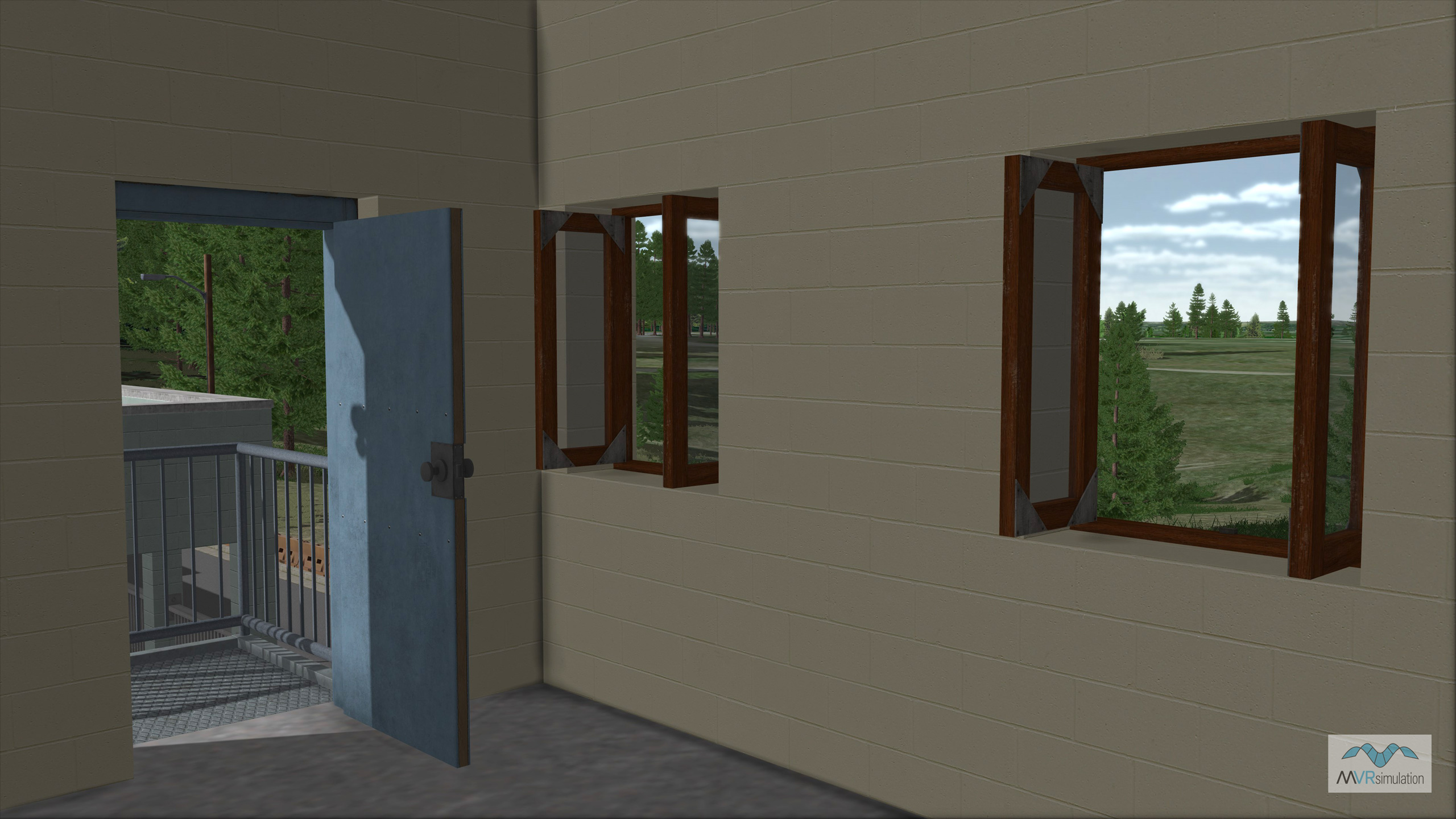
MVRsimulation VRSG view inside a multi-level building model on virtual Leschi Town terrain, with a modeled interior and doors and windows that open/close on a switch state.
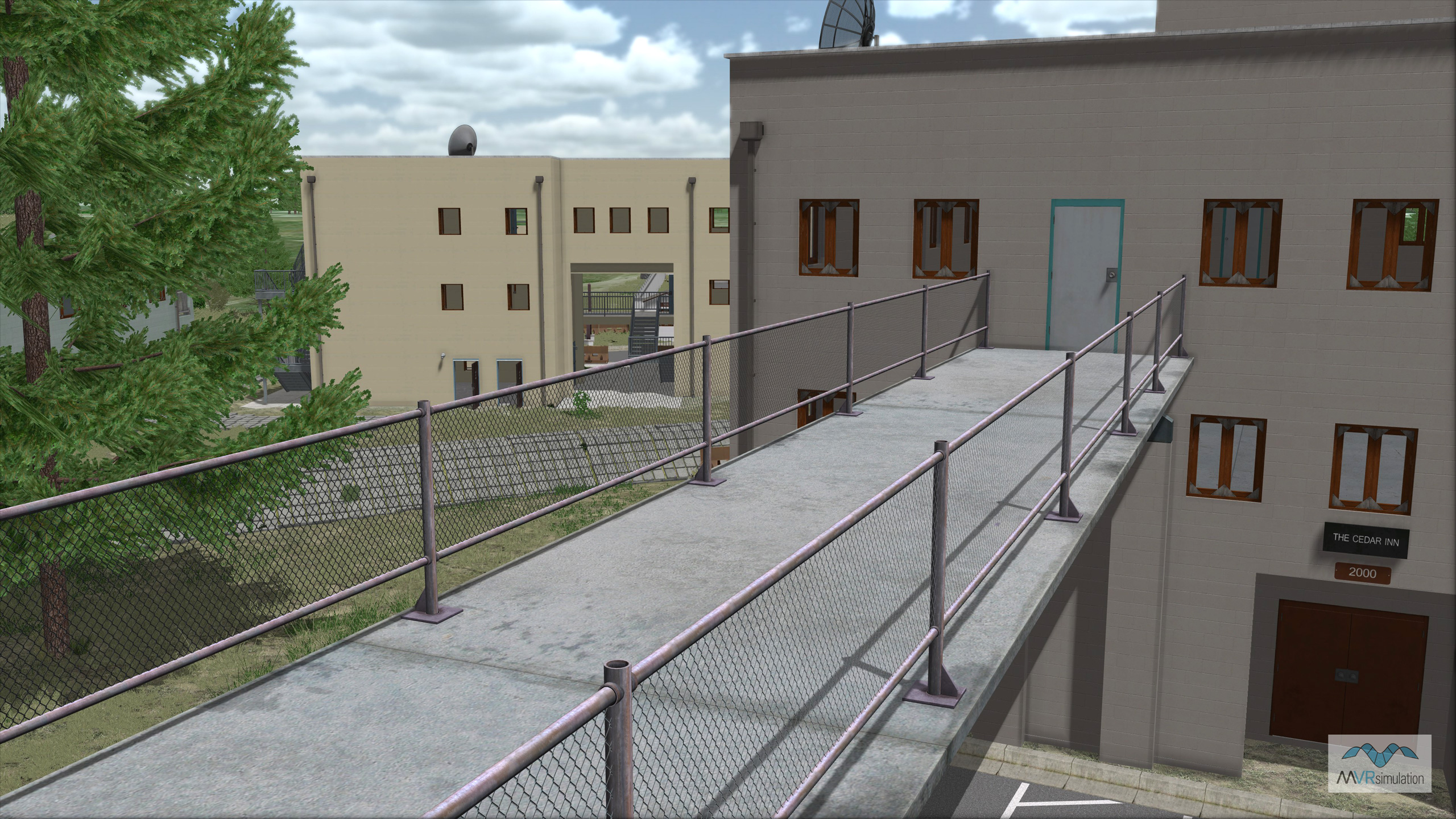
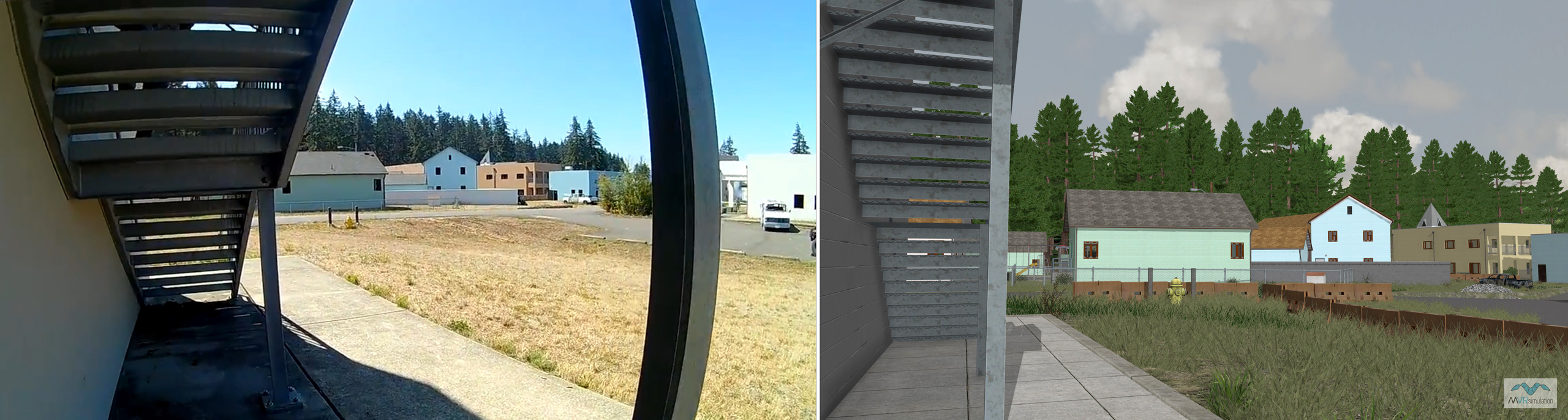
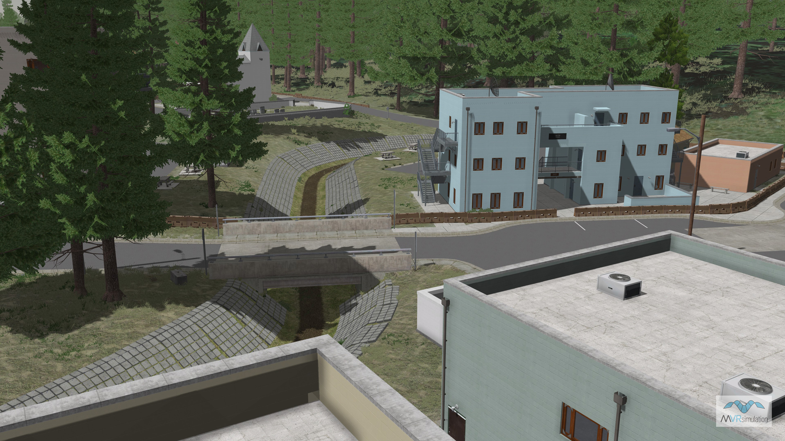
MVRsimulation VRSG scene of a walkway between multi-level buildings on virtual Leschi Town.
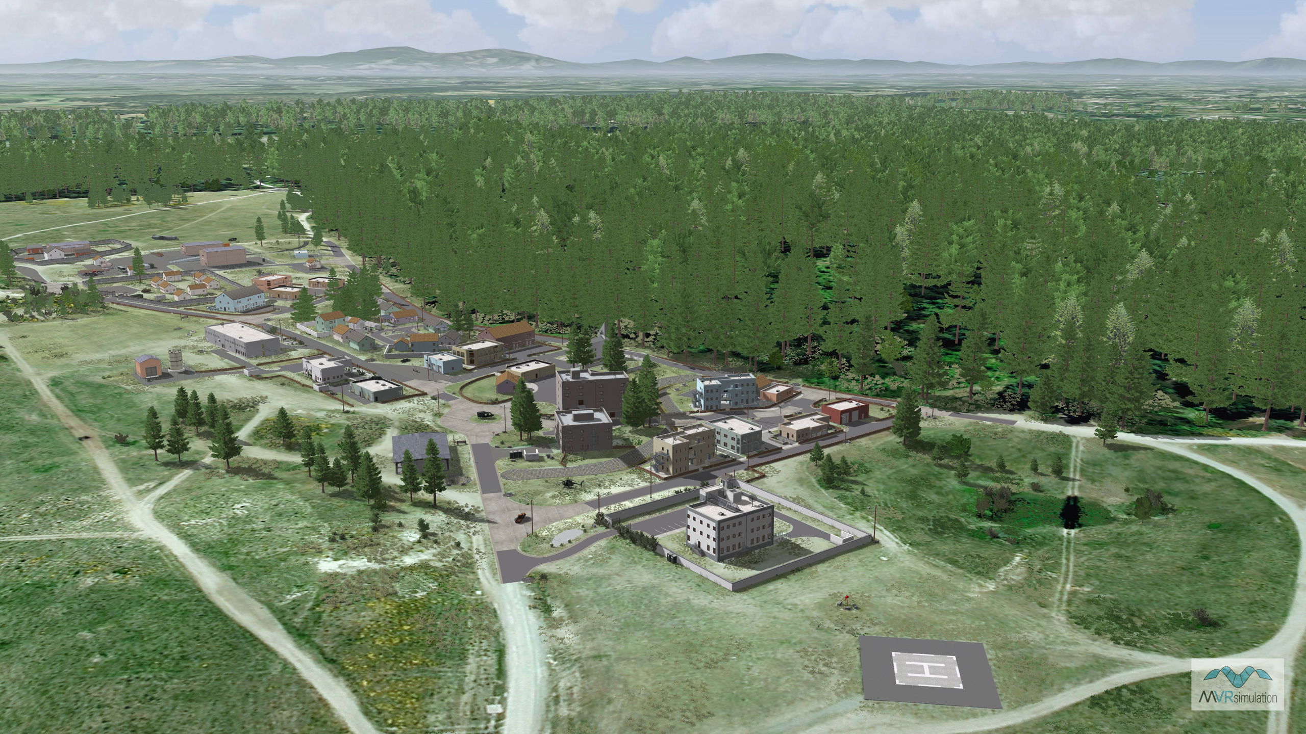
MVRsimulation VRSG overview scene of virtual Leschi Town training site.
From Photographs to a Photorealistic Proving Ground
Leschi Town is a combined arms collective training facility (CACTF) at Joint Base Lewis-McChord designed to train soldiers in complex urban environments. MVRsimulation created a geospecific virtual replica of the facility for use in various simulators that run Virtual Reality Scene Generator (VRSG). This virtual site is used by Joint Terminal Attack Controller (JTAC) and Joint Fires Observer (JFO) trainees for pre-mission rehearsals and simulated close air support missions.
The primary benefit of a virtual counterpart is its ability to improve a trainee's situational awareness and familiarity with the area before they begin live training at the physical site. It is used by units such as the 5th Air Support Operations Squadron in their dome and desktop simulators to prepare for training events at the actual Leschi Town facility. This pre-mission rehearsal capability allows trainees to know the area before they set foot on the ground.
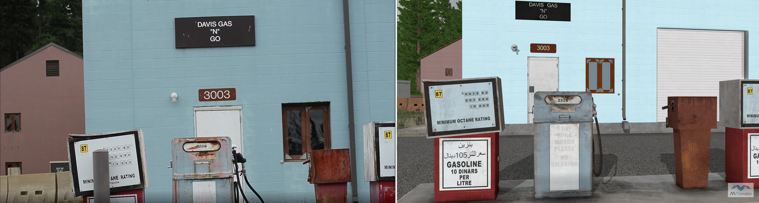
The virtual terrain was created with substantial 3D content to accurately represent the training area. This includes 52 geospecific MOUT building models, which feature interiors, multiple levels, and articulated windows and doors. The scene is further detailed with over 100 other cultural elements such as bridges, signs, and fences. These models were created based on hundreds of photographs taken of the facility. These on-site photos were used as a reference to create photorealistic textures and to guide the modeling of the 3D structures, ensuring a high-fidelity visual match with their real-world counterparts. Then, they were geolocated on the terrain using Scenario Editor.
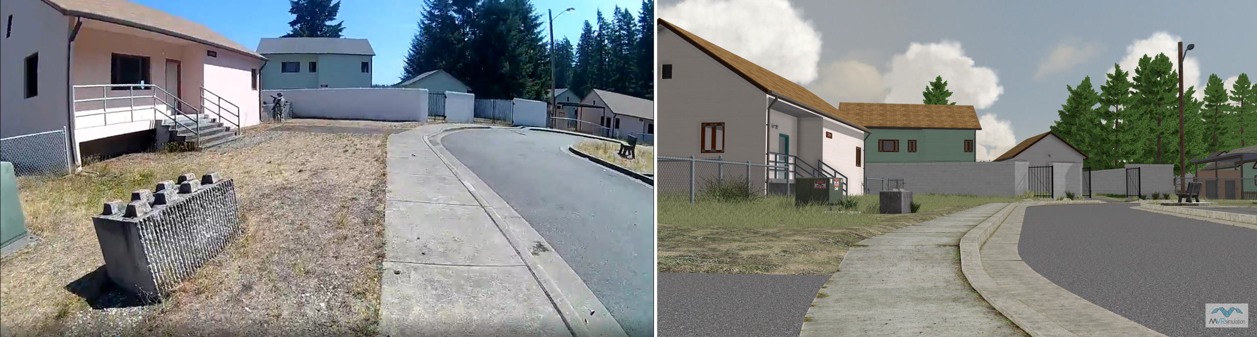
Below is a series of images of the Leschi Town training site. You can compare photographs of the actual Leschi Town on the left side with the VRSG screen captures of the simulated scene on the right. Reference photos of the actual Leschi Town were captured from public video footage of the Washington National Guard 205th Training Regiment conducting Officer Candidate School (OCS) Phase III training.
Photos of the Leschi Town MOUT site
VRSG screen captures of the same scene